Wikipedia:Graphics Lab/Map workshop/Archive/Dec 2018
| This is an archive of past discussions for the period 2019. Do not edit the contents of this page. If you wish to start a new discussion or revive an old one, please do so on the current main page. |

Request Kalākaua's 1874–75 state visit to the United States
-
 Preliminary version of the map

- Article(s)
- Kalākaua's 1874–75 state visit to the United States
- Request
- Honolulu→San Francisco→across America by rail→Washington D. C. and the eastern seaboard states listed
- Return trip: Niagara Falls→Chicago→Milwaukee→Missouri→San Francisco→Honolulu
- This is the basic trip. Details are in the section headers of the article. I've never requested a map before, so am suggesting one similar to what was done for Kalakaua journey around the world (above). The article is at FAC at the moment, and one of the reviewers suggeseted a map would be good. -- — Maile (talk) 02:03, 24 November 2018 (UTC)
- @AntiCompositeNumber: I recommend a partial map of the world (maybe just Hawaii and North America or just the Western Hemisphere) and for the “across America by rail” segment, it should follow closely the railway not just a crow fly distance between SF and DC. The potential is for this map to be more detailed than the world tour map since it is a more condense trip. KAVEBEAR (talk) 03:56, 24 November 2018 (UTC)
- KAVEBEAR, I'm using File:North America second level political division 2.svg for the map, and I have been following the path based on the towns in the article. I don't have the information between Aurora and Chicago and Jefferson City to Aurora, so if you have a good source for that route, that would be helpful. --AntiCompositeNumber (talk) 04:01, 24 November 2018 (UTC)
- I do not know for sure. The routes are following the railroad of the time. There are a lot of maps of historical railroads so we can get it more precise. I have asked on ref desk. Preliminary version looks good. Let see what others or user:Maile66 thinks. KAVEBEAR (talk) 04:17, 24 November 2018 (UTC)
- KAVEBEAR, I'm using File:North America second level political division 2.svg for the map, and I have been following the path based on the towns in the article. I don't have the information between Aurora and Chicago and Jefferson City to Aurora, so if you have a good source for that route, that would be helpful. --AntiCompositeNumber (talk) 04:01, 24 November 2018 (UTC)
- @AntiCompositeNumber: I recommend a partial map of the world (maybe just Hawaii and North America or just the Western Hemisphere) and for the “across America by rail” segment, it should follow closely the railway not just a crow fly distance between SF and DC. The potential is for this map to be more detailed than the world tour map since it is a more condense trip. KAVEBEAR (talk) 03:56, 24 November 2018 (UTC)
- Note to KAVEBEAR and AntiCompositeNumber. Please see FAC comment that a state visit does not begin until the head of state arrives at the first destination. Does that mean we should confine this map to the mainland United States? — Maile (talk) 01:49, 26 November 2018 (UTC)
- @Maile66 and KAVEBEAR: In my opinion, that would be leaving out important, encyclopedic information. That decision is for you all though. --AntiCompositeNumber (talk) 01:56, 26 November 2018 (UTC)
- If we leave Hawaii on the map, and it becomes an issue at FAC, would it be difficult to make the change? I'm all for leaving Hawaii on the map, since he didn't magically appear in San Francisco out of nowhere. — Maile (talk) 02:06, 26 November 2018 (UTC)
- Maile I think you are overthinking the comment. The inclusion of Hawaii will not raise a concern since the map is suppose to show the journey. KAVEBEAR (talk) 02:22, 26 November 2018 (UTC)
- OK. Then let's leave the map as is. — Maile (talk) 02:27, 26 November 2018 (UTC)
- Btw, unless there are any additional leads on the ref desk, I think this is the best we are going to get with the map since it would be a lot of additional research to look into exact railroad routes. KAVEBEAR (talk) 02:31, 26 November 2018 (UTC)
- OK. Then let's leave the map as is. — Maile (talk) 02:27, 26 November 2018 (UTC)
- Maile I think you are overthinking the comment. The inclusion of Hawaii will not raise a concern since the map is suppose to show the journey. KAVEBEAR (talk) 02:22, 26 November 2018 (UTC)
- If we leave Hawaii on the map, and it becomes an issue at FAC, would it be difficult to make the change? I'm all for leaving Hawaii on the map, since he didn't magically appear in San Francisco out of nowhere. — Maile (talk) 02:06, 26 November 2018 (UTC)
- AntiCompositeNumber I took the liberty of sticking the version above into the article. — Maile (talk) 02:52, 26 November 2018 (UTC)
- AntiCompositeNumber Niagara Fall is misspelled. It is missing an a.KAVEBEAR (talk) 16:53, 6 December 2018 (UTC)
- KAVEBEAR, Fixed. --AntiCompositeNumber (talk) 18:05, 7 December 2018 (UTC)
- Graphist opinion(s)
 Request taken by AntiCompositeNumber (talk) 02:39, 24 November 2018 (UTC).
- @Maile66 and KAVEBEAR: I'm going to call this
 Done now, as I'm taking a bit of a wikibreak. There's something odd going on with the text rendering that I didn't get to track down, you might want to ask at WP:SVGHELP about that. If there's any changes you want made, drop a note here and ping me and I'll deal with them when I get back. --AntiCompositeNumber (talk) 15:23, 30 November 2018 (UTC)
- It is done and inserted in the article. Thank you. — Maile (talk) 15:31, 30 November 2018 (UTC)
- @Maile66 and KAVEBEAR: I'm going to call this
Burundi moved its capital.
https://commons.wikimedia.org/wiki/File:Capital_not_largest_city.svg
Burundi moved its capital, so it needs to be in red now. ― Дрейгорич / Dreigorich Talk 03:48, 30 December 2018 (UTC)
- @Дрейгорич: The file was updated by TilmannR. Please check. KCVelaga (talk) 09:57, 9 January 2019 (UTC)
- Looks like it's done. ― Дрейгорич / Dreigorich Talk 14:10, 9 January 2019 (UTC)
{{resolved}}
South Sudan missing.
-
 Cyrillic alphabet

- Article(s)
- [[1]]
- Request
- South Sudan missing. ― Дрейгорич / Dreigorich Talk 02:18, 6 December 2018 (UTC)
- Discussion
Georgia and the Iranian Khanates in the South Caucasus in the Early Nineteenth Century
- Article(s)
- Khanates of the Caucasus
- Request
- Hi there. Could someone make a replica of "Map 1 - Georgia and the Iranian Khanates in the South Caucasus in the Early Nineteenth Century", located on page XVIII of Bournoutian, George A. (2018). Armenia and Imperial Decline: The Yerevan Province, 1900-1914. Routledge? You can view the book by using Amazon's Look Inside! feature,[2] or Google.books.[3]. Thanks in advance! - LouisAragon (talk) 22:37, 12 December 2018 (UTC)
- Discussion
Timeline of the introduction of color television in countries
- Article(s)
- Timeline of the introduction of color television in countries
- Request
- Hi, can you make an animation of the timeline that colour television is introduced in each country. Thanks. -- RainbowSilver2ndBackup (talk) 12:47, 22 December 2018 (UTC)
- Discussion
Kingdom of Italy
-
 Kingdom of Italy with the pre-World War 1 borders
 -
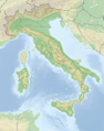 Relief map of Italy with today's borders
 -
 Relief map of Northern Italy with today's borders


_(US50)_(-grid).svg)
- Article(s)
- Alpini and Mountain Artillery formations in World War I
- Request
- Good Day. As described at Wikipedia talk:Graphics Lab/Map workshop#Kingdom of Italy relief map I would need a relief map of Northern Italy in the pre-World War 1 borders for an article about the Italian mountain infantry before and during the war. The Italian mountain infantry were locally recruited and based in villages in valleys of the Alps. The names of these villages and valleys were used as names for the battalions. At Alpini and Mountain Artillery formations in World War I#Geographical Distribution I inserted for now the "Italy location map 1905" map, but as one can see this map has two problems: a) it includes all of Italy when only the North is needed and b) this map is just white, so it does not show how the mountain infantry was located entirely within the Alps. Therefore a high resolution relief location map of Northern Italy based on i.e. File:Reliefkarte Italien.png with pre-World War 1 borders like in this map: File:Italy location map 1905.svg (and, if possible, without the post World War II regional boundaries) would be ideal for the article and also for articles about the Italian Front (World War I). The Southernmost mountain infantry unit was the Pieve di Teco Battalion in Pieve di Teco (at 44°3′N 7°55′E) and a map would not need to include Italy to the South of that. Thank you, and with best regards -- noclador (talk) 20:25, 10 January 2019 (UTC)
- Discussion
@Noclador: I can help you with that but I will need your support during the process.
![]() Request taken by Goran tek-en (talk) 20:17, 18 January 2019 (UTC).
Request taken by Goran tek-en (talk) 20:17, 18 January 2019 (UTC).
- @Goran tek-en: first: thank you!! and please: whatever support you need, let me know and I will do my best to help. noclador (talk) 21:31, 18 January 2019 (UTC)
- @Noclador: First we have to agree on which area the map should show, Is this the correct area?, if not you have to show me on a map, thanks. --Goran tek-en (talk) 15:33, 19 January 2019 (UTC)
- @Goran tek-en: email for you. noclador (talk) 23:04, 19 January 2019 (UTC)
- @Noclador: Base map draft (takes time to load). I don't know how much you know about the differences between a bitmap image e.a. png and vector image e.a. svg. This is a vector image and when one create a relief map in this format it becomes very large in Mb. When we are done with everything I will try to reduce the size but that will always be on the expense of details. But we will look at that later om, check this base map and give me feed back, thanks. --Goran tek-en (talk) 18:29, 21 January 2019 (UTC)
- @Goran tek-en: Wow! That's an amazingly detailed map. Excellent work! It depicts the correct area and the level of detail is fantastic. You were correct - it took quite long to load... so a reduction in size is needed (but even if we lose a third of the detail, it will still be a great map). Cheers, noclador (talk) 19:27, 21 January 2019 (UTC)
- @Noclador: Do you want me to use military symbols from this template file:Template_of_Military_Symbols.svg?
- I have looked at the article and I guess you want to keep the oval colored symbols as you have them explained in the article, but please tell me. Draft with the symbols. This is how the symbols looks on the map. Give me feed back before I continue, thanks. --Goran tek-en (talk) 18:55, 22 January 2019 (UTC)
- @Noclador: Do you want me to use military symbols from this template file:Template_of_Military_Symbols.svg?
- @Goran tek-en: Wow! That's an amazingly detailed map. Excellent work! It depicts the correct area and the level of detail is fantastic. You were correct - it took quite long to load... so a reduction in size is needed (but even if we lose a third of the detail, it will still be a great map). Cheers, noclador (talk) 19:27, 21 January 2019 (UTC)
- @Noclador: Base map draft (takes time to load). I don't know how much you know about the differences between a bitmap image e.a. png and vector image e.a. svg. This is a vector image and when one create a relief map in this format it becomes very large in Mb. When we are done with everything I will try to reduce the size but that will always be on the expense of details. But we will look at that later om, check this base map and give me feed back, thanks. --Goran tek-en (talk) 18:29, 21 January 2019 (UTC)
- @Goran tek-en: email for you. noclador (talk) 23:04, 19 January 2019 (UTC)
- @Noclador: First we have to agree on which area the map should show, Is this the correct area?, if not you have to show me on a map, thanks. --Goran tek-en (talk) 15:33, 19 January 2019 (UTC)
- @Goran tek-en: first: thank you!! and please: whatever support you need, let me know and I will do my best to help. noclador (talk) 21:31, 18 January 2019 (UTC)
@Goran tek-en: You're adding the symbols? I didn't expect that. I thought you make a map and then we switch the current map of Italy in the article with your map. Isn't it like this that when you insert the symbols in the svg file that then i.e. the map can't be used for the mountain artillery units below? I don't know what is better respectively easier for you. As the map is now - it is very fine and ok with me; including the symbols you created. We just need to add the Pinerolo Battalion (white symbol) and the names of the units. And then do the same for the mountain artillery units a bit further below. For me the important aspect is that the same map is used for both - the mountain artillery and Alpini unit sections, so a reader can immediately see how the units were dispersed along the Alpine arch and numbered from West to East. Your work has been stellar - if you are willing to create both maps (Alpini and mountain artillery) with symbols included - please proceed :-), if you feel it is too much work: then stop at the map. Thank you, noclador (talk) 21:49, 22 January 2019 (UTC)
- @Noclador: I think it's up to you how you want to use the map. Mostly I create the finished map like this, file:Largest geographic expansion of Luftwaffe W-Leit Southeast in the middle of 1944.svg and in that way I have control over how the text/symbols are shown, but yeas it's a fixed map showing just that. If you want I can make two maps but it's really up to you what you want so you have to decide if you want to use your method as before or me making two different fixed maps, they would include unit's name if you want that. Just tell me which thanks. --Goran tek-en (talk) 22:33, 22 January 2019 (UTC)
- @Goran tek-en: Given the option I would prefer my method, as this allows more flexibility with future articles. I.e. one article I have in mind is about the order of battle at the outbreak of the war on 24 May 1915 with a map depicting where the divisions of both sides were placed. If you're ok with this, then creating the raw relief map that I could then use in Location map+ will be enough. Thank you, noclador (talk) 08:21, 23 January 2019 (UTC)
- @Noclador: I will work on reducing the size but I will need the following;
- Name of the file
- Description
- Category/ies at commons
- to be able to upload it at commons. --Goran tek-en (talk) 18:59, 23 January 2019 (UTC)
- @Noclador: I will work on reducing the size but I will need the following;
- @Goran tek-en: Given the option I would prefer my method, as this allows more flexibility with future articles. I.e. one article I have in mind is about the order of battle at the outbreak of the war on 24 May 1915 with a map depicting where the divisions of both sides were placed. If you're ok with this, then creating the raw relief map that I could then use in Location map+ will be enough. Thank you, noclador (talk) 08:21, 23 January 2019 (UTC)
@Goran tek-en: I would suggest:
- File name: "North Italy relief location map 1905.svg" to bring it in line with File:Italy location map 1905.svg and North Italy relief location map.png
- Description: "Relief location map of Northern Italy with 1905 borders."
- Category: "Historical location maps of Italy" seems appropriate.
Thank you, noclador (talk) 21:12, 23 January 2019 (UTC)
- @Noclador: Is this size OK or do you want it smaller? Full size. --Goran tek-en (talk) 16:45, 24 January 2019 (UTC)
- @Goran tek-en: the optimal version took long to load. I think for that reason the smaller size is preferable. noclador (talk) 21:25, 24 January 2019 (UTC)
@Noclador: Now you can find it here Commons:file:North Italy relief location map 1905.svg. If you are happy with this please put the code {{resolved|1=~~~~}} on this request so it can be archived, thanks. ![]() Done --Goran tek-en (talk) 17:54, 25 January 2019 (UTC)
Done --Goran tek-en (talk) 17:54, 25 January 2019 (UTC)
- @Goran tek-en: One question: in other relief maps the areas outside of the country depicted are a bit "white-ed" out. Like i.e. here: File:Italy relief location map-blank.jpg. This makes the border more pronounced. Would that be possible? If no, also ok. Thank you. noclador (talk) 20:30, 25 January 2019 (UTC)
- @Noclador: Faded draft, like this? --Goran tek-en (talk) 11:20, 26 January 2019 (UTC)
- @Goran tek-en: Yes, the faded draft is perfect! (Sorry for the late reply. I was travelling.) Thank you! As soon as you have uploaded the final map I will mark this request as:
{{resolved|1=~~~~}}. Thank you again! noclador (talk) 14:10, 28 January 2019 (UTC)
- @Goran tek-en: Yes, the faded draft is perfect! (Sorry for the late reply. I was travelling.) Thank you! As soon as you have uploaded the final map I will mark this request as:
- @Noclador: Faded draft, like this? --Goran tek-en (talk) 11:20, 26 January 2019 (UTC)
- @Goran tek-en: One question: in other relief maps the areas outside of the country depicted are a bit "white-ed" out. Like i.e. here: File:Italy relief location map-blank.jpg. This makes the border more pronounced. Would that be possible? If no, also ok. Thank you. noclador (talk) 20:30, 25 January 2019 (UTC)
@Noclador: New version uploaded. --Goran tek-en (talk) 14:42, 28 January 2019 (UTC)
@Goran tek-en: Thank you! I still have a question, and if you happen to know the answer please let me know: when I put the graphic into the article the location of the units is all distorted. Do I need to create a location template before I can use the map? As for the map:
- The template doesn't work, but the graphic work is done. And so this thread can be archived. noclador (talk) 18:25, 28 January 2019 (UTC)
- @Noclador: I'm sorry but I don't know how to make it work in an article like that, I never work in articles so you have to find information somewhere. The template probably doesn't work here as this request is in Archive for Dec 2018. --Goran tek-en (talk) 19:58, 28 January 2019 (UTC)
@Goran tek-en: Thank you! I will see if an editor experienced in location templates can help me. Thank you for your work, patience and great attitude! I appreciate your competent help. noclador (talk) 22:20, 29 January 2019 (UTC)
Question, re. keeping borders
Sorry, dumbass title. What I mean is; using File:English counties 1851.svg—or the bottom half anyway!—is it possible to fill in areas in different colours, showing political control, etc., but keep the boundaries? In fact, File:Red state, blue state.svg is the kind of thing I'm talking about. I'm sure I can usually do something like that in PDN, but for some reason, it's not having it. Any suggestions, kind kartographerrs? MTIA :) ——SerialNumber54129 18:47, 13 December 2018 (UTC)?
- Serial Number 54129, Yes, in fact this is one of the largest benefits of the SVG format. I don't think Paint.NET supports SVG though, so you'll have to use Inkscape. --AntiCompositeNumber (talk) 19:18, 13 December 2018 (UTC)
- AntiCompositeNumber...maaan Inkscape is so complicated :) Thanks very much for the information though, much appreciated! ——SerialNumber54129 19:25, 13 December 2018 (UTC)
- Further to this, have we got a walk-through on uploading svg here? ——SerialNumber54129 15:05, 14 December 2018 (UTC)
- @Serial Number 54129: Uploading svg files here is identical to uploading any other sort of media. Is there something specific you were confused about? Also, if you'd like someone to complete the task for you, just request it with the details. Like AntiCompositeNumber stated, it is an easy fix. Pbroks13 (talk) 18:18, 15 December 2018 (UTC)
- Cheers Pbroks13; when I upload as an svg I get the following error message:Southern counties 1140 + towns.svg <a> elements can only link (href) to data: (embedded file), http:// or https://, or fragment (#, same-document) targets. For other elements, such as <image>, only data: and fragment are allowed. Try embedding images when exporting your SVG. Found <image http://www.w3.org/1999/xlink:href="494px-english_counties_1851.svg.png">.I wasn't particularly dspleased with my attempt (which is here), although it has a massive border, but I had to upload it as a .png, which I guess defeats the object somewhat. It certainly makes all the extra work rather pointless :) ——SerialNumber54129 19:40, 15 December 2018 (UTC)
- @Serial Number 54129: It looks like you are using Inkscape. I am not sure why this is happening to you without seeing the file. Could you could you open SVG your file in notepad and paste the text here with
{{Collapse|1=THE NOTEPAD TEXT GOES HERE.|bg=#F0F2F5}}?- @Pbroks13: Firstly, can I apologise for the delay in getting back to you, especially when you are helping me, which I appreciate. I totally forgot about this, sory! Here is the notepad; will you be able to repoen it in Inkscape? Hope all's well! ——SerialNumber54129 13:35, 22 December 2018 (UTC)
- @Serial Number 54129: Its okay. Sorry for the late response as well, I've been busy with holiday stuff. Now, the issue is that there is a png image in this file. That needs to be deleted. I think all you want to do is replace that png image with a colored rectangle for the water. If you still can't get it to work, I can upload it for you. Pbroks13 (talk) 15:29, 28 December 2018 (UTC)
- @Pbroks13: Firstly, can I apologise for the delay in getting back to you, especially when you are helping me, which I appreciate. I totally forgot about this, sory! Here is the notepad; will you be able to repoen it in Inkscape? Hope all's well! ——SerialNumber54129 13:35, 22 December 2018 (UTC)
- @Serial Number 54129: It looks like you are using Inkscape. I am not sure why this is happening to you without seeing the file. Could you could you open SVG your file in notepad and paste the text here with
- Cheers Pbroks13; when I upload as an svg I get the following error message:Southern counties 1140 + towns.svg <a> elements can only link (href) to data: (embedded file), http:// or https://, or fragment (#, same-document) targets. For other elements, such as <image>, only data: and fragment are allowed. Try embedding images when exporting your SVG. Found <image http://www.w3.org/1999/xlink:href="494px-english_counties_1851.svg.png">.I wasn't particularly dspleased with my attempt (which is here), although it has a massive border, but I had to upload it as a .png, which I guess defeats the object somewhat. It certainly makes all the extra work rather pointless :) ——SerialNumber54129 19:40, 15 December 2018 (UTC)