The Tropical Cyclones Portal
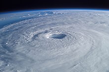
A tropical cyclone is a storm system characterized by a large low-pressure center, a closed low-level circulation and a spiral arrangement of numerous thunderstorms that produce strong winds and heavy rainfall. Tropical cyclones feed on the heat released when moist air rises, resulting in condensation of water vapor contained in the moist air. They are fueled by a different heat mechanism than other cyclonic windstorms such as Nor'easters, European windstorms and polar lows, leading to their classification as "warm core" storm systems. Most tropical cyclones originate in the doldrums, approximately ten degrees from the Equator.
The term "tropical" refers to both the geographic origin of these systems, which form almost exclusively in tropical regions of the globe, as well as to their formation in maritime tropical air masses. The term "cyclone" refers to such storms' cyclonic nature, with anticlockwise rotation in the Northern Hemisphere and clockwise rotation in the Southern Hemisphere. Depending on its location and intensity, a tropical cyclone may be referred to by names such as "hurricane", "typhoon", "tropical storm", "cyclonic storm", "tropical depression" or simply "cyclone".
Types of cyclone: 1. A "Typhoon" is a tropical cyclone located in the North-west Pacific Ocean which has the most cyclonic activity and storms occur year-round. 2. A "Hurricane" is also a tropical cyclone located at the North Atlantic Ocean or North-east Pacific Ocean which have an average storm activity and storms typically form between May 15 and November 30. 3. A "Cyclone" is a tropical cyclone that occurs in the South Pacific and Indian Oceans.
Selected named cyclone -
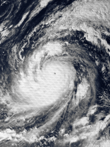
Typhoon Tip, known in the Philippines as Super Typhoon Warling, was the largest and most intense tropical cyclone ever recorded. The forty-third tropical depression, nineteenth tropical storm, twelfth typhoon, and third super typhoon of the 1979 Pacific typhoon season, Tip developed out of a disturbance within the monsoon trough on October 4 near Pohnpei in Micronesia. Initially, Tropical Storm Roger to the northwest hindered the development and motion of Tip, though after the storm tracked farther north, Tip was able to intensify. After passing Guam, Tip rapidly intensified and reached peak sustained winds of 305 km/h (190 mph) and a worldwide record-low sea-level pressure of 870 hPa (25.69 inHg) on October 12. At its peak intensity, Tip was the largest tropical cyclone on record, with a wind diameter of 2,220 km (1,380 mi). Tip slowly weakened as it continued west-northwestward and later turned to the northeast, in response to an approaching trough. The typhoon made landfall in southern Japan on October 19, and became an extratropical cyclone shortly thereafter. Tip's extratropical remnants continued moving east-northeastward, until they dissipated near the Aleutian Islands on October 24.
U.S. Air Force aircraft flew 60 weather reconnaissance missions into the typhoon, making Tip one of the most closely observed tropical cyclones. Rainfall from Tip indirectly led to a fire that killed 13 Marines and injured 68 at Combined Arms Training Center, Camp Fuji in the Shizuoka Prefecture of Japan. Elsewhere in the country, the typhoon caused widespread flooding and 42 deaths; offshore shipwrecks left 44 people killed or missing. (Full article...)Selected article -
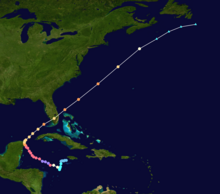
Hurricane Wilma was the most intense tropical cyclone in the Atlantic basin on record in terms of minimum barometric pressure, with an atmospheric pressure of 882 millibars (26.0 inHg). Wilma's destructive journey began in the second week of October 2005. A large area of disturbed weather developed across much of the Caribbean and gradually organized to the southeast of Jamaica. By late on October 15, the system was sufficiently organized for the National Hurricane Center to designate it as Tropical Depression Twenty-Four.
The depression drifted southwestward, and under favorable conditions, it strengthened into Tropical Storm Wilma on October 17. Initially, development was slow due to its large size, though convection steadily organized. From October 18, and through the following day, Wilma underwent explosive deepening over the open waters of the Caribbean; in a 30-hour period, the system's central atmospheric pressure dropped from 982 millibars (29.0 inHg) to the record-low value of 882 millibars (26.0 inHg), while the winds increased to 185 mph (298 km/h). At its peak intensity, the eye of Wilma was about 2.3 miles (3.7 km) in diameter, the smallest known eye in an Atlantic hurricane. After the inner eye dissipated due to an eyewall replacement cycle, Hurricane Wilma weakened to Category 4 status, and on October 21, it made landfall on Cozumel and on the Mexican mainland with winds of about 150 mph (240 km/h). (Full article...)Selected image -

Selected season -

The 2005 Atlantic hurricane season was the most active year on record until surpassed by 2020. It featured 28 tropical or subtropical storms. The United States National Hurricane Center named 27 storms, exhausting the annual pre-designated list, requiring the use of six Greek letter names, and adding an additional unnamed storm during a post-season re-analysis. A record 15 storms attained hurricane status, with maximum sustained winds of at least 74 miles per hour (119 km/h). Of those, a record seven became major hurricanes, rated Category 3 or higher on the Saffir–Simpson scale. Four storms of this season became Category 5 hurricanes, the highest ranking.
The four Category 5 hurricanes during the season were: Emily, Katrina, Rita, and Wilma. In July, Emily reached peak intensity in the Caribbean Sea, becoming the first Category 5 hurricane of the season, later weakening and striking Mexico twice. In August, Katrina reached peak winds in the Gulf of Mexico but weakened by the time it struck the U.S. states of Louisiana and Mississippi. The most devastating effects of the season were felt on the Gulf Coast of the United States, where Katrina's storm surge crippled New Orleans, Louisiana, for weeks and devastated the Mississippi coastline. Katrina became the costliest U.S. hurricane, leaving $125 billion in damage and 1,392 deaths. Rita followed in September, reaching peak intensity in the Gulf of Mexico before weakening and hitting near the border of Texas and Louisiana. The season's strongest hurricane, Wilma, became the most intense Atlantic hurricane on record, as measured by barometric pressure. Lasting for ten days in October, Wilma moved over Cozumel, the Yucatán Peninsula, and Florida, causing over $22 billion in damage and 52 deaths. (Full article...)Related portals
Currently active tropical cyclones

Italicized basins are unofficial.
- North Atlantic (2024)
- No active systems
- East and Central Pacific (2024)
- No active systems
- West Pacific (2024)
- No active systems
- North Indian Ocean (2024)
- No active systems
- Mediterranean (2023–24)
- No active systems
- Australian region (2023–24)
- No active systems
- South Pacific (2023–24)
- No active systems
- South Atlantic (2023–24)
- No active systems
Last updated: 02:33, 2 May 2024 (UTC)
Tropical cyclone anniversaries

- May 6, 1957 - Typhoon Trix (track pictured) reached its peak intensity with a central pressure of 950 hPa (mbar) to the east of the Philippines.

May 7
- 1932 - A tropical storm moved across Hispaniola.
- 2011 - Tropical Storm Aere (pictured) affects the Philippines killing 48 people and Php1.4 billion (US$34 million) in damages.

May 8
- 2003 - Cyclone Manou reached its peak intensity in the Indian Ocean with a central pressure of 967 hPa (mbar). Manou killed 70 people in Madagascar.
- 2017 - Cyclone Donna (pictured) attained peak intensity in the South Pacific Ocean, with peak 10 minute winds of 205 km/h (125 mph); this made it the strongest ever recorded Southern Hemisphere tropical cyclone in the month of May.
Did you know…
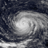


- …that the Joint Typhoon Warning Center considers that Typhoon Vera (pictured) of 1986 is actually two distinct systems, formed from two separated low-level circulations?
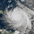
- …that Hurricane Agatha (pictured) was the strongest Pacific hurricane to make landfall in Mexico in May since records began in 1949?
- …that Cyclone Raquel (track pictured) travelled between the Australian and South Pacific basins between the 2014–15 and 2015–16 seasons, spanning both seasons in both basins?
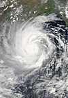
- …that Cyclone Amphan (pictured) in 2020 was the first storm to be classified as a Super Cyclonic Storm in the Bay of Bengal since 1999?
General images -

The list of North Carolina hurricanes between 1900 and 1949 encompasses 75 tropical cyclones or their remnants that affected the U.S. state of North Carolina. Collectively, cyclones in North Carolina during that time period resulted in 53 total fatalities, as well as about $328 million in damage in 2008 USD. Tropical cyclone affected the state in all but nine seasons. In the 1916 season, five storms affected the state, which makes it the season with the most storms impacting the state.
The strongest hurricanes to affect the state during the time period were the 1933 Outer Banks hurricane and the 1944 Great Atlantic Hurricane, which produced winds of Category 3 status on the Saffir–Simpson hurricane scale within the state. The 1933 Outer Banks hurricane was the deadliest hurricane in the state during the time period, which killed 21 people. The remnants of a hurricane in 1940 dropped heavy rainfall in the state, which caused over $150 million in damage (2008 USD) from flooding and landslides. Most storms affected the state in September, though in the first half of the 20th century, cyclones impacted the state between May and December. (Full article...)Topics
Subcategories
Related WikiProjects
WikiProject Tropical cyclones is the central point of coordination for Wikipedia's coverage of tropical cyclones. Feel free to help!
WikiProject Weather is the main center point of coordination for Wikipedia's coverage of meteorology in general, and the parent project of WikiProject Tropical cyclones. Three other branches of WikiProject Weather in particular share significant overlaps with WikiProject Tropical cyclones:
- The Non-tropical storms task force coordinates most of Wikipedia's coverage on extratropical cyclones, which tropical cyclones often transition into near the end of their lifespan.
- The Floods task force takes on the scope of flooding events all over the world, with rainfall from tropical cyclones a significant factor in many of them.
- WikiProject Severe weather documents the effects of extreme weather such as tornadoes, which landfalling tropical cyclones can produce.
Things you can do
 |
Here are some tasks awaiting attention:
|
Wikimedia
The following Wikimedia Foundation sister projects provide more on this subject:
-
Commons
Free media repository -
Wikibooks
Free textbooks and manuals -
Wikidata
Free knowledge base -
Wikinews
Free-content news -
Wikiquote
Collection of quotations -
Wikisource
Free-content library -
Wikiversity
Free learning tools -
Wikivoyage
Free travel guide -
Wiktionary
Dictionary and thesaurus
