Wikipedia:Graphics Lab/Map workshop/Archive/Jul 2023
| This is an archive of past discussions for the period 2023. Do not edit the contents of this page. If you wish to start a new discussion or revive an old one, please do so on the current main page. |
 | Archives of 2023: January, February, March, April, May, June, July, August, September, October, November, December |
Updates to map of country subdivisions
-
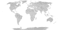 Map of world subdivisions

- Article(s)
- Administrative division and others
- Request
- Could someone update the map of national subdivisions for the following changes?: new cantons in Luxembourg, municipalities in Latvia, new regions in Chile, Tanzania, the Philippines, Mali, Kazakhstan, Ghana, and Ethiopia, new prefectures in the Central African Republic, new provinces in Equatorial Guinea, Burundi, Algeria, Laos, Indonesia, Nepal, and the Democratic Republic of the Congo, new governorates in Lebanon, new administrative area in South Sudan have been created. -- HapHaxion (talk / contribs) 23:58, 3 July 2023 (UTC)
- Discussion
Polar bear range map
-
![Current range map]]](//upload.wikimedia.org/wikipedia/commons/thumb/2/24/Polar_bear_range_map.png/120px-Polar_bear_range_map.png) Current range map]]
Current range map]] -
 New map
![Current range map]]](/wiki/File:Polar_bear_range_map.png)
.svg)
- Article(s)
- Polar bear
- Request
- Requesting a new range map based on the map here. The current one has no source. Please ignore the four colors, borders and labels and highlight it like the old range map. Thank you. LittleJerry (talk) 10:40, 11 August 2023 (UTC)
- Discussion
 Request taken by M.Bitton (talk) 12:08, 11 August 2023 (UTC).
 Done you'll notice that I used the IUCN data (the source that you supplied is based on it). M.Bitton (talk) 23:26, 13 August 2023 (UTC)
{{resolved}}
Maps displaying the Asian and European parts of Azerbaijan, Georgia, and Kazakhstan
-
 Example image showing the African and Asian parts of Egypt

- Article(s)
- List of transcontinental countries
- Request
- Make maps displaying the Asian and European parts of Azerbaijan, Georgia, and Kazakhstan in the same style as the example image showing the African and Asian parts of Egypt.
- Here is how the border between the Asian and European parts of each country is defined:
- Azerbaijan
- Asian part: Land south of the Greater Caucasus Watershed.
- European part: Land north of the Greater Caucasus Watershed.
- Georgia
- Asian part: Land south of the Greater Caucasus Watershed.
- European part: Land north of the Greater Caucasus Watershed.
- Kazakhstan
- Asian part: Land east of the Ural River.
- European part: Land west of the Ural River.
- -- Treetoes023 (talk) 23:32, 10 July 2023 (UTC)
- Discussion
Map displaying the North American and South American parts of Panama
-
Example image showing the African and Asian parts of Egypt
- Article(s)
- List of transcontinental countries
- Request
- Make a map displaying the North American and South American parts of Panama in the same style as the example image showing the African and Asian parts of Egypt. -- Treetoes023 (talk) 23:32, 10 July 2023 (UTC)
- Discussion
- @Treetoes023: there is no consensus as to what the boundary is between North and South America --Guerillero Parlez Moi 09:35, 22 July 2023 (UTC)
- @Guerillero: Isn't the Panama Canal the boundary between North America and South America, just like the Suez Canal is the boundary between Africa and Asia? – Treetoes023 (talk) 17:45, 22 July 2023 (UTC)
- Not always. Serranía del Darién is also a common choice for cartographers --Guerillero Parlez Moi 20:46, 22 July 2023 (UTC)
- @Guerillero: Oh, well in that case we should have a map that shows both borders, like this map does for the border(s) between Europe and Asia. – Treetoes023 (talk) 22:26, 22 July 2023 (UTC)
- Not always. Serranía del Darién is also a common choice for cartographers --Guerillero Parlez Moi 20:46, 22 July 2023 (UTC)
- @Guerillero: Isn't the Panama Canal the boundary between North America and South America, just like the Suez Canal is the boundary between Africa and Asia? – Treetoes023 (talk) 17:45, 22 July 2023 (UTC)
Visa policy of Israel
-
 current map

- Article(s)
- Visa policy of Israel
- Request
- Can somebody please create standard visa policy map in svg? Grey areas should be the same, there is no "simplified visa process" mentioned in the article. Thanks! Artem.G (talk) 11:29, 17 August 2023 (UTC)
- Discussion

Visa policy of the State of Israel

![]() Request taken by ~ Argenti Aertheri(Chat?) 22:47, 31 August 2023 (UTC).
Request taken by ~ Argenti Aertheri(Chat?) 22:47, 31 August 2023 (UTC).
![]() Done ~ Argenti Aertheri(Chat?) 23:52, 6 September 2023 (UTC)
Done ~ Argenti Aertheri(Chat?) 23:52, 6 September 2023 (UTC)
- Nice, thank you! Artem.G (talk) 11:02, 7 September 2023 (UTC)
{{resolved}}
Gordie Howe International Bridge map
- Article(s)
- Gordie Howe International Bridge
- Request
- Hello, can someone extract the details of the Gordie Howe International Bridge from OpenStreetMap and make a map with labels? The bridge is located in Detroit, Michigan, United States and Windsor, Ontario, Canada. I made an example to show the relevant labelling, but it's not wikipedia worthy! Thanks! Turini2 (talk) 07:46, 25 July 2023 (UTC)
- Discussion