Republic of Namibia | |
|---|---|
| Motto: "Unity, Liberty, Justice" | |
| Anthem: "Namibia, Land of the Brave" | |
 | |
| Capital and largest city | Windhoek 22°34.2′S 17°5.167′E / 22.5700°S 17.086117°E |
| Official languages | English |
| Recognised regional languages | Afrikaans, German, Oshiwambo |
| Demonym(s) | Namibian |
| Government | Republic |
| Hifikepunye Pohamba | |
| Nahas Angula | |
| Asser Kuveri Kapere | |
| Theo-Ben Gurirab | |
| Peter Shivute | |
| Legislature | Parliament |
| National Council | |
| National Assembly | |
| Independence from South Africa | |
• Date | 21 March 1990 |
| Area | |
• Total | 825,418 km2 (318,696 sq mi) (34th) |
• Water (%) | negligible |
| Population | |
• 2009 estimate | 2,108,665[1] (142nd) |
• 2008 census | 2,088,669 |
• Density | 2.5/km2 (6.5/sq mi) (235th) |
| GDP (PPP) | 2009 estimate |
• Total | $13.771 billion[2] |
• Per capita | $6,614[2] |
| GDP (nominal) | 2009 estimate |
• Total | $9.459 billion[2] |
• Per capita | $4,543[2] |
| Gini (2003) | 70.7[1] Error: Invalid Gini value (1st) |
| HDI (2007) | Error: Invalid HDI value (128th) |
| Currency | Namibian dollar (NAD) |
| Time zone | UTC+1 (WAT) |
• Summer (DST) | UTC+2 (WAST) |
| Drives on | left |
| Calling code | +264 |
| ISO 3166 code | NA |
| Internet TLD | .na |


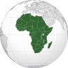
Namibia, officially the Republic of Namibia (Afrikaans: Republiek van Namibië, German: Republik Namibia), is a country in southern Africa whose western border is the Atlantic Ocean. It shares land borders with Angola and Zambia to the north, Botswana to the east and South Africa to the south and east. It gained independence from South Africa on 21 March 1990 following the Namibian War of Independence. Its capital and largest city is Windhoek. Namibia is a member state of the United Nations (UN), the Southern African Development Community (SADC), the African Union (AU), and the Commonwealth of Nations.
The dry lands of Namibia were inhabited since early times by Bushmen, Damara, and Namaqua, and since about the 14th century AD by immigrating Bantu who came with the Bantu expansion. It became a German Imperial protectorate in 1884 and remained a German colony until the end of World War I. In 1920, the League of Nations mandated the country to South Africa, which imposed its laws and from 1948, its apartheid policy.
In 1966, uprisings and demands by African leaders led the United Nations to assume direct responsibility over the territory. It recognized the South West Africa People’s Organization (SWAPO) as the official representative of the Namibian people in 1973. Namibia, however, remained under South African administration during this time. Following internal violence, South Africa installed an interim administration in Namibia in 1985. With the exception of Walvis Bay — a city that remained under South African control until 1994 — Namibia obtained full independence from South Africa in 1990.
Namibia has a population of 2.1 million people and a stable multiparty parliamentary democracy. Agriculture, herding, tourism and mining of precious stones and metals form the backbone of Namibia's economy. It is the second least densely populated country in the world, after Mongolia. Approximately half the population live below the international poverty line, and the nation has suffered heavily from the effects of HIV/AIDS, with 15% of the adult population infected with HIV in 2007.
History
editThe name of the country is derived from the Namib Desert, considered to be the oldest desert in the world.[3] Before its independence in 1990, the area was known first as German South-West Africa (Deutsch-Südwestafrika), then as South-West Africa, reflecting the colonial occupation by the Germans and the British.
Pre-colonial period
editThe dry lands of Namibia were inhabited since early times by Bushmen, Damara, Namaqua, and since about the 14th century AD, by immigrating Bantu who came with the Bantu expansion. The first Europeans to disembark and explore the region were the Portuguese navigators Diogo Cão in 1485 and Bartolomeu Dias in 1486, still the region was not claimed by the Portuguese crown.
In the late 19th century Dorsland trekkers (also known as Junker Boers) crossed the area on their way from the Transvaal to Angola.[4] However, like most of Sub-Saharan Africa, Namibia was not extensively explored by Europeans until the 19th century, when traders and settlers arrived, principally from Germany and Sweden.
German rule
editNamibia became a German colony in 1884 to forestall British encroachment and was known as German South-West Africa (Deutsch-Südwestafrika)[5]—apart from Walvis Bay, which was under British control. From 1904 to 1907, the Herero and the Namaqua took up arms against the Germans and in the subsequent Herero and Namaqua genocide, 10,000 Nama (half the population) and approximately 65,000 Hereros (about 80% of the population) were killed.[6][7] The survivors, when finally released from detention, were subject to a policy of dispossession, deportation, forced labor, and racial segregation and discrimination in a system that in many ways anticipated apartheid. Indeed, some historians have speculated the German genocide in Namibia was a model used by Nazis in the Holocaust,[8] but most scholars say that episode was not especially influential for Nazis, who were children at the time.[9] The memory of genocide remains relevant to ethnic identity in independent Namibia and to relations with Germany.[10]
South African rule and the struggle for independence
editSouth Africa occupied the colony during World War I and administered it as a League of Nations mandate territory. Although the South African government desired to incorporate 'South-West Africa' into its territory, it never officially did so, although it was administered as the de facto 'fifth province', with the white minority having representation in the whites-only Parliament of South Africa.
Following the League's supersession by the United Nations in 1946, South Africa refused to surrender its earlier mandate to be replaced by a United Nations Trusteeship agreement, requiring closer international monitoring of the territory's administration. During the 1960s, when European powers granted independence to their colonies and trust territories in Africa, pressure mounted on South Africa to do so in Namibia. In 1966 the International Court of Justice dismissed a complaint brought by Ethiopia and Liberia against South Africa's continued presence in the territory, but the U.N. General Assembly subsequently revoked South Africa's mandate.[11]
Soon thereafter the South-West Africa People's Organisation (SWAPO) military wing, People's Liberation Army of Namibia, a guerrilla group began their armed struggle for independence,[12] but it was not until 1988 that South Africa agreed to end its occupation[13] of Namibia, in accordance with a United Nations peace plan for the entire region. During the South African occupation of Namibia, white commercial farmers, most of whom came as settlers from South Africa and represented 0.2% of the national population, owned 74% of arable land.[14] The country was divided into bantustans, as South Africa did in her own country. Transition for independence started in 1989 and on 21 March 1990 the country officially claimed full independence. Sam Nujoma was sworn in as the first President of Namibia watched by Nelson Mandela (who had been released from prison shortly beforehand) and representatives from 147 countries, including 20 heads of state.[15] Walvis Bay was ceded to Namibia in 1994 upon the end of Apartheid in South Africa.
After independence
editSince independence Namibia has successfully completed the transition from white minority apartheid rule to parliamentary democracy. Multiparty democracy was introduced and has been maintained, with local, regional and national elections held regularly. Several registered political parties are active and represented in the National Assembly, although Swapo Party has won every election since independence.[16] The transition from the 15-year rule of President Sam Nujoma to his successor, Hifikepunye Pohamba in 2005 went smoothly.[17]
Namibian government has promoted a policy of national reconciliation and issued an amnesty for those who had fought on either side during the liberation war. The civil war in Angola had a limited impact on Namibians living in the north of the country. In 1998, Namibia Defence Force (NDF) troops were sent to the Democratic Republic of the Congo as part of a Southern African Development Community (SADC) contingent. In August 1999, a secessionist attempt in the northeastern Caprivi region was successfully quashed.[17]
Politics
edit
The politics of Namibia takes place in a framework of a presidential representative democratic republic, whereby the president of Namibia is elected to a five-year term and is both the head of state and the head of government, and of a multi-party system. Executive power is exercised by the government. Legislative power is vested in both the government and the bicameral Parliament, the National Assembly and the National Council. The judiciary is independent of the executive and the legislature. The management of the rule of law and the observance of basic human rights in Namibia are constantly scrutinized.[18]
Namibia held Presidential and the National Assembly elections on 27 and 28 November 2009. The Electoral Commission of Namibia published a "Handbook for Election Observers in Namibia" to enable observers (and party agents) to professionally observe the Presidential and National Assembly Elections 2009, the Regional Councils and Local Authorities Elections 2010 and subsequent By-Elections.[18]
Foreign relations
editNamibia follows a largely independent foreign policy, with lingering affiliations with states that aided the independence struggle, including Libya and Cuba. With a small army and a fragile economy, the Namibian Government's principal foreign policy concern is developing strengthened ties within the Southern African region. A dynamic member of the Southern African Development Community, Namibia is a vocal advocate for greater regional integration. Namibia became the 160th member of the United Nations on 23 April 1990. On its independence it became the fiftieth member of the Commonwealth of Nations.[citation needed]
International disputes
editNamibia is involved in several minor international disputes, including:
- Small residual disputes with Botswana along the Caprivi Strip, including the Situngu marshlands and specifically Kasikili or Sedudu Island.[citation needed]
- A dormant dispute over where the boundaries of Botswana, Namibia, Zambia and Zimbabwe converge.[citation needed]
- Disputes over Angolan rebels and refugees residing in Namibia.[citation needed]
Geography and climate
edit.jpg)
At 825,418 km2 (318,696 sq mi),[19] Namibia is the world's thirty-fourth largest country (after Venezuela). After Mongolia, Namibia is the least densely populated country in the world (2.5 inhabitants per square kilometre (6.5/sq mi)).
Administrative division
edit
Namibia is divided into 13 regions and subdivided into 107 constituencies. Regional councillors are directly elected through secret ballots (regional elections) by the inhabitants of their constituencies.[20]
Geographical areas
editThe Namibian landscape consists generally of five geographical areas, each with characteristic abiotic conditions and vegetation with some variation within and overlap between them: the Central Plateau, the Namib Desert, the Great Escarpment, the Bushveld, and the Kalahari Desert.
Central Plateau
edit


The Central Plateau runs from north to south, bordered by the Skeleton Coast to the northwest, the Namib Desert and its coastal plains to the southwest, the Orange River to the south, and the Kalahari Desert to the east. The Central Plateau is home to the highest point in Namibia at Königstein elevation 2,606 meters (8,550 ft).[21] Within the wide, flat Central Plateau is the majority of Namibia’s population and economic activity. Windhoek, the nation’s capital, is located here, as well as most of the arable land. Although arable land accounts for only 1% of Namibia, nearly half of the population is employed in agriculture.[22]
The abiotic conditions here are similar to those found along the Escarpment; however the topographic complexity is reduced. Summer temperatures in the area can reach 40 °C (104 °F), and frosts are common in the winter.
Namib Desert
editThe Namib Desert is a broad expanse of hyper-arid gravel plains and dunes that stretches along the entire coastline, which varies in width between 100 to many hundreds of kilometres. Areas within the Namib include the Skeleton Coast and the Kaokoveld in the north and the extensive Namib Sand Sea along the central coast.[23] The sands that make up the sand sea are a consequence of erosional processes that take place within the Orange River valley and areas further to the south. As sand-laden waters drop their suspended loads into the Atlantic, onshore currents deposit them along the shore. The prevailing south west winds then pick up and redeposit the sand in the form of massive dunes in the widespread sand sea, the largest sand dunes in the world. In areas where the supply of sand is reduced because of the inability of the sand to cross riverbeds, the winds also scour the land to form large gravel plains. In many areas within the Namib Desert, there is little vegetation with the exception of lichens found in the gravel plains, and in dry river beds where plants can access subterranean water.
Great Escarpment
editThe Great Escarpment swiftly rises to over 2,000 meters (6,562 ft). Average temperatures and temperature ranges increase as you move further inland from the cold Atlantic waters, while the lingering coastal fogs slowly diminish. Although the area is rocky with poorly developed soils, it is nonetheless significantly more productive than the Namib Desert. As summer winds are forced over the Escarpment, moisture is extracted as precipitation.[24] The water, along with rapidly changing topography, is responsible for the creation of microhabitats which offer a wide range of organisms, many of them endemic. Vegetation along the escarpment varies in both form and density, with community structure ranging from dense woodlands to more shrubby areas with scattered trees. A number of Acacia species are found here, as well as grasses and other shrubby vegetation.
Bushveld
editThe Bushveld is found in north eastern Namibia along the Angolan border and in the Caprivi Strip which is the vestige of a narrow corridor demarcated for the German Empire to access the Zambezi River. The area receives a significantly greater amount of precipitation than the rest of the country, averaging around 400 mm (15.7 in) per year. Temperatures are also cooler and more moderate, with approximate seasonal variations of between 10 and 30 °C (50 and 86 °F). The area is generally flat and the soils sandy, limiting their ability to retain water.[25] Located adjacent to the Bushveld in north-central Namibia is one of nature’s most spectacular features: the Etosha Pan. For most of the year it is a dry, saline wasteland, but during the wet season, it forms a shallow lake covering more than 6,000 square kilometres (2,317 sq mi). The area is ecologically important and vital to the huge numbers of birds and animals from the surrounding savannah that gather in the region as summer drought forces them to the scattered waterholes that ring the pan. The Bushveld area has been demarcated by the World Wildlife Fund as part of the Angolan Mopane woodlands ecoregion, which extends north across the Cunene River into neighbouring Angola.
Kalahari Desert
editThe Kalahari Desert is perhaps Namibia’s best known geographical feature. Shared with South Africa and Botswana, it has a variety of localized environments ranging from hyper-arid sandy desert, to areas that seem to defy the common definition of desert. One of these areas, known as the Succulent Karoo, is home to over 5,000 species of plants, nearly half of them endemic; fully one third of the world’s succulents are found in the Karoo.
The reason behind this high productivity and endemism may be the relatively stable nature of precipitation.[26] The Karoo apparently does not experience drought on a regular basis, so even though the area is technically desert, regular winter rains provide enough moisture to support the region’s interesting plant community. Another feature of the Kalahari, indeed many parts of Namibia, are inselbergs, isolated mountains that create microclimates and habitat for organisms not adapted to life in the surrounding desert matrix.
Coastal Desert
editNamibia’s Coastal Desert is one of the oldest deserts in the world. Its sand dunes, created by the strong onshore winds, are the highest in the world.[27]
The Namib Desert and the Namib-Naukluft National Park is located here. The Namibian coastal deserts are one of the richest source of diamonds on earth. It is divided into the northern Skeleton Coast and the southern Diamond Coast. Because of the location of the shoreline—at the point where the Atlantic's cold water reach Africa—there is often extremely dense fog.[28]
Sandy beach comprises 54% and mixed sand and rock add another 28%. Only 16% of the total length is rocky shoreline. The coastal plains are dune fields, gravel plains covered with lichen and some scattered salt pans. Near the coast there are areas where the dunes are vegetated with hammocks.[29] Namibia has rich coastal and marine resources that remain largely unexplored.[30]
Weather and climate
editNamibia has more than 300 days of sunshine per year. It is situated at the southern edge of the tropics; the Tropic of Capricorn cuts the country about in half. The winter (June - August) is generally dry, both rainy seasons occur in summer, the small rainy season between September and November, the big one between February and April.[31] Humidity is low, and average rainfall varies from almost zero in the coastal desert to more that 600 mm in the Caprivi Strip. Rainfall is however highly variable, and droughts are common.[32] The last[update] bad rainy season occurred in summer 2006/07.[33]
Weather and climate in the coastal area are dominated by the cold, north-flowing Benguela current of the Atlantic Ocean which accounts for very low precipitation (50 mm per year or less), frequent dense fog, and overall lower temperatures than in the rest of the country.[32] In Winter, occasionally a condition known as Bergwind or Oosweer (Afrikaans: East weather) occurs, a hot dry wind blowing from the inland to the coast. As the area behind the coast is a desert, these winds can develop into sand storms with sand deposits in the Atlantic Ocean visible on satellite images.[34]
The Central Plateau and Kalahari areas have wide diurnal temperature ranges of up to 30C.[32]
Towns
edit
The capital and largest city, Windhoek, is in the centre of the country. It is home to the country's Central Administrative Region, Windhoek Hosea Kutako International Airport and the country's railhead. Other important towns are:
- Arandis, uranium mine
- Walvis Bay, sea port, international airport, railhead
- Oshakati, main business centre in the North, railhead
- Otjiwarongo, main business centre in Central-North, rail junction
- Lüderitz, sea port, railhead
- Gobabis, farming centre
- Keetmanshoop, railhead
- Tsumeb, mining
- Swakopmund, Tourism (Ex German Colonial town)
- Rundu,
- Katima Mulilo
- Omaruru
Population
editDemographics
edit
Namibia has the second-lowest population density of any sovereign country, after Mongolia. The majority of the Namibian population is black African — mostly of the Ovambo ethnicity, which forms about half of the population — and concentrated in the north of the country. Other ethnic groups are the Herero and Himba people, who speak a similar language.
In addition to the Bantu majority, there are large groups of Khoisan (such as Nama and Bushmen), who are descendants of the original inhabitants of Southern Africa. The country also contains some descendants of refugees from Angola. There are also two smaller groups of people with mixed racial origins, called "Coloureds" and "Basters", who together make up 6.5% (with the Coloureds outnumbering the Basters two to one). As of 2006 there were as many as 40,000 Chinese in Namibia.[35]
Whites of Portuguese, Dutch, German, British and French ancestry make up about 7% of the population; they form the second-largest population of European ancestry, both in terms of percentage and actual numbers, in Sub-Saharan Africa after South Africa.[1] Most Namibian whites and nearly all those of mixed race speak Afrikaans and share similar origins, culture, and religion as the white and coloured populations of South Africa. A smaller proportion of whites (around 30,000) trace their family origins directly back to German colonial settlers and maintain German cultural and educational institutions. Nearly all Portuguese settlers came to the country from the former Portuguese colony of Angola.[36]
Religion
editThe Christian community makes up at least 80% of the population of Namibia, with at least 50% of these Lutheran. At least 10% of the population hold indigenous beliefs. Followers of Islam account for 3% of the population. The faith of the remaining portion of the population is unknown.[1]
Missionary work during the 1800s drew many Namibians to Christianity. While most Namibian Christians are Lutheran, there also are Roman Catholic, Methodist, Anglican, African Methodist Episcopal, Dutch Reformed Christians and Mormon (Latter-Day Saints) represented, as well as some Jewish people.[37]
Language
edit
The official language is English. Until 1990, German and Afrikaans were also official languages. Long before Namibia's independence from South Africa, SWAPO had decided on the country's becoming officially monolingual, consciously choosing this approach in contrast to that of its neighbour which was regarded as "a deliberate policy of ethnolinguistic fragmentation."[38] Therefore, English became the sole official language of Namibia. A number of other languages have received semi-official recognition by being allowed as medium of instruction in primary schools.
Half of all Namibians speak Oshiwambo as their first language, whereas the most widely understood language is Afrikaans. Among the younger generation, the most widely understood language is English. Both Afrikaans and English are used primarily as a second language reserved for public sphere communication, but small first language groups exist throughout the country.
While the official language is English, most of the white population speaks either German or Afrikaans. Even today, 90 years after the end of the German colonial era, the German language plays a leading role as a commercial language. Afrikaans is spoken by 60% of the white community, German is spoken by 32%, English is spoken by 7% and Portuguese by 1%.[1] Geographical proximity to Portuguese-speaking Angola explains the relatively high number of lusophones.
Health
editThe AIDS epidemic is a large problem in Namibia. Though its rate of infection is substantially lower than that of its eastern neighbor, Botswana, approximately 15% of the adult population is[update] infected with HIV.[39] In 2001, there were an estimated 210,000 people living with HIV/AIDS, and the estimated death toll in 2003 was 16,000. The HIV/AIDS epidemic is considered as a killer disease and as it has reduced the number of working class people, the number of orphans has increased. It falls to the government to provide education, food, shelter and clothing for these orphans.[40]
The malaria problem seems to be compounded by the AIDS epidemic. Research has shown that in Namibia the risk of contracting malaria is 14.5% greater if a person is also infected with HIV. The risk of death from malaria is also raised by approximately 50% with a concurrent HIV infection.[41] Given infection rates this large, as well as a looming malaria problem, it may be very difficult for the government to deal with both the medical and economic impacts of this epidemic. The country had only 598 physicians in 2002. [42]
Economy
edit
Namibia’s economy is tied closely to South Africa’s due to their shared history.[43][44] It consists primarily of mining (12.4% of the gross domestic product in 2007), agriculture (9.5%), and manufacturing (15.4%).[45]
In terms of revenue, mining is the biggest contributor to Namibia's economy, accounting for 25% of the country's income.[46]
Rich alluvial diamond deposits make Namibia a primary source for gem-quality diamonds.[47] Namibia also produces large quantities of lead, zinc, tin, silver, and tungsten.
Namibia has a high unemployment rate. "Strict unemployment" (people actively seeking a full time job) stood at 20.2% in 2000, 21.9% in 2004 and spiraled to 29,4 per cent in 2008. Under a broader definition (including people that have given up searching for employment) unemployment rose from 36.7% in 2004 to 51.2% in 2008. This estimate considers people in the informal economy as employed. The study that arrived at these results has been hailed "by far superior in scope and quality to any that has been available previously" by Labour and Social Welfare Minister Immanuel Ngatjizeko.[48]
Approximately half the population live below the international poverty line of U.S.$1.25 a day.[49] There is a number of legislative measures in place to alleviate poverty and unemployment. In 2004 a labour act was passed to protect people from job discrimination stemming from pregnancy and HIV/AIDS status. In early 2010 the Government tender board announced that "henceforth 100 per cent of all unskilled and semi-skilled labour must be sourced, without exception, from within Namibia".[50]
Transportation
editDespite the remote nature of much of the country, Namibia has seaports, airports, highways, and railways (narrow-gauge). The country seeks to become a regional transportation hub; it has an important seaport and several landlocked neighbors. The Central Plateau already serves as a transportation corridor from the more densely populated north to South Africa, the source of four-fifths of Namibia’s imports.[22]
Agriculture
edit
About half of the population depends on agriculture (largely subsistence agriculture) for its livelihood, but Namibia must still import some of its food. Although per capita GDP is five times the per capita GDP of Africa's poorest countries, the majority of Namibia's people live in rural areas and exist on a subsistence way of life. Namibia has one of the highest rates of income inequality in the world, due in part to the fact that there is an urban economy and a more rural cash-less economy. The inequality figures thus take into account people who do not actually rely on the formal economy for their survival.
Agreement has been reached on the privatisation of several more enterprises in coming years, with hopes that this will stimulate much needed foreign investment. However, reinvestment of environmentally derived capital has hobbled Namibian per capita income.[51] One of the fastest growing areas of economic development in Namibia is the growth of wildlife conservancies. These conservancies are particularly important to the rural generally unemployed population.
Electricity
editElectricity in Namibia is generated mainly by Thermal and Hydroelectric Power Plants. Non-Conventional methods of electricity generation also play some role. Domestic Supply voltage is 220V AC. The Electricity Control Board [52] is a statutory regulatory authority responsible for regulating electricity generation, transmission, distribution, supply, import and export in Namibia.
Cost of living
edit.jpg)
The cost of living in Namibia is high. This is because many items used in daily life need to be imported, resulting in high transportation costs. Monopoly in some business sectors also causes higher profit booking and further raising of prices. For example, approximate prices (as of 2010) of electricity in Windhoek is 0.5873 N$ per unit (KWH) added with ECB levy of 0.0060 N$ per unit. A Fixed Cost based on the load is added to the bill and The Minimum amount is 48N$ (up to 10A load).[53] The Price of Gasoline (Petrol) is over 7 N$ per Liter,[54] and The price of Liquid Petroleum Gas (LPG) is close to 3 N$ per Liter.[55] Rent for a family accommodation may exceed 12000 N$ per month in safe urban locations.[56] Personal income tax is applicable to total taxable income of an Individual and All individuals are taxed at progressive marginal rates over a series of income brackets. The tax year runs from 1 March to 28 February.
Tax rates for the 2010 tax year are as follows:
| Taxable amount | Rates of tax |
|---|---|
| Where the taxable amount does not exceed N$ 40 000 | 0% |
| between N$ 40 001 and N$ 80 000 | 27% of the amount by which the taxable amount exceeds N$ 40 000 |
| between N$ 80 001 and N$ 200 000 | N$ 10 800 + 32% of the amount by which the taxable amount exceeds N$ 80 000 |
| between N$ 200 001 and N$ 750 000 | N$ 49200 + 34% of the amount by which the taxable amount exceeds N$ 200 000 |
| over N$ 750 000 | N$ 236 200 + 37% of the amount by which the taxable amount exceeds N$ 750 000 |
An employee's salary is normally paid in Namibian dollars (1 US Dollar = 7.37 Namibian Dollars approx.)[58] and income tax is deducted by the employer.
Tourism
edit
Namibia generally attracts eco-tourists with the majority visiting to experience the different climates and natural geographical landscapes such as the great eastern desert and plains. There are many lodges and reserves to accommodate eco-tourists. In addition, extreme sports such as sandboarding and 4x4ing have become popular, and many cities have companies that provide tours. The most visited places include the Caprivi Strip, Fish River Canyon, Sossusvlei, the Skeleton Coast Park, Sesriem, Etosha Pan and the coastal towns of Swakopmund, Walvis Bay and Lüderitz.[citation needed]
Child labour
editChild labour occurs in Namibia, and key stakeholders including government ministries endorsed the Action Programme towards the Elimination of Child Labour in January 2008. It has been reported that Namibia may also be a source and destination for trafficked children; however, the magnitude of the problem is not well documented. Low public awareness and inadequate training for law enforcement and social service officials are major obstacles to combating the problem. There is evidence that children are trafficked within the country for domestic activities, including forced agricultural labor, cattle herding and vending. Child prostitution cases have also been reported.[59] Laws exist against child labor and trafficking; however, the government has failed to prosecute a single case in human trafficking.
Mining
edit
URANIUM- Namibia is the fourth largest exporter of non-fuel minerals in Africa and has overtaken Russia as the fourth biggest uranium supplier in the world, on track to meet its target of becoming the world’s third largest supplier by 2015.[60]
Namibia’s first commercial uranium mine, Rossing Uranium, started operating in 1976. Rossing Uranium Ltd was formed in 1970 (now 68.6% Rio Tinto, 15% Iran, 10% Industrial Development Corporation of South Africa, 3% Namibian government). The company has mined the deposit from 1976 as a large-scale open pit in very hard rock. Rossing has nominal capacity of 4000 tU/yr and to the end of 2009 had supplied 94,963 tU. In 2009 it produced 3519 tU (2008: 3449 tU, 2007: 2582 tU, 2006: 3067 tU), making it the third largest uranium mine in the world.[61]
Namibia accounted for ten per cent of global uranium supply last year.
Uranium mines currently operating in Namibia are:
- Rio Tinto’s , Rossing Uranium
- Areva Resources Namibia’s , Trekkopje
- Paladin Energy’s , Langer Heinrich
- Forsys Metals Corporation’s Valencia mine
- Extract Resources’s , Rossing South
, to name a few.
The Langer Heinrich uranium mine was opened in 2007.[62]
There has been significant investment in uranium mining in Namibia and with these mega-investments in uranium projects,lots of job opportunities can be created, improving the social-economic situation of the country.[63]

DIAMONDS - Namibia has a rich history of diamond mining recorded from as early as the 1900's, when German prospectors attempted the first diamond exploration on Elizabeth Bay (aka Elisabethbucht) near Lüderitz.[64]
The first diamond was found by Zacharias Lewala, an employee on the railways near Lüderitzbucht (south west coast of Namibia) who showed it to his supervisor, August Stauch, known as the first diamond pioneer of Namibia. Official confirmation of the discovery resulted in a diamond rush to the area, and the then German government immediately seized control of the area, branding it Sperrgebiet, or "forbidden territory".[65]
The small mining town of Kolmanskop (now a ghost town) was established to the east of Lüderitz. During the mid 1910s, the Sperrgebiet coast accounted for 20 percent of the worldwide diamond take. In 1920, after the first world war, Germany lost control of Namibia to the government of South Africa, and the company Consolidated Diamond Mines(CDM),(predecessor to Namdeb) was formed.
Namdeb Diamond Corporation (Pty) Limited is owned in equal shares by the Government of the Republic of Namibia and De Beers Group. This partnership was formed in 1994 - although De Beer's is associated with Namibian diamonds from as early as 1920.
Diamonds are still being produced in Namibia, more than 90 years since their first discovery. Namibia's production of rough diamonds (ranked 8th in the world) in 1999,is estimated at 1,56 Million carats (that is 1,4% of the world's production). The Namibian diamonds are mainly gem quality, and are the biggest contributor to the Namibian economy.[66]
Military
editThe constitution of Namibia defined the role of the military as "defending the territory and national interests." Namibia formed the Namibian Defence Force (NDF), comprising former enemies in a 23-year bush war: the People's Liberation Army of Namibia (PLAN) and South West African Territorial Force (SWATF). The British formulated the force integration plan and began training the NDF, which consists of five battalions and a small headquarters element.
The United Nations Transitional Assistance Group (UNTAG)'s Kenyan infantry battalion remained in Namibia for three months after independence to assist in training the NDF and to stabilize the north. According to the Namibian Defence Ministry, enlistments of both men and women will number no more than 7,500. Defence and security account for approximately 3.7% of government spending.
Culture
editEducation
edit
Namibia has compulsory free education for 10 years between the ages of 6 and 16. Grades 1-7 are primary level, grades 8-12 secondary. In 1998, there were 400,325 Namibian students in primary school and 115,237 students in secondary schools. The pupil-teacher ratio in 1999 was estimated at 32:1, with about 8% of the GDP being spent on education.[67]
Most schools in Namibia are state-run, however, there are a few private schools that serve the country's education system. Among these are St. Pauls College, Windhoek Afrikaanse Privaatskool, Deutsche Höhere Privatschule and Windhoek Gymnasium. Curriculum development, educational research, and professional development of teachers is centrally organised by the National Institute for Educational Development (NIED) in Okahandja.[68]
There are four Teacher Training Colleges, three Colleges of Agriculture, a Police Training College, a Polytechnic, and a National University.
Communal Wildlife Conservancies
edit
Namibia is one of few countries in the world to specifically address conservation and protection of natural resources in its constitution.[69] Article 95 states, “The State shall actively promote and maintain the welfare of the people by adopting international policies aimed at the following: maintenance of ecosystems, essential ecological processes, and biological diversity of Namibia, and utilization of living natural resources on a sustainable basis for the benefit of all Namibians, both present and future.”[69]
In 1993, the newly formed government of Namibia received funding from the United States Agency for International Development (USAID) through its Living in a Finite Environment (LIFE) Project.[70] The Ministry of Environment and Tourism with the financial support from organizations such as USAID, Endangered Wildlife Trust, WWF, and Canadian Ambassador’s Fund, together form a Community Based Natural Resource Management (CBNRM) support structure. The main goal of this project is promote sustainable natural resource management by giving local communities rights to wildlife management and tourism.[71]
Sport
editThe most popular sport in Namibia is football (soccer). The Namibia national football team qualified for the 2008 Africa Cup of Nations. Rugby union and cricket are also popular. Namibia were participants in the 1999, 2003 and 2007 Rugby World Cups. They also played in the 2003 Cricket World Cup. Inline Hockey was first played in 1995 and has also become more and more popular in the last years. The Women's Inline Hockey National Team participated in the 2008 FIRS World Championships. Namibia is the home for one of the toughest footraces in the world, the Namibian ultra marathon. The most famous sportist from Namibia is certainly Frankie Fredericks, sprinter (100 and 200 m). He won 4 Olympic silver medals (1992, 1996) and also has medals from several World Athletics Championships. He is also known for humanitarian activities in Namibia and further.
Gallery
edit-
 Dune in Namibia.
 -
Petroglyphs near Twyfelfontein.
-
 Roter Kamm crater, in the Namib Desert (Landsat image)
 -
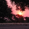 Namibian sunset.
 -
 Cape Ground Squirrels (Xerus inauris), close to Solitaire, Namibia.
 -
 Ruacana Falls, Namibia
 -
 The Kunene River near Swartbooisdrift
 -

-
 Aerial photo of Central Windhoek
 -
 Fish River Canyon, Namibia
 -
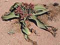 A Welwitschia mirabilis (female) in Namibia
 -
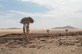 Quiver trees in the Skeleton Coast Park, Namibia
 -
 Aerial photo of Mercury Island, Namibia


.jpg)
See also
editSport
editLists
editReferences
edit- ^ a b c d e Central Intelligence Agency (2009). "Namibia". The World Factbook. Retrieved January 23, 2010.
- ^ a b c d "Namibia". International Monetary Fund. Retrieved 2010-04-21.
- ^ Namib desert (AT1315) World Wide Fund for Nature site on the Namib Desert
- ^ Klausdierks.com, Dorsland trekkers, Chronology of Namibian History, 2 January 2005
- ^ "German South West Africa". Encyclopædia Britannica. Retrieved 2008-04-15.
{{cite web}}: Italic or bold markup not allowed in:|publisher=(help) - ^ Drechsler, Horst (1980). Let us die fighting, originally published (1966) under the title "Südwestafrika unter deutsche Kolonialherrschaft". Berlin: Akademie-Verlag.
- ^ Mohamed Adhikari, "'Streams Of Blood And Streams Of Money': New Perspectives on the Annihilation of the Herero and Nama Peoples Of Namibia, 1904-1908," Kronos: Journal Of Cape History 2008 34: 303-320
- ^ Benjamin Madley, "From Africa to Auschwitz: How German South West Africa Incubated Ideas and Methods Adopted and Developed by the Nazis in Eastern Europe," European History Quarterly 2005 35(3): 429-464 says it influenced Nazis.
- ^ Robert Gerwarth, et al. "L'Antichambre de l'Holocauste? A propos du Debat sur les Violences Coloniales et la Guerre d'Extermination Nazie" ("The Antechamber of the Holocaust? The Debate on Colonial Violence and the Nazi War of Extermination") Vingtième Siècle 2008 (99): 143-159 says most scholars think it did not influence the Nazis.
- ^ Reinhart Kössler, and Henning Melber, "Völkermord und Gedenken: Der Genozid an den Herero und Nama in Deutsch-Südwestafrika 1904-1908," ("Genocide and memory: the genocide of the Herero and Nama in German South-West Africa, 1904-08") Jahrbuch zur Geschichte und Wirkung des Holocaust 2004: 37-75
- ^ "Namibian War of Independence 1966-1988". Armed Conflict Events Database. Retrieved 30 November 2009.
- ^ Petronella Sibeene (17 April 2009). "Swapo Party Turns 49". New Era.
- ^ Klaus Dierks Chronology of Namibian History, 1977
- ^ Land reform in Namibia: Why not? Southern African Report, January 1994
- ^ "Chronology of Namibian Independence". Klausdierks.com. Retrieved 2010-06-26.
- ^ "Country report: Spotlight on Namibia". Commonwealth Secretariat. Retrieved 12 July 2010.
- ^ a b "IRIN country profile Namibia". IRIN. Retrieved 12 July 2010.
- ^ a b Bösl, Anton (2008). Bösl, Anton; Horn, Nico (eds.). The Independence of the Judiciary in Namibia (PDF) (pdf). Publications sponsored by Konrad Adenauer Stiftung. Macmillan Education Namibia. ISBN 978-99916-0-807-5. Retrieved 2010-06-26.
- ^ "Rank Order - Area". CIA World Fact Book. Retrieved 2008-04-12.
- ^ "Namibia National Council". Inter-Parliamentary Union. Retrieved 14 July 2010.
- ^ "Landsat.usgs.gov". Landsat.usgs.gov. Retrieved 2010-06-26.
- ^ a b World Almanac. 2004.
- ^ Spriggs, A. 2001.(AT1315)
- ^ Spriggs, A. 2001.(AT1316)
- ^ Cowling, S. 2001.
- ^ Spriggs, A. 2001.(AT0709)
- ^ "NASA - Namibia's Coastal Desert". www.nasa.gov. Retrieved 2009-10-09.
- ^ "An Introduction to Namibia". www.geographia.com. Retrieved 2009-10-09.
- ^ "NACOMA - Namibian Coast Conservation and Management Project". www.nacoma.org.na. Retrieved 2009-10-09.
- ^ Sparks, Donald L. "Namibia's Coastal and Marine Development Potential -- Sparks 83 (333): 477 -- African Affairs". afraf.oxfordjournals.org. Retrieved 2009-10-09.
- ^ "The Rainy Season". Real Namibia. Retrieved 28 July 2010.
- ^ a b c "Namibia". Encyclopedia Britannica. Retrieved 28 July 2010.
- ^ Olszewski, John (28 May 2009). "Climate change forces us to recognise new normals". Namibia Economist.
- ^ Olszewski, John (25 June 2010). "Understanding Weather - not predicting it". Namibia Economist.
- ^ China and Africa: Stronger Economic Ties Mean More Migration, By Malia Politzer, Migration Information Source, August 2008
- ^ Flight from Angola, The Economist , August 16, 1975
- ^ "U.S. Department of State". State.gov. 2010-06-10. Retrieved 2010-06-26.
- ^ Pütz, Martin. Official Monolingualism in Africa: A sociolinguistic assessment of linguistic and cultural pluralism in Africa. in: Discrimination through language in Africa? Perspectives on the Namibian Experience. Mouton de Gruyter. Berlin: 1995. p.155.
- ^ Hivinsight.com, HIV InSite Knowledge Base, Comprehensive, up-to-date information on HIV/AIDS treatment, prevention, and policy from the University of California San Francisco
- ^ (aidsinafrica.net, 2007)
- ^ (Korenromp, et al. 2005)
- ^ "Who.int" (PDF). Afro.who.int. Retrieved 2010-06-26.
- ^ (United States Central Intelligence Agency, 2007)
- ^ (United States State Department, 2007)
- ^ "US Department of State". State.gov. 2010-06-10. Retrieved 2010-06-26.
- ^ "Mining in Namibia.doc" (PDF). NIED. Retrieved 2010-06-26.
- ^ Dan Oancea: Deep-Sea Mining and Exploration http://technology.infomine.com/articles/1/99/deep-sea-mining.undersea-miners.black-smoker/deep-sea.mining.and.aspx
- ^ The Namibian 4 February 2010 "Half of all Namibians unemployed" by Jo-Mare Duddy
- ^ Human Development Indices, Table 3: Human and income poverty, p. 35. Retrieved on 1 June 2009
- ^ The Namibian 3 Feb 2010 "Tender Board tightens rules to protect jobs", by Tileni Mongudhi
- ^ (Lange, 2004)
- ^ "Namibia Electricity Control Board". Ecb.org.na. Retrieved 2010-06-26.
- ^ "Interim Schedule Of Approved Tariffs" (PDF). Retrieved 2010-06-26.
- ^ "Nationmaster Resource". Nationmaster.com. Retrieved 2010-06-26.
- ^ Graig, Augetto. "Namibian News Online". Namibian.com.na. Retrieved 2010-06-26.
- ^ "Property Listing in Namibia". Myproperty.com.na. Retrieved 2010-06-26.
- ^ PAYE12 Volume 18 published by The Ministry of Finance in Namibia
- ^ "Finance/Currency Conversion, Yahoo.com". Finance.yahoo.com. Retrieved 2010-06-26.
- ^ The Namibian on child labour, 1 February 2008
- ^ [The Namibian "Nam 4th biggest uranium producer"]. The Namibian. 2009-05-06.
{{cite web}}: Check|url=value (help) - ^ "Uranium in Nambia". World Nuclear Association. 2010-09-01.
- ^ Dan Oancea: Mining Uranium at Namibia's Langer Heinrich Mine http://www.infomine.com/publications/docs/Mining.com/Feb2008e.pdf
- ^ [The Namibian "Nam 4th biggest uranium producer"]. The Namibian. 2009-05-06.
{{cite web}}: Check|url=value (help) - ^ "Diamond Mines of the World:Namibia". All about gemstones.
- ^ "Diamond Mining". Diamond Namibia.
- ^ "Diamond Mining". Diamond Namibia.
- ^ Encyclopedia of Nations Namibia- Education
- ^ "National Institute for Educational Development". Nied.edu.na. Retrieved 2010-06-26.
- ^ a b (Stefanova 2005)
- ^ (Community Based Natural Resource Management, date unknown)
- ^ (UNEP et al. 2005)
- General references
- AIDSinAfrica.net Web Publication (2007), Retrieved May 20, 2007. From Aidsinafrica.net
- Christy, S.A. (2007) Namibian Travel Photography
- Community Based Natural Resource Management (CBNRM) Programme Details (n.d.). Met.gov.na
- Cowling, S. 2001. Succulent Karoo (AT 1322) World Wildlife Fund Website: Worldwildlife.org
- Horn, N/Bösl, A (eds), Human rights and the rule of law in Namibia, Macmillan Namibia 2008.
- Horn, N/Bösl, A (eds), The independence of the judiciary in Namibia, Macmillan Namibia 2008.
- KAS Factbook Namibia, Facts and figures about the status and development of Namibia, Ed. Konrad-Adenauer-Stiftung e.V.
- Korenromp, E.L., Williams, B.G., de Vlas, S.J., Gouws, E., Gilks, C.F., Ghys, P.D., Nahlen, B.L. (2005). Malaria Attributable to the HIV-1 Epidemic, Sub-Saharan Africa. Emerging Infectious Diseases, 11, 9, 1410-1419.
- Lange, Glenn-marie. Wealth, Natural Capital, and Sustainable Development: Contrasting Examples from Botswana and Namibia. Environmental & Resource Economics; Nov 2004, Vol. 29 Issue 3, pp. 257–83, 27 p.
- Fritz, Jean-Claude . La Namibie indépendante. Les coûts d'une décolonisation retardée, Paris, L'Harmattan, 1991.
- Spriggs, A. 2001. Namib Desert (AT1315) World Wildlife Fund Website: Worldwildlife.org
- Spriggs, A. 2001. Namibian Savannah Woodlands (AT1316) World Wildlife Fund Website: Worldwildlife.org
- Spriggs, A. 2001. Namibian Savannah Woodlands (AT0709) World Wildlife Fund Website: Worldwildlife.org
- Stefanova K. 2005. Protecting Namibia’s Natural Resources. EjournalUSA.
- UNEP, UNDP, WRI, and World Bank. 2005. Nature in Local Hands: The Case for Namibia’s Conservancies. Wri.org
- World Almanac. 2004. World Almanac Books. New York, NY
External links
edit Definitions from Wiktionary
 Media from Commons
 News from Wikinews
 Quotations from Wikiquote
 Texts from Wikisource
 Textbooks from Wikibooks
 Resources from Wikiversity
- "Namibia". The World Factbook (2024 ed.). Central Intelligence Agency.
- Namibia from UCB Libraries GovPubs
- Xasman/sandbox/Rep-of-Namibia at Curlie
 Wikimedia Atlas of Namibia
- Government
- Republic of Namibia Government Portal
- Chief of State and Cabinet Members
- Education
Places adjacent to Xasman/sandbox/Rep-of-Namibia | ||||||||||||||||
|---|---|---|---|---|---|---|---|---|---|---|---|---|---|---|---|---|
| ||||||||||||||||

