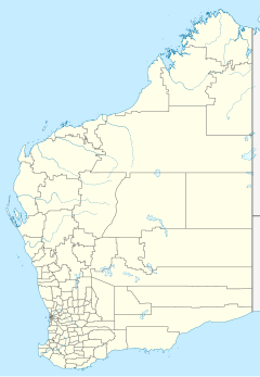
Roebuck Plains Station is a pastoral lease that is located close to the township of Broome in the Kimberley region of Western Australia. It is one of the closest pastoral leases to Broome.
Roebuck Plains is also the name of a roadhouse on the Great Northern Highway, just east of Broome.
The Plains in the name is associated with wetlands situated adjacent to Roebuck Bay.[1]
Description edit
The station is located approximately 30 kilometres (19 mi) east of Broome on a rich marine floodplain. It occupies an area of 2,760 square kilometres (1,066 sq mi) and is able to support around 20,000 head of cattle.[2] The property is a mixture of floodplains and sandy pindan country.[3]
History edit
The traditional owners of the area are the Yawuru peoples.[2] The property was acquired and developed by the pearlers, Streeter and Company, to supply meat to Broome. A slaughterhouse was also established on the outskirts of town to process the cattle and sheep that were being raised on the property.[4]
The homestead burnt down in 1949; the fire started from a defective kerosene refrigerator.[5]
In 1953 the 2,900-square-kilometre (1,120 sq mi) station was acquired by the Harris family.[6] It was stocked with 10,000 head of cattle at the time.[7][8]
The Indigenous Land Corporation acquired Roebuck Plains Station in 1999, and in 2006 the Federal Court determined the station was the exclusive possession of the Yawuru under native title.[2] In 2014 the ILC handed the lease over to the Nyamba Buru Yawuru Corporation. Pat Dodson, the chairman of the company, accepted the lease but handed management of the station back to the ILC. The property and the adjacent commercial cattle yards are worth around A$15 million.[9] The plains are also subject to analysis of indigenous perceptions of the landscape.[clarification needed][10]
In 2018, the property was flooded when it received 1,625 millimetres (64 in) of rain through the wet season, with half of it falling in one week in January. The 6,000 head of cattle had to be moved off the floodplains to higher ground. The cyclone that brought the rain also caused extensive damage to the property, with trees blown over, buildings damaged and fences washed away.[3]
See also edit
Notes edit
- ^ Livesey, N. J. G. (Nigel John George); Harris, Jillian (Jillian Rose); Brash, S.J; Australian Heritage Commission; Murdoch University; Heritage Council of Western Australia; Murdoch University. Natural Environment Documentation Project (1994), Roebuck Plains and associated wetland system : supporting documentation for inclusion on the register of the National Estate : report to the Australian Heritage Commission and the Heritage Council of Western Australia, January 1994, Murdoch University, retrieved 23 February 2018
- ^ a b c "Roebuck Plains Station". Indigenous Land Corporation. Retrieved 24 February 2018.
- ^ a b Courtney Fowler; Michelle Stanley (1 February 2018). ""When the only way home is to fly": The big wet hits pastoral stations on Kimberley coast". Australian Broadcasting Corporation. Retrieved 24 February 2018.
- ^ "Roebuck Plains Station (Site)". InHerit. Heritage Council of Western Australia. 1 January 2017. Retrieved 24 February 2018.
- ^ "Station home blaze". The West Australian. Vol. 65, no. 19, 671. Western Australia. 3 August 1949. p. 24. Retrieved 24 February 2018 – via National Library of Australia.
- ^ "Remote resting place for a right royal bed..." The Australian Women's Weekly. Vol. 45, no. 41. Australia. 15 March 1978. p. 55. Retrieved 24 February 2018 – via National Library of Australia.
- ^ "Big Station at Broome to be sold". The West Australian. Vol. 69, no. 20, 811. Western Australia. 2 April 1953. p. 7. Retrieved 24 February 2018 – via National Library of Australia.
- ^ "English Farmer Finds W.A. A Land Of Opportunity". Western Mail. Western Australia. 16 April 1953. p. 54. Retrieved 24 February 2018 – via National Library of Australia.
- ^ Vanessa Mills (3 September 2014). "Kimberley Station deeds handed to Broome's Traditional Owners". Australian Broadcasting Corporation. Retrieved 24 February 2018.
- ^ Benterrak, Krim; Muecke, Stephen, 1951-; Roe, Paddy, 1912-2001 (1996), Reading the country : introduction to nomadology (Rev. ed.), Fremantle Arts Centre Press, ISBN 978-1-86368-071-4
{{citation}}: CS1 maint: multiple names: authors list (link) CS1 maint: numeric names: authors list (link)
