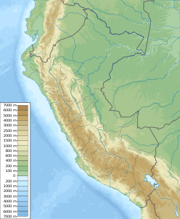
Huandoy[2][3][4] (probably from Quechua wantuy, to transfer, to transpose, to carry, to carry a heavy load)[5] or Tullparaju[6] (possibly from Quechua tullpa rustic cooking-fire, stove, rahu snow, ice, mountain with snow)[7][8] is a mountain located inside Huascarán National Park in Ancash, Peru. It is the second-tallest peak of the Cordillera Blanca section of the Andes, after Huascarán. These two peaks are rather nearby, separated only by the Llanganuco glacial valley (which contains the Llanganuco Lakes) at 3,846 m asl.
| Huandoy | |
|---|---|
| Tullparaju | |
 Huandoy | |
| Highest point | |
| Elevation | 6,360 m (20,870 ft)[1] |
| Prominence | 1,645 m (5,397 ft)[1] |
| Listing | Ultra |
| Coordinates | 09°01′43″S 77°39′56″W / 9.02861°S 77.66556°W[1] |
| Geography | |
| Location | Yungay Province, Ancash, Peru |
| Parent range | Cordillera Blanca, Andes |
| Climbing | |
| First ascent | 1932 by H. Bernard, E. Hein, H. Hoerlin and E. Schneider |
| Easiest route | Southwest face |
It is a snow-capped mountain with four peaks arranged in the form of a fireplace, the tallest of which is 6,395 m. The four peaks are each over 6,000 m, and are:[6]
- Huandoy (6,395 m)
- Huandoy-West (6,356 m)
- Huandoy-South (6,160 m)
- Huandoy-East (6,000 m)
It was first climbed in 1932 by a German party.[9]
Myth
editHuascarán was a noble man who lived in a certain place in Áncash, while Huandoy was a woman who lived in a small town very close to where this mountain is now. Huascarán was enormously in love with the girl, so they always saw each other secretly. One day Huascarán's father found out that he was in love with the little woman, so he asked the Sun God for help. Seeing that he could not separate the two lovers, he decided to turn them into mountains, but the divinity decided to bring them together so that despite their being mountains continued with their love.
See also
editReferences
edit- ^ a b c "Peru: 22 Mountain Summits with Prominence of 1,500 meters or greater" Peaklist.org. Listed as "Nevados Hunadoy". Retrieved 2012-04-17.
- ^ Peru 1:100 000, Carhuás (19-h). IGN (Instituto Geográfico Nacional - Perú).
- ^ Alpenvereinskarte 0/3a. Cordillera Blanca Nord (Peru). 1:100 000. Oesterreichischer Alpenverein. ISBN 3-928777-57-2.
- ^ Biggar, John (2020). The Andes: A Guide for Climbers and Skiers. Andes. p. 85. ISBN 978-0-9536087-6-8.
- ^ "babylon.com". Archived from the original on 2016-03-04. Retrieved 2013-10-06.
- ^ a b Ricker, John (1977). Yuraq Janka: A Guide to the Peruvian Andes. The Mountaineers Books. pp. 78–80. ISBN 9781933056708.
- ^ Vocabulario comparativo quechua ecuatoriano - quechua ancashino -- castellano - English Archived 2016-03-04 at the Wayback Machine (pdf)
- ^ "babylon.com". Archived from the original on 2014-12-29. Retrieved 2013-10-04.
- ^ Lefebvre, Thierry L'invention occidentale de la haute montagne andine, M@ppemonde Vol. 19, p. 16 (2005)
External links
edit- "Huandoy". Peakware.com. Archived from the original on 2016-03-04.
- "Huandoy, Peru" on Peakbagger
