Xiaohe Township (simplified Chinese: 小河乡; traditional Chinese: 小河鄉; pinyin: Xiǎohé Xiāng) is a rural township in Liuyang City, Hunan Province, People's Republic of China.[1] As of the 2015 census it had a population of 15,500 and an area of 11.8-square-kilometre (4.6 sq mi). It is surrounded by Baishui Township on the east, Zhangfang Town on the north, Huangmao Town on the south, and Yonghe Town on the west.[2]
Xiaohe Township
小河乡 | |
|---|---|
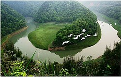
 The Crocodile river bay in Xiaohe, Liuyang | |
| Coordinates: 28°2′22″N 114°03′31″E / 28.03944°N 114.05861°E | |
| Country | People's Republic of China |
| Province | Hunan |
| Prefecture-level city | Changsha |
| County-level city | Liuyang |
| Area | |
| • Total | 111.8 km2 (43.2 sq mi) |
| Population (2015) | 15,500 |
| Time zone | UTC+8 (China Standard) |
| Postal code | 410308 |
| Area code | 0731 |
Administrative divisions
editAs of April 2016, the village-level divisions of Xiaohe Township were adjusted from seven to five. There are five villages in the township.[3]
| English name | Chinese name | Notes |
|---|---|---|
| Wushi Village | 乌石村 | |
| Tanwan Village | 潭湾村 | village reformed by merging the former Tanwan Village and Yanping Village |
| Xinhe Village | 新河村 | village reformed by merging the former Xinhe Village and Jinsha Village |
| Huangbei Village | 皇碑村 | |
| Tianxin Community | 田心社区 |
Geography
editThe Zhushuqiao Reservoir (株树桥水库) is located in the township.
The Xiaoxi River (小溪河) runs northeast–southwest through the township.[2]
Mount Jinzhonghu (金钟湖) is the highest point in the township, which stands 884.7 metres (2,903 ft) above sea level.
Mount Qiyan (旗燕山) is the second highest natural elevation in the township, with 776 metres (2,546 ft) above sea level.
Economy
editXiaohe Township's manufacturing products include fireworks.
Black goat, rabbit and pig are important to the economy.
Education
edit- Xiaohe Middle School
Transportation
editThe County road X001 runs through the town.
Celebrity
edit- Tang Ping (汤平), a lieutenant general in the People's Liberation Army.
- Wang Shaokun (王绍坤), revolutionary.
- Guo Ziming (郭子明), military officer in the Chinese Red Army.
References
edit- ^ [dead link]
- ^ a b Zhang Hong, ed. (2018). 《中国分省系列地图册:湖南》 [Maps of Provinces in China: Hunan] (in Chinese). Xicheng District, Beijing: SinoMaps Press. pp. 34–35. ISBN 978-7-5031-8949-4.
- ^ 浏阳市乡镇区划调整改革结果公示(不含未调整乡镇)(组图). 163.com (in Chinese). 2016-04-15.
