Wikipedia talk:WikiProject New York City Public Transportation/Unidentified locations/Archive 3
| This is an archive of past discussions. Do not edit the contents of this page. If you wish to start a new discussion or revive an old one, please do so on the current talk page. |
| Archive 1 | Archive 2 | Archive 3 | Archive 4 |
Closed questions from April 2015 to June 2016 on are here.
First Avenue?

The camera location does not match any existing station, but the nearest one is First Avenue. The service bullet, as far as I can see it, is indeed gray, like the color of the L service. I don't see the station name, but the word below is Brooklyn. I am trying to find this brick wall on Street View, on the southern side of 14th Street and the adjacent streets... Vcohen (talk) 18:49, 9 April 2015 (UTC)
- The sign actually says (Something) Street Station to Downtown and Brooklyn. The L only has "Avenue" stations and only goes crosstown. Epic Genius (talk) 15:46, 10 April 2015 (UTC)
- ...and it is actually 8th Street-NYU station on the BMT Broadway Line. Epic Genius (talk) 15:49, 10 April 2015 (UTC)
- Thank you. I still see a gray bullet, but I know you are right... Vcohen (talk) 16:16, 10 April 2015 (UTC)
- ...and it is actually 8th Street-NYU station on the BMT Broadway Line. Epic Genius (talk) 15:49, 10 April 2015 (UTC)
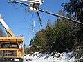
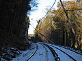
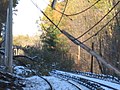
Abandoned railroad in Queens

Where could it be? Vcohen (talk) 12:45, 10 April 2015 (UTC)
- In Queens. That's where the Flickr description puts the image. The Rockaway Beach Branch is the only abandoned railroad in Queens that still has extant rails for long distances on its right-of-way, so it could be that this image is of the Rockaway Beach Branch. However, it's more likely that this image could be the Bushwick Branch or this spur off the Montauk Branch near Grand Avenue. Epic Genius (talk) 13:57, 10 April 2015 (UTC)
- On a related note, it looks similar to a paved over abandoned railroad just north of the Maurice Avenue railroad crossing. Plus, a bonus point to the person who can find a picture of that nonexistent railroad crossing on the left, on 58th Street. Epic Genius (talk) 14:04, 10 April 2015 (UTC)
- In short, all options are open... Vcohen (talk) 14:27, 10 April 2015 (UTC)
- Short unnamed spur off 30th place. The buildings are no longer extant. Pi.1415926535 (talk) 02:19, 11 April 2015 (UTC)
- I never would have thought that. But Pi is right (though there seem to be lots of abandoned railway spurs in Queens). Epic Genius (talk) 17:08, 12 April 2015 (UTC)
- But the remnant of the spur is still there. Funny, Forgotten NY never mentioned that. Epic Genius (talk) 17:10, 12 April 2015 (UTC)
- Short unnamed spur off 30th place. The buildings are no longer extant. Pi.1415926535 (talk) 02:19, 11 April 2015 (UTC)
- In short, all options are open... Vcohen (talk) 14:27, 10 April 2015 (UTC)
- On a related note, it looks similar to a paved over abandoned railroad just north of the Maurice Avenue railroad crossing. Plus, a bonus point to the person who can find a picture of that nonexistent railroad crossing on the left, on 58th Street. Epic Genius (talk) 14:04, 10 April 2015 (UTC)
An El station in an Edward Hopper painting
Here's another unusual quest for this article; Renowned artist Edward Hopper once had a painting called "The El Station," which looks like an IRT station of some kind. The only question is, which one? ---------User:DanTD (talk) 17:26, 27 March 2015 (UTC)
- It is more likely that Hopper just took a random elevated station as inspiration, and that this does not strictly resemble any station in particular. Epic Genius (talk) 03:16, 31 March 2015 (UTC)
- So that building in the background doesn't serve as a clue, huh? Oh well... :( ---------User:DanTD (talk) 05:05, 31 March 2015 (UTC)
Mysterious Metro-North Yard
Stepping outside of the New York City Subway system once again, I'm still trying to find out about this image from an apparent yard during a blizzard in 2013.
.jpg)
Although there are probably several other Metro-North related images I could ask about as well. ---------User:DanTD (talk) 15:06, 23 March 2015 (UTC)
- UPDATE - Practically all loose images in the commons:Category:Metro-North Railroad lines seem to be on the Harlem Line, but I have no proof either way. Somebody out there must have something. ---------User:DanTD (talk) 04:34, 8 April 2015 (UTC)
IND Sixth Avenue mosaic
Another user categorized the image below as being on the IND Sixth Avenue Line before I moved it to the more specific "IND Sixth Avenue Line stations" category. Obviously the question is which IND Sixth Avenue Line station can these mosaics be found. I could just forget about it, and move the commons cat "New York City Subway mosaics" to "New York City Subway mosaics in Manhattan," but I want to be sure it's not York Street (IND Sixth Avenue Line) before I do that. ---------User:DanTD (talk) 23:51, 12 April 2015 (UTC)
- I'm assuming 14th Street / Sixth Avenue (New York City Subway). See this, also in the same photostream and, I assume, taken right before this photo was. Epic Genius (talk) 01:34, 13 April 2015 (UTC)
- 14th certainly has signs like that, however I do not recall if 23 does. It very well might. 2604:2000:C6AC:D00:3959:C2EF:4408:4B7B (talk) 02:52, 16 April 2015 (UTC)

Trip to Brighton

The original name of this shot is "Trip to Brighton." The station should be on Brighton Line, I suppose... Vcohen (talk) 20:53, 18 April 2015 (UTC)
- Any possibility this could be from Coney Island – Stillwell Avenue (New York City Subway) on the BMT Brighton Line platforms? ---------User:DanTD (talk) 22:50, 18 April 2015 (UTC)
- The structure above the train is a track, isn't it? Vcohen (talk) 05:10, 19 April 2015 (UTC)

- I have found the answer. It's NY Aquarium. Vcohen (talk) 09:10, 19 April 2015 (UTC)
- Haven't you been looking for lower level platforms at West Eighth Street – New York Aquarium (New York City Subway) until a couple of weeks ago? ---------User:DanTD (talk) 13:05, 19 April 2015 (UTC)
- I have found the answer. It's NY Aquarium. Vcohen (talk) 09:10, 19 April 2015 (UTC)
Staten Island Railway station in 1973
Yet another one from outside of the subway system, but not necessarily outside of the New York City Transit Authority this time. Does anyone want to try to guess where this old image of a Staten Island Railway station was? ---------User:DanTD (talk) 04:46, 14 April 2015 (UTC)
- Here is the same image on flickr. A comment on the page says: "this is the station in Grant City on Staten Island. It doesn't look much different now." However, I have no idea how to prove or disprove that. Vcohen (talk) 11:30, 14 April 2015 (UTC)
- I just took a Google Street View from North Railroad Avenue, and I see a central gable in the pedestrian crosswalk that isn't in the 1973 image. If this is Grant City, I suspect the person who wrote that message didn't see the change as being that significant. ---------User:DanTD (talk) 13:20, 15 April 2015 (UTC)
- I think these gables were installed at all the stations of the railroad after 1973 to form their new style. Vcohen (talk) 17:34, 15 April 2015 (UTC)
- Here is a 1972 photo. Vcohen (talk) 08:38, 20 April 2015 (UTC)
- I just took a Google Street View from North Railroad Avenue, and I see a central gable in the pedestrian crosswalk that isn't in the 1973 image. If this is Grant City, I suspect the person who wrote that message didn't see the change as being that significant. ---------User:DanTD (talk) 13:20, 15 April 2015 (UTC)
Another old El image
I've got another image of something that goes back before any of us were born. ---------User:DanTD (talk) 01:44, 19 April 2015 (UTC)
_pg725_BATTERY_PARK,_ELEVATED_RAILROADS_AT_SOUTH_AND_STATEN_ISLAND_FERRIES,_AND_BARGE_OFFICE.jpg)
- South Ferry (IRT elevated station) was a huge station at Battery Park, and the picture is of South Ferry station. Epic Genius (talk) 22:51, 19 April 2015 (UTC)
- Okay, it's there. The spur really threw me off. ---------User:DanTD (talk) 01:32, 20 April 2015 (UTC)
- if by spur, you mean the trackage curving left closest to us, that connected the 6th/9th elevated which is to the far right with the 2nd/3rd which is to the far left. At the time of this photo, I believe it was used as part of the engine change(as el trains were not push pull equipped!)216.165.95.66 (talk) 15:46, 22 April 2015 (UTC)
- Okay, it's there. The spur really threw me off. ---------User:DanTD (talk) 01:32, 20 April 2015 (UTC)
An old PATH station image from 1973.
This image of an alleged PATH station in Manhattan is the only one not categorized in a station category. Unfortunately, it's another image from 1973, which means it's something I would never have recognized back then since I was trapped in school on Long Island at the time, and only went to the city either to visit relatives, or to go through the city on vacations. ---------User:DanTD (talk) 16:35, 23 April 2015 (UTC)
- Thinking through this- Assuming we are looking down from the street, which I think we are- Not 23rd or 14th as all exits there are shared with the subway. 9th is a level entry into a building prior to the stairs, so it is not there. Christopher is into a building as well. The stairs there are immediate, however I think the easiest way to barricade would be at the top, and there is an awning so it would be darker. My best guess is that this is the south end of 33rd street, but that is just through process of elimination, based on the potentially false assumption that this is looking down a street stair.
50th Street

Which 50th Street is this? None of them seems as deep. Vcohen (talk) 15:47, 23 April 2015 (UTC)
- 50th Street (IND Eighth Avenue Line). The southbound E train platform has an escalator directly to Worldwide Plaza at ground level. Epic Genius (talk) 16:37, 23 April 2015 (UTC)
- Thank you very much. Vcohen (talk) 17:25, 23 April 2015 (UTC)
Kings Highway
.jpg)
.jpg)
Which Kings Highway are these? Vcohen (talk) 15:33, 23 April 2015 (UTC)
- Probably Kings Highway (IND Culver Line). One of them has an F train in the photo. Epic Genius (talk) 16:39, 23 April 2015 (UTC)
- Thank you very much. Vcohen (talk) 17:25, 23 April 2015 (UTC)
- That was an F train? I should've read that part. I was already about to rule out Kings Highway (BMT Sea Beach Line), due to the fact that it's an open cut and has no center platforms. ---------User:DanTD (talk) 18:47, 23 April 2015 (UTC)
- Thank you very much. Vcohen (talk) 17:25, 23 April 2015 (UTC)
Pedestrian tunnel


Do these two images represent the passageway under 50th Street? Vcohen (talk) 17:36, 23 April 2015 (UTC)
- I suppose so (though I've never used the passageway before). They look very similar. Epic Genius (talk) 18:43, 23 April 2015 (UTC)
- That is definitely the 50th street passageway.216.165.95.66 (talk) 20:21, 23 April 2015 (UTC)
- Thanks! Vcohen (talk) 11:30, 24 April 2015 (UTC)
- That is definitely the 50th street passageway.216.165.95.66 (talk) 20:21, 23 April 2015 (UTC)
Another escalator

After the success of one escalator, I am posting another one. Vcohen (talk) 19:16, 23 April 2015 (UTC)
- Looks like Smith 9th Streets before the rebuild to me.(obviously has been a few years, but it fits both my memory and the current layout.)216.165.95.66 (talk) 20:24, 23 April 2015 (UTC)
- It appears that it is Smith–9th Streets. Epic Genius (talk) 20:33, 23 April 2015 (UTC)
- That station has so many pictures, I've been considering splitting off the Ninth Street Gowanus Canal Bridge as a separate commons category. ---------User:DanTD (talk) 02:33, 24 April 2015 (UTC)
- As do the Second Avenue Subway stations, 34th Street – Hudson Yards station, and Dyckman Street IRT station categories, among others. Many of them still need to be diffused. Epic Genius (talk) 02:51, 24 April 2015 (UTC)
- That's true. I suppose when the Second Avenue Subway stations and 34th Street – Hudson Yards are open, many of the existing pictures will have to be split off into construction galleries. I tried to split the Fort George Tunnel off of Dyckman Street because it was attached to the station, but it evidently it wasn't as successful as I thought it would be. ---------User:DanTD (talk) 12:26, 24 April 2015 (UTC)
- As do the Second Avenue Subway stations, 34th Street – Hudson Yards station, and Dyckman Street IRT station categories, among others. Many of them still need to be diffused. Epic Genius (talk) 02:51, 24 April 2015 (UTC)
- That station has so many pictures, I've been considering splitting off the Ninth Street Gowanus Canal Bridge as a separate commons category. ---------User:DanTD (talk) 02:33, 24 April 2015 (UTC)
Thanks! Vcohen (talk) 11:30, 24 April 2015 (UTC)
An exact AirTrainJFK station
I know we're no longer improving articles on AirTrain JFK stations, but I'd still like to know the exact location of this station. ---------User:DanTD (talk) 13:33, 27 April 2015 (UTC)

- Jamaica? Vcohen (talk) 14:39, 27 April 2015 (UTC)
- Yeah, definitely Jamaica. Epic Genius (talk) 17:25, 27 April 2015 (UTC)
Some other ones from the unidentified page.

This one is the Times Square shuttle, Times Square, Track 3. Nowhere else has columns of the between track type out on the platform like that.216.165.95.66 (talk) 17:06, 27 April 2015 (UTC)
- So that was a platform? Nice work, indeed. Epic Genius (talk) 17:17, 27 April 2015 (UTC)

This one is Houston Street. IRT 7th avenue line. See the bottom tiles. http://i.ytimg.com/vi/N4oXItGRti0/maxresdefault.jpg
- The Houston Street station has blue tiles. The ones in this picture are green. Epic Genius (talk) 17:17, 27 April 2015 (UTC)
- They look Blue to me. The "Va" on the sign fits the Varick Street exit. Considering that it is a 4 track wide dual contracts station I see nowhere else it could be. The Lexington IRT(103/110) and Broadway BMT do not have low colored tiles that high on the wall, outside of Canal, which is maroon. (Canal on the Bridge line is green, but this is not a 2 track line.), so that leaves 7th avenue. 18th, Canal and Franklin all have more elaborate designs there. 23rd and 28th both are white tiles down to the floor. Christopher is a pinkish tan with no border which does not match this image.216.165.95.66 (talk) 18:34, 27 April 2015 (UTC)

This is Penn Station IND. See the Pipe design: https://www.youtube.com/watch?v=-i6uewdXNHw
- Good work. Epic Genius (talk) 17:17, 27 April 2015 (UTC)
_R46_in_Lower_Manhattan.jpg)
This one is still bugging me. I really think it is Broadway Lafayette- Right lighting, Floor tiles, and right height on the wall tile band. http://farm6.static.flickr.com/5250/5274768274_668bcd5317.jpg 216.165.95.66 (talk) 17:06, 27 April 2015 (UTC)
Another escalator again

Another escalator request.
What station is this? I think it's in Manhattan, at one of the unrenovated stations, but can't say for sure. Epic Genius (talk) 15:54, 26 April 2015 (UTC)
- I'm not sure why, but I've been leaning towards Fifth Avenue / 53rd Street (IND Queens Boulevard Line). I vaguely remember some image of the sign above the escalators and stairs in older pictures of that escalator shaft. ---------User:DanTD (talk) 16:43, 26 April 2015 (UTC)
- @DanTD: Was that station renovated after 2002? This picture was taken in September 2002. Epic Genius (talk) 17:42, 26 April 2015 (UTC)
- I'm not entirely sure when any renovation took place. All I remember is that there used to be old signs above the stairs, and that there's clearly one in that picture. But now that I'm looking at them, they look like the wrong signs. ---------User:DanTD (talk) 18:20, 26 April 2015 (UTC)
- Yeah, plus the escalators are split into two halves. it can't be 5th Avenue/53rd Street. In terms of dirty old stations, it may not actually be in Manhattan. Epic Genius (talk) 19:29, 26 April 2015 (UTC)
- This one looks to me a lot like Times Square 7 prior to renovation.(http://www.nycsubway.org/perl/show?560)216.165.95.66 (talk) 15:29, 27 April 2015 (UTC)
- http://www.bridgeandtunnelclub.com/bigmap/citywide/subway/signs/grasp.jpg From the other direction, claims to be Times Square on the website. Makes me pretty certain this is TSQ.216.165.95.66 (talk) 18:45, 27 April 2015 (UTC)
- Yeah, plus the escalators are split into two halves. it can't be 5th Avenue/53rd Street. In terms of dirty old stations, it may not actually be in Manhattan. Epic Genius (talk) 19:29, 26 April 2015 (UTC)
- I'm not entirely sure when any renovation took place. All I remember is that there used to be old signs above the stairs, and that there's clearly one in that picture. But now that I'm looking at them, they look like the wrong signs. ---------User:DanTD (talk) 18:20, 26 April 2015 (UTC)
- @DanTD: Was that station renovated after 2002? This picture was taken in September 2002. Epic Genius (talk) 17:42, 26 April 2015 (UTC)
A new member to the Escalators family

We have a good family of escalators. Here is a new member to it. Vcohen (talk) 18:14, 26 April 2015 (UTC)
- Let me guess, Lexington Avenue – 53rd Street (IND Queens Boulevard Line)? Epic Genius (talk) 19:26, 26 April 2015 (UTC)
- I would have guessed the escalator to the 7 train at Grand Central. The really low ceiling parallel to the slope of the escalator reminds of there. oknazevad (talk) 14:17, 27 April 2015 (UTC)
- Certainly not Lex/53rd. Don't think it is Grand Central either, but I forget the configuration of the upper bank at the east end of the 7 platform.216.165.95.66 (talk) 16:16, 27 April 2015 (UTC)
- I found it!! High Street on the A. http://subwaynut.com/ind/higha/higha11.jpg 216.165.95.66 (talk) 20:38, 27 April 2015 (UTC)
- Very nice on behalf of this anonymous IP. Here's one of Victor's submitted photographs. ---------User:DanTD (talk) 23:46, 27 April 2015 (UTC)
- Sorry, who is Victor? Vcohen (talk) 08:22, 28 April 2015 (UTC)
- I'm assuming this guy. Epic Genius (talk) 13:27, 28 April 2015 (UTC)
- Actually, I was talking about "Vcohen." He just submitted "m01229's" picture. ---------User:DanTD (talk) 14:16, 28 April 2015 (UTC)
- OK, thank you for giving me a name, but I already have one... Vcohen (talk) 14:53, 28 April 2015 (UTC)
- Actually, I was talking about "Vcohen." He just submitted "m01229's" picture. ---------User:DanTD (talk) 14:16, 28 April 2015 (UTC)
- I'm assuming this guy. Epic Genius (talk) 13:27, 28 April 2015 (UTC)
- Sorry, who is Victor? Vcohen (talk) 08:22, 28 April 2015 (UTC)
- Very nice on behalf of this anonymous IP. Here's one of Victor's submitted photographs. ---------User:DanTD (talk) 23:46, 27 April 2015 (UTC)
- I would have guessed the escalator to the 7 train at Grand Central. The really low ceiling parallel to the slope of the escalator reminds of there. oknazevad (talk) 14:17, 27 April 2015 (UTC)
Entrance

The photographer says, "The warrens of Canal Street." Vcohen (talk) 18:42, 29 April 2015 (UTC)
- Looking North down the stairs from the J platform down to the SB N/Q platform. As titled, this is Canal Street.216.165.95.66 (talk) 20:53, 29 April 2015 (UTC)
- Oy vey, it is not an entrance. Thank you. Vcohen (talk) 05:18, 30 April 2015 (UTC)
LIRR lines
Another non-NYC Subway quest, this time a little closer to home for me. There are six loose photographs in the Long Island Rail Road lines category that I suspect are all on the Main Line, but five of them look like they're on the North Fork of Long Island.
-
 For some reason, I think this is in the Bethpage-Farmingdale area.
 -
 But this and the others...
 -
 .. I'm convinced are on the North Fork, somewhere.
 -
 All we need for these...
 -
 ..are exact...
 -
 .. locations.
.jpg)
.jpg)
.jpg)
.jpg)
.jpg)
.jpg)
Admittedly, I've actually walked and even biked on the tracks of the main line during my youth, but I've never seen any of these areas. So who can prove where these are? ---------User:DanTD (talk) 15:07, 30 April 2015 (UTC)
- Well, they're on non-electrified lines. That leaves the Greenport, Port Jefferson east of Huntington, Oyster Bay north of Roslyn, Central, and Montauk branches. Epic Genius (talk) 17:26, 3 May 2015 (UTC)
- I think we can scratch off the Central, due to the lack of development, and in the case of everything but the first one, Oyster Bay due to the flat landscape and open fields. ---------User:DanTD (talk) 14:01, 4 May 2015 (UTC)
Elevated line

This is a station and a sharp turn to the left after it. The train is either a 2 or a Z (I cannot identify the car model to say whether it's IRT or not). There are enough things on the background that can be recognized, but not by me. I have checked all elevated stations with sharp turns to the left, none of them match the buildings in the photo. Vcohen (talk) 19:33, 8 May 2015 (UTC)
- Bullet looks purple, which is consistent with the service-character looking like a 7. DMacks (talk) 19:39, 8 May 2015 (UTC)
- Thanks for correcting my color blindness... Vcohen (talk) 19:59, 8 May 2015 (UTC)
- The smokestack layout looks like we're looking north–west at Ravenswood generating station (Queens, just north of Queensboro Bridge); might be other power plants possible, that's just first similar I noticed). I can't judge the distance, but I don't see a similar curve on the (7) facing that way (might be a weird perspective that makes the curve look very sharp). It also looks like the train is coming out of a station that is two-track (or maybe also a central express/through-track?) with side-platforms. DMacks (talk) 20:02, 8 May 2015 (UTC)
- Probable slightly-different view from same flickr-stream. About 45° bend? DMacks (talk) 20:16, 8 May 2015 (UTC)
- It's the 7 Express train, near Court Square. You can see the Queensboro Bridge from here. Also, after coming out of the tunnel at Hunters Point Avenue, the 7 train makes a 90 degree curve to the northwest, then curves sharply so that it goes directly to the north. This was before the 5 Pointz block was destroyed, and definitely before gentrification. Epic Genius (talk) 22:19, 8 May 2015 (UTC)
- Yes. Thank you very much. Vcohen (talk) 07:32, 9 May 2015 (UTC)
Another mysterious PATH location

I've posted this image on another Port Authority Trans-Hudson related topic, but from what little I can see, this looks like it might be at Journal Square Transportation Center. ---------User:DanTD (talk) 15:51, 12 May 2015 (UTC)
Another Staten Island Railway station
I have a guess about this one, and I'd like to know if I'm right. ---------User:DanTD (talk) 12:55, 23 May 2015 (UTC)
.jpg)
- You're right. oknazevad (talk) 17:45, 23 May 2015 (UTC)
- Thanks. I changed it. ---------User:DanTD (talk) 04:40, 24 May 2015 (UTC)
23rd Street El Station (which one?)
Who recognizes the location of this old el station way in the background of this picture of streetcars along 23rd Street? This is from a Vanity Fair article from 1903, by the way. I'm hoping it's not the IRT Sixth Avenue Line station, because that one already has an image. ---------User:DanTD (talk) 19:35, 5 May 2015 (UTC)

I know where this is. This is the Third Avenue El. At this link [1] you can see that there was a Fifth National Bank at Third Avenue and 23rd Street. Kew Gardens 613 (talk) 23:03, 3 June 2015 (UTC)
Garbage cans or something at a station

Instead of trying to find out the location of a station, this time I thought I'd do something different, which is to identify an item at a station. I already know this is Simpson Street (IRT White Plains Road Line) because I took this picture, but I'm not sure what this thing is on the platforms. It looks like a storage bin for garbage cans, or recycling bins, or maybe even electrical equipment for the station, but I haven't got a clue what it is. ---------User:DanTD (talk) 20:45, 26 May 2015 (UTC)
- Hmm... looks like a storage bin to me, because 1) there's a lock and 2) there's no opening for garbage. Epic Genius (talk) ± 14:12, 29 May 2015 (UTC)
- Seems reasonable enough. The question now is, what do they store in them? ---------User:DanTD (talk) 17:22, 29 May 2015 (UTC)
- I don't know...I don't work for the MTA. My best guess is that the cabinet is used to store construction or janitorial supplies. Epic Genius (talk) ± 21:23, 29 May 2015 (UTC)
- Seems reasonable enough. The question now is, what do they store in them? ---------User:DanTD (talk) 17:22, 29 May 2015 (UTC)

- I have found one with more transparent windows. You can try to approach it and look inside... Vcohen (talk) 16:26, 31 May 2015 (UTC)
- Yes, definitely a storage cabinet. Should they have their own commons category? Epic Genius (talk) 16:39, 31 May 2015 (UTC)
- Honestly, I'd rather use an existing one, if any. ---------User:DanTD (talk) 17:31, 4 June 2015 (UTC)
- Now, I am not certain that there are no other uses for these sorts of boxes, but I do know that they are used for trash. Between when the garbage cans are emptied and when the garbage train comes, garbage is stored in carts which themselves are kept in these enclosures. 216.165.95.66 (talk) 17:39, 4 June 2015 (UTC)
- So, yes, they are used for the storage of trash. Epic Genius (talk) 02:55, 5 June 2015 (UTC)
- Now, I am not certain that there are no other uses for these sorts of boxes, but I do know that they are used for trash. Between when the garbage cans are emptied and when the garbage train comes, garbage is stored in carts which themselves are kept in these enclosures. 216.165.95.66 (talk) 17:39, 4 June 2015 (UTC)
- Honestly, I'd rather use an existing one, if any. ---------User:DanTD (talk) 17:31, 4 June 2015 (UTC)
- Yes, definitely a storage cabinet. Should they have their own commons category? Epic Genius (talk) 16:39, 31 May 2015 (UTC)
- I have found one with more transparent windows. You can try to approach it and look inside... Vcohen (talk) 16:26, 31 May 2015 (UTC)
Ozone Park

The page of this file says it is in Ozone Park. According to the bus map of Queens, the only point where the Q7 meets an elevated subway station is here. The problem is that I don't see in the Street View image the things I do see in the original file behind the station. Vcohen (talk) 16:06, 6 June 2015 (UTC)
- Its right there see this view, [2] see the same store. Kew Gardens 613 (talk) 02:37, 7 June 2015 (UTC)
- Oh, it's the opposite side. The map shows the bus route south of the subway line only. Thank you. Vcohen (talk) 06:48, 7 June 2015 (UTC)
Random BMT stations
Okay, I'm wondering about some of these BMT stations:
-
This one is said to be on the BMT Brighton Line, but where?
-
 An undetermined BMT Astoria Line station
 -
 Another undetermined Astoria Line station
.jpg)
.jpg)
I almost considered throwing in an IND station in the mix, but I changed my mind. ---------User:DanTD (talk) 23:55, 8 June 2015 (UTC)
- The Brighton one is in fact on the Brighton. West 8th- Aquarium. 216.165.95.66 (talk) 14:33, 9 June 2015 (UTC)
- I see absolutely no indication of location on the second, although it appears as if it could easily be in the same location as the third. That one is at Broadway, on the Astoria Line. What is the IND station you were going to throw at us? 216.165.95.66 (talk) 14:37, 9 June 2015 (UTC)
- This one, although I wanted to wait until more were available so I could start a separate thread about it. ---------User:DanTD (talk) 15:12, 9 June 2015 (UTC)
- That is the Northbound express track of the CPW IND between 109th and 110th streets 216.165.95.66 (talk) 16:38, 9 June 2015 (UTC)
- Yeah, I figured that had to be anywhere between 103rd and 110th Street. The image description said it was caused by a water main break at 106th Street. ---------User:DanTD (talk) 20:25, 9 June 2015 (UTC)
- I think we can appropriately rename these files, or at least categorize them. Epic Genius (talk) 03:26, 11 June 2015 (UTC)
- I'd certainly do both, at least for the third image. If there's more confirmation about the second, I'd do the same with that one. ---------User:DanTD (talk) 04:31, 11 June 2015 (UTC)
- I think we can appropriately rename these files, or at least categorize them. Epic Genius (talk) 03:26, 11 June 2015 (UTC)
- Yeah, I figured that had to be anywhere between 103rd and 110th Street. The image description said it was caused by a water main break at 106th Street. ---------User:DanTD (talk) 20:25, 9 June 2015 (UTC)
- That is the Northbound express track of the CPW IND between 109th and 110th streets 216.165.95.66 (talk) 16:38, 9 June 2015 (UTC)
- This one, although I wanted to wait until more were available so I could start a separate thread about it. ---------User:DanTD (talk) 15:12, 9 June 2015 (UTC)
Undetermined New Jersey Transit station
It had to happen sooner or later, but I've just added the first New Jersey Transit commuter railroad station to this project. For some reason I keep thinking this might be at MSU, but I'd like real proof.---------User:DanTD (talk) 15:35, 12 June 2015 (UTC)
- Hoboken! Taken from near the HBLR. 216.165.95.66 (talk) 19:24, 12 June 2015 (UTC)
- That was one of my other ideas. So, it's near the HBLR terminal, eh? I also noticed an antenna in the background. Where's that, and what's it for? ---------User:DanTD (talk) 03:02, 13 June 2015 (UTC)
- It's not there anymore. That antenna was demolished when the clock tower was restored (it sat on the original clock tower foundation) . It was a radio antenna. This is clearly the end of track 18, the southern most terminal track, which is normally not used for passengers. It clearly isn't MSU, because it's low platform, and a terminal track, of which neither are true for MSU. oknazevad (talk) 15:38, 13 June 2015 (UTC)
- Well, okay then. Glad this was solved. ---------User:DanTD (talk) 23:43, 13 June 2015 (UTC)
- It's not there anymore. That antenna was demolished when the clock tower was restored (it sat on the original clock tower foundation) . It was a radio antenna. This is clearly the end of track 18, the southern most terminal track, which is normally not used for passengers. It clearly isn't MSU, because it's low platform, and a terminal track, of which neither are true for MSU. oknazevad (talk) 15:38, 13 June 2015 (UTC)
- That was one of my other ideas. So, it's near the HBLR terminal, eh? I also noticed an antenna in the background. Where's that, and what's it for? ---------User:DanTD (talk) 03:02, 13 June 2015 (UTC)

PATH WTC again


I already know that the first photo is the old platform. What about the second one? Vcohen (talk) 17:06, 19 June 2015 (UTC)
- First is temporary platform post 9/11(Third Generation). Second is current platform(Fourth Generation).216.165.95.66 (talk) 18:03, 19 June 2015 (UTC)
- Sorry, how do you count generations? I know about three entrances, the fourth being the Transportation Hub currently under constructions. Do you mean each of them has its set of platforms? Vcohen (talk) 19:33, 19 June 2015 (UTC)
- 1- Old Hudson Terminal, 2- Old WTC, 3- Post 9/11 Temporary Station, 4- New WTC. 2-4 are all roughly in the same location. 100.38.13.227 (talk) 19:59, 20 June 2015 (UTC) (Above IP on Vacation)
- I see, thanks. Vcohen (talk) 20:13, 20 June 2015 (UTC)
- 1- Old Hudson Terminal, 2- Old WTC, 3- Post 9/11 Temporary Station, 4- New WTC. 2-4 are all roughly in the same location. 100.38.13.227 (talk) 19:59, 20 June 2015 (UTC) (Above IP on Vacation)
- Sorry, how do you count generations? I know about three entrances, the fourth being the Transportation Hub currently under constructions. Do you mean each of them has its set of platforms? Vcohen (talk) 19:33, 19 June 2015 (UTC)
Another IND Eighth Avenue Line image
This is more than likely going to be another hard one, but it's of a bunch of token vending machines at an undetermined IND Eighth Avenue Line station from 1974, although by the title, they make it look like it's from 1970. ---------User:DanTD (talk) 03:56, 21 June 2015 (UTC)
One LIRR grade crossing during Hurricane Irene
Okay, MTA had some pics of some of their preparations for Hurricane Irene and Hurricane Sandy on Flickr, which were transferred here. And there's one grade crossing shown before Hurricane Irene that I'm having too much trouble locating.
-
 Non-electrified and a single track...definitely not in Brooklyn or Queens.
 -
 This store could be a clue.
 -
 A divided highway at this crossing too, although I'm pretty sure it's not William Floyd Parkway.
.jpg)
.jpg)
.jpg)
I can only think of this as possibly being either on the Oyster Bay Branch north of East Williston, Main Line east of Ronkonkoma (both unlikely), the Central Branch, the Port Jefferson Branch east of Huntington Station, or Montauk Branch. And that's still too broad of a range of possibilities. ---------User:DanTD (talk) 00:29, 5 July 2015 (UTC)
- Is in fact WF Parkway; check the matching businesses in the background. Pi.1415926535 (talk) 01:10, 5 July 2015 (UTC)
- Wow, that's a surprise. The road looked a little narrow in the third picture, and it's obvious at least one of the businesses was replaced. Also, don't forget I took some pics of Mastic-Shirley (LIRR station) back in November. ---------User:DanTD (talk) 01:50, 5 July 2015 (UTC)
A new set of enigmas
-
 Times Sq 123
 -
 Union R
 -

-
 53/Lex
 -
 53/Lex


I am not sure it's OK to create one section of discussion for four pictures, so feel free to change that. Thanks in advance. Vcohen (talk) 19:50, 21 June 2015 (UTC)
- The third of those is somewhere along a tri-tracked side platform section of the J. That means Marcy Ave to Flushing Ave, Kosciuszko St to Chauncey Street, or 111st St. Pi.1415926535 (talk) 20:04, 21 June 2015 (UTC)
- First is Times Square, North end of southbound 123 platform. Fourth is 53/Lex, Easternmost escalator bank. Pi is correct on third. I have surely seen the second, just not placing it at the moment. It is a rebuilt station which appears to be Dual contracts to me. Maybe Union on the R? The tiled beam makes me think triboro system.216.165.95.66 (talk) 17:06, 22 June 2015 (UTC)
- Looking again at #3, The box at the end of the platform puts it at Flushing, Kosciuszko or Halsey. I think only Flushing has tall enough buildings visible for it to be there. 216.165.95.66 (talk) 17:14, 22 June 2015 (UTC)
- First is Times Square, North end of southbound 123 platform. Fourth is 53/Lex, Easternmost escalator bank. Pi is correct on third. I have surely seen the second, just not placing it at the moment. It is a rebuilt station which appears to be Dual contracts to me. Maybe Union on the R? The tiled beam makes me think triboro system.216.165.95.66 (talk) 17:06, 22 June 2015 (UTC)
- The first image is definitely the Times Square 1/2/3 station. The third image is a renovated station on the J line between Chauncey Street and Marcy Avenue (so one of 216.165.95.66's three candidates must be right). The fourth image might be on the 53rd Street Line, and I've definitely seen that escalator-stairs combo before. I think it's either 7th or Lexington Avenues, but Lexington Avenue only has one double escalator that I know of, which is enclosed all the way. I could be wrong, though. Epic Genius (talk) 02:06, 24 June 2015 (UTC)
- Lex has 6 escalators, arranged west to east as double, single, single, double. The two double banks are original. The singles were added in the mid 2000s and late 1980s-early 1990s respectively. The image is of the eastern double bank, which ends up on the east side of Third avenue. 216.165.95.66 (talk) 17:43, 24 June 2015 (UTC)
- Oh, I see. Thanks. So my nagging suspicion, that it was a station I'd used before, was right. Epic Genius (talk) 00:30, 26 June 2015 (UTC)
- Confirming my suspicions on #2. It is Union on the R. NB platform, North Stair, looking south.2604:2000:C6AC:D00:446:AA15:9EAC:9945 (talk) 22:48, 2 July 2015 (UTC) (Same person as above IP)
- Oh, I see. Thanks. So my nagging suspicion, that it was a station I'd used before, was right. Epic Genius (talk) 00:30, 26 June 2015 (UTC)
- Lex has 6 escalators, arranged west to east as double, single, single, double. The two double banks are original. The singles were added in the mid 2000s and late 1980s-early 1990s respectively. The image is of the eastern double bank, which ends up on the east side of Third avenue. 216.165.95.66 (talk) 17:43, 24 June 2015 (UTC)
Thank you for all the answers. I have marked the solved enigmas and am going to rename and categorize them. Meanwhile another one has been added. Vcohen (talk) 14:10, 4 July 2015 (UTC)
- 5th is also Lex/53rd. Eastern single escalator. 100.38.13.227 (talk) 02:57, 6 July 2015 (UTC) (Same person as prior IPs.)
- Thank you very much. Vcohen (talk) 06:39, 6 July 2015 (UTC)
Old Brooklyn El near the Brooklyn Bridge
This image of the "Brooklyn Bridge an elevated railways from Brooklyn," and it's PNG counterpart has a station attached to it, and it's obviously something made or inherited by the BMT. But something about it doesn't seem that familiar. ---------User:DanTD (talk) 00:33, 7 July 2015 (UTC)
- Could it be the BMT Fulton Street Line? Wild guess, but it may fit. Epic Genius (talk) 00:55, 7 July 2015 (UTC)
- That was my first thought. But it seems kind of small to be Sands Street (BMT station), and looks a little too high to be Court Street – Myrtle Avenue (BMT Fulton Street Line). ---------User:DanTD (talk) 01:16, 7 July 2015 (UTC)
- UPDATE: Wait a minute; I just found out it is Sands Street. Sometimes you just get lucky. ---------User:DanTD (talk) 01:20, 7 July 2015 (UTC)
- Oh well, I guess I was a quarter right. Epic Genius (talk) 03:06, 7 July 2015 (UTC)
- UPDATE: Wait a minute; I just found out it is Sands Street. Sometimes you just get lucky. ---------User:DanTD (talk) 01:20, 7 July 2015 (UTC)
- That was my first thought. But it seems kind of small to be Sands Street (BMT station), and looks a little too high to be Court Street – Myrtle Avenue (BMT Fulton Street Line). ---------User:DanTD (talk) 01:16, 7 July 2015 (UTC)
,_1827-1909.jpg)
Ad for Boardwalk Empire on an old Lo-V
As the title describes, I'm looking for the location of an old Lo-V with an ad for Boardwalk Empire on the back, somewhere between Times Square-42nd Street and 96th Street. ---------User:DanTD (talk) 13:18, 9 July 2015 (UTC)

Mysterious Metro-North stations on the New Haven Line
I've spotted this image of a Metro-North station somewhere on the New Haven Line taken during the September 25, 2013 ConEd power disruption.
-
 I know this isn't Mount Vernon East, that's for sure. I'm not sure it's even in New York.
 -
 There's a category claiming this in Fairfield County in this one.
 -
 Wherever this is, there's a Norwalk Transit District bus stop sign there.
-_20130926_071415_(9950002905).jpg)
-_20130520_163836_(8768321392).jpg)
-_20130520_163841_(8768320530).jpg)
I may look for others on that line. ---------User:DanTD (talk) 13:38, 12 July 2015 (UTC)
- First one's Rye. The other two are actually from the May 2013 derailment; same photographer within the same minute so they'll be the same station which I should get soon. Pi.1415926535 (talk) 15:02, 13 July 2015 (UTC)
- Second two are both Norwalk, very distinctive awning. Pi.1415926535 (talk) 15:08, 13 July 2015 (UTC)
- Ah, so that bridge is US 1 over the tracks and Station Plaza. I see it now. I had a hard time zooming in on it to see the pedestrian bridge that's closer to US 1. I wasn't sure the third one was truly Norwalk, because I know that their buses stop at more than one station. -------User:DanTD (talk) 16:11, 13 July 2015 (UTC)
- For a lot of these flickr photos, the EXIF information is incredibly valuable. Often the same photographer will have multiple photos in short succession, time of day can indicate direction via shadows, etc. Pi.1415926535 (talk) 16:54, 13 July 2015 (UTC)
- Ah, so that bridge is US 1 over the tracks and Station Plaza. I see it now. I had a hard time zooming in on it to see the pedestrian bridge that's closer to US 1. I wasn't sure the third one was truly Norwalk, because I know that their buses stop at more than one station. -------User:DanTD (talk) 16:11, 13 July 2015 (UTC)
- Second two are both Norwalk, very distinctive awning. Pi.1415926535 (talk) 15:08, 13 July 2015 (UTC)
Old Long Island Buses
Can we do buses here too? I've got two images of some old Long Island/MSBA buses that I'm convinced are on Hillside Avenue in Queens.
-
 There's an Associated/Super A Supermarket in this one.
 -
 And some other stores close to the street here.


Efforts to zoom in on the storefronts here haven't worked so far. I tried to see if Super A had that store on their website, but so far, no such luck. ---------User:DanTD (talk) 16:34, 13 July 2015 (UTC)
- The second one is an N21 outbound to Glen Cove, operating on an odd routing via Roosevelt Avenue. Added description and coords. Pi.1415926535 (talk) 17:22, 13 July 2015 (UTC)
- First was indeed on Hillside. Supermarket has changed brands. Added description and coords. Pi.1415926535 (talk) 17:36, 13 July 2015 (UTC)
- I see that, and I certainly took that into consideration. Thanks a lot. There are also some images along the Q17 and other bus routes that were photographed during Hurricane Irene (and possibly Sandy), that I mentioned in WT:NYC in the past, although I haven't brought them here yet.---------User:DanTD (talk) 17:45, 13 July 2015 (UTC)
- First was indeed on Hillside. Supermarket has changed brands. Added description and coords. Pi.1415926535 (talk) 17:36, 13 July 2015 (UTC)
More buses, this time in New York City
.jpg)
As I stated above, I had asked about this on WT:NYC, but that question was never answered and now it's on Archive page #5; I spotted another picture listed as an unidentified location, but despite the fact that it's blurry, it's obviously of the Q17 (New York City bus). So wherever this is, it has to be North-Central Queens. Another image exists, probably of the back of this bus. I'm also curious about a group of images of the Q7, but I'll gather those and others in the future. ---------User:DanTD (talk) 16:17, 16 July 2015 (UTC)
Staircases
Hello all,


This time I have brought a couple of staircases. Vcohen (talk) 09:50, 25 July 2015 (UTC:
- Second one is 72/CPW, northmost stair. looking up towards mezzanine/uptown platform from Downtown platform. First one? I have to think about that one a bit more... 100.38.13.227 (talk) 02:45, 27 July 2015 (UTC)
- First one could be downtown platform of 51st Street (IRT Lexington Avenue Line). Epic Genius (talk) 22:41, 27 July 2015 (UTC)
- It is not 51st. Nearly certain it is Dual Contracts though. Relatively recent renovation too.100.38.13.227 (talk) 03:52, 28 July 2015 (UTC)
- Another station that comes to mind is Grand Central (IRT Flushing Line). Epic Genius (talk) 14:33, 29 July 2015 (UTC)
- I almost had some doubts about that, because I barely saw the escalator next to it. ---------User:DanTD (talk) 18:03, 8 August 2015 (UTC)
- Another station that comes to mind is Grand Central (IRT Flushing Line). Epic Genius (talk) 14:33, 29 July 2015 (UTC)
- It is not 51st. Nearly certain it is Dual Contracts though. Relatively recent renovation too.100.38.13.227 (talk) 03:52, 28 July 2015 (UTC)
- First one could be downtown platform of 51st Street (IRT Lexington Avenue Line). Epic Genius (talk) 22:41, 27 July 2015 (UTC)
WTM
Hello all,
I am trying to categorize some images uploaded by participants of Wikis Take Manhattan 2009. Among them there is a group with a corrupt link to the commons category of Brooklyn Bridge – City Hall (IRT Lexington Avenue Line), but I guess the station is Fulton Street (BMT Nassau Street Line). Am I right?


Vcohen (talk) 09:14, 8 August 2015 (UTC)
- If there are misidentified as being in the "Brooklyn Bridge - City Hall" station, they could belong in the Chambers Street (BMT Nassau Street Line) gallery instead. Anyone else want to weigh in on this? ---------User:DanTD (talk) 18:00, 8 August 2015 (UTC)
- The sign in the first photo says, "take the uptown 4-5 to Brooklyn Bridge for transfer to J." That means the station is to the south of the Brooklyn Bridge – City Hall / Chambers Street complex. Vcohen (talk) 19:48, 8 August 2015 (UTC)
- Good work. A great many pix from our "Takes" contests are still undercategorized, and some mis- or just plain un- catted. Probably many are better than the examples seen here and ought to be properly identified. Maybe we can do a better job in this October's contest in cooperation with Openhousenewyork. Jim.henderson (talk) 15:18, 10 August 2015 (UTC)
- Are there more un/under/miscategorized subway-related photos? Vcohen (talk) 15:38, 10 August 2015 (UTC)
- Yes, that is Fulton Street. (Also, any file with the string "WTM..." in the file name may need to be re-examined if it's in a subway category.) Epic Genius (talk) 17:00, 11 August 2015 (UTC)
Transformer, generator, or something else?
Anyone remember when I took that picture of the garbage can storage area at Simpson Street (IRT White Plains Road Line)? Well the same day I was jumping all over the Bronx, I also returned to Eastchester - Dyre Avenue (IRT Dyre Avenue Line) and spotted this little item in the right-of-way of the former southbound local New York, Westchester and Boston Railway line. As you can guess, this is another query about a picture where I already know the location. As the title of this thread implies, I'd like to know if this is either a transformer, or a generator, or some other item. ---------User:DanTD (talk) 01:42, 4 August 2015 (UTC)
- That is probably a electrical shed. Epic Genius (talk) 13:45, 18 August 2015 (UTC)

Age of a sign in Pelham Parkway Dyre Avenue station
Bear in mind, I'm posting this message with a broken wrist; During my vacation, I was able to get an interesting shot of an old sign inside the Pelham Parkway (IRT Dyre Avenue Line) station. It's an old lighted-sign that says "To City" on the left and "From City" on the right ---------User:DanTD (talk) 19:59, 27 September 2015 (UTC)

I think that it does. — Preceding unsigned comment added by Kew Gardens 613 (talk • contribs)
- Me too. I don't recall any post-1941 signs of any type that say "To City" and "From City" from after 1941. This has got to be from the NYWB era. Epic Genius (talk) 02:02, 29 September 2015 (UTC)
- I hope you're both right, because if you are, it'd be a kick-ass relic! ---------User:DanTD (talk) 15:21, 29 September 2015 (UTC)
- I hope so too, because if I'm wrong, I'm going to take the next 5 train to Boston. Epic Genius (talk) 00:53, 30 September 2015 (UTC)
Chambers St (JZ)
Colleagues, what caption can I give to this link? Which entrance is this? Vcohen (talk) 11:09, 27 September 2015 (UTC)
- That's the station mezzanine from near the station's south end (Brooklyn Bridge). Epic Genius (talk) 14:40, 28 September 2015 (UTC)
- Thanks. Vcohen (talk) 16:49, 28 September 2015 (UTC)
- Actually, it's under, or very close to, the Brooklyn Bridge ramps. Epic Genius (talk) 17:10, 28 September 2015 (UTC)
- If you have an idea how to change the link caption, do it directly in the article, please. I don't feel sure enough to do it myself. Vcohen (talk) 17:39, 28 September 2015 (UTC)
- I disagree- This is the north mezzanine. This is the one connected to the underpass to the Lex, not the overpass. 74.64.118.140 (talk) 23:49, 4 October 2015 (UTC)(the ip guy)
- If you have an idea how to change the link caption, do it directly in the article, please. I don't feel sure enough to do it myself. Vcohen (talk) 17:39, 28 September 2015 (UTC)
- Actually, it's under, or very close to, the Brooklyn Bridge ramps. Epic Genius (talk) 17:10, 28 September 2015 (UTC)
- Thanks. Vcohen (talk) 16:49, 28 September 2015 (UTC)
Carroll Street tracks

How many tracks are in the photo? I see two tracks and a train on a third one, all being parallel, and I know it's impossible, because only two express tracks are sunken at this station. What do I see incorrectly? Vcohen (talk) 13:33, 1 October 2015 (UTC)
- You are seeing the tracks from the platform. Four tracks are shown; the train is on the fourth (furthest) track. That track is slightly elevated above the others. Epic Genius (talk) 20:25, 1 October 2015 (UTC)
- Sorry, I don't see that it's slightly elevated... I am really trying to see that. Vcohen (talk) 20:44, 1 October 2015 (UTC)
- Do you see the wheels on the train? Next to the wheels, there is a beam. Its bottom is just above the express tracks. I am pretty sure it's not a third rail (and this could have been taken at the station's flat south end, anyway). Epic Genius (talk) 21:16, 1 October 2015 (UTC)
- No, I can see neither the wheels nor the beam. I see that the car is slanting just parallel to the tracks in front of it. Vcohen (talk) 21:39, 1 October 2015 (UTC)
- I have requested rotation. In the meantime, do you see the rows of lights? In between, the beams seem to narrow until you see the train window. If you look below it, you see the beams going down to track level. The track level of the back track is about 6 inches higher than the express tracks. (The express tracks are about 15 feet below at the north end, but there is a very small height difference at the south end.) Epic Genius (talk) 23:08, 1 October 2015 (UTC)
- Sorry, I don't see how you measure these 6 inches. I believe you are right, but I also believe that this image is not clear enough to demonstrate the track configuration at this station. Thank you anyway. Vcohen (talk) 08:56, 2 October 2015 (UTC)
- Yeah, I guess it's too blurry to tell.
 Epic Genius (talk) 01:28, 3 October 2015 (UTC)
- Yeah, I guess it's too blurry to tell.
- Sorry, I don't see how you measure these 6 inches. I believe you are right, but I also believe that this image is not clear enough to demonstrate the track configuration at this station. Thank you anyway. Vcohen (talk) 08:56, 2 October 2015 (UTC)
- I have requested rotation. In the meantime, do you see the rows of lights? In between, the beams seem to narrow until you see the train window. If you look below it, you see the beams going down to track level. The track level of the back track is about 6 inches higher than the express tracks. (The express tracks are about 15 feet below at the north end, but there is a very small height difference at the south end.) Epic Genius (talk) 23:08, 1 October 2015 (UTC)
- No, I can see neither the wheels nor the beam. I see that the car is slanting just parallel to the tracks in front of it. Vcohen (talk) 21:39, 1 October 2015 (UTC)
- Do you see the wheels on the train? Next to the wheels, there is a beam. Its bottom is just above the express tracks. I am pretty sure it's not a third rail (and this could have been taken at the station's flat south end, anyway). Epic Genius (talk) 21:16, 1 October 2015 (UTC)
- Sorry, I don't see that it's slightly elevated... I am really trying to see that. Vcohen (talk) 20:44, 1 October 2015 (UTC)

|

|
- These two are less blurry, but they don't show the sunken tracks either... Vcohen (talk) 10:41, 3 October 2015 (UTC)
- All of these photos are taken too far south to see a difference in elevation. Closer to the middle would be ideal I would think. At the north end, the elevation difference would be too much, so the middle two tracks would be totally gone from the field of view. 12.150.171.253 (talk) 01:38, 4 October 2015 (UTC)(The same guy who was IDing a bunch of pics here early in the summer.)
- Something like this could be fine as well, but I don't see such examples with a right license. Vcohen (talk) 12:16, 4 October 2015 (UTC)
- Just out of curiosity, does this mean we can remove the "ramping up express tracks" requested image? ---------User:DanTD (talk) 18:55, 11 October 2015 (UTC)
- Which of the shown images, in your opinion, fits the request? Vcohen (talk) 20:42, 11 October 2015 (UTC)
- Not a clue. I was hoping you or someone else might know. ---------User:DanTD (talk) 23:05, 12 October 2015 (UTC)
- Well, neither of these shows the express tracks ramping up. Oh well. Epic Genius (talk) 02:51, 15 October 2015 (UTC)
- Not a clue. I was hoping you or someone else might know. ---------User:DanTD (talk) 23:05, 12 October 2015 (UTC)
- Which of the shown images, in your opinion, fits the request? Vcohen (talk) 20:42, 11 October 2015 (UTC)
- Just out of curiosity, does this mean we can remove the "ramping up express tracks" requested image? ---------User:DanTD (talk) 18:55, 11 October 2015 (UTC)
- Something like this could be fine as well, but I don't see such examples with a right license. Vcohen (talk) 12:16, 4 October 2015 (UTC)
- All of these photos are taken too far south to see a difference in elevation. Closer to the middle would be ideal I would think. At the north end, the elevation difference would be too much, so the middle two tracks would be totally gone from the field of view. 12.150.171.253 (talk) 01:38, 4 October 2015 (UTC)(The same guy who was IDing a bunch of pics here early in the summer.)
- These two are less blurry, but they don't show the sunken tracks either... Vcohen (talk) 10:41, 3 October 2015 (UTC)
H train in a Rockaway Line station
This is a tough one; It's an H train somewhere along the IND Rockaway Line, but I can't see any clue where it might be. ---------User:DanTD (talk) 23:04, 12 October 2015 (UTC)

- EXIF timestamp on the file is 17:03. Assuming local time is consistent with the sun going down, which means the camera is facing west/southwest. It's all consistent with somewhere out on the island. Among the S stations, the choices are 116th St, 105th St., 98th St., and 90th St. Among those, only 90th St. (Beach 90th Street (IND Rockaway Line)) is an elevated dual-platform station that Google Maps satellite view has (looking outbound, towards the Rockaway Park end) a right-hand uncovered platform near with covering further along, which is also consistent with some uncovered platform on the opposite platform. DMacks (talk) 23:29, 12 October 2015 (UTC)
- Assuming this is an actual H train, it could be anywhere between 90th and 25th. Assuming that we are looking west, canopy positioning eliminates Beach 67th. Considering that the train is wrong railing, it is almost certainly at B 90th. 2604:2000:C6AC:D00:CC4:500B:F689:482D (talk) 23:16, 14 October 2015 (UTC)
- Also, since the tracks in front of this photo are straight, we can also cross out B. 60th and B. 25th Streets. Epic Genius (talk) 02:53, 15 October 2015 (UTC)
- Assuming this is an actual H train, it could be anywhere between 90th and 25th. Assuming that we are looking west, canopy positioning eliminates Beach 67th. Considering that the train is wrong railing, it is almost certainly at B 90th. 2604:2000:C6AC:D00:CC4:500B:F689:482D (talk) 23:16, 14 October 2015 (UTC)
BMT, but is it really in Brooklyn?
I see this image is of a BMT mosaic, but it doesn't have an exact location. I know you posted this from Flickr, Epic Genius, but when I checked that source, it was much more vague. ---------User:DanTD (talk) 01:31, 19 October 2015 (UTC)
- @DanTD: The preceding and following images are of the 4 Av/9 St station in Brooklyn. That must have been a pretty long trip if the photographer went back to Manhattan just to take that picture. Also, both the preceding and following images are also tagged with "Manhattan." epic genius (talk) 14:50, 19 October 2015 (UTC)
- Ugh, I should've looked at the others. Also, judging by the identity of the photographer, you'd think he'd know better. ---------User:DanTD (talk) 15:16, 19 October 2015 (UTC)

East 105 St grade crossing
This time I know where the location is, but I can't find a freely licensed picture of it. So this is slightly out of scope.
This is the East 105th Street grade crossing at nycsubway.org. Are there any free alternatives on archives somewhere, or should it be uploaded as a non-free image? epic genius (talk) 19:00, 30 October 2015 (UTC)
- Also, it existed as late as 1974 for some reason. Maybe the date is wrong, but I don't really know. epic genius (talk) 19:06, 30 October 2015 (UTC)
- The 1974 image contains the station house in front of the grade crossing. Looks like it's closed to me, even if it's not in the conventional manner. ---------User:DanTD (talk) 21:02, 30 October 2015 (UTC)
- The grade crossing's gate appears to be there. Weird, but the grade crossing appears to be where the station entrance and the elevated station house is now. epic genius (talk) 21:22, 30 October 2015 (UTC)
Express track
Is this anywhere on Central Park West? Vcohen (talk) 16:45, 7 November 2015 (UTC)
New York Life Building subway entrance
Comrades,
I have put this image in the category according to its description on flickr, but I still want someone to confirm it is indeed that entrance. Vcohen (talk) 11:09, 20 November 2015 (UTC)
R32 H train somewhere

Does anyone know where this is located? The photographer, who generally makes good NYCS images on Flickr, usually doesn't geotag them. epic genius (talk) 01:59, 23 October 2015 (UTC)
- The only thing I can think of is to look anywhere between Beach-90th and Mott Avenue. I tried to look for something in the buildings behind the screen for a clue, but I never found anything. ---------User:DanTD (talk) 18:22, 23 November 2015 (UTC)
- I can confirm it's Beach 90th. Not only do I have a photo in my collection taken from a slightly different angle (incidentally, it was the only day when both R32s and R46s were in service on the H line), the location can be deduced by a simple process of elimination.
- Given the photo's date, it was during the time the H ran as a shuttle in the Rockaways. This eliminates the rest of the system from consideration.
- It couldn't be Far Rockaway because that station has an island platform.
- It couldn't be Beach 98th, Beach 105th, or Beach 116th because those stations weren't open at the time.
- It couldn't be Beach 25th through Beach 67th since those were intermediate stops; the train operator would need to be in position at the head of the train.
- Beach 90th Street is the only station, given the position shown in the photo and service pattern in place at the time, where the head of the train could be at the other end.
- Therefore, I can conclude that this is Beach 90th Street. R36 (talk) 14:49, 19 December 2015 (UTC)
- I can confirm it's Beach 90th. Not only do I have a photo in my collection taken from a slightly different angle (incidentally, it was the only day when both R32s and R46s were in service on the H line), the location can be deduced by a simple process of elimination.
Subway Light

Where can it be? The columns seem to be usual underground columns, while the station is clearly above-ground. Vcohen (talk) 20:09, 13 December 2015 (UTC)
It could be 59th Columbus Circle via a grate. I remember it looking like that. --Kew Gardens 613 (talk) 20:56, 13 December 2015 (UTC)
- Does anybody remember the columns I took pictures of at Nevins Street (IRT Eastern Parkway Line)? The columns aren't as uncommon as you might think. ---------User:DanTD (talk) 21:37, 13 December 2015 (UTC)
- File:Subway Light vc.jpg is probably underground. I saw "see-through grates" like this one at various IRT Broadway–Seventh Avenue Line stations, especially uptown near the Columbia University area. I don't recall any grates near Columbus Circle, though. epicgenius (talk) 03:25, 14 December 2015 (UTC)
- There are. On the east side of Broadway, just north of Columbus Circle, there are grates located directly above the uptown local track. R36 (talk) 15:25, 19 December 2015 (UTC)
SIRT Picture R44
Could someone help me locate this. It should be pretty easy. --Kew Gardens 613 (talk) 13:28, 13 December 2015 (UTC)
![]()
- It's the second attempt. Look here. Vcohen (talk) 17:29, 13 December 2015 (UTC)
- Compare that to a more recent view from a similar angle here. R36 (talk) 15:29, 19 December 2015 (UTC)
- I finally changed it this morning. ---------User:DanTD (talk) 16:29, 19 December 2015 (UTC)
- Compare that to a more recent view from a similar angle here. R36 (talk) 15:29, 19 December 2015 (UTC)
Mysterious Concourse Line stations
Before I go to bed, I have to ask if anyone can locate these two IND Concourse Line stations being repaired under the FASTRACK program. ---------User:DanTD (talk) 05:52, 25 November 2015 (UTC)
-
 What little info I could find...
 -
 .. indicated they were strictly in The Bronx.
.jpg)
.jpg)
- Based solely on the color of the tile shown in those stations, it could be either 167th Street, 170th Street, or 174th-175th. R36 (talk) 15:14, 19 December 2015 (UTC)
- Oh, I really hope it's 174th–175th Streets (IND Concourse Line). That gallery needs extra images. ---------User:DanTD (talk) 16:28, 19 December 2015 (UTC)
Our toughest challenge yet
Okay, this one leaves no clue about the location. The only possible way to figure out where it is has to be the buildings. I figure it has to be either in Midtown or Lower Manhattan, but I would be willing to consider the possibility of it being in either Downtown Brooklyn or Long Island City, as surprising as that seems. ---------User:DanTD (talk) 01:50, 20 December 2015 (UTC)
- Also, isn't it time we start moving the old messages to Archive page 4? ---------User:DanTD (talk) 01:51, 20 December 2015 (UTC)
.jpg)
Mezzanine

Could anybody read the sign? Vcohen (talk) 20:55, 20 December 2015 (UTC)
- I tried. Sadly, I couldn't. ---------User:DanTD (talk) 19:13, 21 December 2015 (UTC)

- Here is one more. I think it is a different station. Unfortunately, this image has nothing to read. Vcohen (talk) 07:46, 22 December 2015 (UTC)
- Like the first one, I see a sign in the distance, but the second one is even further away. They don't look like the same stations at all, though. ---------User:DanTD (talk) 15:21, 22 December 2015 (UTC)
- The first one is Bedford–Nostrand Avenues (IND Crosstown Line) because it has an exit to "Bedford Av and Lafayette Av". The second one is West Fourth Street – Washington Square because it has stairs to both an upper-level station and a lower-level station under the same right-of-way, and I think that only West Fourth Street has both the sufficient number of tracks and the correct alignment. epicgenius (talk) 23:05, 23 December 2015 (UTC)
- A ton of thanks. Vcohen (talk) 07:38, 24 December 2015 (UTC)
- The first one is Bedford–Nostrand Avenues (IND Crosstown Line) because it has an exit to "Bedford Av and Lafayette Av". The second one is West Fourth Street – Washington Square because it has stairs to both an upper-level station and a lower-level station under the same right-of-way, and I think that only West Fourth Street has both the sufficient number of tracks and the correct alignment. epicgenius (talk) 23:05, 23 December 2015 (UTC)
- Like the first one, I see a sign in the distance, but the second one is even further away. They don't look like the same stations at all, though. ---------User:DanTD (talk) 15:21, 22 December 2015 (UTC)
- Here is one more. I think it is a different station. Unfortunately, this image has nothing to read. Vcohen (talk) 07:46, 22 December 2015 (UTC)
Q train in Coney Island
Though it's barely visible, that's a Q train riding the top of this line in Coney Island, and it looks like it's west of West Eighth Street – New York Aquarium (New York City Subway). So, I've got one question about it in the caption below; ---------User:DanTD (talk) 15:07, 25 December 2015 (UTC)
.jpg)
- BMT Brighton Line, of course. There are lots of such images in that category. Vcohen (talk) 09:34, 26 December 2015 (UTC)
- Okay, it's done. I've still got other Brooklyn-related line pics to fix too. ---------User:DanTD (talk) 00:55, 27 December 2015 (UTC)
The old hamburger stand in the station revisited
Remember before the days when we had separate sections on unidentified locations, I had asked about some worn out pic of a hamburger stand in a some unknown "42nd Street" station?

Well, check out the background of this old one her on the IRT Lexington Avenue Line. Maybe this was Grand Central – 42nd Street (New York City Subway) all along. ---------User:DanTD (talk) 23:26, 20 November 2015 (UTC)
- Hmm... Looks to me like Times Square at the Shuttle platform. That's the only station I know of with that much space to have a burger stand at platform level. R36 (talk) 14:59, 19 December 2015 (UTC)

Compare this to the photo above.

- So why would they claim they were waiting for the Lexington Avenue Line, which doesn't go to Times Square? Sure, your suggestion makes sense, but it doesn't exactly jive with the NARA's description of where it's supposed to be. ---------User:DanTD (talk) 15:37, 19 December 2015 (UTC)
- The 2 photos are clearly the same stand. Nowhere on the Lex is on such a curve for the local track, nor is there enough platform space for it. The north terminal rollsign on the train even appears to be identically set slightly too low! I think these two are minutes apart at most. TSQ Shuttle platform! 2604:2000:C689:9700:7D5D:955E:1B0C:225C (talk) 00:21, 1 January 2016 (UTC)
- So why would they claim they were waiting for the Lexington Avenue Line, which doesn't go to Times Square? Sure, your suggestion makes sense, but it doesn't exactly jive with the NARA's description of where it's supposed to be. ---------User:DanTD (talk) 15:37, 19 December 2015 (UTC)
Music
It would be fine if somebody can identify both the station and the musicians. Vcohen (talk) 18:58, 21 December 2015 (UTC)
- There's something kind of contemporary about the pillars at the station. For a while I was leaning towards one of the Penn Station subway stations, maybe even Penn itself. As for the musicians themselves, have you considered looking through the Music Under New York commons galleries? ---------User:DanTD (talk) 19:12, 21 December 2015 (UTC)
- The pillars look like these, don't they? Vcohen (talk) 19:24, 21 December 2015 (UTC)
- I knew they looked familiar! Now we have to be sure no other stations have pillars like that. ---------User:DanTD (talk) 20:30, 21 December 2015 (UTC)
- South Mezzanine Grand Central Lexington ave line. You can see the passage to the shuttle behind. 2604:2000:C689:9700:7D5D:955E:1B0C:225C (talk) 00:15, 1 January 2016 (UTC)
- I'm very sure that it's the Grand Central station mezzanine, near the shuttle passage (as the above user said). The musicians, based on the banner behind them and a subsequent Google search seem to be YAZ Band. Their website says they're a part of the MUNY program and will be performing in GCT, so I feel it's a safe bet. rellmerr (talk page • contribs) 21:50, 3 January 2016 (UTC)
- South Mezzanine Grand Central Lexington ave line. You can see the passage to the shuttle behind. 2604:2000:C689:9700:7D5D:955E:1B0C:225C (talk) 00:15, 1 January 2016 (UTC)
- I knew they looked familiar! Now we have to be sure no other stations have pillars like that. ---------User:DanTD (talk) 20:30, 21 December 2015 (UTC)
- The pillars look like these, don't they? Vcohen (talk) 19:24, 21 December 2015 (UTC)
Metro-North images revisited
Let's try this again from last year; Stepping outside of the New York City Subway system once again, I'm still trying to find out about this image from an apparent yard during a blizzard in 2013.
And there are still plenty of loose images in the commons:Category:Metro-North Railroad lines that seem to be on the Harlem Line;
-
 ... like these.
 -
 For some reason...
 -
 .. I suspect this group of pics...
 -
 .. might've been between Valhalla...
 -
 .. and Mount Pleasant.
-_IMG_1596_(6303571470).jpg)
-_IMG_1597_(6303047507).jpg)
-_IMG_1598_(6303573628).jpg)
-_IMG_1599_(6303049331).jpg)
-_IMG_1600_(6303049905).jpg)
Somebody here must have some clue about where they might be. ---------User:DanTD (talk) 03:41, 4 January 2016 (UTC)
Red lamps

It's somewhere in Brooklyn Heights... Vcohen (talk) 20:50, 26 January 2016 (UTC)
- That's a McDonalds and a laundromat across the street. I can't find any McDonalds within walking distance of Brooklyn Heights that matches; why do you think it's there? "Holiday in the Heights" appears to be the name of a show, not necessarily a geographic reference. Pi.1415926535 (talk) 21:29, 26 January 2016 (UTC)
- That's because it's in Flatbush, not Brooklyn Heights. The station is Parkside Avenue (BMT Brighton Line). As can be seen in this Street view, there is an exit-only on the left side of the road and a McDonald's and laundromat on the right. epicgenius (talk) 01:44, 27 January 2016 (UTC)
Thank you very much. The photo is included in an album named Brooklyn, so I thought that Heights and Brooklyn gave together Brooklyn Heights... You are right, they may not. Vcohen (talk) 05:35, 27 January 2016 (UTC)
ACBD

This time I am sure it is not Brooklyn. Unfortunately, I cannot see the street number. Vcohen (talk) 09:10, 28 January 2016 (UTC)
It says 145th Street in Manhattan.--Kew Gardens 613 (talk) 10:59, 28 January 2016 (UTC)
- Thank you! Vcohen (talk) 12:11, 28 January 2016 (UTC)
- Your Welcome. It says on the subway entrance. --Kew Gardens 613 (talk) 13:09, 28 January 2016 (UTC)
- I see the entrance and the words "Street Station", but could not read the number. Vcohen (talk) 15:05, 28 January 2016 (UTC)
Another mysterious Metro-North image
Simple question, who knows where this is?
And the questions about those other Metro-North images above still haven't been answered. ---------User:DanTD (talk) 06:30, 24 February 2016 (UTC)
City Hall (BMT Broadway Line)
Hello all. I did not upload this photo yet. I know what station it is. But where was this photo taken from? Where is this mirror, crossing the platform? Vcohen (talk) 14:55, 20 January 2016 (UTC)
- Control tower at the northern end of the platform. DMacks (talk) 07:06, 24 February 2016 (UTC)
Old Brooklyn Bridge station
Some of you are really going love this... or hate it because it's so old it's really hard to find any info about. This images as described as a "Brooklyn Bridge, New York, Station Building." But what kind of station is this? ---------User:DanTD (talk) 21:31, 25 February 2016 (UTC)
This is the original Brooklyn Bridge Railway station, Brooklyn, on the north side of Sands Street, for the cable trains on the bridge. It opened in 1883, and I don't see the walkway to the elevated railway that was added in 1885, so that gives the possible date. JoeBrennan (talk) 03:42, 25 December 2017 (UTC)

57th Street

This picture was categorized by its author in the category of 57th Street (BMT Broadway Line), but it seems to be a picture of 57th Street (IND Sixth Avenue Line). Am I right? Vcohen (talk) 20:25, 7 March 2016 (UTC)
You are right.--Kew Gardens 613 (talk) 21:31, 7 March 2016 (UTC) There are only two tracks.
- [3] might well be a reverse angle on this same scene (note location and relative positions of of signal and blurry vertical black text on wall). DMacks (talk) 21:52, 7 March 2016 (UTC)
New archive redlink
OT, the Archive page 4 hasn't been used yet, and the Archive page 3 is getting pretty crowded. Shouldn't most of the old unidentified pages be archived on Number four by now? ---------User:DanTD (talk) 19:51, 8 March 2016 (UTC)
- Current archive size (
|maxarchivesize=) for rollover is 100K. The size of /Archive 3 is 78,604 at the moment. No objection to lowering the size-limit, or doing a manual one-time bump to /Archive 4. DMacks (talk) 20:16, 8 March 2016 (UTC)
IRT Flushing Line station reconstruction images
Six images of undetermined IRT Flushing Line stations still are lingering in the vicinity of Long Island City. Of these six four contain the following message:
"This weekend, workers rehabilitated the Court Square and Vernon-Jackson stations on the 7 Line. Photo by Metropolitan Transportation Authority / Demetrius Crichlow."
I'm tempted to use the EXIF data, but that's not always reliable. Anyone have any exact locations? ---------User:DanTD (talk) 00:08, 13 March 2016 (UTC)
- Eh? I'm not seeing coordinates in their EXIF. I've never seen them in MTA photos, but then I've never before seen MTA releasing blurry camera phone photos, either. Jim.henderson (talk) 16:58, 14 March 2016 (UTC)
- I only can't determine one.--Kew Gardens 613 (talk) 17:48, 6 April 2016 (UTC)
G-Train location suspicion
I can only guess about the location of this one, but it's probably a good guess. ---------User:DanTD (talk) 20:11, 6 April 2016 (UTC)
- I am 99% sure. That was the only elevated G station in the 1990s. And definitely the only curved elevated G station. So 99.9% sure. epicgenius @ 20:19, 6 April 2016 (UTC) (talk) 20:19, 6 April 2016 (UTC)
- Okay, I changed it. The gallery's not as packed of a category as it used to be, but if that's where it was, so be it. ---------User:DanTD (talk) 00:28, 7 April 2016 (UTC)

BDFM

Hello all. May I be sure that it is 47th–50th Streets – Rockefeller Center (IND Sixth Avenue Line)? I see that it's the only station with all of BDFM and without any additional train. Vcohen (talk) 12:20, 3 April 2016 (UTC)
I guess, this is the same place... Vcohen (talk) 20:16, 4 April 2016 (UTC)
- Yeah, it looks like the 47th/50th Street station. 42nd Street has a fare control that is much longer; 34th Street's tiling is different; West 4th Street has stairs up to the A/C/E platforms; and Broadway-Lafayette just doesn't look like that. epicgenius @ 14:05, 6 April 2016 (UTC) (talk) 14:05, 6 April 2016 (UTC)
- Thanks. But anyway: if I see at the entrance of a station the letters BDFM, does it mean that the station has no transfer to other stations? 42nd Street has transfer to the 7, 34th Street has transfer to the NQR, West 4th Street has transfer to the ACE (at the same station), and Broadway-Lafayette has transfer to the 46. Are all these bullets supposed to appear at the entrance along with the BDFM? Vcohen (talk) 14:21, 6 April 2016 (UTC)
- The entrance features the bullets of all of the services at the station, except probably Park Place in Manhattan. So, 42nd Street will say "B D F M 7", 34th Street will say "B D F M N Q R", West 4th will say "A C E B D F M", and so on. epicgenius @ 14:45, 6 April 2016 (UTC) (talk) 14:45, 6 April 2016 (UTC)
- The sign above the fare control will show the bullets of all the services as well. An example is this. epicgenius @ 14:49, 6 April 2016 (UTC) (talk) 14:49, 6 April 2016 (UTC)
- So, if the sign says BDFM, the station can be 47th–50th Streets only. Am I right? Vcohen (talk) 17:40, 6 April 2016 (UTC)
- Yes. This can only possibly be 47th/50th Streets. epicgenius @ 18:46, 6 April 2016 (UTC) (talk) 18:46, 6 April 2016 (UTC)
- Thank you. Vcohen (talk) 19:42, 6 April 2016 (UTC)
- I believe that is the 49th street fare control, looking south2604:2000:C689:9700:488:76AB:71CB:7EE3 (talk) 00:55, 13 April 2016 (UTC)
- Thanks. Vcohen (talk) 07:58, 13 April 2016 (UTC)
- I believe that is the 49th street fare control, looking south2604:2000:C689:9700:488:76AB:71CB:7EE3 (talk) 00:55, 13 April 2016 (UTC)
- Thank you. Vcohen (talk) 19:42, 6 April 2016 (UTC)
- Yes. This can only possibly be 47th/50th Streets. epicgenius @ 18:46, 6 April 2016 (UTC) (talk) 18:46, 6 April 2016 (UTC)
- So, if the sign says BDFM, the station can be 47th–50th Streets only. Am I right? Vcohen (talk) 17:40, 6 April 2016 (UTC)
- Thanks. But anyway: if I see at the entrance of a station the letters BDFM, does it mean that the station has no transfer to other stations? 42nd Street has transfer to the 7, 34th Street has transfer to the NQR, West 4th Street has transfer to the ACE (at the same station), and Broadway-Lafayette has transfer to the 46. Are all these bullets supposed to appear at the entrance along with the BDFM? Vcohen (talk) 14:21, 6 April 2016 (UTC)
Graffiti NOT from Jackson Heights on the 7 train
This view from the IRT Flushing Line claims to be in Jackson Heights, but judging by the white railing and that building on the street, this has to be Elmhurst. On the other hand, sometimes I wonder why I even ask. ---------User:DanTD (talk) 03:21, 9 April 2016 (UTC)


- There is another image that shows the same place. Vcohen (talk) 10:13, 9 April 2016 (UTC)
- One of the two reasons I refused to believe this was Jackson Heights. ---------User:DanTD (talk) 00:08, 16 April 2016 (UTC)
Underneath New York

The only thing I know is that it is not a station. I don't know even if it is the NYC Subway, Metro-North or something else. Vcohen (talk) 20:40, 18 April 2016 (UTC)
- I zoomed in on a couple of sings saying "Drop 3rd Rail Shoes Here," one of which was obstructed by the tunnel itself. Looking at those buildings, I'm currently leaning towards the West Side Line, but don't confirm that just yet. ---------User:DanTD (talk) 21:04, 18 April 2016 (UTC)
- Yes, you are right. See this picture.
 --Kew Gardens 613 (talk) 22:18, 18 April 2016 (UTC)
- Thank you, this is the building. Vcohen (talk) 08:04, 19 April 2016 (UTC)
- You are welcome.--Kew Gardens 613 (talk) 21:02, 19 April 2016 (UTC)
- The day photo shows the POV of the night one. Living nearby, I have geotagged both. Jim.henderson (talk) 13:14, 21 April 2016 (UTC)
- Thank you, this is the building. Vcohen (talk) 08:04, 19 April 2016 (UTC)

Mysterious IRT Flushing background station
I've seen this on Wikipedia for years, and even with User:Epic Genius's cropping, it's difficult to figure out where this station on the IRT Flushing Line is. The original version was taken by User:Error46146, and there's clearly a station at the top of that hill where the R62A is descending from on the opposite track. I've even considered identifying it by the building in the background and I still can't figure out where this is. So who can? ---------User:DanTD (talk) 00:07, 16 April 2016 (UTC)
-
 The cropped version...
 -
 .. and the original.
.jpg)

- @DanTD: Looks like 52nd Street to me, based on the angle of the buildings. epicgenius: unlimited epicness (talk) 20:55, 25 April 2016 (UTC)
New Lots Line during the 2016 Blizzard
I have been hoping this station was either Rockaway Avenue (IRT New Lots Line) or Van Siclen Avenue (IRT New Lots Line), but I know better than to get my hopes up. Anyone have a clue on what station it really is? ---------User:DanTD (talk) 20:47, 1 May 2016 (UTC)
- Tough one. There's enough detail, such as graffiti on one of the wooden benches and rust patterns on a roof beam, that someone with some time could take a 3-train ride and recognize it. DMacks (talk) 21:03, 1 May 2016 (UTC)
- The sign says Saratoga if you look closely. This should solve it.--Kew Gardens 613 (talk) 21:06, 1 May 2016 (UTC)
- Oh, I tried to look at it, but there was too much glare on that sign. ---------User:DanTD (talk) 21:43, 1 May 2016 (UTC)
- It looks like either Rockaway or Saratoga, judging from the sign. epicgenius (talk) 19:01, 5 May 2016 (UTC)
- The first letter is clearly an S and maybe it is just my young eyes, but to me it clearly says Saratoga.--Kew Gardens 613 (talk) 00:19, 9 May 2016 (UTC)
- I'm not that much older myself, but I can't really see well. To me, it looks like an "S" as well, but I can't confirm this. Infinitely Awesome Epic Genius (talk) 18:37, 9 May 2016 (UTC)
- The first letter is clearly an S and maybe it is just my young eyes, but to me it clearly says Saratoga.--Kew Gardens 613 (talk) 00:19, 9 May 2016 (UTC)
- It looks like either Rockaway or Saratoga, judging from the sign. epicgenius (talk) 19:01, 5 May 2016 (UTC)
- Oh, I tried to look at it, but there was too much glare on that sign. ---------User:DanTD (talk) 21:43, 1 May 2016 (UTC)
PATH station
Hello all. The first image is categorized in commons:Category:Grove Street (PATH station). I guess it's a mistake and these blue Ionic capitals belong to either 14th or 23rd Street.
-
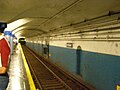 ?
? -
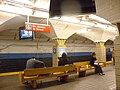 Grove
Grove -
 14th
14th -
 23rd
23rd


Which one is it exactly? Vcohen (talk) 13:36, 20 May 2016 (UTC)
- The first one is probably 14th judging from the first digit. epicgenius (talk) 20:15, 20 May 2016 (UTC)
- I think it is 14th by the level of the blue-white "waterline" relative to the arches of the niches. At 23rd it's a bit higher. So, let's say it is 14th. Thank you. Vcohen (talk) 20:27, 20 May 2016 (UTC)
- Agreed. Little out of focus, but fairly readable. Fortunately, PATH is small enough and it's stations each just distinct enough that it's relatively easy to figure out. oknazevad (talk) 20:29, 20 May 2016 (UTC)
- I think it is 14th by the level of the blue-white "waterline" relative to the arches of the niches. At 23rd it's a bit higher. So, let's say it is 14th. Thank you. Vcohen (talk) 20:27, 20 May 2016 (UTC)
Gun Hill Road

This image is in commons:Category:Gun Hill Road (IRT Dyre Avenue Line). Should it be in commons:Category:Gun Hill Road (IRT White Plains Road Line)? It looks like an elevated line. Vcohen (talk) 18:48, 23 May 2016 (UTC)
- Yes.--Kew Gardens 613 (talk) 19:43, 23 May 2016 (UTC)
- Thanks. Vcohen (talk) 20:06, 23 May 2016 (UTC)
- Great. Now I've got more of a reason to hit Gun Hill Road (IRT Dyre Avenue Line) when I come back to NYC. ---------User:DanTD (talk) 21:31, 23 May 2016 (UTC)
- Thanks. Vcohen (talk) 20:06, 23 May 2016 (UTC)
Unknown HBLR stop

Anyone know where this Hudson-Bergen Light Rail stop is? ---------User:DanTD (talk) 22:20, 7 June 2016 (UTC)
- Northbound train at Pavonia/Newport. That's the Westin at upper left, and the north mall garage reflected in the windshield. Pi.1415926535 (talk) 22:46, 7 June 2016 (UTC)
I am not sure
Colleagues, I have uploaded several images and am not sure about identifying them.
-
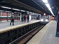 Is this the Canarsie Line station of the Broadway Junction complex?
 -
 Is this the White Plains Road Line station of the 149th Street - Grand Concourse complex?
 -
 Is this an entrance that is still under construction when the station has opened?


Thanks in advance. Vcohen (talk) 08:49, 10 June 2016 (UTC)
- You didn't need our help as much as you thought - you're right on all three. Pi.1415926535 (talk) 14:37, 10 June 2016 (UTC)
- Unbelievable. Thank you. Vcohen (talk) 15:02, 10 June 2016 (UTC)
Turnstiles at Mets - Willets Point

How is it possible that turnstiles don't block the full width of the entrance? Is it the same abandoned part of the platform as here? Vcohen (talk) 20:42, 20 June 2016 (UTC)
- These are only used during Mets games. A fence is pulled over to the edge of the turnstiles. When there are no Mets games, passengers use the turnstiles downstairs and don't have to use them twice.--Kew Gardens 613 (talk) 20:45, 20 June 2016 (UTC)
- Thanks. Does it mean there are several such turnstile banks along the platform? Vcohen (talk) 07:03, 21 June 2016 (UTC)
- Your welcome. There are two, one for each entrance to the platform.--Kew Gardens 613 (talk) 15:21, 21 June 2016 (UTC)
- Yep. Makes the place far less confusing for those rushing to catch the next train after a game. (ps, don't spell Mets with all caps. It's not an acronym). oknazevad (talk) 17:46, 21 June 2016 (UTC)
- Oops, that was not intended.--Kew Gardens 613 (talk) 19:10, 21 June 2016 (UTC)
- Yep. Makes the place far less confusing for those rushing to catch the next train after a game. (ps, don't spell Mets with all caps. It's not an acronym). oknazevad (talk) 17:46, 21 June 2016 (UTC)
- Your welcome. There are two, one for each entrance to the platform.--Kew Gardens 613 (talk) 15:21, 21 June 2016 (UTC)
- Thanks. Does it mean there are several such turnstile banks along the platform? Vcohen (talk) 07:03, 21 June 2016 (UTC)
Another mysterious Flushing El image
This was taken during the "February 2013 Nor'easter," but doesn't have a location. ---------User:DanTD (talk) 13:19, 8 June 2016 (UTC)
.jpg)
- This is a hard one. The image on Flickr is tagged as Queensboro Plaza, and the surrounding images in the album are all between Court Square and 33rd Street, but I can't even tell from this image if it's two-tracked or three-tracked. -- rellmerr (talk page • contribs) 19:48, 22 June 2016 (UTC)
Well, this is on a concrete viaduct, so it is certainly three tracks. Kylo, Rey, & Finn Consortium (talk) 01:04, 25 June 2016 (UTC)
Three abandoned objects
Hello all,
-
 The image is labeled as "Second Avenue Provision." Is it the same object as this one?
 -
 The platform is low, unlike subway platforms, but the image has a "Subway" hashtag.
 -
 I guess it's one of the three closed IRT stations in Manhattan.


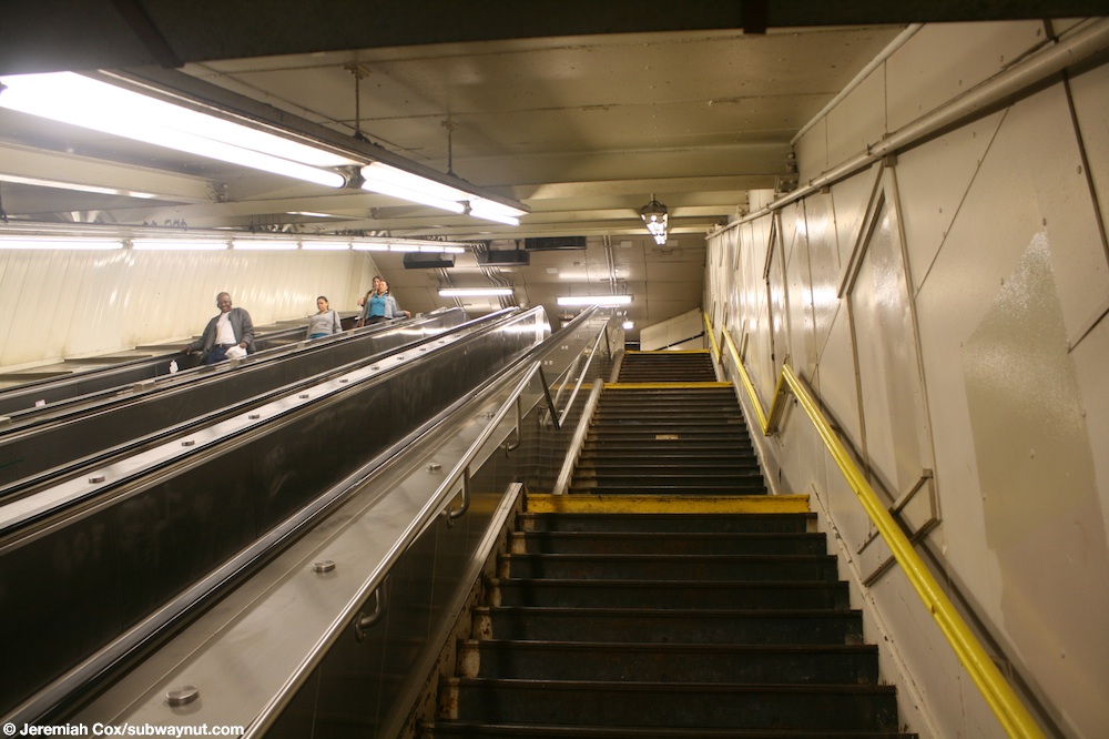
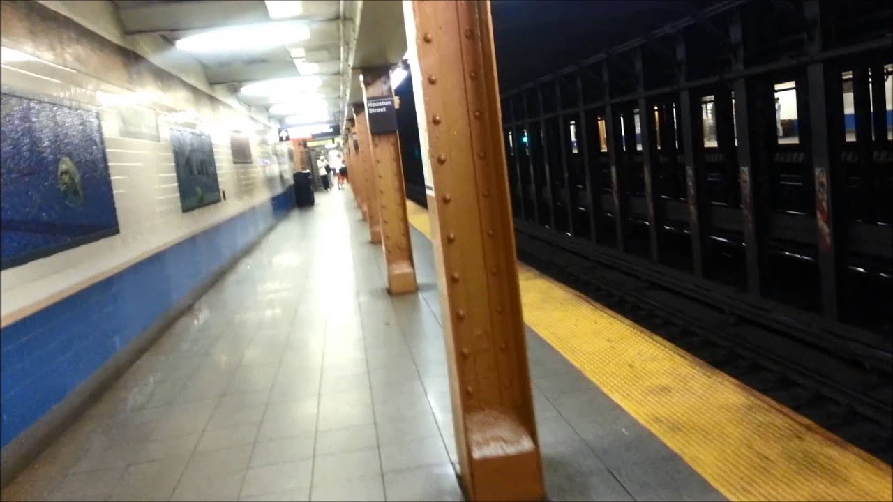
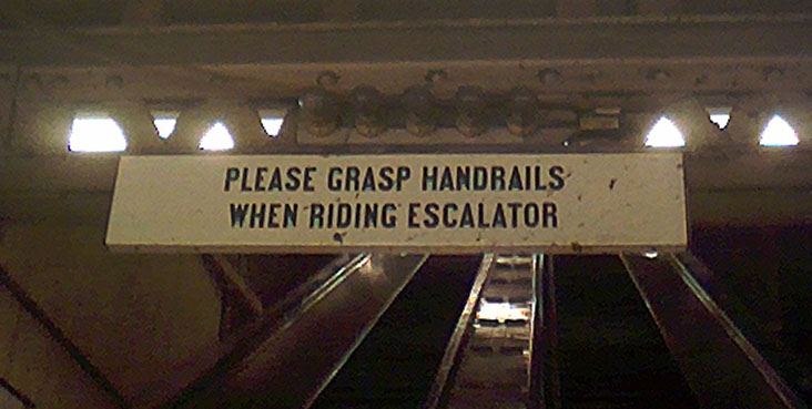
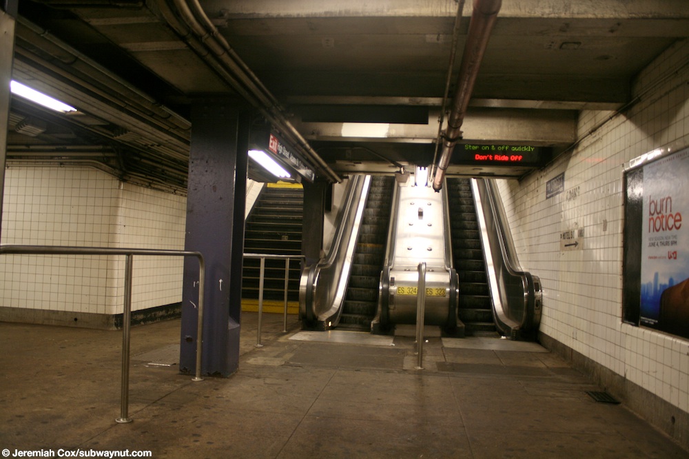
.jpg)
Thanks in advance. Vcohen (talk) 14:27, 20 June 2016 (UTC)
- @Vcohen: Picture #1 looks like a different tunnel segment, namely the one at Confucius Plaza, which has graffiti on it. The uptown Second Avenue Subway segments weren't reported to have any graffiti. I have no idea what Picture #2 is, but I suspect that it could belong to the LIRR Bay Ridge Branch near Broadway Junction, according to the previous picture in the stream. Picture #3 does seem to be one of the IRT stations, but I can't tell for sure. Kylo, Rey, & Finn Consortium (talk) 15:55, 20 June 2016 (UTC)
- I bet the second one is either of the Williamsburg Bridge or Queensborough Bridge trolley terminals. There aren't many available photos of the latter, but the columns don't match. I would suspect that it's Williamsburg.
- Third one is probably 91st Street. 18th Street had narrow platforms, Worth had square columns, and 91st is far more gratified than the other two. Pi.1415926535 (talk) 16:52, 20 June 2016 (UTC)
- I agree with Pi's assessment of #3. However, #2 shows tracks, whereas neither the Williamsburg Bridge terminal nor the Queensboro Bridge terminal has any tracks anymore. Kylo, Rey, & Finn Consortium (talk) 18:01, 20 June 2016 (UTC)
- 1 clearly is the south end SAS segment- the others don't have curves like that. 2 is in the NYC subway. That is not a low platform- it is an emergency exit. I have seen that view before but don't remember where it is, although I think it is on the Fulton IND, Perhaps the Euclid layup tracks?. 3. 91st street. Signal plate says B(roadway)- if it was Worth or 18th, the signal plate would say M!2604:2000:C689:9700:DFE:2CF9:A275:CE5 (talk) 04:24, 30 June 2016 (UTC)
- For #3, the IP makes a good point about reading the New York City Subway chaining code on the signal plate to determine the line. Going further with that chaining code, the distance is also consistent...about 32900 feet from City Hall, and even the track-code for the side platform/local track. DMacks (talk) 04:49, 30 June 2016 (UTC)
- 1 clearly is the south end SAS segment- the others don't have curves like that. 2 is in the NYC subway. That is not a low platform- it is an emergency exit. I have seen that view before but don't remember where it is, although I think it is on the Fulton IND, Perhaps the Euclid layup tracks?. 3. 91st street. Signal plate says B(roadway)- if it was Worth or 18th, the signal plate would say M!2604:2000:C689:9700:DFE:2CF9:A275:CE5 (talk) 04:24, 30 June 2016 (UTC)
- I agree with Pi's assessment of #3. However, #2 shows tracks, whereas neither the Williamsburg Bridge terminal nor the Queensboro Bridge terminal has any tracks anymore. Kylo, Rey, & Finn Consortium (talk) 18:01, 20 June 2016 (UTC)
Thank you. So, I am going to rename and categorize #1 and #3. Vcohen (talk) 07:06, 21 June 2016 (UTC)