User talk:Zero0000/2016
Clarification request archived edit
Your request for clarification has been archived at Wikipedia talk:Arbitration/Requests/Case/Palestine-Israel articles 3. For the Arbitration Committee, Miniapolis 20:34, 21 January 2016 (UTC)
Hello, Zero0000, about this diff, I added the cite from The Economist to the Richard Meinertzhagen article to try to give a reference within the article for the term "bumf," which is defined in Wiktionary and, of course, the OED. I thought of The Economist, as a publication, to be a reliable source, not original research and that the explanation within the article might be helpful to others. "Bumf" as a definition doesn't deserve its own article, so wikilinking was not an option. Linking to Wiktionary is contra to the Manual of Style and the OED is a paysite. Still and all, is there a better way to include an explanation of the term in the Meinertzhagen article? It could be helpful to those for whom the term is not at the top of their everyday parlance. Geoff | Who, me? 22:47, 1 February 2016 (UTC)
@Glane23:. Hi, it isn't clear to me why the word "bumf" is in the article at all, since it appears in Wikipedia's voice. Even more so regarding "Australian bumf" (what is that?). If it was a quotation then we could discuss how to deal with the word, but in our text we should just replace it by something readers will understand. Unfortunately that paragraph has very unclear sourcing and I can't tell if the word "bumf" originated in one of the sources given or whether it was introduced there by some Wikipedia editor. The word does not appear in the Official History cited; I don't have "Army Diary" handy to check. Actually I believe it is a paraphrase of the book of Grainger (cited next), which has "This, of course, relied on the enemy’s understanding of the peculiar Australian attitude to discipline and ‘bumf’."(p107). That makes sense, but our phrase "comprehension of Australian bumf" doesn't make sense, which suggests that whoever put it into the article didn't understand it. The following sentence "The main consequence was a swap in the German High Command, and Mustafa Kemal's resignation." is also clearly derived from Grainger, but Grainger does not attribute any of that to the haversack ruse. I'd like to remove the whole paragraph; objections? (Also, this should be on the article talk page.) Zerotalk 00:03, 2 February 2016 (UTC)
Hi edit
Yes agreed, that's what it is. I have a preference at this point to try to broaden out the scope, as an overview of the travel books would be good. What we have at the moment is worse than sub-par.
By the way, I would be highly appreciative of your thoughts at the RFC at IPCOLL.
Oncenawhile (talk) 13:52, 2 February 2016 (UTC)
Could I add later members and additional enemies.
Iron max 3 (talk) 04:01, 11 February 2016 (UTC) Iron max 3 Iron max 3 (talk) 04:01, 11 February 2016 (UTC)
WWHF is a reliable source edit
The WWHF is a reliable source. It's a government agency of Israel. It is not a private agency. It interacts and deals with archaeologists and historians. Why would you claim it is not reliable? Sir Joseph (talk) 23:49, 11 February 2016 (UTC)
- Because it isn't reliable. The State of Israel's position on history is also not reliable. Neither of them are scholarly sources. Zerotalk 23:56, 11 February 2016 (UTC)
- @Sir Joseph: And note how that source says "Nevertheless, most historians believe that the Western Wall became a popular prayer area only since the Ottoman conquest of Jerusalem in 1517 (5277)." That is indeed the consensus of historians. Zerotalk 00:12, 12 February 2016 (UTC)
- That is because popular means easier and less restrictive to get to. (due to crusades and war etc.) Not that Jews didn't pray at the wall. So then the WWHF should be a RS anyway?? Sir Joseph (talk) 00:19, 12 February 2016 (UTC)
- @Sir Joseph: No, unreliable sources often include correct statements. Government departments are only used without attribution for matters clearly within their competence and not subject to dispute. For example, we cite the Israeli Bureau of Statistics all over the place. For matters as sensitive as the history of the WW, there are legions of scholars to rely on instead. Zerotalk 00:29, 12 February 2016 (UTC)
- That is because popular means easier and less restrictive to get to. (due to crusades and war etc.) Not that Jews didn't pray at the wall. So then the WWHF should be a RS anyway?? Sir Joseph (talk) 00:19, 12 February 2016 (UTC)
- @Sir Joseph: And note how that source says "Nevertheless, most historians believe that the Western Wall became a popular prayer area only since the Ottoman conquest of Jerusalem in 1517 (5277)." That is indeed the consensus of historians. Zerotalk 00:12, 12 February 2016 (UTC)
Guy Le Strange edit
Re: [1], is he not a RS? Chesdovi (talk) 14:26, 18 February 2016 (UTC)
@Chesdovi: Sorry, I didn't see your question. See my answer in the section below. I'll add: also we have to be careful with sources 126 years old. Zerotalk 14:46, 19 February 2016 (UTC)
Question edit
I noticed this edit. You removed information as OR, although it is sourced. Did I miss anything? Debresser (talk) 15:15, 18 February 2016 (UTC)
- @Debresser: The source does not connect this information to the issue at hand. It is only some editor's opinion that it is related. Lots of gate names have changed or moved around over time; it requires an expert to know what conclusions to draw from a particular example. Zerotalk 23:28, 18 February 2016 (UTC)
Does this page fall under WP:ARBPIA, in your opinion? Since you are an admin and have edited that page, you might have some ideas. The section on Western Wall#Views does raise questions. Thanks, EdJohnston (talk) 18:18, 25 February 2016 (UTC)
- @EdJohnston: Hi Ed, good question. The only possible yes/no answer is "yes" since that place is a historical flashpoint between Jews and Muslims. But there is a longer answer. Usually topic-bans are enforced with some allowance for the nature of the edits. Two illustrative examples: (1) User Gilabrand has a well-deserved topic ban from the I-P conflict but frequently edits articles which are clearly under ARBPIA. However, I won't report her if her edits remain restricted to matters that do not involve the I-P conflict by a reasonable interpretation. (2) The article List of state leaders in 2016 is clearly as a whole not under ARBPIA, but there is a war going on there over the single line that refers to Palestine. I would say that I-P-banned editors are not allowed to partake in that war even though they are welcome to edit the parts of article about, say, Iceland or Japan. In the matter under discussion, you should also be aware that it largely comes out of an intra-Jewish conflict (Chesdovi belongs to a thread within Judaism that is largely despised by the mainstream). Chesdovi is overall not a worse editor than Debresser and far better than Sir Joseph. Cheers. Zerotalk 22:51, 25 February 2016 (UTC)
- thanks for the gratuitous attack. What makes him better then me? I'm not an SPA. I don't create obvious POV articles and then when those articles are deleted insert insert the pov pointy into main space. Don't make it seem like you're not uninvolved without a pov. His edits are extremely combative and disruptive to the project.Sir Joseph (talk) 23:04, 25 February 2016 (UTC)
- That's my honest opinion of your editing practice. And you are the last person who should complain about attacks. Zerotalk 23:12, 25 February 2016 (UTC)
- That's why I stopped dealing with him. I don't know how much you have seen of him dealing with me. As for the issue at hand, I am not in favor, in general, but for him, when he edits he makes it an Israel/Palestinian issue, but in general I don't think the page should be under ds, similar to Jew or other pages.Sir Joseph (talk) 23:18, 25 February 2016 (UTC)
- That's my honest opinion of your editing practice. And you are the last person who should complain about attacks. Zerotalk 23:12, 25 February 2016 (UTC)
- thanks for the gratuitous attack. What makes him better then me? I'm not an SPA. I don't create obvious POV articles and then when those articles are deleted insert insert the pov pointy into main space. Don't make it seem like you're not uninvolved without a pov. His edits are extremely combative and disruptive to the project.Sir Joseph (talk) 23:04, 25 February 2016 (UTC)
- If I may be allowed to add my opinion here, I would like to do so. Especially since my name has been taken in vain here. Otherwise, I would suggest somebody move it to EdJohnston's talkpage.
- First off, I completely fail to understand why an admin would have a more qualified opinion about this question than a non-admin, and in my humble opinion WikiProject pages like WP:JUDAISM, WP:ISRAEL and WP:PALESTINE are the obvious and correct places to inquire regarding this question. That is even disregarding the fact that in the ARBPIA area Zero himself has a clear POV, meaning that I find it strange and worrying that his opinion is the only one EdJohnston asked for.
- To answer the question itself. There is no straightforward answer. Part of articles like Western Wall is ARBPIA related, while the majority of the article is not. The degree varies, but in this case it is fairly easy to isolate the problematic sections. In this I completely agree with Zero. I would like to note on this occasion, that despite our different POVs, I much respect Zero, and we have solved many difficult issues together. Debresser (talk) 23:46, 25 February 2016 (UTC)
- I do disagree with the statement that "Chesdovi is overall not a worse editor than Debresser". That is in addition to the fact that I fail to understand why the question as it was posed necessitated in Zero's opinion an answer regarding any specific editors. Chesdovi is an extreme POV editor, who cherrypicks his sources and uses them in grossly misleading ways, as I have suspected for many years and has been proven recently with three examples on the talkpage of Western Wall. The same can not be said about me, and has not been said about me. Debresser (talk) 23:51, 25 February 2016 (UTC)
- @Debresser: Both you and Chesdovi have views quite different from mine, but I respect you both and can work with you both as I have demonstrated many times. Often when you claim that Chesdovi is misrepresenting some source it sees to me that he is just reading it with different colored glasses from the color you wear. I suspect that your antipathy towards him is as much to do with the fact that you find his opinions "disgusting" (your word) as with his actual editing behavior. Zerotalk 05:35, 26 February 2016 (UTC)
- Although I know I am not a paragon of virtue, I really feel that I am able to divest my editing from my personal opinions. My attitude is helped by the fact that I was raised in Europe (not in the Middle East), and enjoyed a classical education, including university studies in the exact sciences.
- I think the simple fact that Chesdovi and I agree on many of his edits, including as proposed by him on the talkpage of that very same Western Wall article, proves this. Same can be said for editing with User:Hulda, for example, who has a very pro Palestine POV, and even you. That is why I really don't appreciate when editors accuse me of POV editing or, in other contexts, "being too close to Judaism-related articles" etc.
- In short, I would like to repeat that I think your comparison between Chesdovi and me is not justified by our respective edits and editing patterns, and can only hope that if you re-read the pertaining section on Western Wall carefully, you will see for yourself that Chesdovi is indeed guilty of misrepresenting sources. Debresser (talk) 09:27, 26 February 2016 (UTC)
- @Debresser: Both you and Chesdovi have views quite different from mine, but I respect you both and can work with you both as I have demonstrated many times. Often when you claim that Chesdovi is misrepresenting some source it sees to me that he is just reading it with different colored glasses from the color you wear. I suspect that your antipathy towards him is as much to do with the fact that you find his opinions "disgusting" (your word) as with his actual editing behavior. Zerotalk 05:35, 26 February 2016 (UTC)
Seaman edit
Hello Zero. I really appreciate what you wrote about me (and to the issue) re. the Seaman arbitration issue. Thank you.
For what it's worth, here is, in my opinion, what we are dealing with there. Mr Seaman was until recently one of the policy makers organising the covered payment of government money to sympathetic students in- and outside Israel, who would then support the current government's politics on Facebook, Twitter etc. pretending to act as private, objective contributors. He managed to get fired by his own gov't right before launching the programme on a grand scale, for making quite rude and undiplomatic political comments on his private FB page. His "friends" (or himself?) usually try to whitewash his WP page anonymously, Plot Spoiler is the only exception in a very long time, but the most extreme one of them all. Here he displayed all the hallmarks of Mr. Seaman's own system-savvy and aggressive style, but WP isn't the Gov. Press Office. Thankfully. But I would bet anything I have that this isn't the end of it, perseverance is the other "Seamanship" top characteristic.
I didn't add anything to the article, I only brought back in what Plot Spoiler had blighted. I have rearranged one lead paragraph setting the events in a more logical, chronological sequence and addressed Plot Spoiler's formal complaints re. subchapter headings. The only additional material comes from our dear Dr. Dr. Nishidani, WP's highly regarded Oxbridge luminary.
I am trying to concentrate on real life for a change, stay as civil as possible, and keep my distance from "The Conflict", but Mr. Seaman & Co. will always have my undivided attention; manipulation of public opinion, censorship and aggressive behaviour from people acting as civil servants are to me like the red rag to a bull. Thanks again and all the best, ArmindenArminden (talk) 07:22, 27 February 2016 (UTC)
mail edit

It may take a few minutes from the time the email is sent for it to show up in your inbox. You can at any time by removing the {{You've got mail}} or {{ygm}} template.
. Oncenawhile (talk) 00:40, 10 March 2016 (UTC)
Emmaus-Nicopolis edit
(Note: I have posted the same message on the Emmaus Talk-Page)
Shalom, User:Zero0000. It's good to communicate with you again. I wanted to ask your opinion about the necessity of mentioning areas now fully under Jewish legal control and jurisdiction as being, formerly, under the control of the Arab Legion during and prior to the Arab-Israeli War of 1948, in other words, what some call the "West Bank." Since the term "West Bank" implies that it was formerly under a different jurisdiction, but is no longer under that jurisdiction today, what good purpose is there in mentioning that a city is "in" (note present-tense) the West Bank? If we take Emmaus Nicopolis, for example, it is fully under Israeli law and jurisdiction, whereas not even the Palestinian Authority controls the region. It seems terribly misleading to write in that article: "The site today is inside Canada Park in the West Bank, and maintained by the Jewish National Fund of Canada." It tends to ignore current historical facts about the site's legal jurisdiction. As we know, the Arab village, Imwas, was a border-line village. The Arab legion occupied the nearby Latrun monastery during the war in 1948. The result of the campaign to expand the Jerusalem Corridor as far as the western foothills of the Judean mountains, freeing it from pockets of resistance, helped, in the final analysis, to determine the border of Israel with Jordan during the 1949 Armistice Agreement. See: Har’el: Palmach brigade in Jerusalem, Zvi Dror (ed. Nathan Shoḥam), Hakibbutz Hameuchad Publishers: Benei Barak 2005, p. 273 (Hebrew). Remember what Ben-Gurion said during the War in 1948 about a region then occupied by the Egyptian army: "In the Negev we shall not buy the land. We shall conquer it. You forget that we are at war!" (See: Mêrôn Benveniśtî, Sacred landscape: the buried history of the Holy Land since 1948, p. 120). The Arabs, meanwhile, also vied with Israel over the control of territory by means of war, while the Jordanian Arab Legion had decided to concentrate its forces in Bethlehem and in Hebron in order to save that district for its Arab inhabitants, and to prevent territorial gains for Israel. Thus is it stated by Sir John Bagot Glubb, in his book, A Soldier with the Arabs, London 1957, p. 200. You see, the same principle applies today. Now that Israel has taken full-control of these territories after the Six Day War in 1967, there is no reason to insist on its former entities, since it is a way of politicizing what should be our intent as editors to remain neutral. IMHO.
Writing about this place, in particular, that it is located in the "West Bank" is a contentious issue, and I think that we'd do best by avoiding it altogether. For one reason, on the "West Bank map," the village actually sits in a Gray Area, not clearly demarcated. For another reason, it is more of a political statement than a reflection of the reality, where Israelis recognize the area as under Israeli jurisdiction. Thirdly, Israelis themselves do not call this area by the name the West Bank. Davidbena (talk) 14:39, 16 March 2016 (UTC)
- @Davidbena: The position of the Green Line was determined in the armistice agreements and Imwas was on the Jordanian side. I really don't see what else there is to say; it is in the West Bank and nobody disputes it. It is definitely not a "contentious issue". So we should say it is in the West Bank. It isn't our job to help Israel annex the West Bank by pretending that facts are not facts. I also don't think you are right that it is "fully under Israeli law and jurisdiction"; actually it is in Area C, which is under Israeli control but not sovereignty per Oslo agreements and the international law of occupation applies according to Israel as well as everyone else. Zerotalk 22:51, 16 March 2016 (UTC)
- Okay, User:Zero0000, and let me thank you for your reply. Let's just say it was on the Jordanian side. But today's Israeli border is NOT the 1948 border. Today, the village is in Israel. Can we then compromise on this issue and write instead, "The site today is inside Canada Park in what was formerly Jordan (i.e. West Bank), but now in Israel and maintained by the Jewish National Fund of Canada."??? Does this sound better? The reason why I'm asking is because the current edit ignores current political facts. It's like saying that "The city, Sioux Falls, South Dakota, is in the Sioux Indian Nation," rather than in the United-States. To this very day, many Lakota native American Indians do not recognize the sovereignty of the United-States over their ancestral homeland, but it does not change the fact, does it? Israel has sovereignty over Emmaus-Nicopolis, and it should be mentioned as in the State of Israel. IMHO. One more thing: The Oslo Accords did not give full sovereignty of lands to the Palestinian Authority, but was only a means to achieve administrative cooperation between the Palestinian Arabs working in conjunction with and under the auspices of the Jewish State. As for its current status, see Oslo Accords#End of the interim period. Davidbena (talk) 23:28, 16 March 2016 (UTC)
- Emmaus-Nicopolis is, indeed, within the territorial bounds of the State of Israel, just as all of Jerusalem is in the State of Israel, even though it too was divided until 1967. Ask any Israeli citizen, or check maps published by the Government of Israel, the village of Emmaus is NOT listed as being in another State or country, nor in the West Bank (a term rarely used by Israelis). Furthermore, to deny this fact is very strange to me. We're talking here about Israeli sovereignty (military or otherwise) over this territory. The Oslo Accords were meant to settle the final status of the territory, but it did NOT, as yet, settle the final status. Meanwhile, the place (Emmaus) is still in Israel. Article X (IX), Annex II, in the Oslo Accords specifically states:
- Okay, User:Zero0000, and let me thank you for your reply. Let's just say it was on the Jordanian side. But today's Israeli border is NOT the 1948 border. Today, the village is in Israel. Can we then compromise on this issue and write instead, "The site today is inside Canada Park in what was formerly Jordan (i.e. West Bank), but now in Israel and maintained by the Jewish National Fund of Canada."??? Does this sound better? The reason why I'm asking is because the current edit ignores current political facts. It's like saying that "The city, Sioux Falls, South Dakota, is in the Sioux Indian Nation," rather than in the United-States. To this very day, many Lakota native American Indians do not recognize the sovereignty of the United-States over their ancestral homeland, but it does not change the fact, does it? Israel has sovereignty over Emmaus-Nicopolis, and it should be mentioned as in the State of Israel. IMHO. One more thing: The Oslo Accords did not give full sovereignty of lands to the Palestinian Authority, but was only a means to achieve administrative cooperation between the Palestinian Arabs working in conjunction with and under the auspices of the Jewish State. As for its current status, see Oslo Accords#End of the interim period. Davidbena (talk) 23:28, 16 March 2016 (UTC)
- "It is understood that, subsequent to the Israeli withdrawal, Israel will continue to be responsible for external security, and for internal security and public order of settlements and Israelis. Israeli military forces and civilians may continue to use roads freely within the Gaza Strip and the Jericho area."
Quick clarification edit
I noted that in your comment at WP:AN/I you happened to assume that I am a female editor. I'm not, and I am a male editor. The "Neve" part is basically just the word even—just happened to be the first word to enter my mind for a username—backwards.--Neve–selbert 08:40, 19 March 2016 (UTC)
- @Neve-selbert: Ok, thanks for explaining. I'l refer to you as "he" henceforth. Zerotalk 08:49, 19 March 2016 (UTC)
Edit Reverts edit
Friendly question for you. Also not sure that this is the proper place to ask, but am wondering why you reverted my edit? Hoping that you are friendly to newbies & are willing to reply here as I have not set up my user page (still finding my way). SeaBeeDee 08:17, 26 March 2016 (UTC)SeaBeeDeeSeaBeeDee 08:17, 26 March 2016 (UTC) SeaBeeDee 08:17, 26 March 2016 (UTC)
Thank you for your constructive advice on unnecessary links. I have sent you a Smiley Award. Looking forward to becoming the best Wikipedian that I can be, thanks to friendly advice like yours! SeaBeeDee 00:10, 29 March 2016 (UTC) — Preceding unsigned comment added by SeaBeeDee (talk • contribs)
Map mistake edit
Hi Zero0000,
You or I made in mistake in the localisatio of Imwas. See both these maps: [2]. I think that you put it on the Monastery location. I don't remember which sources I have used at the time (should be Morris - 1948) but I had asked Yoav G. to check my maps... What is your mind ? Pluto2012 (talk) 06:44, 12 April 2016 (UTC)
- I lack time and have to go.
- But this map is false. The fort was in the Jordanian territory and east of the 1949 line. How else could it be ? Did the Israeli get the evaucation of this ? Pluto2012 (talk) 06:54, 12 April 2016 (UTC)
- @Pluto2012: Yes, the latitude and longitude give for Imwas and Emmaus Nicopolis are wrong, and different from each other. I'll try to fix that soon. In this map that I made, I copied the armistice lines from an official Israeli source of the 1950s, which differs a bit from Google's version. Zerotalk 16:26, 12 April 2016 (UTC)
@Pluto2012: @Huldra: I adjusted the coordinates but the fact that maps don't exactly agree is a problem. I'll try again later. Please be more specific about what problems you see. On this map, Latrun village is shown but not the Police Post (fort); I'll try to add it. Also the location of Emmaus Nicopolis is just to the left of the red blob "Imwas". Zerotalk 00:45, 13 April 2016 (UTC)
- Hi Zero0000
- Between my post and you reading of it somebody changed the article and removed a map...
- I wonder if this map of 1948 is right:
- [3]
- I am not sure but it defers from yours.
- I think I based mine on this one and I used the road alongside Ayalon valley as a reference to locate Imwas when it turns. Pluto2012 (talk) 03:39, 13 April 2016 (UTC)
- Pluto2012 (talk) 03:27, 13 April 2016 (UTC)
![[3]](https://commons.wikimedia.org/wiki/File:Latroun_%2819_juillet%29.png)
Hi @Pluto2012:. One thing to realise is that the main NW-SE road through the Latrun Interchange did not exist in 1948, nor I think in 1967. It is newer. My map shows the new road, but your map and this one show the old roads. That's the main reason things seem to have moved in major ways. For the armistice line I used this map. Note how it passes through Latrun village, as it does on this one but not on your map. Cheers. Zerotalk 09:19, 13 April 2016 (UTC)
Smiley Award for you! edit

|
For your contributions to Wikipedia and humanity in general, you are hereby granted the coveted: Random Smiley Award (Explanation and Disclaimer) |
Thank you for your advice! SeaBeeDee 00:04, 29 March 2016 (UTC) SeaBeeDee 00:04, 29 March 2016 (UTC) — Preceding unsigned comment added by SeaBeeDee (talk • contribs)
File permission problem with File:BBCreel116.png edit

Thanks for uploading File:BBCreel116.png. I noticed that while you provided a valid copyright licensing tag, there is no proof that the creator of the file has agreed to release it under the given license.
If you are the copyright holder for this media entirely yourself but have previously published it elsewhere (especially online), please either
- make a note permitting reuse under the CC-BY-SA or another acceptable free license (see this list) at the site of the original publication; or
- Send an email from an address associated with the original publication to permissions-en@wikimedia.org, stating your ownership of the material and your intention to publish it under a free license. You can find a sample permission letter here. If you take this step, add {{OTRS pending}} to the file description page to prevent premature deletion.
If you did not create it entirely yourself, please ask the person who created the file to take one of the two steps listed above, or if the owner of the file has already given their permission to you via email, please forward that email to permissions-en@wikimedia.org.
If you believe the media meets the criteria at Wikipedia:Non-free content, use a tag such as {{non-free fair use}} or one of the other tags listed at Wikipedia:File copyright tags#Fair use, and add a rationale justifying the file's use on the article or articles where it is included. See Wikipedia:File copyright tags for the full list of copyright tags that you can use.
If you have uploaded other files, consider checking that you have provided evidence that their copyright owners have agreed to license their works under the tags you supplied, too. You can find a list of files you have created in your upload log. Files lacking evidence of permission may be deleted one week after they have been tagged, as described on criteria for speedy deletion. You may wish to read Wikipedia's image use policy. If you have any questions please ask them at the Media copyright questions page. Thank you. Kelly hi! 11:51, 17 May 2016 (UTC)
File permission problem with File:BBCreel125.png edit
Thanks for uploading File:BBCreel125.png. I noticed that while you provided a valid copyright licensing tag, there is no proof that the creator of the file has agreed to release it under the given license.
If you are the copyright holder for this media entirely yourself but have previously published it elsewhere (especially online), please either
- make a note permitting reuse under the CC-BY-SA or another acceptable free license (see this list) at the site of the original publication; or
- Send an email from an address associated with the original publication to permissions-en@wikimedia.org, stating your ownership of the material and your intention to publish it under a free license. You can find a sample permission letter here. If you take this step, add {{OTRS pending}} to the file description page to prevent premature deletion.
If you did not create it entirely yourself, please ask the person who created the file to take one of the two steps listed above, or if the owner of the file has already given their permission to you via email, please forward that email to permissions-en@wikimedia.org.
If you believe the media meets the criteria at Wikipedia:Non-free content, use a tag such as {{non-free fair use}} or one of the other tags listed at Wikipedia:File copyright tags#Fair use, and add a rationale justifying the file's use on the article or articles where it is included. See Wikipedia:File copyright tags for the full list of copyright tags that you can use.
If you have uploaded other files, consider checking that you have provided evidence that their copyright owners have agreed to license their works under the tags you supplied, too. You can find a list of files you have created in your upload log. Files lacking evidence of permission may be deleted one week after they have been tagged, as described on criteria for speedy deletion. You may wish to read Wikipedia's image use policy. If you have any questions please ask them at the Media copyright questions page. Thank you. Kelly hi! 11:51, 17 May 2016 (UTC)
Map desperately needed edit
Ok, I´m working on User:Huldra/Jisr al Majami ...and the related Naharayim (and to some degree: Gesher, Israel and Island of Peace). I have ...sort of.... cleaned up things in the commons categories (at least the worst). The thing is: There are 2 old (Mamluk? Roman?) bridges, each with a parallel modern railway bridge. One pair is now in User:Huldra/Jisr al Majami -category...the other pair is in the Naharayim-commons -category. Oh, and Naharayim was -partly- named Jisr al Majami earlier. It is a mess. We desperately need a proper map over the area.....interested? Huldra (talk) 23:54, 26 May 2016 (UTC)
- @Huldra: Yeah, that is quite a puzzle. See the two 20-22 maps at http://rosetta.nli.org.il/delivery/DeliveryManagerServlet?dps_pid=IE21693218 . At 2032/2255 you can see the road bridge and railway bridge that I usually see called Jisr al Majami. But where are the other bridges you mention? I see a pair of bridges at 204/228 on a different river, is that it? 11:43, 27 May 2016 (UTC)
- For some reason the http://rosetta.nli.org.il/delivery/DeliveryManagerServlet?dps_pid=IE21693218 does not work for me (it goes fuzzy when I try to focus), but yeah, you are right. The one spanning the Jordan river is what Petersen calls Jisr al Majami, this commons-cat (with the adjoining Ottoman rail-bridge here.)
- The other bridge, *also* often called Jisr al Majami, is further up, spanning the Yarmuk. While the surrounding around "the lower" Jordan Jisr al Majami have not changed much, the surroundings around Yarmuk Jisr al Majami have changed enormously, due to the electric power station, and dam, which was there until 1948. The railway-bridge at Yarmuk was called "Yarmuk valley glider bridge", its commons-cat is here. As you can see, the writers/uploaders commonly refer to the adjacent old bridge as "Roman". As you can see here, there is basically nothing much left of the rail bridge at Yarmuk (it is the one in the front), while the adjacent Yarmuk Jisr al Majami (at around 3 o´clock) has been repaired in the middle. Huldra (talk) 20:43, 27 May 2016 (UTC)
- @Huldra: The 1:20000 maps only focus for me at full magnification, and sometimes only then with persistence. Today I can't get them to load at all. Incidentally, I don't see where the Yarmuk bridge is called Jisr al Majami. That page of Fischbach doesn't say that. Incidentally, the Jordan bridge is shown and named on the Jacotin map. Zerotalk 06:46, 28 May 2016 (UTC)
- Oh, @Huldra: Check your email for a great source. Zerotalk 13:30, 28 May 2016 (UTC)
- I got the source, and it is great (though they could have used some better ce; they speak of "Peterson" and "Carmon". Hmmmpr.)
- From what I understand, from sources such as this [4] [5] [6], the whole area which is called Naharayim on Wikipedia, was called Jisr al Majami during the Mandate era (Naharayim was just the Hebrew name, while Baqoura was the Arab name.) And if you look at the pictures in the commons cat of the Yarmuk bridge: Category:Yarmuk valley glider bridge, many of them are called "Jisr al Majami. Interestingly, while Jacotin clearly mentioned the Jordan Jisr al Majami, there is no indication of a Yarmouk Jisr al Majami; perhaps the Yarmouk -bridge wasn´t "Roman" after all? Huldra (talk) 20:20, 29 May 2016 (UTC)
- @Huldra: It is confusing about where the name "Jisr el Majami" was applied. I strongly suspect Fishbach is wrong, since all of the mandate-era maps I looked at showed it only on the west side of the Jordan and never on the east side. The place called Naharayim is never called Jisr el Majami on any map I looked at (many). In early maps it is called Tel Or, though I have one source which describes Naharayim and Tel Or as adjacent rather than identical. A typical map is here (1930s); note that in addition to the bridge with name Jisr el Majami there is a village called Jisr el Majami and a village called Tel Or, on opposite sides of the river. This later map (1940s) still has the village Jisr el Majami on the west (as well as the new Gesher) and on the east it has "Naharayim (Tel Or)". For sure the "Jisr el Majami" in the censuses and Village Statistics, as well as the Palestine village lists published right up to 1947, was on the west of the river since those documents did not include Transjordan. I have some relevant stuff about land sales in the 1920s that I didn't sort out. About the bridges: there is an article of Albright where he calls the Jordan bridge "Roman", but that idea seems to now be discarded. I don't see sources on the Yarmuk bridge. I'm in a time-panic for about 3 weeks but after that I'll spend more time on this, including a map. Zerotalk 00:38, 30 May 2016 (UTC)
- By the way, note that Gesher was initially close to the bridge but after 1948 it moved about 1km west. Zerotalk 00:47, 30 May 2016 (UTC)
- This 1954 Hebrew map shows Tel Or and Naharayim separately, and is also a good source for "Peace Island". Zerotalk 00:58, 30 May 2016 (UTC)
- There is no hurry, I´m not going to move User:Huldra/Jisr al Majami to mainspace in quite a while!
- Also it is not only Fishbach. If you look at the commons-cat for the Yarmouk-bridge, this this and this were all uploaded from the Australian War Memorial, while this was uploaded from the Matson-collection, and all of them call the Yarmouk-bridge for Jisr al Majami.
- Also, from what I`ve read: the Gesher kibbutz started inside the old Khan, (on land that baron Rothschild had bought), they moved to the present location after 1948/9. Huldra (talk) 20:47, 30 May 2016 (UTC)
- I believe those images of the Yarmuk bridge are mislabelled. But I can't prove it. Zerotalk 00:56, 31 May 2016 (UTC)
- @Huldra: Now I found an 1850 map (Zimmermann) that labels the Yarmuk bridge "Jisr el Ajjeh". Have you seen that name? More recently, l see a 1924 map that calls it "Jisr es Saghar" and I find it elsewhere spelled "Jisr [el] Saghir". For example it is called that in Grootkerk p338 (referring to a name list compiled by the Dept. of Antiquities; I have that list). It is also called that in Schumacher's 1888 book Pella, p8 (try here —do you know where a copy of the whole book can be found)? Also this handbook. And page 730 here. I'm out of time, probably there is a lot more to find. Zerotalk 03:00, 31 May 2016 (UTC) Zerotalk 03:00, 31 May 2016 (UTC)
- I still think that it is unlikely that three different authorities (Fischbach, Australian War Memorial, Matson) all have gotten it wrong; I find it more likely that Naharayim also was named Jisr al Majami, at least for a while.
- No, I haven´t found Schumacher's 1888 book Pella anywhere (with full view).
- And there is a further mixup at Jisr al-Sidd (further north on the Jordan river). Most seem to agree that there were (at least) two bridges, named Jisr al-Sidd and Umm al-Qanafir. However, Petersen, 2001, thinks they were the same(!). Huldra (talk) 23:10, 31 May 2016 (UTC)
- @Huldra: Before the founding of Tel Or and Naharayim, and sometimes afterwards too, the whole local region was called Jisr al-Majami. For example you can find variations on "Jisr al-Majami Power Station" in heaps of places both before and after it was built. So I agree with you on that point. But that doesn't say anything about the name of the Yarmuk bridge. Correct me if I'm wrong, but I don't see that any of the photographic sources you bring state that the bridge itself (rather than the locality) was called Jisr el-Majami. On the other hand, the sources I brought explicitly give a name to the bridge: Jisr Saghir. One of them is the official Australian war history and another is the mandatory government's Department of Antiquities. When I have more time, I'll write the authors of that paper I sent you. Zerotalk 01:59, 2 June 2016 (UTC)
- Well, "Jisr" means "Bridge", that the whole area was given the name Jisr al-Majami just points to the importance of the place, IMO. Also, this, from 1944, gives the position of Jisr Saghir at 204/228 (while Jisr al-Majami is given at 203/225). To me, that looks as if Jisr Saghir is north of Tel Or/Naharayim? Huldra (talk) 02:41, 2 June 2016 (UTC)
- @Huldra: 204/228 is exactly the location of the old bridge over the Yarmuk River, within meters. It is north of Naharayim with the artificial reservoir between. I don't know of any old bridges in the neighborhood except this one and Jisr el Majami. That list you found is the "Geographical List" that Grootkerk cites. Zerotalk 10:00, 2 June 2016 (UTC)
- Well, "Jisr" means "Bridge", that the whole area was given the name Jisr al-Majami just points to the importance of the place, IMO. Also, this, from 1944, gives the position of Jisr Saghir at 204/228 (while Jisr al-Majami is given at 203/225). To me, that looks as if Jisr Saghir is north of Tel Or/Naharayim? Huldra (talk) 02:41, 2 June 2016 (UTC)
_and_railway_bridge_(background).jpg)
FYI edit
Hi. Nableezy pointed out that you hadn't commented yet on my proposal at Talk:Ancient_synagogues_in_Palestine#Requested_move_4_June_2016. Since you participated in the move discussion above that, and since I much appreciate our previous interactions, you are cordially invited to present your opinion on my move proposal. Debresser (talk) 18:33, 9 June 2016 (UTC)
Zionist colonisation in Uganda edit
I hope you agree with the changes which I made in the "Zionism" article based on your hints: pages 55/56! --L.Willms (talk) 09:18, 22 June 2016 (UTC)
ANI Notification edit
![]() There is currently a discussion at Wikipedia:Administrators' noticeboard/Incidents regarding an issue with which you may have been involved. The thread is A Conflict. Thank you. Gestrid (talk) 05:39, 14 July 2016 (UTC)
There is currently a discussion at Wikipedia:Administrators' noticeboard/Incidents regarding an issue with which you may have been involved. The thread is A Conflict. Thank you. Gestrid (talk) 05:39, 14 July 2016 (UTC)
If you can do me a favour edit
And not delete this. I want to have a laugh every now and then.--Bolter21 (talk to me)
- @Bolter21: Ok, I was thinking about rev-delling it but you are welcome to keep it. Zerotalk 12:22, 18 July 2016 (UTC)
- (talk page stalker):@Bolter21: if this happens repeatedly, you could consider setting up something like my "fan mail" archive - see the archive box at the top of my talk page. Just a thought. --NSH001 (talk) 22:46, 21 July 2016 (UTC)
About an edit you made three years ago edit
Hello Zero0000, somewhere in 2013 you made this edit in which you wrote that "During the 1929 Palestine riots, three residents were killed and the remainder left" in the Kibbutz of Ein Zeitim. Your provided this source: ""Three new villages in N. Palestine". Palestine Post. January 18, 1946. p. 1", what is it exactly? I want to use it for a section I created for 1929 Palestine riots but I am not sure about it.--Bolter21 (talk to me) 22:11, 21 July 2016 (UTC)
- @Bolter21: The full text of the Palestine Post up to the time it became the Jerusalem Post can be found at the Historical Jewish Press site. There have been some arguments around whether it is reliable, but I think it is citable with the possible exception of the 1948 war period when it became very partisan like all newspapers on both sides. Zerotalk 22:56, 21 July 2016 (UTC)
- I believe it is reliable, just the name of the source seems wierd, what is exactly "three new villages in N. Palestine? is it a news article or a seperate text published by PP? And why it is "page 1"? I usually trust other Wikipedians, when using sourced statements with no links, but this one seemd suspicious..--Bolter21 (talk to me) 23:00, 21 July 2016 (UTC)
- @Bolter21: You can see the answers from the citation format: {{cite news|title = Three new villages in N. Palestine | newspaper = Palestine Post | date = January 18, 1946 | page = 1}}. "Three new villages in N. Palestine" is the article title, "Palestine Post" is the newspaper name, "January 18, 1946" is the newspaper issue, and "1" is the page number. There would be a field "author=.." except that this one is just "Palestine Post Reporters". It is possible to also give a direct url to the page, but you need to edit out the Javascript stuff that the website gives you: [7]. Zerotalk 08:43, 22 July 2016 (UTC)
- Alright then. I am not used to see such sources (physical newspapers) so I wanted to be sure this source is not a reference mistake.--Bolter21 (talk to me) 11:46, 22 July 2016 (UTC)
- @Bolter21: You can see the answers from the citation format: {{cite news|title = Three new villages in N. Palestine | newspaper = Palestine Post | date = January 18, 1946 | page = 1}}. "Three new villages in N. Palestine" is the article title, "Palestine Post" is the newspaper name, "January 18, 1946" is the newspaper issue, and "1" is the page number. There would be a field "author=.." except that this one is just "Palestine Post Reporters". It is possible to also give a direct url to the page, but you need to edit out the Javascript stuff that the website gives you: [7]. Zerotalk 08:43, 22 July 2016 (UTC)
- I believe it is reliable, just the name of the source seems wierd, what is exactly "three new villages in N. Palestine? is it a news article or a seperate text published by PP? And why it is "page 1"? I usually trust other Wikipedians, when using sourced statements with no links, but this one seemd suspicious..--Bolter21 (talk to me) 23:00, 21 July 2016 (UTC)
Thank you edit
Thank you for your contribution to the discussion on Wehrmachtbericht at the NPOV noticeboard. As a follow-up, I posted a link to the Talk pages where it had come up, and it may have helped to sway an editor's opinion, which originally was for inclusion: Wehrmachtbericht transcript. It was great to get input from uninvolved editors, so thanks again. K.e.coffman (talk) 01:03, 23 July 2016 (UTC)
Transjordan edit
Thank you for providing this link. I wonder if there are any sources discussing Transjordan's relationship with the British Mandate of Palestine? Specifically those about the borders in the link. To be blunt, anything that would destroy the fictional spinoff; that Jordan was carved out of "Palestine" and stolen from the Jews and the Palestinians? And that would destroy this fictional map --Makeandtoss (talk) 11:53, 29 July 2016 (UTC)
- @Makeandtoss: I uploaded an extract from that image to Commons: File:PalestineandTransjordan1922.jpg. You can add it to articles when it is relevant. The dashed red lines are a bit mysterious. The map doesn't explain them, but they might represent the approximate extent of British influence. It's also interesting that the name "Kerak" is given more prominence than the name "Trans-Jordania". As to your question, which text in which articles are you concerned about? Zerotalk 13:36, 29 July 2016 (UTC)
- There were some content on sister Wikipedia projects (like Wikiquote and Wikivoyage) that were infuriatingly promoting faaaaar right-wing Zionist idea of Jordan being a Palestinian homeland, I removed the nonsense. It seems to me that they are so convinced of this idea due to this map, which happens to be fictional. I wanted to find a source mentioning the borders seen in the 1920 atlas so that I can add them to Wikipedia. --Makeandtoss (talk) 14:08, 29 July 2016 (UTC)
- @Makeandtoss: I think you mean "Jewish homeland". One source on this is this article in an academic journal, which also treats the similar myth about the Golan. I was surprised when I read it because the writer is usually considered very right-wing. If you can't obtain access to the article, send me email. Zerotalk 03:25, 30 July 2016 (UTC)
- Actually, both! Sometimes Jewish homeland and Palestinian homeland! "Jordan was carved out of Mandatory Palestine, it BELONGS to the JEWS" and "Jordan is Palestine, Jordan never existed" (ironically missing out on the fact that Jordan is 27 years older than Israel). I can't view the article but damn why doesn't Commons have a restriction on original research. The map's usage across multiple Wikipedias is horrendous. --Makeandtoss (talk) 08:20, 31 July 2016 (UTC)
- @Makeandtoss: I think you mean "Jewish homeland". One source on this is this article in an academic journal, which also treats the similar myth about the Golan. I was surprised when I read it because the writer is usually considered very right-wing. If you can't obtain access to the article, send me email. Zerotalk 03:25, 30 July 2016 (UTC)
- There were some content on sister Wikipedia projects (like Wikiquote and Wikivoyage) that were infuriatingly promoting faaaaar right-wing Zionist idea of Jordan being a Palestinian homeland, I removed the nonsense. It seems to me that they are so convinced of this idea due to this map, which happens to be fictional. I wanted to find a source mentioning the borders seen in the 1920 atlas so that I can add them to Wikipedia. --Makeandtoss (talk) 14:08, 29 July 2016 (UTC)
Maps edit
Hello. As you probably know, I am making maps every now and then. My question to you is, what program(s) and maybe even methods do you use for mapping? I use (as weird as it might sound) MSpaint for all mappings and very rarely I use photoshop.--Bolter21 (talk to me) 12:19, 7 August 2016 (UTC)
I noticed your edit to this page. See this discussion I had with Nishidani: I am trying to get the article speedily deleted and userfied while the AfD for The Bloody Day in Jaffa is going on - this won't happen if other people add content to it. I do not know enough about the topic to judge whether the article is notable or not - if it is I can drop the idea. Kingsindian ♝ ♚ 14:42, 26 August 2016 (UTC)
Have you a RS for the complete quote and perhaps also contextual analysis edit
of the B-G remark Zionism Has Reached the End of the Road here? Plenty of time, no hurry. Thanks Nishidani (talk) 07:41, 5 September 2016 (UTC)
- @Nishidani: I heard it is in this collection and it seems a bit similar to the extract you can see there. I don't know an English source. Zerotalk 08:32, 5 September 2016 (UTC)
Extended confirmed protection edit
Hello, Zero0000. This message is intended to notify administrators of important changes to the protection policy.
Extended confirmed protection (also known as "30/500 protection") is a new level of page protection that only allows edits from accounts at least 30 days old and with 500 edits. The automatically assigned "extended confirmed" user right was created for this purpose. The protection level was created following this community discussion with the primary intention of enforcing various arbitration remedies that prohibited editors under the "30 days/500 edits" threshold to edit certain topic areas.
In July and August 2016, a request for comment established consensus for community use of the new protection level. Administrators are authorized to apply extended confirmed protection to combat any form of disruption (e.g. vandalism, sock puppetry, edit warring, etc.) on any topic, subject to the following conditions:
- Extended confirmed protection may only be used in cases where semi-protection has proven ineffective. It should not be used as a first resort.
- A bot will post a notification at Wikipedia:Administrators' noticeboard of each use. MusikBot currently does this by updating a report, which is transcluded onto the noticeboard.
Please review the protection policy carefully before using this new level of protection on pages. Thank you.
This message was sent to the administrators' mass message list. To opt-out of future messages, please remove yourself from the list. 17:49, 23 September 2016 (UTC)
Request edit
Hi, I would like to ask for your opinion on the state of discussion at Talk:History of the Jews and Judaism in the Land of Israel. The discussion is constantly being discontinued, what are Wiki policies on this issue? Not looking for your support on the discussion, strictly policy advice.. Makeandtoss (talk) 12:53, 5 October 2016 (UTC)
Mount Zion edit
Please read my edit comments. I'm happy to discuss if you have any problems to save time on reversion related process. Crock81 (talk) 10:10, 8 October 2016 (UTC)
- @Crock81: If you are considering the "hill" thing, you are confusing me with another user as I did not edit regarding that. Zerotalk 10:27, 8 October 2016 (UTC)
- PS. You need to find somone with much better knowledge of German orthography than I for a source, but there are no words in German starting with Tz, which I remember from school days. Because political Zionism was created in late 19th century Austria, it was spelled in German, with a Z, though the sound approximates the Hebrew Ts in Tsadi. German-speaking Jews would have been phonetically correct. Crock81 (talk) 10:32, 8 October 2016 (UTC)
- @Crock81: I know how צ is pronounced, and I know how Z is pronounced in German. That's not the point. You introduced a theory that "Zion" got to be spelt that way due to German influence, but for that theory you need to provide a citation. That spelling appeared in English publications long before political Zionism appeared in Germany. For example: 1659 1766. If you can't provide a source for a German origin of the spelling, your addition needs to be removed. Incidentally, your claims about "hill" have problems too. The article hill only gives the 610m definition as the UK standard, but Mt Zion is not in the UK. Zerotalk 11:15, 8 October 2016 (UTC)
- Sorry, but I had no way of knowing what you know. There were no formal rules for English spelling until late 19th century, so spelling of Zion in the 17th century is very likely a borrowing from the continent, perhaps the Dutch. I would be surprised if anyone could offer a source you seek.
- In Israel it is Har Tzion, not tel Tzion, or any other word for hill. Apparently this logic was inadequate for the previous article editors. Given Wikipedia is in English language, and the subject has modern scientific measurements and cultural values, why not use both? 11:30, 8 October 2016 (UTC) — Preceding unsigned comment added by Crock81 (talk • contribs)
- @Crock81: If a source cannot be provided, the information cannot be included. That is one of the basic policies of Wikipedia. Also, "tel" means an artificial mound, such as generated by a settlement over a very long period of time. Zerotalk 02:24, 9 October 2016 (UTC)
- @Crock81: I know how צ is pronounced, and I know how Z is pronounced in German. That's not the point. You introduced a theory that "Zion" got to be spelt that way due to German influence, but for that theory you need to provide a citation. That spelling appeared in English publications long before political Zionism appeared in Germany. For example: 1659 1766. If you can't provide a source for a German origin of the spelling, your addition needs to be removed. Incidentally, your claims about "hill" have problems too. The article hill only gives the 610m definition as the UK standard, but Mt Zion is not in the UK. Zerotalk 11:15, 8 October 2016 (UTC)
- Re-reading this, what are you saying, that early (i.e. 19th century) Jewish Zionists were reading 17th century English literature to get their spelling for Zionism?! It isn't commonsensical to assume this, and is not something that requires validation or sources, because you are asking me to prove Theodor Herzl spoke German! The earliest Zionismus I can Google is 1868. How about you prove to me that Zvi Hirsch Kalischer's name was spelled with a Zayin in Hebrew, despite every article reference showing otherwise. Even the original Jewish Encyclopedia article the Wikiepdia article is based on has an error in the title. Its an emphatic-Z (diacritic) in the title (look closely), but the Polish equivalent is a C for the /ts/ sound. So, if you were a good editor, you would move that article to a correct name, Cvi or Tsvi, right? ;-)
- Last offer. We can collaborate and do good, or you can keep being disruptive and antagonistic, in which case all that will happen is that I will make a few dollars in Amazon and Wikipedia will get yet another 'OOPS moment' in cyberspace Crock81 (talk) 09:30, 11 October 2016 (UTC)
- Actually, this is what I'm saying. There are no contemporary, i.e. TaNaKh, sources that use any other words than har, i.e. mountain, so calling it a 'hill is OR. However, I'm going to spend some time on re-editing the article and adding references, both cultural and academic. It will however take time. Would you mind protecting the article while I do so? I'm happy to of course discuss editing on talk and incorporate any data others may suggest, again, given it is rationally referenced. One of the current references uses 'hill' in the text in spite of quoting TaNaKh passages which say mountain. Crock81 (talk) 05:53, 9 October 2016 (UTC)
- @Crock81: If I protect the article it would prevent you from editing it. Calling it a hill is not OR if modern reliable sources call it that. In general, you seem to not understand what OR means and I suggest you read those policy pages again as the one violating the rules here is you. Zerotalk 07:08, 9 October 2016 (UTC)
- There are many 'sources' on many subjects that are, and have been proven to be full of shit. Many academics, for reasons of intellectual dishonesty, bias or some political perspective say absolute nonsense. The greatest problem is with terminology because many people use words like they were sheets of toilet paper. The particular 'source' used in the article now has not (that I can see) defined what a mountain or a hill is, because it isn't relevant to the author.
- Very many Wikipedia articles relay on electronic sources because most editors I have med can't be bothered to get books even from a library. No one trusts a reference that isn't accessible online, but few people actually have read the entire work to understand authors perspective. They often do not realise that their 'reference' is in fact used as argument/evidence for exactly the opposite idea the editor is trying to present in the article. This makes Wikipedia worthless because it isn't trusted. I have come up against this time and again, with admins siding with technical upholding of Wikipedia 'policy' that prevents improvement and completion of articles, thought he people doing the criticising would not EVER actually have done anything about the article themselves.
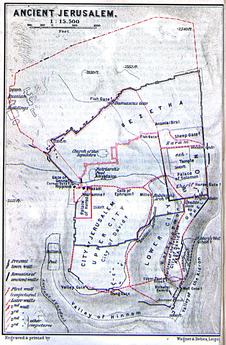
- Mount Zion is a classic example. WTF is it with the 'three locations'??! This is as blatant an OR theory as I have ever seen, all based on one misquoted book! No one had considered that the well over 100 original source references in TaNaKh may consider Zion a synonym to Jerusalem? No one considered that a city may simultaneously have two names? No one considered that the loss of the location for Zion the mountain was caused by the Roman policy of depopulation of Jerusalem and later the Byzantine Christian Greek speaking culture which decided to relocate the name to an event more significant to itself? Look at this map I can date it to before 1888 because it doesn't have the New Gate yet, but notice something else? It’s got two cities of David! That beats three Mount Zions!
- I’m not going to waste time on this article if I'm going to have to argue every word and edit with people that have too much time on their hands. I don't, so if I do get interference, I will just 'walk' and you or Hetzl1888 can find another editor for this not an insignificant article, in the scheme of things. I'm happy to work with productive people, but if I face disruption, it will not be any problem for me to walk away. I can still do the article, and publish on Amazon for $1 and make Wikipedia a laughing stock. You pick Crock81 (talk) 08:41, 9 October 2016 (UTC)
- @Crock81: If I protect the article it would prevent you from editing it. Calling it a hill is not OR if modern reliable sources call it that. In general, you seem to not understand what OR means and I suggest you read those policy pages again as the one violating the rules here is you. Zerotalk 07:08, 9 October 2016 (UTC)
- Actually, this is what I'm saying. There are no contemporary, i.e. TaNaKh, sources that use any other words than har, i.e. mountain, so calling it a 'hill is OR. However, I'm going to spend some time on re-editing the article and adding references, both cultural and academic. It will however take time. Would you mind protecting the article while I do so? I'm happy to of course discuss editing on talk and incorporate any data others may suggest, again, given it is rationally referenced. One of the current references uses 'hill' in the text in spite of quoting TaNaKh passages which say mountain. Crock81 (talk) 05:53, 9 October 2016 (UTC)
- @Crock81: So we should just stand back and watch you edit against the well-established policies of Wikipedia? It doesn't work that way. You have to obey the rules or you have to leave. Those are your only options. Personally I have a considerable knowledge of the subject, and I love books on paper (almost 400 of mine, all about Middle East history, sit on the shelves behind me as I type and two very large libraries are nearby). But I don't just insert what I believe into articles without providing the best sources I can find. Unlike you. Regarding that map, you are wrong again: it is dated 1912 and it doesn't show New Gate because it is intended to be a depiction of ancient Jerusalem. It doesn't have two City of Davids either; it shows two locations that were considered possible at that time with a question mark after each. Zerotalk 10:01, 9 October 2016 (UTC)
- I had watched the article for over two years because I had just been too busy with the real world. If it was up to me, I'd just start from scratch but I know how that would look to admins. You want to do it, by all means...DO IT. See who gets a better result, you in Wikipedia or me in Amazon. It isn't quite the same when there is a competitive option that administrative privilages cannot do anything about, is it? So yes, either leave it to me, or you do it. I find that projects are better accomplished when someone OWNS THE PROJECT. You want ownership, I'll stay out of your way. But if I own the article, you should stay on the talk page, and encourage other distructive-minded to do same.
- And, I thought there was a semi-protect that allows editor exclusions. And, if not, why not?!
- The PURPOSE of Wikipedia WAS to provide encyclopaedic-standard articles, not to enforce its policies on those that try to do so. According to Denis Diderot in the article "Encyclopédie", the Encyclopédie's aim was "to change the way people think". not to enforce editorial rules.
- The poor state of this not unimportant article is due to the people with the fortitude to take it on having all been bullied out of editing by the very tactics you are using on me now, but, I'm not going to stand for it, and I will retaliate.
- There isn't a problem with inserting content into article without sources! There are a multitude of articles with tags requesting references going back years! It just tells the reader that this particular statement is not validated, but it is still content because it survives the logic & common sense tests. You think there is something I added that fails these tests, put it in the talk page.
- How would the map authors in 1912 know anything about the various walls given the primitive and very short duration archaeological work by amateurs that had been carried out to that date. And the two cities of David, with question marks, prove it. The sources on which the map relied had completely disregarded the sources within the culture that OWNS the property, and had done so for millennia.Crock81 (talk) 11:36, 9 October 2016 (UTC)
Your case against me edit
Zero0000, I'm not going to play your game. I have seen all too many of these 'case files', which just waste time, and which are called Kangaroo court here in Australia. Your mates will show up, and use every WP: tag there is with voluminous links to my edits and reverts to show that I'm not fit to edit and promptly block me so they can go back to their ham&cheese sandwich and coke. No one is going to listen to me or bother to read what I write because most people with admin priv are biased, and I had seen it many times exercised in my own and cases of others. So, you go and file, but I DON'T CARE. I do care to write a good article, but if I don't get the opportunity to do that in Wikipedia, I'll do it somewhere else...it’s a big cyberspace out there mate :-) You should try reading Wikipedia:Administrators' guide/Dealing with disputes on your own user page before compiling cases. I have invited you several times to talk, but you refused. You claim I'm not adding sources, but I have done so, and I have a life, have just started, and there isn't anything I added which is 'controversial'. I certainly edited out more OR than is warranted by Wikipedia or anyone's common sense. Go ahead, do the [[8]]. See how far you get, but I'm sure you have done this many times before. If you had something of substance, you would have got another admin to block me by now. Crock81 (talk) 09:00, 11 October 2016 (UTC)
Until the next one edit
AN3 complaint about Dinesh D'Souza edit
- Dinesh D'Souza (edit | talk | history | links | watch | logs)
- 2016: Obama's America (edit | talk | history | links | watch | logs)
There is a currently open complaint at AN3 about these articles. Each participant has already been notified under WP:ARBAP2. Both sides continue to revert vigorously in the service of what I assume are their personal opinions. One option for the admin who closes the AN3 is No Violation, due to the lack of a 3RR. (though there might be a trivial one at 2016: Obama's America, where one person continued to wikilink the date '2012'. ). Another option is to ban both parties from the topic of Dinesh D'Souza for a period of time on all pages of Wikipedia. Since I notice you have commented in the 3RR I wonder if you think that the dispute is at a stage where topic bans ought to be considered. Thanks for any opinion, EdJohnston (talk) 23:03, 17 October 2016 (UTC)
- @EdJohnston: Hi Ed. I agree and said so at AN/EW. Zerotalk 06:02, 18 October 2016 (UTC)
Opinion needed on a map edit
Hey. I"ve created a map of the Mandate recently (and kinda negelected it), so now I want to start creating maps from it. Now the first set of maps is to make a map of minorities in Palestine (Jews, Christians and Others, I am not going to make a map for Muslims becuase it is too much work). I had a problem of asthetics with the map of Christians. As you can see, there are many places where there are less than 10% Christians, and most of those places have 1% Christians, so can you think of any solution to this? I thought about replacing the 10% color with a small marker instead, that would be placed only on the location of the village/city.--Bolter21 (talk to me) 14:58, 20 October 2016 (UTC)
- @Bolter21: Interesting question. One thing that occurs to me is that you don't have a continuous gradient from 0 to 100 because 0 is represented by a dark grey which is closer to 100% than to 10%. I tried experimentally to change the dark grey into white or neutral almost-white, say #f6f6f6, and I think it looks better. Now you can use a very pale green for the small Christian percentages and it still looks fine. It would be ok to ignore the tiniest percentages though; I not sure of the reasonable cutoff. Zerotalk 23:10, 20 October 2016 (UTC)
- I have a thing, when creating demographic maps, I want them to be as accurate as it can get (while not going beyond sourcable content). I tried changing it to almost white and a more pale green (here) but I am not quite satesfied with it. Also, since this is a very large image (4000x8000px) in Raster graphics but there is no Feathering for the borders (like in your maps for example), complete opposite colors of black borders on white background, does not seem to mix that well, and to me at least (and I have a high resolution monitor) it looks rough (though I didn't try uploading to Commons). If you can think of any other solution it"ll be great (sorry for the perfectionism).--Bolter21 (talk to me) 00:12, 21 October 2016 (UTC)
- @Bolter21: I prefer the light colors, but as you say the fine wriggly lines don't look great. It is one reason I prefer the antialiasing that a raster-based format like photoshop provides, though that has its limitations too. Readers won't look at it in only one magnification either, so you are at the mercy of Wikipedia's rescaling algorithms. What happens if you change the village boundaries into a mid-grey rather than black? The boundaries between two dark greens won't look right, but maybe they can be black still. Zerotalk 00:32, 21 October 2016 (UTC)
- I have a thing, when creating demographic maps, I want them to be as accurate as it can get (while not going beyond sourcable content). I tried changing it to almost white and a more pale green (here) but I am not quite satesfied with it. Also, since this is a very large image (4000x8000px) in Raster graphics but there is no Feathering for the borders (like in your maps for example), complete opposite colors of black borders on white background, does not seem to mix that well, and to me at least (and I have a high resolution monitor) it looks rough (though I didn't try uploading to Commons). If you can think of any other solution it"ll be great (sorry for the perfectionism).--Bolter21 (talk to me) 00:12, 21 October 2016 (UTC)
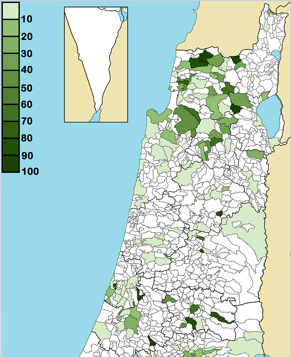
Re maps edit
Sorry to bother, Zero, this is just offhand, no urgency nor obligation. Noting the above, I wondered whether there is some Australian wiki editor who knows how to do simple maps for tribal territories, more or less along the lines you get in Sarah Yu's monograph p.2? It's just coloured blocks. Or rather, do you know on what wiki page I could make that enquiry for assistance? Nishidani (talk) 09:53, 21 October 2016 (UTC)
Beit Qad has been nominated for Did You Know edit
Hello, Zero0000. Beit Qad, an article you either created or to which you significantly contributed,has been nominated to appear on Wikipedia's Main Page as part of Did you know![]() . You can see the hook and the discussion here. You are welcome to participate! Thank you. APersonBot (talk!) 12:01, 22 October 2016 (UTC)
. You can see the hook and the discussion here. You are welcome to participate! Thank you. APersonBot (talk!) 12:01, 22 October 2016 (UTC)
DYK for Beit Qad edit
On 11 November 2016, Did you know was updated with a fact from the article Beit Qad, which you recently created, substantially expanded, or brought to good article status. The fact was ... that the modern Palestinian village of Beit Qad is associated with the biblical locality of Beth Ekad, mentioned in the Book of Kings as the site of a massacre? The nomination discussion and review may be seen at Template:Did you know nominations/Beit Qad. You are welcome to check how many page hits the article got while on the front page (here's how, Beit Qad), and it may be added to the statistics page if the total is over 5,000. Finally, if you know of an interesting fact from another recently created article, then please feel free to suggest it on the Did you know talk page.
reliable source edit
I find it annoying that OED isn't considered a reliable source based on its author not having enough initialisms after his name. If that's a precedent many wikipedia pages don't seem to follow it, as in here, here here and here and every page in this category.--Monochrome_Monitor 11:35, 12 November 2016 (UTC)
- I see you aren't going to comment on how you find it convenient to ignore your rule for a specific article.--Monochrome_Monitor 04:27, 17 November 2016 (UTC)
Two-Factor Authentication now available for admins edit
Hello,
Please note that TOTP based two-factor authentication is now available for all administrators. In light of the recent compromised accounts, you are encouraged to add this additional layer of security to your account. It may be enabled on your preferences page in the "User profile" tab under the "Basic information" section. For basic instructions on how to enable two-factor authentication, please see the developing help page for additional information. Important: Be sure to record the two-factor authentication key and the single use keys. If you lose your two factor authentication and do not have the keys, it's possible that your account will not be recoverable. Furthermore, you are encouraged to utilize a unique password and two-factor authentication for the email account associated with your Wikimedia account. This measure will assist in safeguarding your account from malicious password resets. Comments, questions, and concerns may be directed to the thread on the administrators' noticeboard. MediaWiki message delivery (talk) 20:34, 12 November 2016 (UTC)
A new user right for New Page Patrollers edit
Hi Zero0000.
A new user group, New Page Reviewer, has been created in a move to greatly improve the standard of new page patrolling. The user right can be granted by any admin at PERM. It is highly recommended that admins look beyond the simple numerical threshold and satisfy themselves that the candidates have the required skills of communication and an advanced knowledge of notability and deletion. Admins are automatically included in this user right.
It is anticipated that this user right will significantly reduce the work load of admins who patrol the performance of the patrollers. However,due to the complexity of the rollout, some rights may have been accorded that may later need to be withdrawn, so some help will still be needed to some extent when discovering wrongly applied deletion tags or inappropriate pages that escape the attention of less experienced reviewers, and above all, hasty and bitey tagging for maintenance. User warnings are available here but very often a friendly custom message works best.
If you have any questions about this user right, don't hesitate to join us at WT:NPR. (Sent to all admins).MediaWiki message delivery (talk) 13:48, 15 November 2016 (UTC)
IP User 110.140.228.5 edit
Hi! You blocked this editor earlier today. Now they are again reinserting the falsified talk page from the "old" user 110.140.189.221, with changes made to other editors postings. Last time the 60 hour block was extended to 1 week for the same thing. At least TP access could be denied? --T*U (talk) 08:09, 18 November 2016 (UTC)
ArbCom Elections 2016: Voting now open! edit
Hello, Zero0000. Voting in the 2016 Arbitration Committee elections is open from Monday, 00:00, 21 November through Sunday, 23:59, 4 December to all unblocked users who have registered an account before Wednesday, 00:00, 28 October 2016 and have made at least 150 mainspace edits before Sunday, 00:00, 1 November 2016.
The Arbitration Committee is the panel of editors responsible for conducting the Wikipedia arbitration process. It has the authority to impose binding solutions to disputes between editors, primarily for serious conduct disputes the community has been unable to resolve. This includes the authority to impose site bans, topic bans, editing restrictions, and other measures needed to maintain our editing environment. The arbitration policy describes the Committee's roles and responsibilities in greater detail.
If you wish to participate in the 2016 election, please review the candidates' statements and submit your choices on the voting page. Mdann52 (talk) 22:08, 21 November 2016 (UTC)
Mail edit
It may take a few minutes from the time the email is sent for it to show up in your inbox. You can at any time by removing the {{You've got mail}} or {{ygm}} template.
The WordsmithTalk to me 00:09, 26 November 2016 (UTC)
sourcing for "considered occupied Palestinian territories" edit
Regarding this edit, the cited source ([9]) does not explicitly say that East Jerusalem is considered by the EU to be part of "occupied Palestinian territories". It refers to "the pre-1967 borders, including with regard to Jerusalem" but it's still left to the reader to infer whether or not the EU considers East Jerusalem to be "Palestinian territory". Also, if we look at the sources provided in the same paragraph regarding the US, both are to the CIA World Factbook and do not describe East Jerusalem as "occupied Palestinian territory". As concerns the US, I cannot find any express statement on state.gov that it considers East Jerusalem to be "Palestinian territory". Since the article is about the Judea and Samaria Area which is specifically defined to exclude East Jerusalem, and the sources do not clearly support the statement with regard to East Jerusalem, would it be better to redraft the sentence removing the mentions of East Jerusalem and Gaza Strip? Mathew5000 (talk) 23:59, 30 November 2016 (UTC)
- To editor Mathew5000: Actually it does: "Israeli settlements in the occupied Palestinian territory: the EU has repeatedly confirmed its deep concern about accelerated settlement expansion in the West Bank including East Jerusalem." The plain meaning of this sentence is that "occupied Palestinian territory" includes the West Bank which includes EJ. There is no other way to read it. It is easy to find other similar statements on the EU site. You should write these questions on the article talk page since other people might have more time to work on it than I do. Zerotalk 08:00, 1 December 2016 (UTC)
- The word "considered" should even be removed. Nobody says that the relativity is considered to explain time dilatation by physicists. It is said it explains time dilatation. The idea that East-Jerusalem would not be an occupied Palestinian territory is so fringe that it is limited to a small part of the Israeli community and should not be given any weight in wikipedia's voice. Pluto2012 (talk) 12:35, 3 December 2016 (UTC)
Extended confirmed protection policy RfC edit
You are receiving this notification because you participated in a past RfC related to the use of extended confirmed protection levels. There is currently a discussion ongoing about two specific use cases of extended confirmed protection. You are invited to participate. ~ Rob13Talk (sent by MediaWiki message delivery (talk) 16:31, 22 December 2016 (UTC))