| This user page is actively undergoing a major edit for Please could somebody help translating the original from German Wikipedia?. To help avoid edit conflicts, please do not edit this page while this message is displayed. This page was last edited at 20:01, 10 November 2020 (UTC) (3 years ago) – this estimate is cached, . Please remove this template if this page hasn't been edited for a significant time. If you are the editor who added this template, please be sure to remove it or replace it with {{Under construction}} between editing sessions. |
{{Infobox of a municipality in Germany | District of Niederndorf | Community type = City | Municipalities = Freudenberg (Siegerland) | Alternative ad-commune name = Freudenberg | Town coat | Latitude = 50/52 // N | Length of degree = 07/54 // E | State = North-Rhine / Westphalia | Height = 262 <! - Source: Geodata Center -> | Area = 6.82 | Population = 1741 | Inhabitants' stand-by date = 2011-12-31 | Date of incorporation = 1969-01-01 | Postcode1 = 57258 | Postal code2 = | Country code1 = 02734 | Dialing code2 = | Location map | Location map description }}
Freudenberg | |
|---|---|
_COA.svg) Coat of arms | |
Location of Freudenberg within Siegen-Wittgenstein district 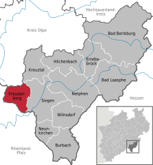 | |
 Freudenberg  Freudenberg | |
| Coordinates: 50°53′59″N 07°52′00″E / 50.89972°N 7.86667°E | |
| Country | Germany |
| State | North Rhine-Westphalia |
| Admin. region | Arnsberg |
| District | Siegen-Wittgenstein |
| Subdivisions | 17 |
| Government | |
| • Mayor | Nicole Reschke (SPD) |
| Area | |
| • Total | 54.48 km2 (21.03 sq mi) |
| Elevation | 330 m (1,080 ft) |
| Population (2022-12-31)[1] | |
| • Total | 17,773 |
| • Density | 330/km2 (840/sq mi) |
| Time zone | UTC+01:00 (CET) |
| • Summer (DST) | UTC+02:00 (CEST) |
| Postal codes | 57258 |
| Dialling codes | 02734 |
| Vehicle registration | SI |
| Website | www.freudenberg-stadt.de |


Niederndorf 'is a district of Freudenberg in the Kreis Siegen-Wittgenstein, North Rhine-Westphalia.
geography edit
Niederndorf is located in the southern part of Freudenberg in a hilly middle mountain landscape and borders Rhineland-Palatinate (RLP). The neighborhoods are Oberfischbach, Dirlenbach and Niederfischbach (RLP). The highest peak in Niederndorf is the Giebelwald with . There also flows one of the brooks, which flow through the village, the Uebach. In the village, it flows into the Fischbach. The landscape around Freudenberg consists of about two-thirds of foliage and firs forests
History edit
Niederndorf was mentioned for the first time in the year 1423. <ref> Map Principality of Nassau-Siegen: Certificates of the settlement up to 1500 </ Ref>
In 1886 the road construction in Niederndorf led to a change in the townscape, when both the old mill and five houses had to give way. <Ref> Siegerländer Heimatkalender 1990, p.12, 65th edition, ed. Siegerländer Heimat- und Geschichtsverein eV , Verlag für Heimatliteratur </ ref> Niederndorf was incorporated into Freudenberg on 1 January 1969. <ref> [author missing] </ ref>
Population numbers edit
Population numbers of the place: <ref> Otto Schaefer: The circle Siegen , Siegen 1968 </ ref> <ref> freudenberg-stadt.de: MnavID = 1744.19 & sNavID = 1744.33 & La = 1 Population distribution (regularly updated) </ ref>
|
|
|
|

- ^ "Bevölkerung der Gemeinden Nordrhein-Westfalens am 31. Dezember 2022 – Fortschreibung des Bevölkerungsstandes auf Basis des Zensus vom 9. Mai 2011" (in German). Landesbetrieb Information und Technik NRW. Retrieved 20 June 2023.
- ^ Cite error: The named reference
administrative historywas invoked but never defined (see the help page).