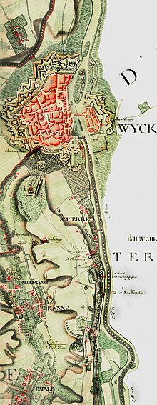

The Ferraris map or map of the Austrian Netherlands is a historical map created between 1770 and 1778 by the count Joseph de Ferraris in response to a request by Prince Charles Alexander of Lorraine. It represents the systematic map on such a scale, in "Belgium" as well as in Western Europe.
There are three original versions of the map. The Royal Library of Belgium, the Austrian National Library and National Library of the Netherlands each have one.
History edit
The topographic survey was performed on a territory corresponding to today's Belgium and Luxembourg as well as some territories now belonging to Germany and the Netherlands.
The map was published at the original scale of 1/11.520 and includes 275 sheets.
External links edit
- Media related to Category:Ferraris at Wikimedia Commons
- "The Ferraris map on the website of the Royal Library of Belgium"..
