|
|
Landmark name
|
Image
|
Date listed
|
Location
|
Neighborhood
|
Summary
|
| 1
|
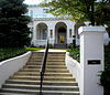
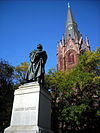
Adams Memorial
|

|
March 16, 1972
|
Webster St. and Rock Creek Church Rd., NW.
38°56′50″N 77°0′39″W / 38.94722°N 77.01083°W / 38.94722; -77.01083 (Adams Memorial)
|
Fort Totten
|
|
| 2
|
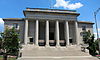
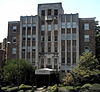
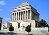
Administration Building, Carnegie Institute of Washington
|
|
October 15, 1966
|
1530 P St., NW.
38°54′33.75″N 77°2′10.1″W / 38.9093750°N 77.036139°W / 38.9093750; -77.036139 (Administration Building, Carnegie Institute of Washington)
|
Dupont Circle
|
|
| 3
|
Alden, Babcock, Calvert Apartments
|

|
May 25, 1990
|
2620 13th St., NW.
38°55′27″N 77°1′49″W / 38.92417°N 77.03028°W / 38.92417; -77.03028 (Alden, Babcock, Calvert Apartments)
|
Columbia Heights
|
|
| 4
|
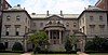
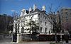
Larz Anderson House
|
|
April 7, 1971
|
2118 Massachusetts Ave., NW.
38°54′39″N 77°2′53″W / 38.91083°N 77.04806°W / 38.91083; -77.04806 (Anderson, Larz, House)
|
Dupont Circle
|
National headquarters of the Society of the Cincinnati
|
| 5
|
Andrew Rankin Memorial Chapel, Frederick Douglas Memorial Hall, Founders Library
|

|
January 3, 2001
|
2441 and 2365 6th St. NW; and 500 Howard Place NW
38°55′21″N 77°1′13.38″W / 38.92250°N 77.0203833°W / 38.92250; -77.0203833 (Andrew Rankin Memorial Chapel, Frederick Douglas Memorial Hall, Founders Library)
|
Howard University
|
|
| 6
|
Apartment Building at 2225 N Street
|

|
September 9, 1994
|
2225 N St., NW.
38°54′27″N 77°3′0″W / 38.90750°N 77.05000°W / 38.90750; -77.05000 (Apartment Building at 2225 N Street)
|
Dupont Circle
|
|
| 7
|
Armed Forces Retirement Home-Washington
|

|
December 5, 2007
|
3700 N Capitol St NW
38°56′10.85″N 77°0′32.59″W / 38.9363472°N 77.0090528°W / 38.9363472; -77.0090528 (Armed Forces Retirement Home-Washington)
|
Park View
|
|
| 8
|
Armstrong Manual Training School
|

|
August 16, 1996
|
Jct. of 1st and P Sts., NW
38°54′32″N 77°0′49″W / 38.90889°N 77.01361°W / 38.90889; -77.01361 (Armstrong Manual Training School)
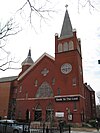
|
Truxton Circle
|
|
| 9
|
Army Medical Museum
|

|
October 15, 1966
|
Armed Forces Institute of Pathology Building, Walter Reed Army Medical Center, 13th St. and Fern Pl.
38°58′40.79″N 77°1′46.8″W / 38.9779972°N 77.029667°W / 38.9779972; -77.029667 (Army Medical Museum)
|
Walter Reed Army Medical Center
|
|
| 10
|
Francis Asbury Memorial
|

|
October 11, 2007
|
Reservation 309-B, 16th & Mt. Pleasant Sts. NW
38°55′47″N 77°2′13″W / 38.92972°N 77.03694°W / 38.92972; -77.03694 (Asbury, Francis, Memorial)
|
Mount Pleasant
|
|
| 11
|
Banneker Recreation Center
|
|
April 28, 1986
|
2500 Georgia Ave. NW
38°55′20″N 77°1′25″W / 38.92222°N 77.02361°W / 38.92222; -77.02361 (Banneker Recreation Center)
|
Columbia Heights
|
|
| 12
|
George M. Barker Company Warehouse
|

|
August 27, 2008
|
1525 7th St., NW.
38°54′35.92″N 77°1′17.22″W / 38.9099778°N 77.0214500°W / 38.9099778; -77.0214500 (Barker, George M., Company Warehouse)
|
Logan Circle-Shaw
|
|
| 13
|
Battleground National Cemetery
|

|
October 15, 1966
|
6625 Georgia Ave., NW.
38°58′14″N 77°1′37″W / 38.97056°N 77.02694°W / 38.97056; -77.02694 (Battleground National Cemetery)
|
Brightwood
|
|
| 14
|
Joseph Beale House
|

|
May 8, 1973
|
2301 Massachusetts Ave., NW.
38°54′46″N 77°3′5″W / 38.91278°N 77.05139°W / 38.91278; -77.05139 (Beale, Joseph, House)
|
Kalorama Heights
|
|
| 15
|
Perry Belmont House
|

|
May 8, 1973
|
1618 New Hampshire Ave., NW.
38°54′44″N 77°2′30″W / 38.91222°N 77.04167°W / 38.91222; -77.04167 (Belmont, Perry, House)
|
Dupont Circle
|
|
| 16
|
Blagden Alley-Naylor Court Historic District
|

|
November 16, 1990
|
Bounded by O, 9th, M, & 10th Sts. NW.
38°54′44″N 77°1′33″W / 38.91222°N 77.02583°W / 38.91222; -77.02583 (Blagden Alley--Naylor Court Historic District)
|
Logan Circle-Shaw
|
|
| 17
|
Boulder Bridge and Ross Drive Bridge
|

|
March 20, 1980
|
Rock Creek Park
38°56′53″N 77°2′42″W / 38.94806°N 77.04500°W / 38.94806; -77.04500 (Boulder Bridge and Ross Drive Bridge)
|
Rock Creek Park
|
Extends to both sides of Rock Creek
|
| 18
|
Anthony Bowen YMCA
|
|
October 3, 1983
|
1816 12th St. NW
38°54′53″N 77°2′25″W / 38.91472°N 77.04028°W / 38.91472; -77.04028 (Bowen, Anthony, YMCA)
|
Cardozo-Shaw
|
|
| 19
|
Brodhead-Bell-Morton Mansion
|

|
October 14, 1987
|
1500 Rhode Island Ave., NW
38°54′26.89″N 77°2′5.97″W / 38.9074694°N 77.0349917°W / 38.9074694; -77.0349917 (Brodhead--Bell--Morton Mansion)
|
Dupont Circle
|
|
| 20
|
Blanche K. Bruce House
|
|
May 15, 1975
|
909 M St., NW
38°54′21″N 77°1′29″W / 38.90583°N 77.02472°W / 38.90583; -77.02472 (Bruce, Blanche K., House)
|
Logan Circle-Shaw
|
|
| 21
|
Buildings at 1644-1666 Park Road NW
|
|
November 6, 1986
|
1644-1666 Park Rd. NW
38°55′54″N 77°2′17″W / 38.93167°N 77.03806°W / 38.93167; -77.03806 (Buildings at 1644--1666 Park Road NW)
|
Mount Pleasant
|
|
| 22
|
Lucinda Cady House
|
|
May 28, 1975
|
7064 Eastern Ave., NW.
38°58′40″N 77°1′7″W / 38.97778°N 77.01861°W / 38.97778; -77.01861 (Cady, Lucinda, House)
|
Takoma
|
|
| 23
|
Cairo Apartment Building
|

|
September 9, 1994
|
1615 Q St., NW.
38°54′41″N 77°2′16″W / 38.91139°N 77.03778°W / 38.91139; -77.03778 (Cairo Apartment Building)
|
Dupont Circle
|
|
| 24
|
Canadian Embassy
|

|
April 3, 1973
|
1746 Massachusetts Ave., NW.
38°54′29.41″N 77°2′26.28″W / 38.9081694°N 77.0406333°W / 38.9081694; -77.0406333 (Canadian Embassy)
|
Dupont Circle
|
Now the Embassy of Uzbekistan; also known as the Clarence Moore House
|
| 25
|
Francis L. Cardozo Senior High School
|

|
September 30, 1993
|
Jct. of 13th and Clifton Sts., NW.
38°55′14″N 77°1′48″W / 38.92056°N 77.03000°W / 38.92056; -77.03000 (Cardozo, Francis L., Senior High School)
|
Columbia Heights
|
|
| 26
|
Mary Ann Shadd Cary House
|

|
December 8, 1976
|
1421 W. St., NW
38°55′10″N 77°2′8″W / 38.91944°N 77.03556°W / 38.91944; -77.03556 (Cary, Mary Ann Shadd, House)
|
Cardozo-Shaw
|
|
| 27
|
Codman-Davis House
|

|
October 11, 1979
|
2145 Decatur Pl., NW
38°54′48.86″N 77°2′54.07″W / 38.9135722°N 77.0483528°W / 38.9135722; -77.0483528 (Codman-Davis House)
|
Kalorama Heights
|
|
| 28
|
Connecticut Avenue Bridge
|

|
July 3, 2003
|
Connecticut Ave., NW of Rock Creek
38°55′16″N 77°3′2″W / 38.92111°N 77.05056°W / 38.92111; -77.05056 (Connecticut Avenue Bridge)
|
Kalorama Heights and Woodley Park
|
Extends to both sides of Rock Creek
|
| 29
|
Cosmos Club
|

|
April 3, 1973
|
2121 Massachusetts Ave., NW.
38°54′41″N 77°2′54″W / 38.91139°N 77.04833°W / 38.91139; -77.04833 (Cosmos Club)
|
Dupont Circle
|
Also known as the Richard H. Townsend House
|
| 30
|
Elliott Coues House
|

|
May 15, 1975
|
1726 N St., NW
38°54′25″N 77°2′24″W / 38.90694°N 77.04000°W / 38.90694; -77.04000 (Coues, Elliott, House)
|
Dupont Circle
|
|
| 31
|
Duncanson-Cranch House
|
|
July 26, 1973
|
468-470 N St., NW.
38°54′26″N 77°1′5.91″W / 38.90722°N 77.0183083°W / 38.90722; -77.0183083 (Duncanson-Cranch House)
|
Logan Circle-Shaw
|
|
| 32
|
Dupont Circle Historic District
|

|
July 21, 1978
|
Roughly bounded by Florida and Rhode Island Aves., T, 17th, 21st, and 22nd Sts.
38°54′38″N 77°2′38″W / 38.91056°N 77.04389°W / 38.91056; -77.04389 (Dupont Circle Historic District)
|
Dupont Circle
|
|
| 33
|
Eighteen Hundred Block Park Road, NW
|
|
November 15, 1978
|
1801-1869 Park Rd., NW.
38°55′57″N 77°2′35″W / 38.93250°N 77.04306°W / 38.93250; -77.04306 (Eighteen Hundred Block Park Road, NW)
|
Mount Pleasant
|
|
| 34
|
Embassy Building No. 10
|
|
November 6, 1986
|
3149 Sixteenth St. NW
38°55′52″N 77°2′11″W / 38.93111°N 77.03639°W / 38.93111; -77.03639 (Embassy Building No. 10)
|
Columbia Heights
|
|
| 35
|
Embassy Gulf Service Station
|

|
September 30, 1993
|
2200 P St., NW.
38°54′33″N 77°2′59″W / 38.90917°N 77.04972°W / 38.90917; -77.04972 (Embassy Gulf Service Station)
|
Dupont Circle
|
|
| 36
|
Engine Company 12
|
|
June 6, 2007
|
1626 N. Capitol St., NW
38°54′43″N 77°0′35″W / 38.91194°N 77.00972°W / 38.91194; -77.00972 (Engine Company 12)
|
Bloomingdale
|
|
| 37
|
Engine Company 21
|

|
June 27, 2007
|
1763 Lanier Place NW
38°55′34″N 77°2′31″W / 38.92611°N 77.04194°W / 38.92611; -77.04194 (Engine Company 21)
|
Lanier Heights
|
|
| 38
|
Engine Company 22
|
|
May 18, 2011
|
5760 Georgia Ave., NW
38°57′36″N 77°1′42″W / 38.96000°N 77.02833°W / 38.96000; -77.02833 (Engine Company 22)
|
Brightwood Park
|
Firehouses in Washington DC MPS
|
| 39
|
Engine Company 26
|
|
May 18, 2011
|
1340 Rhode Island Ave., NW
38°54′32″N 77°1′54″W / 38.90889°N 77.03167°W / 38.90889; -77.03167 (Engine Company 26)
|
Logan Circle-Shaw
|
Firehouses in Washington DC MPS
|
| 40
|
Euclid Apartments
|
|
April 29, 2010
|
1740 Euclid St, NW
38°55′22.38″N 77°2′25.56″W / 38.9228833°N 77.0404333°W / 38.9228833; -77.0404333 (Euclid Apartments)
|
Adams Morgan
|
|
| 41
|
Evans-Tibbs House
|
|
September 8, 1987
|
1910 Vermont Ave. NW
38°54′57″N 77°1′35″W / 38.91583°N 77.02639°W / 38.91583; -77.02639 (Evans--Tibbs House)
|
Cardozo-Shaw
|
|
| 42
|
Fire Department Headquarters-Fire Alarm Headquarters
|
|
May 18, 2011
|
300 McMillan Dr., NW.
38°55′24″N 77°0′47″W / 38.92333°N 77.01306°W / 38.92333; -77.01306 (Fire Department Headquarters-Fire Alarm Headquarters)
|
Bloomingdale
|
Firehouses in Washington DC MPS
|
| 43
|
First African New Church
|
|
January 29, 2009
|
2105-07 10th St., NW.
38°55′6″N 77°1′33″W / 38.91833°N 77.02583°W / 38.91833; -77.02583 (First African New Church)
|
Cardozo-Shaw
|
|
| 44
|
Fort View Apartments
|
|
January 21, 2010
|
6000-6020 and 6030-6050 13th Place, N.W.
38°57′48.86″N 77°1′51.51″W / 38.9635722°N 77.0309750°W / 38.9635722; -77.0309750 (Fort View Apartments)
|
Brightwood
|
|
| 45
|
Fourteenth Street Historic District
|
|
November 9, 1994
|
Roughly bounded by S, 12th, N and 15th Sts., NW.
38°54′30″N 77°1′47″W / 38.90833°N 77.02972°W / 38.90833; -77.02972 (Fourteenth Street Historic District)
|
Logan Circle-Shaw
|
|
| 46
|
Fraser Mansion
|
|
August 19, 1975
|
1701 20th St., NW.
38°54′46″N 77°2′42″W / 38.91278°N 77.04500°W / 38.91278; -77.04500 (Fraser Mansion)
|
Dupont Circle
|
|
| 47
|
Frelinghuysen University, Former Classroom Building
|

|
November 6, 1995
|
1800 Vermont Ave., NW.
38°54′54″N 77°1′37″W / 38.91500°N 77.02694°W / 38.91500; -77.02694 (Frelinghuysen University, Former Classroom Building)
|
Cardozo-Shaw
|
|
| 48
|
Fuller House
|
|
February 21, 1985
|
2317 Ashmead Pl., NW
38°55′8″N 77°2′53″W / 38.91889°N 77.04806°W / 38.91889; -77.04806 (Fuller House)
|
Adams Morgan
|
|
| 49
|
Nathaniel Parker Gage School
|
|
November 19, 2008
|
2035 2nd St., NW.
38°55′3.98″N 77°0′52.42″W / 38.9177722°N 77.0145611°W / 38.9177722; -77.0145611 (Gage, Nathaniel Parker, School)
|
Bloomingdale
|
|
| 50
|
General Federation of Women's Clubs Headquarters
|

|
December 4, 1991
|
1734 N St., NW.
38°54′25″N 77°2′25″W / 38.90694°N 77.04028°W / 38.90694; -77.04028 (General Federation of Women's Clubs Headquarters)
|
Dupont Circle
|
|
| 51
|
James Cardinal Gibbons Memorial
|

|
October 11, 2007
|
Reservation 309-G, 16th St. & Park Rd. NW.
38°55′59″N 77°2′11″W / 38.93306°N 77.03639°W / 38.93306; -77.03639 (Gibbons, James Cardinal, Memorial)
|
Mount Pleasant
|
|
| 52
|
Gladstone and Hawarden Apartment Buildings
|

|
September 7, 1994
|
1419 and 1423 R St., NW.
38°54′46″N 77°1′59″W / 38.91278°N 77.03306°W / 38.91278; -77.03306 (Gladstone and Hawarden Apartment Buildings)
|
Logan Circle-Shaw
|
The Gladstone
|
| 53
|
Samuel Gompers House
|

|
September 23, 1974
|
2122 1st St., NW
38°55′2″N 77°0′46″W / 38.91722°N 77.01278°W / 38.91722; -77.01278 (Gompers, Samuel, House)
|
Bloomingdale
|
|
| 54
|
Grace Reformed Church, Sunday School and Parish House
|
|
April 18, 1991
|
1405 15th St., NW.
38°54′32″N 77°2′3″W / 38.90889°N 77.03417°W / 38.90889; -77.03417 (Grace Reformed Church, Sunday School and Parish House)
|
Logan Circle-Shaw
|
|
| 55
|
Charlotte Forten Grimké House
|

|
May 11, 1976
|
1608 R St., NW.
38°54′45″N 77°2′13″W / 38.91250°N 77.03694°W / 38.91250; -77.03694 (Grimke, Charlotte Forten, House)
|
Dupont Circle
|
|
| 56
|
Samuel Hahnemann Monument
|

|
October 11, 2007
|
Reservation 64, Massachusetts & Rhode Island Aves. at Scott Cir. NW
38°54′33″N 77°2′10″W / 38.90917°N 77.03611°W / 38.90917; -77.03611 (Hahnemann, Samuel, Monument)
|
Golden Triangle
|
|
| 57
|
Hampshire Garden Apartment Buildings
|
|
September 9, 1994
|
4912 New Hampshire Ave., 208, 222, 236 and 250 Farragut St., 4915 3rd St. and 215, 225 and 235 Emerson St., NW.
38°57′2″N 77°0′53″W / 38.95056°N 77.01472°W / 38.95056; -77.01472 (Hampshire Garden Apartment Buildings)
|
Brightwood Park
|
|
| 58
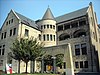
|
Christian Heurich Mansion
|

|
June 23, 1969
|
1307 New Hampshire Ave., NW.
38°54′29″N 77°2′40″W / 38.90806°N 77.04444°W / 38.90806; -77.04444 (Heurich, Christian, Mansion)
|
Golden Triangle
|
|
| 59
|
Hillandale-Main Residence and Gatehouse
|
|
January 31, 1995
|
3905 Mansion Ct., NW. and 3905 Reservoir Rd., NW.
38°54′57″N 77°3′21″W / 38.91583°N 77.05583°W / 38.91583; -77.05583 (Hillandale--Main Residence and Gatehouse)
|
Burleith-Hillandale
|
|
| 60
|
Hilltop Manor
|

|
July 26, 2007
|
3500 14th St., NW
38°56′4.58″N 77°1′59.58″W / 38.9346056°N 77.0332167°W / 38.9346056; -77.0332167 (Hilltop Manor)
|
Columbia Heights
|
|
| 61
|
Anthony Holmead Archeological Site
|
|
April 27, 1995
|
1801 23rd St., NW
38°54′52.17″N 77°3′0.87″W / 38.9144917°N 77.0502417°W / 38.9144917; -77.0502417 (Holmead, Anthonay, Archeological Site)
|
Kalorama Heights
|
|
| 62
|
Holt House
|

|
April 24, 1973
|
Adams Mill Rd. in the National Zoological Park
38°55′31″N 77°2′50″W / 38.92528°N 77.04722°W / 38.92528; -77.04722 (Holt House)
|
Rock Creek Park
|
|
| 63
|
House at 2437 Fifteenth Street, NW
|

|
March 16, 1988
|
2437 Fifteenth St., NW
38°55′20″N 77°2′11″W / 38.92222°N 77.03639°W / 38.92222; -77.03639 (House at 2437 Fifteenth Street, NW)
|
Columbia Heights
|
Also known as the Old Hungarian Embassy
|
| 64
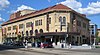
|
Howard Theatre
|

|
February 15, 1974
|
620 T St., NW.
38°54′55″N 77°1′17″W / 38.91528°N 77.02139°W / 38.91528; -77.02139 (Howard Theatre)
|
Cardozo-Shaw
|
|
| 65
|
Charles Evans Hughes House
|
|
November 28, 1972
|
2223 R St., NW
38°54′45″N 77°2′58″W / 38.91250°N 77.04944°W / 38.91250; -77.04944 (Hughes, Charles Evans, House)
|
Kalorama Heights
|
|
| 66
|
Immaculate Conception Church
|
|
September 17, 2003
|
1315 8th St., NW
38°54′26″N 77°1′22″W / 38.90722°N 77.02278°W / 38.90722; -77.02278 (Immaculate Conception Church)
|
Logan Circle-Shaw
|
|
| 67
|
Indonesian Embassy
|
|
January 18, 1973
|
2020 Massachusetts Ave., NW.
38°54′36″N 77°2′47″W / 38.91000°N 77.04639°W / 38.91000; -77.04639 (Indonesian Embassy)
|
Dupont Circle
|
Also known as the Walsh-McLean House
|
| 68
|
Ingleside
|
|
January 8, 1987
|
1818 Newton St. NW
38°56′1″N 77°2′35″W / 38.93361°N 77.04306°W / 38.93361; -77.04306 (Ingleside)
|
Mount Pleasant
|
|
| 69
|
Japanese Embassy
|

|
February 20, 1973
|
2520 Massachusetts Ave., NW.
38°54′54″N 77°3′23″W / 38.91500°N 77.05639°W / 38.91500; -77.05639 (Japanese Embassy)
|
Kalorama Heights
|
|
| 70
|
Kalorama Triangle Historic District
|
|
May 4, 1987
|
Roughly bounded by Connecticut Ave., Columbia Rd., and Calvert St.
38°55′14″N 77°2′47″W / 38.92056°N 77.04639°W / 38.92056; -77.04639 (Kalorama Triangle Historic District)
|
Kalorama Heights
|
|
| 71
|
Lafayette Apartment Building
|

|
September 7, 1994
|
1605-1607 7th St., NW.
38°54′42″N 77°1′18″W / 38.91167°N 77.02167°W / 38.91167; -77.02167 (Lafayette Apartment Building)
|
Logan Circle-Shaw
|
|
| 72
|
Edward Simon Lewis House
|

|
July 23, 1973
|
456 N St., NW.
38°54′25.18″N 77°1′4.8″W / 38.9069944°N 77.018000°W / 38.9069944; -77.018000 (Lewis, Edward Simon, House)
|
Logan Circle-Shaw
|
|
| 73
|
Lincoln Industrial Mission-Lincoln Memorial Congregational Church
|

|
February 24, 1995
|
1701 11th St., NW.
38°54′47″N 77°1′36″W / 38.91306°N 77.02667°W / 38.91306; -77.02667 (Lincoln Industrial Mission--Lincoln Memorial Congregational Church)
|
Logan Circle-Shaw
|
|
| 74
|
Lincoln Theatre
|

|
October 27, 1993
|
1215 U St. NW
38°55′1″N 77°1′46″W / 38.91694°N 77.02944°W / 38.91694; -77.02944 (Lincoln Theatre)
|
Cardozo-Shaw
|
|
| 75
|
The Lindens
|

|
June 4, 1969
|
2401 Kalorama Rd., NW.
38°55′6″N 77°3′13″W / 38.91833°N 77.05361°W / 38.91833; -77.05361 (Lindens, The)
|
Kalorama Heights
|
|
| 76
|
Logan Circle Historic District
|

|
June 30, 1972
|
Jct. of Rhode Island and Vermont Aves.
38°54′35″N 77°1′49″W / 38.90972°N 77.03028°W / 38.90972; -77.03028 (Logan Circle Historic District)
|
Logan Circle-Shaw
|
|
| 77
|
Henry Wadsworth Longfellow Memorial
|
|
October 11, 2007
|
Reservation 150, Connecticut Ave., M & 18th Sts. NW.
38°54′28″N 77°2′30″W / 38.90778°N 77.04167°W / 38.90778; -77.04167 (Longfellow, Henry Wadsworth, Memorial)
|
Golden Triangle
|
|
| 78
|
Lothrop Mansion
|
|
December 20, 1988
|
2001 Connecticut Ave.
38°55′1″N 77°2′48″W / 38.91694°N 77.04667°W / 38.91694; -77.04667 (Lothrop Mansion)
|
Adams Morgan
|
|
| 79
|
Luther Place Memorial Church
|
|
July 16, 1973
|
1226 Vermont Ave., NW. (Thomas Circle)
38°54′25″N 77°1′56″W / 38.90694°N 77.03222°W / 38.90694; -77.03222 (Luther Place Memorial Church)
|
Logan Circle-Shaw
|
|
| 80
|
Manhattan Laundry
|
|
November 21, 1994
|
1326-1346 Florida Ave., NW.
38°55′12″N 77°1′54″W / 38.92000°N 77.03167°W / 38.92000; -77.03167 (Manhattan Laundry)
|
Cardozo-Shaw
|
|
| 81
|
Mansion at 2401 15th St., NW
|

|
January 28, 1991
|
2401 15th St., NW.
38°55′18″N 77°2′6″W / 38.92167°N 77.03500°W / 38.92167; -77.03500 (Mansion at 2401 15th St., NW.)
|
Columbia Heights
|
Also known as Meridian Hall
|
| 82
|
Guglielmo Marconi Memorial
|

|
October 12, 2007
|
Reservation 309A, 16th & Lamont Sts. NW
38°55′56″N 77°2′13″W / 38.93222°N 77.03694°W / 38.93222; -77.03694 (Marconi, Guglielmo, Memorial)
|
Mount Pleasant
|
|
| 83
|
Mary McLeod Bethune Council House National Historic Site
|

|
October 15, 1982
|
1318 Vermont Ave., NW
38°54′27″N 77°1′52″W / 38.90750°N 77.03111°W / 38.90750; -77.03111 (Mary McLeod Bethune Council House National Historic Site)
|
Logan Circle-Shaw
|
|
| 84
|
Massachusetts Avenue Historic District
|
|
October 22, 1974
|
Both sides of Massachusetts Ave. between 17th St. and Observatory Circle, NW
38°54′50″N 77°3′6″W / 38.91389°N 77.05167°W / 38.91389; -77.05167 (Massachusetts Avenue Historic District)
|
Dupont Circle, Kalorama Heights and Woodland-Normanstone Terrace
|
|
| 85
|
McCormick Apartments
|

|
April 3, 1973
|
1785 Massachusetts Ave., NW
38°54′33″N 77°2′30″W / 38.90917°N 77.04167°W / 38.90917; -77.04167 (McCormick Apartments)
|
Dupont Circle
|
Also known as the Andrew Mellon Building
|
| 86
|
Meeting House of the Friends Meeting of Washington
|

|
September 6, 1990
|
2111 Florida Ave., NW.
38°54′46″N 77°2′52″W / 38.91278°N 77.04778°W / 38.91278; -77.04778 (Meeting House of the Friends Meeting of Washington)
|
Kalorama Heights
|
|
| 87
|
Meridian Hill Park
|

|
October 25, 1974
|
Bounded by 16th, Euclid, 15th, and W Sts., NW.
38°55′16″N 77°2′10″W / 38.92111°N 77.03611°W / 38.92111; -77.03611 (Meridian Hill Park)
|
Columbia Heights
|
|
| 88
|
Meridian House
|

|
May 8, 1973
|
1630 Crescent Pl., NW.
38°55′13″N 77°2′18″W / 38.92028°N 77.03833°W / 38.92028; -77.03833 (Meridian House)
|
Adams Morgan
|
|
| 89
|
Meridian Manor
|
|
March 29, 2001
|
1424 Chapin St., NW
38°55′17″N 77°1′59″W / 38.92139°N 77.03306°W / 38.92139; -77.03306 (Meridian Manor)
|
Columbia Heights
|
|
| 90
|
Meridian Mansions
|
|
July 28, 1983
|
2400 16th St. NW
38°55′17″N 77°2′13″W / 38.92139°N 77.03694°W / 38.92139; -77.03694 (Meridian Mansions)
|
Adams Morgan
|
|
| 91
|
Military Road School
|
|
July 25, 2003
|
1375 Missouri Ave., NW
38°57′43″N 77°1′58″W / 38.96194°N 77.03278°W / 38.96194; -77.03278 (Military Road School)
|
Brightwood
|
|
| 92
|
Miner Normal School
|

|
October 11, 1991
|
2565 Georgia Ave., NW.
38°55′24″N 77°1′21″W / 38.92333°N 77.02250°W / 38.92333; -77.02250 (Miner Normal School)
|
Howard University
|
|
| 93
|
Mount Vernon Square Historic District
|

|
September 3, 1999
|
Roughly bounded by New York Ave., 7th St., N St., and 1st St. NW
38°54′19″N 77°1′4″W / 38.90528°N 77.01778°W / 38.90528; -77.01778 (Mount Vernon Square Historic District)
|
Mount Vernon Square
|
Extends to both sides of M Street
|
| 94
|
Northumberland Apartments
|

|
March 25, 1980
|
2039 New Hampshire Ave., NW
38°55′4″N 77°2′9″W / 38.91778°N 77.03583°W / 38.91778; -77.03583 (Northumberland Apartments)
|
Dupont Circle
|
|
| 95
|
O Street Market
|

|
April 28, 1995
|
1400 7th St., NW.
38°54′31″N 77°1′11″W / 38.90861°N 77.01972°W / 38.90861; -77.01972 (O Street Market)
|
Logan Circle-Shaw
|
|
| 96
|
Olympia Apartments
|

|
June 9, 2003
|
1368 Euclid St. NW
38°55′24.73″N 77°1′54.06″W / 38.9235361°N 77.0316833°W / 38.9235361; -77.0316833 (Olympia Apartments)
|
Columbia Heights
|
|
| 97
|
Thomas Nelson Page House
|

|
September 5, 1975
|
1759 R St., NW.
38°54′46″N 77°2′28″W / 38.91278°N 77.04111°W / 38.91278; -77.04111 (Page, Thomas Nelson, House)
|
Dupont Circle
|
|
| 98
|
Park Tower
|
|
October 30, 1989
|
2440 Sixteenth St., NW.
38°55′19″N 77°2′14″W / 38.92194°N 77.03722°W / 38.92194; -77.03722 (Park Tower)
|
Adams Morgan
|
|
| 99
|
W. H. Penland & Company
|

|
December 29, 1994
|
1211-1219 13th St., NW.
38°54′22″N 77°1′45″W / 38.90611°N 77.02917°W / 38.90611; -77.02917 (Penland, W. H., & Company)
|
Logan Circle-Shaw
|
Also known as Proctor Alley Livery Stable and Mount Vernon Stables
|
| 100
|
Frances Perkins House
|

|
July 17, 1991
|
2326 California St., NW.
38°54′55″N 77°3′7″W / 38.91528°N 77.05194°W / 38.91528; -77.05194 (Perkins, Frances, House)
|
Kalorama Heights
|
|
| 101
|
Petworth Gardens
|
|
November 10, 2008
|
124, 126, 128, and 130 Webster St., NW.
38°56′38.8″N 77°0′47.31″W / 38.944111°N 77.0131417°W / 38.944111; -77.0131417 (Petworth Gardens)
|
Petworth
|
|
| 102
|
Duncan Phillips House
|

|
August 14, 1973
|
1600-1614 21st St., NW.
38°54′40″N 77°2′51″W / 38.91111°N 77.04750°W / 38.91111; -77.04750 (Phillips, Duncan, House)
|
Dupont Circle
|
|
| 103
|
Pierce-Klingle Mansion
|
|
October 10, 1973
|
3545 Williamsburg Lane, NW
38°56′18″N 77°3′0″W / 38.93833°N 77.05000°W / 38.93833; -77.05000 (Pierce-Klingle Mansion)
|
Cleveland Park
|
|
| 104
|
Pink Palace
|

|
August 5, 1991
|
2600 16th St., NW.
38°55′23″N 77°2′13″W / 38.92306°N 77.03694°W / 38.92306; -77.03694 (Pink Palace)
|
Adams Morgan
|
|
| 105
|
The Plymouth
|

|
June 2, 1986
|
1236 Eleventh St. NW
38°54′23″N 77°1′39″W / 38.90639°N 77.02750°W / 38.90639; -77.02750 (Plymouth, The)
|
Logan Circle-Shaw
|
|
| 106
|
Potomac Palisades Site
|
|
April 15, 1982
|
Address Restricted
|
NW
|
|
| 107
|
Prince Hall Masonic Temple
|

|
September 15, 1983
|
1000 U St., NW
38°55′0″N 77°1′35″W / 38.91667°N 77.02639°W / 38.91667; -77.02639 (Prince Hall Masonic Temple)
|
Cardozo-Shaw
|
|
| 108
|
Zalmon Richards House
|

|
October 15, 1966
|
1301 Corcoran St., NW
38°54′42″N 77°1′49″W / 38.91167°N 77.03028°W / 38.91167; -77.03028 (Richards, Zalmon, House)
|
Logan Circle-Shaw
|
|
| 109
|
Riggs-Tompkins Building
|

|
January 5, 1987
|
1403-1405 and 1413 Park Rd. NW and 3300, 3306-3316, 3328, and 3336 Fourteenth St. NW
38°55′50″N 77°1′59″W / 38.93056°N 77.03306°W / 38.93056; -77.03306 (Riggs--Tompkins Building)
|
Columbia Heights
|
|
| 110
|
Rock Creek and Potomac Parkway Historic District
|

|
May 4, 2005
|
Rock Creek and Potomac Parkway
38°54′47″N 77°3′16″W / 38.91306°N 77.05444°W / 38.91306; -77.05444 (Rock Creek and Potomac Parkway Historic District)
|
NW
|
Extends to both sides of Rock Creek
|
| 111
|
Rock Creek Church Yard and Cemetery
|

|
August 12, 1977
|
Webster St. and Rock Creek Church Rd., NW.
38°56′52″N 77°0′47″W / 38.94778°N 77.01306°W / 38.94778; -77.01306 (Rock Creek Church Yard and Cemetery)
|
Fort Totten
|
See Rock Creek Cemetery
|
| 112
|
Rock Creek Park Historic District
|

|
October 23, 1991
|
Roughly, Rock Creek Park from Klingle Rd. to Montgomery County line
38°57′27″N 77°2′42″W / 38.95750°N 77.04500°W / 38.95750; -77.04500 (Rock Creek Park Historic District)
|
NW
|
See Rock Creek Park. Extends to both sides of Rock Creek.
|
| 113
|
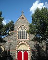
St. Luke's Episcopal Church
|
|
May 11, 1976
|
15th and Church Sts., NW
38°54′36″N 77°2′7″W / 38.91000°N 77.03528°W / 38.91000; -77.03528 (St. Luke's Episcopal Church)
|
Dupont Circle
|
NHL - First independent black Episcopal parish in Washington
|
| 114
|
St. Matthew's Cathedral and Rectory
|

|
January 24, 1974
|
1725-1739 Rhode Island Ave., NW.
38°54′22″N 77°2′24″W / 38.90611°N 77.04000°W / 38.90611; -77.04000 (St. Matthew's Cathedral And Rectory)
|
Golden Triangle
|
|
| 115
|
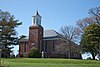
St. Paul's Episcopal Church
|
|
March 16, 1972
|
Rock Creek Church Rd. and Webster St., NW.
38°56′49″N 77°0′44″W / 38.94694°N 77.01222°W / 38.94694; -77.01222 (St. Paul's Episcopal Church)
|
Fort Totten
|
|
| 116
|
Seventh Street Savings Bank
|

|
September 17, 2003
|
1300 7th St. NW
38°54′26″N 77°1′20″W / 38.90722°N 77.02222°W / 38.90722; -77.02222 (Seventh Street Savings Bank)
|
Logan Circle-Shaw
|
|
| 117
|
Shaw Junior High School
|

|
December 22, 2008
|
7th St., and Rhode Island Ave., NW
38°54′44.11″N 77°1′18.93″W / 38.9122528°N 77.0219250°W / 38.9122528; -77.0219250 (Shaw Junior High School)
|
Logan Circle-Shaw
|
|
| 118
|
Sheridan-Kalorama Historic District
|

|
October 30, 1989
|
Roughly bounded by Rock Creek Park, Connecticut Ave., NW., Florida Ave., NW., 22nd St., NW., and P St., NW.
38°54′56″N 77°3′6″W / 38.91556°N 77.05167°W / 38.91556; -77.05167 (Sheridan--Kalorama Historic District)
|
Kalorama Heights
|
|
| 119
|
Billy Simpson's House of Seafood and Steaks
|
|
March 17, 2009
|
3815 Georgia Avenue, NW
38°56′17.45″N 77°1′27.36″W / 38.9381806°N 77.0242667°W / 38.9381806; -77.0242667 (Simpson's, Billy, House of Seafood and Steaks)
|
Petworth
|
|
| 120
|
Sixteenth Street Historic District
|
|
August 25, 1978
|
16th St. between Scott Cir. and Florida Ave. NW
38°54′46″N 77°2′13″W / 38.91278°N 77.03694°W / 38.91278; -77.03694 (Sixteenth Street Historic District)
|
Dupont Circle
|
|
| 121
|
Southern Aid Society-Dunbar Theater Building
|

|
November 6, 1986
|
1901-1903 Seventh St. NW
38°54′56″N 77°1′19″W / 38.91556°N 77.02194°W / 38.91556; -77.02194 (Southern Aid Society--Dunbar Theater Building)
|
Cardozo-Shaw
|
|
| 122
|
Spencer Carriage House and Stable
|

|
August 29, 1996
|
2123 Twining Crt., NW
38°54′33″N 77°2′53″W / 38.90917°N 77.04806°W / 38.90917; -77.04806 (Spencer Carriage House and Stable)
|
Dupont Circle
|
|
| 123
|
Strivers' Section Historic District
|
|
February 6, 1985
|
Roughly bounded by New Hampshire and Florida Aves., 17th and 18th Sts. along T, U, and Willard Sts. NW
38°55′0″N 77°2′26″W / 38.91667°N 77.04056°W / 38.91667; -77.04056 (Strivers' Section Historic District)
|
Dupont Circle
|
|
| 124
|
Studio House
|
|
April 27, 1995
|
2306 Massachusetts Ave., NW.
38°54′43″N 77°3′5″W / 38.91194°N 77.05139°W / 38.91194; -77.05139 (Studio House)
|
Kalorama Heights
|
|
| 125
|
Sulgrave Club
|
|
December 5, 1972
|
1801 Massachusetts Ave., NW.
38°54′34″N 77°2′32″W / 38.90944°N 77.04222°W / 38.90944; -77.04222 (Sulgrave Club)
|
Dupont Circle
|
Also known as Herbert Wadsworth House
|
| 126
|
Charles Sumner School
|

|
December 20, 1979
|
17th and M Sts., NW
38°54′21″N 77°2′18″W / 38.90583°N 77.03833°W / 38.90583; -77.03833 (Sumner, Charles, School)
|
Golden Triangle
|
|
| 127
|
Tenth Precinct Station House
|
|
November 10, 1986
|
750 Park Rd. NW
38°55′54″N 77°1′31″W / 38.93167°N 77.02528°W / 38.93167; -77.02528 (Tenth Precinct Station House)
|
Columbia Heights
|
|
| 128
|
Mary Church Terrell House
|

|
May 15, 1975
|
326 T St., NW
38°54′56″N 77°1′0″W / 38.91556°N 77.01667°W / 38.91556; -77.01667 (Terrell, Mary Church, House)
|
Le Droit Park
|
|
| 129
|
Third Baptist Church
|
|
November 26, 2008
|
1546 5th St., NW.
38°54′38.38″N 77°1′9.25″W / 38.9106611°N 77.0192361°W / 38.9106611; -77.0192361 (Third Baptist Church)
|
Logan Circle-Shaw
|
|
| 130
|
Alma Thomas House
|

|
July 28, 1987
|
1530 Fifteenth St. NW
38°54′39″N 77°2′6″W / 38.91083°N 77.03500°W / 38.91083; -77.03500 (Thomas, Alma, House)
|
Dupont Circle
|
|
| 131
|
Tivoli Theatre
|
|
April 10, 1985
|
3301-3325 14th St. NW
38°55′50″N 77°2′39″W / 38.93056°N 77.04417°W / 38.93056; -77.04417 (Tivoli Theater)
|
Columbia Heights
|
|
| 132
|
Trinity Towers
|

|
December 26, 2001
|
3023 14th St., NW
38°55′41″N 77°1′57″W / 38.92806°N 77.03250°W / 38.92806; -77.03250 (Trinity Towers)
|
Columbia Heights
|
|
| 133
|
Truck Company F
|
|
June 6, 2007
|
1336-1338 Park Rd. NW
38°55′49″N 77°1′54″W / 38.93028°N 77.03167°W / 38.93028; -77.03167 (Truck Company F)
|
Columbia Heights
|
|
| 134
|
True Reformer Building
|
100px
|
January 9, 1989
|
1200 U St., NW
38°55′0″N 77°1′43″W / 38.91667°N 77.02861°W / 38.91667; -77.02861 (True Reformer Building)
|
Cardozo-Shaw
|
|
| 135
|
Tucker House and Myers House
|

|
August 14, 1973
|
2310-2320 S St., NW.
38°54′50″N 77°3′7″W / 38.91389°N 77.05194°W / 38.91389; -77.05194 (Tucker House and Myers House)
|
Kalorama Heights
|
|
| 136
|
U.S. Soldiers' and Airmen's Home
|
|
February 11, 1974
|
Rock Creek Church Rd., NW
38°56′27″N 77°0′44″W / 38.94083°N 77.01222°W / 38.94083; -77.01222 (U.S. Soldiers' and Airmen's Home)
|
Park View
|
|
| 137
|
United States Daughters of 1812, National Headquarters
|

|
December 12, 1997
|
1461 Rhode Island Ave., NW
38°56′54″N 77°4′50″W / 38.94833°N 77.08056°W / 38.94833; -77.08056 (United States Daughters of 1812, National Headquarters)
|
Logan Circle-Shaw
|
|
| 138
|
Walsh Stable
|

|
November 6, 1986
|
1511 (rear) 22nd St. NW
38°54′36″N 77°2′54″W / 38.91000°N 77.04833°W / 38.91000; -77.04833 (Walsh Stable)
|
Dupont Circle
|
|
| 139
|
Warder-Totten House
|
|
April 14, 1972
|
2633 16th St., NW.
38°55′26″N 77°2′10″W / 38.92389°N 77.03611°W / 38.92389; -77.03611 (Warder-Totten House)
|
Columbia Heights
|
|
| 140
|
Wardman Row
|
|
July 27, 1984
|
1416-1440 R St. NW
38°54′44″N 77°2′2″W / 38.91222°N 77.03389°W / 38.91222; -77.03389 (Wardman Row)
|
Logan Circle-Shaw
|
|
| 141
|
Washington Club
|

|
December 5, 1972
|
15 Dupont Circle, NW.
38°54′36″N 77°2′33″W / 38.91000°N 77.04250°W / 38.91000; -77.04250 (Washington Club)
|
Dupont Circle
|
Also known as Patterson House
|
| 142
|
Washington Heights Historic District
|
|
September 27, 2006
|
Bounded by Columbia Rd., NW, 19th St. NW, 18th St. NW and Florida Ave. NW
38°56′47″N 77°2′22″W / 38.94639°N 77.03944°W / 38.94639; -77.03944 (Washington Heights Historic District)
|
Adams Morgan
|
|
| 143
|
David White House
|
|
January 7, 1976
|
1459 Girard St., NW
38°55′32″N 77°2′4″W / 38.92556°N 77.03444°W / 38.92556; -77.03444 (White, David, House)
|
Columbia Heights
|
|
| 144
|
White-Meyer House
|
|
January 20, 1988
|
1624 Crescent Pl., NW
38°55′10″N 77°2′22″W / 38.91944°N 77.03944°W / 38.91944; -77.03944 (White--Meyer House)
|
Adams Morgan
|
|
| 145
|
Whitelaw Hotel
|

|
July 14, 1993
|
1839 13th St. NW
38°54′54″N 77°1′48″W / 38.91500°N 77.03000°W / 38.91500; -77.03000 (Whitelaw Hotel)
|
Cardozo-Shaw
|
|
| 146
|
Whittemore House
|
|
July 16, 1973
|
1526 New Hampshire Ave., NW.
38°54′39″N 77°2′35″W / 38.91083°N 77.04306°W / 38.91083; -77.04306 (Whittemore House)
|
Dupont Circle
|
|
| 147
|
Woodrow Wilson House
|

|
October 15, 1966
|
2340 S St., NW
38°54′49″N 77°3′8″W / 38.91361°N 77.05222°W / 38.91361; -77.05222 (Wilson, Woodrow, House)
|
Kalorama Heights
|
|
| 148
|
Windsor Lodge
|
|
December 8, 1976
|
2139-2141 Wyoming Ave., NW
38°55′3″N 77°2′57″W / 38.91750°N 77.04917°W / 38.91750; -77.04917 (Windsor Lodge)
|
Kalorama Heights
|
|
| 149
|
Carter G. Woodson House
|

|
May 11, 1976
|
1538 9th St., NW
38°54′36″N 77°1′27″W / 38.91000°N 77.02417°W / 38.91000; -77.02417 (Woodson, Carter G., House)
|
Logan Circle-Shaw
|
|
| 150
|
Robert Simpson Woodward House
|
|
January 7, 1976
|
1513 16th St., NW
38°54′32″N 77°2′11″W / 38.90889°N 77.03639°W / 38.90889; -77.03639 (Woodward, Robert Simpson, House)
|
Dupont Circle
|
Home of geologist Robert Simpson Woodward
|
| 151
|
Wyoming Apartments
|

|
September 27, 1983
|
2022 Columbia Rd., NW
38°55′2″N 77°2′45″W / 38.91722°N 77.04583°W / 38.91722; -77.04583 (Wyoming Apartments)
|
Adams Morgan
|
|


.JPG)


.JPG)


.jpg)
.JPG)


.jpg)


