Version 1:The original map edit
_Template_(HR).png)
Who did it? edit
- User:SFC9394, derived from WGS84 data.
What's the projection? edit
- Unknown. It is raw WGS data and therefore geodesic.
What's the problem with it? edit
- I think geodesic data implies that the longitude and latitude lines are curves, not straight lines.
Usable as a location map? edit
- If the bit above about the curves is correct, then no.
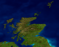
Version 2:Mercator map edit

Who did it? edit
- Me derived from User:SFC9394's original and a Mercator map produced from public domain map engine at http://www.aquarius.geomar.de/omc/
What's the projection? edit
- Mercator from -8W to 0E, 54.5N to 61N
What's the problem with it? edit
- Mercator projection has latitude and longitude as straight lines, but vertical distances increase the further away from the Equator you go.
Usable as a location map? edit
- For Equatorial or small countries, yes, but Scotland is far enough away from the Equator and tall enough for this to become an issue. So no.
Version 3:Equidistant cylindrical map edit

Who did it? edit
- Me derived from a equidistant cylindrical map produced from public domain map engine at http://www.aquarius.geomar.de/omc/ and User:SFC9394's original
What's the projection? edit
- Equidistant cylindrical from -8W to 0E, 54.5N to 61N
What's the problem with it? edit
- In terms of projection, none: equidistant cylindrical is equirectangular (a square on that map would be a square in real life). In terms of user acceptance, this is a problem: people who are used to Mercator or other projections will feel that the country "looks wrong" and object accordingly. There are precedents for this: I believe Russia (a very wide, but not very tall country, proportionately speaking) has the same user acceptance problem.
Usable as a location map? edit
- Yes: there is no distortion north-south or east-west.
Version 4:Equidistant cylindrical map stretched 150% vertically edit

Who did it? edit
- Me derived from an equidistant cylindrical map produced from public domain map engine at http://www.aquarius.geomar.de/omc/ and User:SFC9394's original
What's the projection? edit
- Equidistant cylindrical from -8W to 0E, 54.5N to 61N, stretched 150% north-south.
What's the problem with it? edit
- In terms of projection, probably none (see below). In terms of user acceptance, this will probably be acceptable.
Usable as a location map? edit
- Yes: there is no distortion east-west. The 150% distortion north-south is constant (unlike Mercator, where the distortion varies) and so will probably be coped with by Template:location map
See also edit
- Other images in this series
-
 Version 2 without border.
 -
 Version 3 (blue marble) gotten from NASA's Visible Earth project at http://visibleearth.nasa.gov/

