User:40bus/Chinese character of the day/August 2022
August 30

|
|
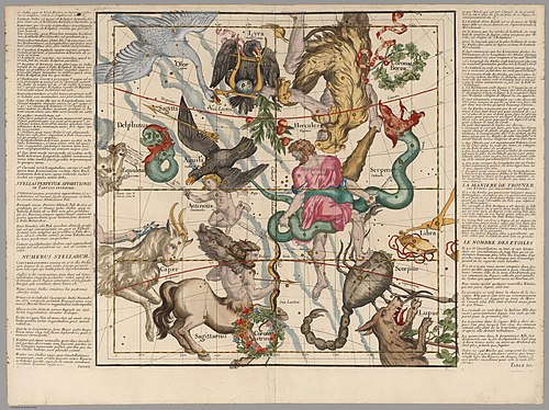
Ignace-Gaston Pardies (1636–1673) was a French Catholic priest and scientist. His celestial atlas, entitled Globi coelestis in tabulas planas redacti descriptio, comprised six charts of the night sky and was first published in 1674. The atlas uses a gnomonic projection so that the plates make up a cube of the celestial sphere. The constellation figures are drawn from Uranometria, but were carefully reworked and adapted to a broader view of the sky. This is the fifth plate from a 1693 edition of Pardies's atlas, featuring constellations including Lyra, Cygnus, Hercules, Ophiuchus, Sagittarius and Scorpius, Aquila, Delphinus, and Corona Australis, as well as Antinous, an obsolete constellation. All of these are visible in the Northern Hemisphere, though a few cross the boundary from the northern sky into the southern sky. Map credit: Ignace-Gaston Pardies
Recently featured:
|
August 31

|
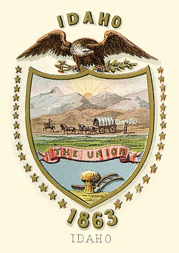
Coat of arms of the Idaho Territory, an organized incorporated territory of the United States that existed from 1863 to 1890. Idaho Territory originally covered all of the present-day states of Idaho and Montana, and almost all of the present-day state of Wyoming, omitting only a corner in the state's extreme southwest portion. It was wholly spanned east-to-west by the bustling Oregon Trail and partly by the other emigrant trails, the California Trail and Mormon Trail which since hitting stride in 1847, had been conveying settler wagon trains to the west, and incidentally, across the continental divide into the Snake River Basin, a key gateway into the Idaho and Oregon Country interiors. After several reductions, the final extent of the territory was admitted to the Union as Idaho. Credit: Henry Mitchell; restored by Godot13
Recently featured:
|