Template:Infobox U.S. county/testcases

Ketchikan Gateway Borough, Alaska

edit

Borough, not county

Side by side comparison
{{Infobox U.S. county}}{{Infobox U.S. county/sandbox}}
Ketchikan Gateway Borough
City (left) and former borough governments
Map of Alaska highlighting Ketchikan Gateway Borough
Location within the U.S. state of Alaska
Map of the United States highlighting Alaska
Alaska's location within the U.S.
Country United States
State Alaska
IncorporatedSeptember 6, 1963[1]
SeatKetchikan
Largest cityKetchikan
Area
 • Total6,654 sq mi (17,230 km2)
 • Land4,858 sq mi (12,580 km2)
 • Water1,795 sq mi (4,650 km2)  27.0%
Population
 • Estimate 
(2018)
13,918
 • Density2.8/sq mi (1.1/km2)
Time zoneUTC−9 (Alaska)
 • Summer (DST)UTC−8 (ADT)
Congressional districtAt-large
Websitewww.kgbak.us
Ketchikan Gateway Borough
City (left) and former borough governments
Map of Alaska highlighting Ketchikan Gateway Borough
Location within the U.S. state of Alaska
Map of the United States highlighting Alaska
Alaska's location within the U.S.
Country United States
State Alaska
IncorporatedSeptember 6, 1963[1]
SeatKetchikan
Largest cityKetchikan
Area
 • Total6,654 sq mi (17,230 km2)
 • Land4,858 sq mi (12,580 km2)
 • Water1,795 sq mi (4,650 km2)  27.0%
Elevation
123 ft (37 m)
Population
 • Estimate 
(2018)
13,918
 • Density2.8/sq mi (1.1/km2)
Time zoneUTC−9 (Alaska)
 • Summer (DST)UTC−8 (ADT)
Congressional districtAt-large
Websitewww.kgbak.us

Idaho County, Idaho

edit

Template_talk:Infobox_U.S._county/Archive_3#Dual_time_zones

Side by side comparison
{{Infobox U.S. county}}{{Infobox U.S. county/sandbox}}
Idaho County
Tolo Lake
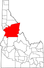
Map of Idaho highlighting Idaho County
Location within the U.S. state of Idaho
Map of the United States highlighting Idaho
Idaho's location within the U.S.
Country United States
State Idaho
FoundedFebruary 4, 1864
Named forA steamer called Idaho that was launched on the Columbia River in 1860
SeatGrangeville
Largest cityGrangeville
Area
 • Total8,503 sq mi (22,020 km2)
 • Land8,477 sq mi (21,960 km2)
 • Water26 sq mi (70 km2)  0.3%
Population
 • Estimate 
(2018)
16,513
 • Density1.9/sq mi (0.7/km2)
Time zones
North of Salmon RiverUTC−8 (Pacific)
 • Summer (DST)UTC−7 (PDT)
South of Salmon RiverUTC−7 (Mountain)
 • Summer (DST)UTC−6 (MDT)
Congressional district1st
Websiteidahocounty.org

West Baton Rouge Parish, Louisiana

edit

Parish, not county

Side by side comparison
{{Infobox U.S. county}}{{Infobox U.S. county/sandbox}}
West Baton Rouge Parish
Antonia (Port Allen, Louisiana)
Map of Louisiana highlighting West Baton Rouge Parish
Location within the U.S. state of Louisiana
Map of the United States highlighting Louisiana
Louisiana's location within the U.S.
Country United States
State Louisiana
FoundedMarch 31, 1807
Named forbâton rouge, French for red stick
SeatPort Allen
Largest cityPort Allen
Area
 • Total204 sq mi (530 km2)
 • Land192 sq mi (500 km2)
 • Water11 sq mi (30 km2)  5.6%
Population
 • Estimate 
(2015)
25,490
 • Density124/sq mi (48/km2)
Time zoneUTC−6 (Central)
 • Summer (DST)UTC−5 (CDT)
Congressional districts2nd, 6th
Websitewww.wbrcouncil.org/Default.asp

Jackson County, Michigan

edit
Side by side comparison
{{Infobox U.S. county}}{{Infobox U.S. county/sandbox}}
Jackson County
Michigan State Prison
Map of Michigan highlighting Jackson County
Location within the U.S. state of Michigan
Map of the United States highlighting Michigan
Michigan's location within the U.S.
Country United States
State Michigan
OrganizedAugust 1[2], 1832
Named forAndrew Jackson
SeatJackson
Largest cityJackson
Area
 • Total723 sq mi (1,870 km2)
 • Land702 sq mi (1,820 km2)
 • Water22 sq mi (60 km2)  3.0%
Population
 (2010)
 • Total160,248
 • Density228/sq mi (88/km2)
Time zoneUTC−5 (Eastern)
 • Summer (DST)UTC−4 (EDT)
Congressional district7th
Websitewww.co.jackson.mi.us

Livingston County, New York

edit
Side by side comparison
{{Infobox U.S. county}}{{Infobox U.S. county/sandbox}}
Livingston County
Livingston County Courthouse
Official seal of Livingston County
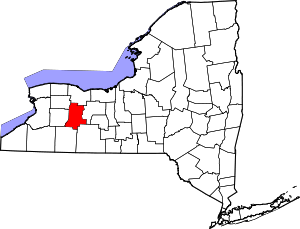
Map of New York highlighting Livingston County
Location within the U.S. state of New York
Map of the United States highlighting New York
New York's location within the U.S.
Country United States
State New York
Founded1821
Named forRobert R. Livingston
SeatGeneseo
Largest villageGeneseo
Area
 • Total640 sq mi (1,700 km2)
 • Land632 sq mi (1,640 km2)
 • Water8.5 sq mi (22 km2)  1.3%
Population
 (2010)
 • Total65,393
 • Density104/sq mi (40/km2)
Time zoneUTC−5 (Eastern)
 • Summer (DST)UTC−4 (EDT)
Congressional district27th
Websitewww.co.livingston.state.ny.us

Prince George's County, Maryland

edit
Side by side comparison
{{Infobox U.S. county}}{{Infobox U.S. county/sandbox}}
Prince George's County
The P.G. County courthouse in 2008, the Boulevard at the Capital Centre in 2005, downtown Upper Marlboro in 2006, the P.G. Plaza in 2004, Laurel's Patuxent Square in 2013, Andrews AFB in 2008, downtown Adelphi in 2008.
Official seal of Prince George's County
Official logo of Prince George's County
Nickname(s): 
"P.G. County", "P.G.", "Ward 9"
Motto(s): 
"Semper Eadem"
(English: "Ever the Same")
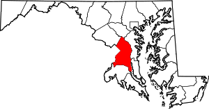
Map of Maryland highlighting Prince George's County
Location within the U.S. state of Maryland
Map of the United States highlighting Maryland
Maryland's location within the U.S.
Coordinates: 1°2′3″N 4°5′6″W / 1.03417°N 4.08500°W / 1.03417; -4.08500
Country United States
State Maryland
FoundedOctober 3, 1695
Named forPrince George of Denmark
SeatUpper Marlboro
Largest cityBowie
Area
 • Total499 sq mi (1,290 km2)
 • Land483 sq mi (1,250 km2)
 • Water16 sq mi (40 km2)  3.2%
Population
 • Estimate 
(2014)
904,430
 • Density1,789/sq mi (691/km2)
Demonym(s)Prince Georgian, P.G. Countyan
Time zoneUTC−5 (Eastern)
 • Summer (DST)UTC−4 (EDT)
ZIP Codes
20607–20774
Area code240, 301
Congressional districts4th, 5th
Websitewww.princegeorgescountymd.gov

Scioto County, Ohio

edit
flag border=no
{{Infobox U.S. county}}{{Infobox U.S. county/sandbox}}
Scioto County
Scioto County Courthouse
Flag of Scioto County
Official seal of Scioto County
Map of Ohio highlighting Scioto County
Location within the U.S. state of Ohio
Map of the United States highlighting Ohio
Ohio's location within the U.S.
Country United States
State Ohio
FoundedMarch 24, 1803[3]
Named fora Wyandot [4] word for deer or deer-hunting
SeatPortsmouth
Largest cityPortsmouth
Area
 • Total616 sq mi (1,600 km2)
 • Land610 sq mi (1,600 km2)
 • Water5.9 sq mi (15 km2)  1.0%
Population
 (2010)
 • Total79,499
 • Density130/sq mi (50/km2)
Time zoneUTC−5 (Eastern)
 • Summer (DST)UTC−4 (EDT)
Congressional districts2nd, 6th
Websitewww.sciotocountyohio.com

York County, Virginia

edit
Side by side comparison
{{Infobox U.S. county}}{{Infobox U.S. county/sandbox}}
York County
York County Courthouse
Map of Virginia highlighting York County
Location within the U.S. state of Virginia
Map of the United States highlighting Virginia
Virginia's location within the U.S.
Country United States
State Virginia
Founded1634
Named forYork
SeatYorktown
Largest communityBethel Manor
Area
 • Total215 sq mi (560 km2)
 • Land105 sq mi (270 km2)
 • Water110 sq mi (300 km2)  51.3%
Population
 • Total65,454
 • Estimate 
(2018)[6]
67,846
 • Density533/sq mi (206/km2)
Time zoneUTC−5 (Eastern)
 • Summer (DST)UTC−4 (EDT)
Congressional district2nd
Websitewww.yorkcounty.gov
  1. ^ 1996 Alaska Municipal Officials Directory. Juneau: AK Department of Community and Regional Affairs. 1996. p. 9.
  2. ^ "Bibliography on Jackson County". Clarke Historical Library, Central Michigan University. Retrieved January 19, 2013.
  3. ^ "Ohio County Profiles: Scioto County" (PDF). Ohio Department of Development. Archived from the original (PDF) on 2007-05-08. Retrieved 2007-04-28.
  4. ^ "Local river names have convoluted origin". Retrieved 3 May 2018.
  5. ^ "American FactFinder". United States Census Bureau. Archived from the original on September 11, 2013. Retrieved 2011-05-14.
  6. ^ "Population and Housing Unit Estimates". Retrieved July 14, 2019.