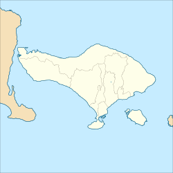
The Telaga Waja is a river which is situated in eastern Bali, Indonesia.[1] It rises on the slope of Mount Abang and passes through towns and wilderness slopes along the region of Rendang Village, reaching the sea in Klungkung Regency.[2][3]
| Telaga Waja River Sungai Telaga Waja, Tukad Telagawaja, Tukad Telagawadja | |
|---|---|
 | |
| Location | |
| Country | Indonesia |
| Province | Bali |
Hydrology
editThe Telaga Waja River is mainly located in the District of Rendang, Karangasem Regency, the eastern part of Bali, the second in length after the Ayung River.[4] The water comes from several springs in the mountains near Mount Agung, the highest mountain in Bali, and is considered holy by Hindu native people, such as Lipang, Arca, and Telaga Waja springs. Also, numerous smaller fountains flow into Telaga Waja, like the Yeh Sah River that sprung out of natural springs.[4] The combination of tributaries and springs contributes to a high water discharge, which is used by the local government for drinking water supply.[4] Tourist attractions along the river are very popular, in particular, rafting.[4][5]
Geography
editThe river flows in the eastern to the southeastern of Bali with a predominantly tropical rainforest climate (designated as Af in the Köppen-Geiger climate classification).[6] The annual average temperature in the area is 24 °C. The warmest month is October when the average temperature is around 27 °C, and the coldest is January, at 22 °C.[7] The average annual rainfall is 2123 mm. The wettest month is January, with an average of 569 mm of rainfall, and the driest is September, with 23 mm of rainfall.[8]
| Sungai Telaga Waja | ||||||||||||||||||||||||||||||||||||||||||||||||||||||||||||
|---|---|---|---|---|---|---|---|---|---|---|---|---|---|---|---|---|---|---|---|---|---|---|---|---|---|---|---|---|---|---|---|---|---|---|---|---|---|---|---|---|---|---|---|---|---|---|---|---|---|---|---|---|---|---|---|---|---|---|---|---|
| Climate chart (explanation) | ||||||||||||||||||||||||||||||||||||||||||||||||||||||||||||
| ||||||||||||||||||||||||||||||||||||||||||||||||||||||||||||
| ||||||||||||||||||||||||||||||||||||||||||||||||||||||||||||
See also
editReferences
edit- ^ Tukad Telagawaja at Geonames.org (cc-by); Last updated 17 January 2012; Database dump downloaded 27 November 2015
- ^ Rough Guide to Bali & Lombok. Rough Guides. 2011. p. 255. ISBN 978-1405381352.
- ^ "Viewfinder Panoramas Digital elevation Model". 21 June 2015.
- ^ a b c d (in Indonesian)Sungai Telaga Waja. Bali Tours Club. Retrieved 27 November 2018.
- ^ (in Indonesian)Bingung isi libur weekend – Ke Telaga Waja Rafting saja. Radar Bali. Jawa Pos. 28 October 2018.
- ^ Peel, M C; Finlayson, B L; McMahon, T A (2007). "Updated world map of the Köppen-Geiger climate classification". Hydrology and Earth System Sciences. 11. doi:10.5194/hess-11-1633-2007.
- ^ a b "NASA Earth Observations Data Set Index". NASA. 30 January 2016.
- ^ "NASA Earth Observations: Rainfall (1 month – TRMM)". NASA/Tropical Rainfall Monitoring Mission. 30 January 2016.
