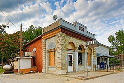
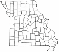
Tebbetts is an unincorporated community in southern Callaway County, Missouri, United States. It is part of the Jefferson City, Missouri Metropolitan Statistical Area. Tebbetts is located on Route 94, approximately 8 miles (13 km) east of Jefferson City, on the north edge of the Missouri River floodplain.[4]
Tebbetts, Missouri | |
|---|---|
 Tebbetts, Missouri Bank Spring 2012 | |
 Location of Tebbetts in Missouri | |
| Coordinates: 38°37′14″N 91°57′45″W / 38.62056°N 91.96250°W | |
| Country | United States |
| State | Missouri |
| County | Callaway |
| Area | |
• Total | 0.68 sq mi (1.75 km2) |
| • Land | 0.65 sq mi (1.68 km2) |
| • Water | 0.03 sq mi (0.07 km2) |
| Elevation | 568 ft (173 m) |
| Population (2020) | |
• Total | 64 |
| • Density | 98.46/sq mi (37.99/km2) |
| ZIP code | 65080[3] |
| Area code | 573 |
| FIPS code | 29-70342 |
| GNIS feature ID | 727509[2] |

A post office called Tebbetts has been in operation since 1895.[5] The community was named after a railroad employee.[6]
The Cote Sans Dessein Archeological Site and Oakley Chapel African Methodist Episcopal Church are listed on the National Register of Historic Places.[7]
Demographics
edit| Census | Pop. | Note | %± |
|---|---|---|---|
| 2020 | 64 | — | |
| U.S. Decennial Census[8] | |||
References
edit- ^ "ArcGIS REST Services Directory". United States Census Bureau. Retrieved September 5, 2022.
- ^ a b U.S. Geological Survey Geographic Names Information System: Tebbetts, Missouri
- ^ "Tebbetts MO ZIP Code". zipdatamaps.com. 2023. Retrieved June 16, 2023.
- ^ Missouri Atlas & Gazetteer, DeLorme, 2007, Third edition, p. 38, ISBN 0-89933-353-2
- ^ "Post Offices". Jim Forte Postal History. Retrieved September 7, 2016.
- ^ "Callaway County Place Names, 1928–1945 (archived)". The State Historical Society of Missouri. Archived from the original on June 24, 2016. Retrieved September 7, 2016.
{{cite web}}: CS1 maint: bot: original URL status unknown (link) - ^ "National Register Information System". National Register of Historic Places. National Park Service. July 9, 2010.
- ^ "Census of Population and Housing". Census.gov. Retrieved June 4, 2016.