This article may contain an excessive number of citations. (November 2023) |
Tatrang,[3][4][5][6][7] Tatirang[8][9][10] (تاتىراڭ بازىرى[11] Chinese: 塔提让镇) is a town in Qiemo / Qarqan County, Bayingolin Mongol Autonomous Prefecture, Xinjiang, China.
Tatrang
ئويتوغراق يېزىسى 塔提让镇 Tatirang | |
|---|---|
 Tatrang Location in Xinjiang | |
| Coordinates: 38°28′16″N 085°41′43″E / 38.47111°N 85.69528°E | |
| Country | China |
| Autonomous Region | Xinjiang |
| Prefecture | Bayingolin |
| County | Qiemo / Qarqan |
| Villages | 5 |
| Population (2010)[1] | |
| • Total | 4,226 |
| Ethnic groups | |
| • Major ethnic groups | Uyghur[2] |
| Time zone | UTC+8 (China Standard) |
History
editIn 1969, Tuanjie Commune (团结公社) was established.[2]
In 1980, Tuanjie Commune became Tatrang Commune (塔提让公社).[2]
In 1984, Tatrang Commune became Tatrang Township (塔提让乡).[2]
In 1986, an 800-year old manuscript copy of Romance of the Western Chamber and twenty-seven other documents were stumbled upon in Tatrang (Tatirang).[8][12]
On October 20, 2014, Tatrang Township became Tatrang Town (塔提让镇) and the boundaries of the town were adjusted adding 26,848 km2 (10,366 sq mi) of land previously administered directly by the county government to the administration of Tatrang.[1][13]
Geography
editTatrang is located on the Qiemo / Qarqan River. Tatrang originally included about 10,000 km2 (3,900 sq mi) of land.[2] In 2014, 26,848 km2 (10,366 sq mi) of land was added to Tatrang.[1][13]
Administrative divisions
editThe examples and perspective in this section may not include all significant viewpoints. (July 2020) |
Tatrang includes five villages:[2][14]
Villages:
- Bashitatirang (Bashita Tirangcun;[15] 巴什塔提让村) 38°28′12″N 085°41′18″E / 38.47000°N 85.68833°E
- Taitukule / Taitukuole (Taitu Kuolecun;[16] 台吐库勒村 / 台吐阔勒村) 38°26′22″N 085°39′11″E / 38.43944°N 85.65306°E
- Serikebuyang (Serike Buyangcun;[17]色日克布央村) 38°28′16″N 085°41′43″E / 38.47111°N 85.69528°E
- Ayaketatirang (Ayake Tatirangcun;[18] 阿亚克塔提让村[19]) 38°29′00″N 085°44′15″E / 38.48333°N 85.73750°E
- Aderesiman (Adere Simancun;[20] 阿德热斯曼村) 38°28′30″N 085°44′04″E / 38.47500°N 85.73444°E
Demographics
edit| Year | Pop. | ±% p.a. |
|---|---|---|
| 2000 | 3,244 | — |
| 2010 | 4,226 | +2.68% |
| [1] | ||
As of 1997[update], 80% of the residents of Tatrang Township were Uyghur.[2]
Historical maps
edit-
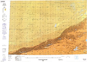
![Map including Tatrang (T’a-t’a-lang) (DMA, 1980)[a]](//upload.wikimedia.org/wikipedia/commons/thumb/f/fb/Operational_Navigation_Chart_G-7%2C_6th_edition.jpg/331px-Operational_Navigation_Chart_G-7%2C_6th_edition.jpg)
-
 Map including Tatrang (DMA, 1990)
![Map including Tatrang (T’a-t’a-lang) (DMA, 1980)[a]](/wiki/File:Operational_Navigation_Chart_G-7,_6th_edition.jpg)

See also
editNotes
edit- ^ From map: "The representation of international boundaries is not necessarily authoritative."
References
edit- ^ a b c d 且末县历史沿革 [Qiemo / Qarqan County Historical Development] (in Simplified Chinese). XZQH.org. 30 January 2015. Retrieved 6 December 2019.
2000年第五次人口普查,且末县常住总人口55540人,其中:{...}塔提让乡3244人、{...}2010年第六次人口普查,且末县常住总人口65572人,其中:{...}塔提让乡4226人,{...}2014年10月20日,自治区政府(新政函[2014]178号)批复同意撤销塔提让乡,设立塔提让镇,并将县直辖的26848平方公里划归塔提让镇管辖。
- ^ a b c d e f g 1997年且末县行政区划 [1997 Qiemo / Qarqan County Administrative Divisions] (in Simplified Chinese). XZQH.org. 10 December 2010. Retrieved 27 July 2020.
塔提让乡 1958年成立第五公社,1969年改称团结公社,1980年更名塔提让公社,1984年改乡。位于县城北39千米。面积1万平方千米,人口0.3万,其中维吾尔族占80%,辖巴什塔提让、台吐阔勒、色日克布央、阿亚克塔提让、阿德热斯曼、尧干墩6个行政村。古迹有恰勒玛旦遗址、苏帕斯坎遗址、阿孜列克东南遗址,阿孜勒克居住遗址,尧干墩东南墓葬、下塔提让烽火台、苏帕斯坦烽火台、阿亚克塔提让烽火台等。
- ^ Tatrang (Approved - N) at GEOnet Names Server, United States National Geospatial-Intelligence Agency
- ^ De Blij, Harm J. (2007). College Atlas of the World. Wiley. p. 185. ISBN 978-0-471-74117-6 – via Internet Archive.
Tatrang
- ^ Geographica: The complete illustrated Atlas of the world. Mynah. 2005. p. 212. ISBN 1-7416-6036-X – via Internet Archive.
Tatrang
- ^ The World Book Atlas. Italy: HarperCollinsPublishers. 2003. p. 88. ISBN 0-7166-2652-7.
Tatrang
- ^ "Records of Xinjiang Ground-jay Podoces biddulphi in Taklimakan Desert, Xinjiang, China" (PDF). 2004. pp. 121, 122. Retrieved 28 July 2020.
Tatrang
- ^ a b "800-year-old manuscript of popular Chinese love story to be exhibited". China Daily. 5 May 2016. Retrieved 28 July 2020.
- ^ Xie Yuzhong 解玉忠 (2003). 地名中的新疆 (in Simplified Chinese). Ürümqi: 新疆人民出版社. p. 149. ISBN 7-228-08004-1.
- ^ Tatirang (Approved - N) at GEOnet Names Server, United States National Geospatial-Intelligence Agency
- ^ تاتىراڭ (Variant Non-Roman Script - VS) at GEOnet Names Server, United States National Geospatial-Intelligence Agency
- ^ 元代《西厢记》手抄本残页亮相沈阳故宫. Xinhua News Agency (in Simplified Chinese). 5 May 2016. Retrieved 28 July 2020.
- ^ a b 新疆维吾尔自治区人民政府关于同意且末县塔提让乡调整行政区域界线和撤乡设镇的批复(新政函〔2014〕178号) (in Simplified Chinese). 3 November 2014. Archived from the original on 2017-09-21. Retrieved 2017-09-20 – via Internet Archive.
- ^ 2019年统计用区划代码和城乡划分代码:塔提让镇 [2019 Statistical Area Numbers and Rural-Urban Area Numbers: Tatrang Town] (in Simplified Chinese). National Bureau of Statistics of the People's Republic of China. 2019. Retrieved 21 July 2020.
统计用区划代码 城乡分类代码 名称 652825102200 220 巴什塔提让村委会 652825102201 220 台吐库勒村委会 652825102202 121 色日克布央村委会 652825102203 220 阿亚克塔提让村委会 652825102204 220 阿德热斯曼村委会
- ^ Bashita Tirangcun (Approved - N) at GEOnet Names Server, United States National Geospatial-Intelligence Agency
- ^ Taitu Kuolecun (Approved - N) at GEOnet Names Server, United States National Geospatial-Intelligence Agency
- ^ Serike Buyangcun (Approved - N) at GEOnet Names Server, United States National Geospatial-Intelligence Agency
- ^ Ayake Tatirangcun (Approved - N) at GEOnet Names Server, United States National Geospatial-Intelligence Agency
- ^ He Yuju 何玉菊 (3 August 2019). 塔提让镇开展百姓舞台大家乐文艺汇演. 新疆且末县人民政府 (in Simplified Chinese). Retrieved 28 July 2020.
塔提让镇阿亚克塔提让村
- ^ Adere Simancun (Approved - N) at GEOnet Names Server, United States National Geospatial-Intelligence Agency
This Xinjiang location article is a stub. You can help Wikipedia by expanding it. |