Talk:Kazungula
| This article is rated C-class on Wikipedia's content assessment scale. It is of interest to the following WikiProjects: | ||||||||||||||
| ||||||||||||||


Four countries meeting at one point? (before 1980 !)
editBefore 1980, the Rhodesian authorities claimed that all four countries met at a single point in the middle of the Zambesi river. Thus, they maintained that the ferry crossing from Botswana to Zambia needed to pass through Rhodesian or South-West-African territory ... and they therefore proceeded to sink it. After independence, Zimbabwe ceded territory to Botswana to widen the north-south link (thereby making a bridge feasible). Is that worth mentioning?--DLMcN (talk) 18:50, 8 July 2011 (UTC)
- [Three years later...] Yes, probably - provided you have proper references, of course. RobinClay (talk) 16:53, 22 June 2014 (UTC)
A Commons file used on this page has been nominated for deletion
editThe following Wikimedia Commons file used on this page has been nominated for deletion:
Participate in the deletion discussion at the nomination page. —Community Tech bot (talk) 14:35, 30 October 2018 (UTC)
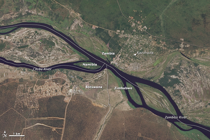
2015 NASA Earth Observatory images
editFYI, http://earthobservatory.nasa.gov/images/85867/double-tripoint-in-southern-africa has satellite photographs of the place, including a small annotated image and a larger unannotated image of the surrounding region. cmɢʟee⎆τaʟκ 05:40, 4 March 2023 (UTC)