Talk:Greigsville and Pearl Creek Railroad
| This article is rated Stub-class on Wikipedia's content assessment scale. It is of interest to the following WikiProjects: | ||||||||||||||||||||||||||||||||||
| ||||||||||||||||||||||||||||||||||


Untitled edit
According to the discussion on [Railroad.net http://railroad.net/forums/viewtopic.php?t=29309&start=0&postdays=0&postorder=asc&highlight=], this railroad was a paper railroad. Since they're a dime a dozen and of little historical interest, I see no reason to keep this article. I'll leave this note here for a bit and then delete the page.
- hmmmm.... not so fast with that delete key! Basil Watkins has this to report:
- The ICC stats have it listed as a common carrier from 1898 to 1909, when it was "practically abandoned". It opened 3m of line in April 1898 with one loco, and "ceased operations" in June 1899. I did find a map somewhere that showed it running from a junction with the DLW north of Greigsville, west to a dead -end spot called "North Greigsville". —The preceding unsigned comment was added by RussNelson (talk • contribs) 04:26, 16 March 2007 (UTC).
What is with this "Hoax" tag? One map has the railroad, the ICC says that it existed, and the railroad history database also lists it.RussNelson 04:35, 7 May 2007 (UTC)
If it's any help, a quick Google Books check suggests the G&PC shared its president, Edward Laton Fuller, with the Genesee and Wyoming Railroad, of which it was a logical extension. Perhaps most of the salt traffic to the BR&P went south and Fuller wanted to shorten the haul? Choess 04:37, 17 May 2007 (UTC)
It was built, but only around Greigsville: [1] I'll fix the article. --NE2 08:53, 16 July 2008 (UTC)
This is the ONLY built railroad in New York State for which I have been unable to find reliable information for the route. All that we know about the route is that it connected to the DL&W south of the current Greigsville (former North Greigsville), was on the west side of the DL&W (otherwise, why the name Pearl Creek), and it served the Greigsville Salt Mine, wherever THAT was. I regard the MinDat location as in error, since there is no indication of any mine at that location, and the USGS map has a mine just a bit to the northwest. But people should have all the information and make up their own mind, when there is a controvery. RussNelson (talk) 18:46, 19 July 2008 (UTC)
NE2 put in an "original research?" tag, however, I see no original research. There are conflicting primary sources. Ordinarily I would accept mindat's location, however it would be beneath a house on a residential street. The fact that a railroad needs to continue at least a train's length past a loading point is an obvious fact not worthy of a reference. RussNelson (talk) 20:14, 19 July 2008 (UTC)
- Mindat only has to the nearest minute, which is pretty bad precision at this scale. How do you even know that the mine shown on the topos (which I believe does match Mindat to the nearest minute) was the mine that existed in the 1890s? --NE2 21:29, 19 July 2008 (UTC)
- Good point. I've done some more searching and can find nothing online to suggest there has only ever been one mine in Greigsville / North Greigsville. But let's leave it there for a while and see if anybody can step up to fix it. RussNelson (talk) 04:14, 20 July 2008 (UTC)
I found a map that shows it all built (yeah right): New York 1903c And another that shows it proposed: New York 1903a Based on the latter, ACME Mapper may be the right-of-way. --NE2 13:43, 20 July 2008 (UTC)
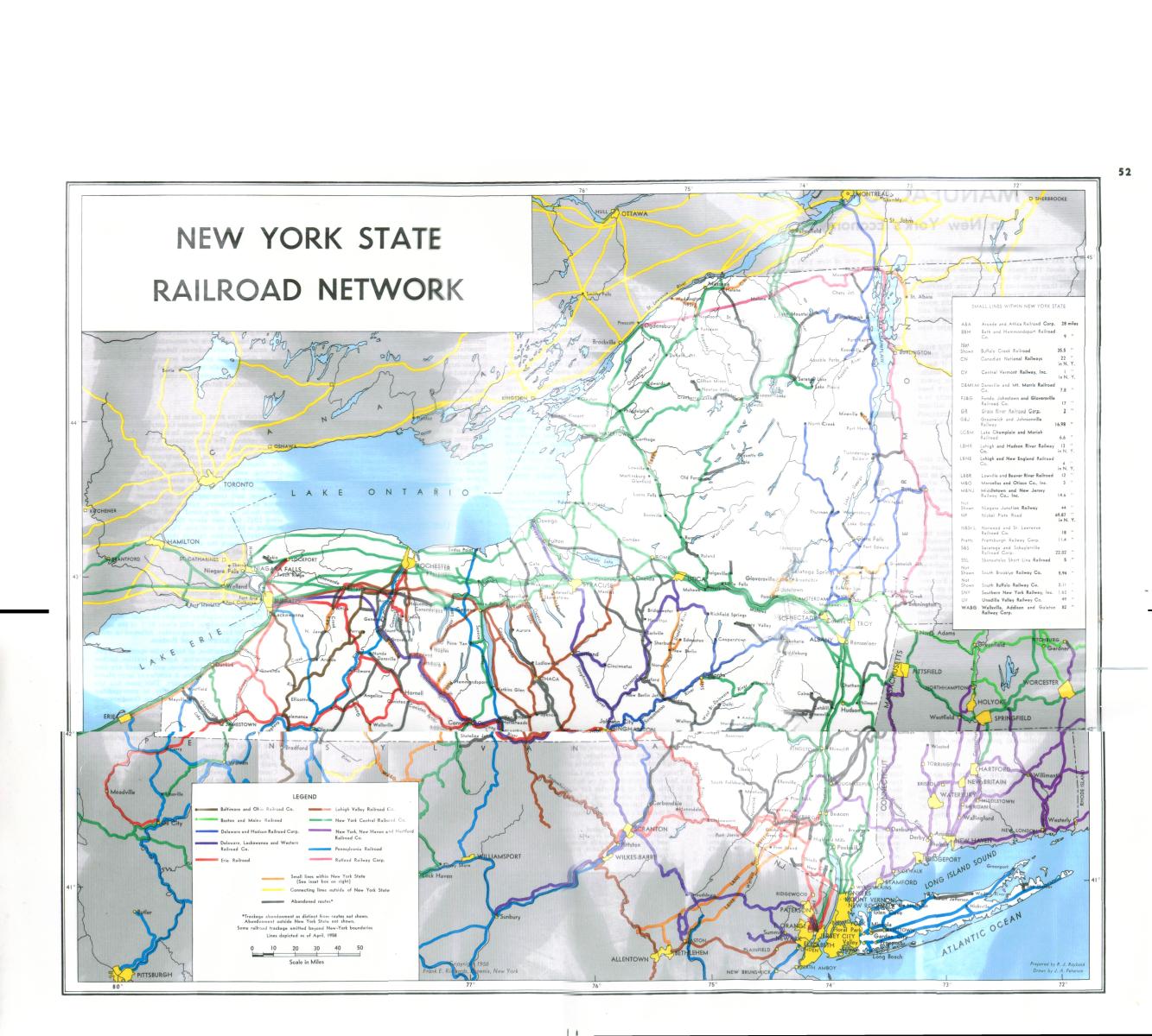
- Yeah, I've stared at that line also. Also at this one:ACME Mapper But the railroad as drawn on those maps, and on the New York State Railroad Network map, is not likely. There are easier ways to go up that hill than a 2.5% grade straight up the side of it. RussNelson (talk) 03:16, 21 July 2008 (UTC)
Another piece of the puzzle: the Retsof Mining Company leased the 1.5 mile branch around the mine. [2] --NE2 09:30, 21 July 2008 (UTC)
The DL&W operated the railroad: [3] --NE2 09:58, 21 July 2008 (UTC)