Talk:Dinder, Sudan
| This article is rated Stub-class on Wikipedia's content assessment scale. It is of interest to the following WikiProjects: | ||||||||||||||
| ||||||||||||||


Previous Dinder page completely wrong. edit
Coordinates for Dinder were completely wrong. Very hard to find references to Dinder's position on the web.
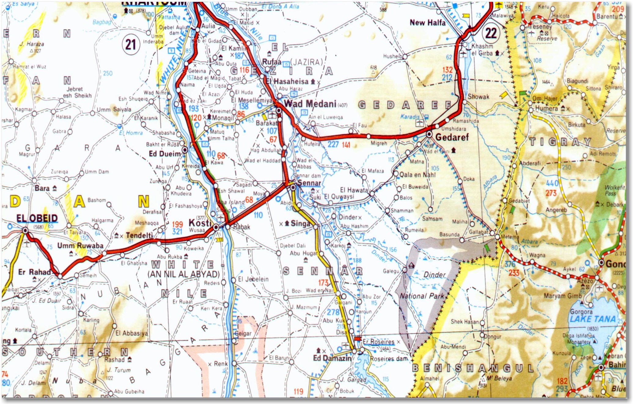
Michelin map excerpt: http://www.geocities.ws/magdi_saeed/Sudan_Maps/Sudan6.jpg
On the Michelin map, go south from Sennar (where the red and yellow highways meet) to Singa, then go east. Next town is Dinder, within a loop of the Dinder river, and in the Sennar state, not Al Jazirah state.
13°16'N 34°8'30"E https://www.google.com/maps/@13.2632423,34.1417642,5501m/data=!3m1!1e3
Take the road southeast from Dinder, second town is Galegu, at the confluence of the Galegu and Dinder rivers. Galegu is actually only a safari camp for the Dinder National Park. https://www.google.com/maps/@12.6046496,35.0223094,5496m/data=!3m1!1e3
Dinder does not abut the park, (100 km from it) but is the gateway for tourists. Quote from http://www.overlandinthesun.com/lions-in-sudan-dinder-national-park/ : "The next day and after a few more villages we were told by the very friendly police in Qala en Nahl (13*46’5″N 35*2’56″E) that we could not just drive into the park, but that we had to go to Dinder town to get permissions! Yah nice bit of a detour."
Quote from http://looklex.com/sudan/dinder.htm : "There are two Dinders. The first is the village packed with people who treat you like you were a film star, and they couldn't mean less harm than they do. ... The village of Dinder is a natural base when you consider entering the Dinder national park ... Lorries will bring you from some train station to the village Dinder. Moving into the national park, is quite difficult, but occasionally somebody drive down here. Then you might get a hike."
Dinder isn't served by Galegu airport. There is no runway anywhere near Galegu. None of the various coords for Galegu airport are near anything, and are 120 km from Dinder. Cptmrmcmillan (talk) 05:08, 15 September 2015 (UTC)