Talk:Clipperton Island/Archive 1
| This is an archive of past discussions. Do not edit the contents of this page. If you wish to start a new discussion or revive an old one, please do so on the current talk page. |
| Archive 1 |
different island?
"In April 1831, John Fitzgerald on his way to San Blas from Callao discovered an island at 18°30′N 114°33′W not shown on any chart." -- This is not the location of Clipperton. What does this sentence refer to and why is in the article? McKay 10:11, 30 June 2006 (UTC)
Those coordinates are very close to Clarion Island. --Mathew5000 05:54, 4 July 2006 (UTC)
Nuclear waste
"The French then planned to dump nuclear waste on the island; perhaps fortunately, Mexico and the United States convinced France to not implement that plan."
Cannot confirm this with a source in French; perhaps a legend. David.Monniaux 09:33, 23 May 2005 (UTC)
Some sources suggest the french considered using clipperton island as a nuclear test site during a dispute with algeria, where their test site was then located. Dropping nuclear bombs would generate nuclear waste, but is significantly different. —Preceding unsigned comment added by 71.110.211.253 (talk) 21:03, 18 January 2010 (UTC)
Clipperton was once considered as a potential nuclear testing center. Because of the war in Algeria, France had to find another site. Eventually, French Polynesia was chosen and the island of Mururoa. From 67 to 69, the French occupied Clipperton to monitor if fallout from the testing were coming to North American and Mexico. It was Operation Bougainville. The main coconut grove is still called "bois Bougainville" and concrete slabs show were the building were once erected. — Preceding unsigned comment added by Wuestehu (talk • contribs) 17:23, 1 August 2012 (UTC)
History Changes?
Is the 'History' part correct ?
This site (http://www.clipperton.fr/incagen.html?oublies.htm~main) says there were 11 survivors (and not 5 as the article says). As there is also a picture of the survivor, it looks like wikipedia is wrong. Note that the story from the linked site would imply that there were no murders of women (all 3 survived). — Preceding unsigned comment added by 82.230.65.68 (talk) 18:04, 18 April 2005 (UTC)
There were 11 survivors as the picture shows.One of them was the wife of Arnaud. In 1978, Cousteau found her son, seen on the picture, and flew him to Clipperton where he was born. (See Cousteau's 1981 movie) — Preceding unsigned comment added by Wuestehu (talk • contribs) 21:19, 1 August 2012 (UTC)
Broken Links and Bad Information
One of the links that is the basis for much of the history section (http://www.clipperton2008.org/Clipperton%20Island%20History.htm) did not work as of November, 2010.
The article mentions "the US Navy warship Lexington" visit[ing] the atoll in late 1915." However, the disambiguation page for [USS Lexington] shows one USS Lexington being scrapped in 1865, and the next not being built until 1927. Both cannot be complete and correct, so where is the mistake? The Clipperton Island page? Or the USS Lexington page? Darkstar8799 (talk) 19:07, 30 November 2010 (UTC)
- I was the one who put that information in there originally, and while that was some time ago, I know that the original reference confirmed what I wrote. That being said, perhaps the reference itself was bad. I'll have to see if I can find something else on this subject to either confirm or deny what is there now; if I can't find something to confirm it, I'll rewrite or remove it. - Ecjmartin (talk) 21:08, 30 November 2010 (UTC)
It was USS Yorktown commanded by Captain Perrill — Preceding unsigned comment added by Wuestehu (talk • contribs) 21:27, 1 August 2012 (UTC)
Fake History?
http://en.wikipedia.org/wiki/Clipperton_Island#Guano_mining_and_the_tragedy_of_1917
has a section which states "lvarez proclaimed himself "king" and began an orgy of rape and murder, before being killed by Captain Arnaud's widow, who had become the recipient of his unwanted attention." This section cites only http://www.clipperton2008.org/ which seems to just be an uncited blog. Can anyone find a citation for this? I suggest removal of that information... — Preceding unsigned comment added by 2604:8800:158:0:224:1DFF:FE28:2A2B (talk) 20:02, 22 June 2012 (UTC)
- I'm going to put in a different source, mainly as a stopgap until I can (hopefully) find something better. This one, at least, works and is not a blog...-Ecjmartin (talk) 00:58, 23 June 2012 (UTC)
Sources ar all the books written on the drama based on what Captain Perrill reported in a letter a couple of years after having rescued the 11 women and children of the Mexican colony. First, to preserve them and because they had been through enough, he did not mention anything about the murder of the light keeper and the ordeal of the women. Later he wrote his wife or daughter and told the story (Cousteau). — Preceding unsigned comment added by Wuestehu (talk • contribs) 21:30, 1 August 2012 (UTC)
Clipperton for sale?
http://www.privateislandsonline.com/clipperton-atoll.htm —Preceding unsigned comment added by 67.193.128.193 (talk) 04:12, 15 September 2009 (UTC)
No...it is not Clipperton and will never be. The Exclusive Economic Zone of the island is as big as France and loaded with deep sea polymetallic nodules. — Preceding unsigned comment added by Wuestehu (talk • contribs) 21:31, 1 August 2012 (UTC)
"Sui generis a possession of France"- wtf?
What does this mean? The sui generis article throws no light on it whatever (especially as it is not at all obvious that it could only be French). Is there any good reason why the text should not read simply "The island is a French possession"? --Red King (talk) 14:48, 2 September 2009 (UTC)
- The sentence is indeeed badly written if there is no explanation. According to the French article, it belongs to the French Public land. The term sui generis can be used for overseas territories as there are permanent resident but that's not the case of this island. We could say Clipperton Island is a property of the state. 86.206.236.201 (talk) 22:08, 2 September 2009 (UTC)
Clipperton was discovered in 1711 and officially and legally claimed in 1858. Mexico contested it after discovering the American guano rush there and occupied it. The pope was asked for international arbitration and he passed it on to Italian king Vittorio Emmanuel. The latter granted Clipperton to France in 1931. — Preceding unsigned comment added by Wuestehu (talk • contribs) 21:34, 1 August 2012 (UTC)
Mexico added Clipperton to its constitution in 1914 under the french name Passion Island: isla de la pasion After the 1931 arbitration it was removed. France celebrated the 300 years of its dicovery in 2011 with conferences, stamps and coins. — Preceding unsigned comment added by Wuestehu (talk • contribs) 21:36, 1 August 2012 (UTC)
Land crabs
The article suggests that the land crabs are introduced, but fails to say so, or to say they were native. How did they get to be the vegetation-destroying dominant animals? Piledhigheranddeeper 4 March 2009 —Preceding unsigned comment added by 64.3.33.116 (talk) 23:30, 4 March 2009 (UTC) Not much mention of the pirate John Clippeton marooned there by Pirate Dampier. Also, myth(?) of A Japanese Radio spy base there in World War 2? Thanks! DecideDatep.m.Sn.6/280921stCent.Dr.EdsonAndre'JohnsononD.D.ulc.SWORDINHAND (talk) 20:06, 28 June 2009 (UTC)
Nowhere in Dampier's autobiographic book on his trip is the island of Clipperton reported one way or another. Check out Google book, Dampier. — Preceding unsigned comment added by Wuestehu (talk • contribs) 21:37, 1 August 2012 (UTC)
contradictions
The new addition "Only in 1855 it was claimed by France." contradicts what is said two sentences earlier. Please give citations! McKay 08:08, 5 July 2006 (UTC)
The article states the last men died trying to reach the mainland. However, on the Costeau programme on the island, a survivor relates the last 3 men (other than the lighthouse keeper) were trying to reach a passing ship and died in the surf.
November 19858, Lieutenant de Vaisseau Victor Edouard François Marie Le Coat de Kervéguen is at Clipperton. A sailor swims in to claim the atoll and collect guano sample. December 1858, Lieutenant de Vaisseau Victor Edouard François Marie Le Coat de Kervéguen make the claim official and legal in the presence of the Governor of Hawaii in Hawaii. — Preceding unsigned comment added by Wuestehu (talk • contribs) 21:43, 1 August 2012 (UTC)
History & Legends
Here is some very interesting information...
Clipperton originally sailed under Captain James Cook on his voyage of discovery. It was on this voyage that Clipperton discovered Clipperton Island in 1705 in the eastern Pacific, 900 miles off the coast of Mexico.
It is said that Cook named the island for him and granted it to him. Clipperton later became a privateer, serving as mate under Captain William Dampier and later became captain of the Success under a different privateering syndicate, in which he also held under his command Captain George Shelvocke of the Speedwell.
In his activities attacking Spanish targets on the west coast of the Americas, he used Clipperton Island as a base from which to stage his attacks and store loot and supplies, fortifying Clipperton Rock and expanding its cave network.
On the voyage around the Cape, he dallied in the islands there hoping that the Speedwell, which had been separated from the Success in a North Atlantic storm, would catch up. When the Success departed the area, Clipperton left two men marooned as punishment on the same island which Alexander Selkirk (who was the basis of the Robinson Crusoe story) had been marooned on years before.
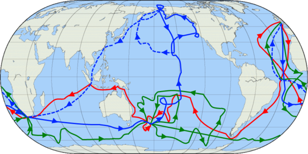
Not sure about Cook and Clipperton. None of his trip as widely reported took him near Clipperton or even close. See map on this same media as a first hint: http://upload.wikimedia.org/wikipedia/commons/thumb/4/4a/Cook_Three_Voyages_59.png/600px-Cook_Three_Voyages_59.png — Preceding unsigned comment added by 208.33.250.10 (talk) 15:32, 10 August 2012 (UTC)
Eric C and garbage on Clipperton
The section called Recent History has a few paragraphs about a visit by "Eric C" (whoever that is!) and talks about garbage washing up there but really doesn't make a lot of sense. (Added this to the bottom because there was no way to add a new section.) — Preceding unsigned comment added by Punstress (talk • contribs) 11:17, 12 August 2012 (UTC)
- New section added. There's a tab on top entitled "New Section" that you can use, next time. Cheers! - Ecjmartin (talk) 13:58, 12 August 2012 (UTC)
Translation needed
The text on the map File:Carteactuelle.jpg is in French. -- Beland (talk) 17:12, 19 October 2012 (UTC)
File:CarteLocal.gif has the same problem. -- Beland (talk) 17:16, 19 October 2012 (UTC)
- That's actually not a problem of the English Wikipedia since these files are stored at Commons. Please ask for help over at the Commons:Graphic Lab/Map workshop. De728631 (talk) 13:28, 14 November 2012 (UTC)
1981 agreement
"For this purpose, an agreement was signed with the French government, represented by the High Commissioner for French Polynesia, whereby Clipperton became French state property."
An agreement between the French government and what other party? I thought it was already a French possession in 1981. Marnanel (talk) 03:52, 21 January 2013 (UTC)
- An excellent question. I'm wondering if it might be the difference between the following two scenerios:
- Prior to 1981, France exercized national sovereignty over the island, but the land on the island was still available for lease or sale (depending upon French law on that subject) to private individuals or concerns.
- After 1981, in addition to exercizing national sovereignty over the island, France also became the actual owner of the land on the island itself, thus making it unavailable to other individuals or concerns.
- This would actually make sense in light of the information in this section, as it was apparently the French government itself that was looking to develop Clipperton--hence, it would be natural that they would want to acquire legal title to the land itself. It all sounds like a formality, but I imagine there were still legal niceties involved that rendered this decision necessary. It's kind-of like the U.S. exercizing national sovereignty over all of its territory, but only owning a small fraction of it outright (for military bases, government buildings, etc.). In this case, France owns the island (sovereignty-wise), and (after 1981) owns the island, land-wise. I'm not sure, of course, but I think that's what might have happened here. - Ecjmartin (talk) 20:30, 21 January 2013 (UTC)
Location
These two statements:
- 1,120 km southwest of Mexico, at 10°17' N, 109°13' W.
- It lies about 965 km from Tejupan Point on Mancanilla Bay, Mexico,
are contradictory. I'm also drawing a blank on those two names given: Tejupan and Mancanilla (somewhere in Guerrero, presumably).
Most Internet hits agree with the first figure. I've also got another (printed) source that says "1248 km SW of Acapulco", but that seems too far. (And, astoundingly, my printed 1991 Britannica says 1300 miles!)
Unless someone can calculate an exact figure, I'd be inclined to change those claims to "1120 km SW of Acapulco", which appears to be the consensus figure and gives a point of reference that's likely to be familiar to most readers, or at least locatable on a map. –Hjr 01:35, 23 Dec 2003 (UTC)
- Clipperton Island is 2420 km NW of the Galapagos Islands (first para), 945 km SE of Socorro Island (first para under Location, lagoon and climate)
According to the diagram in the Wikimedia Commons Atlas of the World, Clipperton is 2390 km NW of the Galapagos Islands, and 945 km SSE of Socorro Island (and 1280 km SW of Acapulco). It is probably sufficiently accurate to give 2400 km to GI and 950 to SI - but if not, stick with the distances given in WCAW? Since Acapulco is reasonably well-known, any harm in adding it as a reference point? BTW, the direction of CI from SI is SSE, not SE. Prisoner of Zenda (talk) 01:46, 16 January 2014 (UTC)
Location, lagoon and climate
"The lagoon ... contains some deep basins with depths of 43 and 22 m (141 and 72 ft) ... " I deleted the minus signs, as the text specifies that they are depths; a negative depth means a height! Prisoner of Zenda (talk) 02:43, 19 February 2014 (UTC)
- Right, thanks. Herostratus (talk) 14:59, 19 February 2014 (UTC)
Not an atoll?
An editor added "Although generally described as an atoll, Clipperton is actually an island of volcanic origin surrounded by a barrier reef.". Couple things about that:
- If it's not an atoll, we ought to change the first sentence of the lede which says "Clipperton Island... is an uninhabited 9 km2 (3.5 sq mi) coral atoll...".
- Sure looks like an atoll to me, see Atoll. There's no central island, just a lagoon. Look at the map. An atoll is an island (or island system) consisting of a (more or less) circular reef which has grown around a volcano which is has subsided, which is exactly what Clipperton looks like to me.
So reverted. Am I missing something? Herostratus (talk) 20:49, 19 September 2014 (UTC)
- No arguments from me. - Ecjmartin (talk) 22:10, 19 September 2014 (UTC)
Area
The first paragraph gives the island's area as 9 sq. km (3.5 sq. mi.) - but the info box at the RHS shows 6 sq. km (2.3 sq. mi.)! (Was the former at low tide and the latter at high tide?) It's unlikely that both are correct ... but what's the correct value? The Wikimedia Commons Atlas of the World states (in words) "a nine sq. km coral atoll" - but immediately below gives the island's area as 1.6 sq. km! The atoll is roughly rectangular, about 4½ km long and 2¾ km wide, giving an area a bit over 12 sq. km; this suggests that the 9 sq. km figure is correct. The 1.6 sq. km would appear to refer to the land area, while the 9 sq. km refers to the area of the atoll. Perhaps "area" needs to be more explicit?Prisoner of Zenda (talk) 01:21, 16 January 2014 (UTC)
- On 30 April 2010 the info box showed 9 sq km and 3.5 sq. mi., which matched the first paragraph. On 29 June 2010 the info box was changed to 6 sq. km and 2.3 sq. mi., so has been inconsistent with the first paragraph for over 4½ years! Prisoner of Zenda (talk) 09:58, 5 February 2015 (UTC)
- Argh this is not good, tsk. I do not have any idea how the area of an atoll is measured -- land area only, or enclosed lagoon -- in the geographical community, and I doubt if we have a standard. However, looking at Bikini Atoll, I see the infobox says "Area (land)" so that the reader at least knows what she's seeing. I suggest we go with something like that in the infobox, then if we want to expand on that in the body text, something like "The total land area is about 1.6 sq km, the total area enclosed by the lagoon is about 9 sq km" or something. Herostratus (talk) 12:13, 5 February 2015 (UTC)
- Herostratus, your proposal sounds good. In the infobox show "Area enclosed by atoll - 9 km2; land area - 1.6 km2". (The land area is consistent with the 'Overseas departments and territories of France' page, where (under 'Uninhabited overseas territories') the land area is given as 2 km2 ... probably rounded up from 1.6 km2.) Prisoner of Zenda (talk) 09:37, 23 July 2015 (UTC)
External links modified
Hello fellow Wikipedians,
I have just added archive links to one external link on Clipperton Island. Please take a moment to review my edit. If necessary, add {{cbignore}} after the link to keep me from modifying it. Alternatively, you can add {{nobots|deny=InternetArchiveBot}} to keep me off the page altogether. I made the following changes:
- Added archive https://web.archive.org/20120502053953/http://www.clippertonproject.com:80/plastic-surveying-and-collection/ to http://www.clippertonproject.com/plastic-surveying-and-collection/
When you have finished reviewing my changes, please set the checked parameter below to true to let others know.
![]() An editor has determined that the edit contains an error somewhere. Please follow the instructions below and mark the
An editor has determined that the edit contains an error somewhere. Please follow the instructions below and mark the |checked= to true
- If you have discovered URLs which were erroneously considered dead by the bot, you can report them with this tool.
- If you found an error with any archives or the URLs themselves, you can fix them with this tool.
Cheers. —cyberbot IITalk to my owner:Online 18:49, 25 August 2015 (UTC)
ENGVAR
The article's subject matter does not clearly favor US spelling over UK spelling, so I believe that the WP:ENGVAR should be determined by the first use. Before a recent edit (~11 hours ago), there was 1 instance of 'harbor' and 1 instance of 'harbours', which sounds like a toss-up to me. An editor (Aerach) changed 'harbor' to 'harbour' making the spelling consistently UK. This edit was reverted by Herostratus, restoring the inconsistency. I (YBG) reverted it to restore consistency. This judgment may be erroneous as there may be other words in the current article or in previous versions that establish a precedence of US over UK, but absent that, I believe the edit mentioned above that established consistency also established the ENGVAR for this article. Full disclosure: my own dialect is US, not UK English. YBG (talk) 06:45, 4 December 2015 (UTC)
External links modified
Hello fellow Wikipedians,
I have just modified one external link on Clipperton Island. Please take a moment to review my edit. If you have any questions, or need the bot to ignore the links, or the page altogether, please visit this simple FaQ for additional information. I made the following changes:
- Added archive http://www.webcitation.org/5QE8rvIqH?url=http%3A%2F%2Fwww.birdlife.org to http://www.birdlife.org
When you have finished reviewing my changes, please set the checked parameter below to true or failed to let others know (documentation at {{Sourcecheck}}).
![]() An editor has determined that the edit contains an error somewhere. Please follow the instructions below and mark the
An editor has determined that the edit contains an error somewhere. Please follow the instructions below and mark the |checked= to true
- If you have discovered URLs which were erroneously considered dead by the bot, you can report them with this tool.
- If you found an error with any archives or the URLs themselves, you can fix them with this tool.
Cheers.—InternetArchiveBot (Report bug) 16:25, 26 November 2016 (UTC)
WWII
The article discusses the US leaving Clipperton at the end of WWII, but doesn't discuss the US arrival, nor what the US did there during the war. Presumably, the US did this with the permission of France, but that should be clarified. Don't Be Evil (talk) 20:32, 14 December 2016 (UTC)
External links modified
Hello fellow Wikipedians,
I have just modified 3 external links on Clipperton Island. Please take a moment to review my edit. If you have any questions, or need the bot to ignore the links, or the page altogether, please visit this simple FaQ for additional information. I made the following changes:
- Corrected formatting/usage for http://www.birdlife.org/
- Added archive https://web.archive.org/web/20090415195236/http://www.divemagazine.co.uk/news/article.asp?UAN=2934&v=5&sp=332382698484330872538 to http://www.divemagazine.co.uk/news/article.asp?UAN=2934&v=5&sp=332382698484330872538
- Added
{{dead link}}tag to http://www.reefbase.org/Summaries/pdf/Clipperton1998.pdf - Added archive https://archive.is/20031121180448/http://193.55.107.45/eurogeo2.htm to http://193.55.107.45/eurogeo2.htm
When you have finished reviewing my changes, you may follow the instructions on the template below to fix any issues with the URLs.
This message was posted before February 2018. After February 2018, "External links modified" talk page sections are no longer generated or monitored by InternetArchiveBot. No special action is required regarding these talk page notices, other than regular verification using the archive tool instructions below. Editors have permission to delete these "External links modified" talk page sections if they want to de-clutter talk pages, but see the RfC before doing mass systematic removals. This message is updated dynamically through the template {{source check}} (last update: 5 June 2024).
- If you have discovered URLs which were erroneously considered dead by the bot, you can report them with this tool.
- If you found an error with any archives or the URLs themselves, you can fix them with this tool.
Cheers.—InternetArchiveBot (Report bug) 15:08, 9 August 2017 (UTC)
Possible flag
CLIPPERTON ISLAND NEED A FLAG WHOS WITH ME TimGeography (talk) 20:22, 20 December 2016 (UTC)
Like, seriously. It needs a flag SOOOO BADLY. TimGeography (talk) 20:23, 20 December 2016 (UTC)
https://en.wikipedia.org/wiki/Flag_of_FranceDon't Be Evil (talk) 18:20, 17 November 2017 (UTC)
External links modified (January 2018)
Hello fellow Wikipedians,
I have just modified 2 external links on Clipperton Island. Please take a moment to review my edit. If you have any questions, or need the bot to ignore the links, or the page altogether, please visit this simple FaQ for additional information. I made the following changes:
- Corrected formatting/usage for http://www.clippertonproject.com/expeditions/clipperton-island-2012/about-clipperton-island/
- Added archive https://web.archive.org/web/20100928092444/http://www.hawaii.edu/aplpj/articles/APLPJ_01.2_heflin.pdf to http://www.hawaii.edu/aplpj/articles/APLPJ_01.2_heflin.pdf
- Added
{{dead link}}tag to http://www.ots.ac.cr/rbt/revistas/45-2/allen.htm
When you have finished reviewing my changes, you may follow the instructions on the template below to fix any issues with the URLs.
This message was posted before February 2018. After February 2018, "External links modified" talk page sections are no longer generated or monitored by InternetArchiveBot. No special action is required regarding these talk page notices, other than regular verification using the archive tool instructions below. Editors have permission to delete these "External links modified" talk page sections if they want to de-clutter talk pages, but see the RfC before doing mass systematic removals. This message is updated dynamically through the template {{source check}} (last update: 5 June 2024).
- If you have discovered URLs which were erroneously considered dead by the bot, you can report them with this tool.
- If you found an error with any archives or the URLs themselves, you can fix them with this tool.
Cheers.—InternetArchiveBot (Report bug) 11:50, 21 January 2018 (UTC)
External link
There is a tremendous amount of information available on the island (in french only) from Jean-Louis Etienne's recent expedition (April 5th, 2005). See http://www.jeanlouisetienne.com/clipperton/default.cfm
Regarding the distance, the great circle distance is either 1151km or 1238km SW of Acapulco depending on which great circle calculator one is using. — Preceding unsigned comment added by 83.78.104.71 (talk) 13:18, 21 April 2005 (UTC)
There is another better Satelite Image from the Spot Satelite at: http://www.spotimage.fr/automne_modules_files/standard/public/p747_imageEnlargedIMAGE_cliperton-new_big.jpg — Preceding unsigned comment added by 83.78.104.71 (talk) 13:18, 15:49, 3 May 2005 (UTC)
Self-deprecating Humour
Is the last paragraph really nessesary? — Preceding unsigned comment added by 207.72.2.36 (talk) 10:26, 21 November 2005 (UTC)
- By and large, the french have no knowledge of the Clipperton Island in the first place, let alone use it as a reference for anything, so I guess not. — Preceding unsigned comment added by 82.231.41.7 (talk) 18:43, 2 January 2006 (UTC)
Clipperton
Re: "Clipperton is often used by the French as a self-deprecating ironic reference to the importance of the French overseas possessions." I've studied these overseas territories and never heard that. I'll remove the sentence, please re-add it only if you have a reference. Herve661 (talk) 23:14, 5 October 2007 (UTC)
Image
It looks like there's land in the background and it can't be Mexico. Is it really Clipperton?

— Preceding unsigned comment added by 213.228.0.12 (talk) 08:55, 29 March 2006 (UTC)
- According to the NOAA it is. The picture can be found here. NOAA Photo Library The land that you see behind the palm trees is likely the far side of the island. — Preceding unsigned comment added by Joeld123 (talk • contribs) 15:03, 21 April 2006 (UTC)
- Clipperton is a coral ring 7 miles round and 10 feet above water. The land on the other side is...the other side of the ring. Clipperton is also nicknamed "the lake in the middle of the ocean" — Preceding unsigned comment added by Wuestehu (talk • contribs) 17:24, 1 August 2012 (UTC)
Magellan
I don't believe Magellan came anywhere close to this island. After rounding Tierra del Fuego, his fleet sailed essentially west/northwest to the Philippines. — Preceding unsigned comment added by Jwbacin (talk • contribs) 17:25, 16 January 2006 (UTC)
- I 100% agree. Magellan did not even cross into the Northern Hemisphere until he was WELL West of Cliperton island. Who REALLY discovered Clipperton? It was NOT Magellan!— Preceding unsigned comment added by 68.107.76.218 (talk) 02:59, 17 September 2006 (UTC)
Beside one theory (Nunn -Essay - Magellan's Route in the Pacific author George E. Nunn- reported by Skaggs -Clipperton: A History of the Island the World Forgot [Jimmy M. Skaggs]- that said that Magellan sailed North and East via Clipperton, everybody aggrees that he did not and recent computer modelling even state that Magellan benefited from the tail winds of a local El Nino occurence. Magellan's pilots recorded every navigation points that were found and are available. Nunn thinks they wrote down wrong one to extend the Spanish possessions to the spice island...or something far stretched like that. — Preceding unsigned comment added by Wuestehu (talk • contribs) 17:50, 1 August 2012 (UTC)