This is an archive of past discussions. Do not edit the contents of this page. If you wish to start a new discussion or revive an old one, please do so on the current talk page.
Latest comment: 16 years ago2 comments2 people in discussion
I remember reading that the name "Antarctica" was based off the combination "Anti-Arctos" meaning no bears/polar bears, can anyone verify this? —Preceding unsigned comment added by 203.97.120.37 (talk) 03:57, 20 December 2007 (UTC)
The name Antarctica is a romanized version of the Greek compound word Αntarktiké (Aνταρκτική), meaning "Opposite of the Arctic". The word Arctic comes from the Greek word arktos (άρκτος) , which means bear. This is due to the location of the constellation (a group of stars) Ursa Major, the "Great Bear", above the Arctic region. Mick gold (talk) 15:07, 22 January 2008 (UTC)
Birds
Latest comment: 16 years ago2 comments2 people in discussion
The article states "The Snow Petrel is one of only three birds that breed exclusively in Antarctica." and then goes on to list six species of penguin that breed there. So what are the other two exclusively breeding birds? Do we take it that four of those penguins also breed elsewhere?--Shantavira|feed me09:18, 5 January 2008 (UTC)
Latest comment: 16 years ago2 comments2 people in discussion
"Various countries claim areas of it, although as a rule, no other countries recognize such claims".
While MANY countries do not recognise the claims, there are also countries that do. This statement does not gel with the "Australian Antarctic territory" entry which lists the countries which recognise the Australian claim - THis hardly makes sense if "as a rule no other countries recognise such claims"70.189.213.149 (talk) 20:36, 15 January 2008 (UTC)
I suspect what was meant was that no countries without claims have recognised any claims, not that no countries have recongnised any claims. I've reworded it to make this clearer, and given a source for mutual recognition. -- Avenue (talk) 14:21, 16 January 2008 (UTC)
Ice Sheet Thickness
Latest comment: 16 years ago4 comments3 people in discussion
Please see section 1.6? above to read a little more about why this number is uncertain and how the current wording came about. Of course the average ice thickness may not be all that informative as a thickness--most of the ice sheet is either thicker or thinner than this number, ranging from 0 to over 4 km. Having said that, a definitive reference would be nice. StephenHudson (talk) 09:59, 10 February 2008 (UTC)
Perhaps because the last person to edit it didn't want to choose one reference as being better than others. I agree that the Lythe et al. 2001 is probably the best current reference available, but there are also others (1.83 km from BAS, 2.1 km from BAS and NASA, and the ones discussed above). I may try to change all refs to the ice sheet thickness to the 1.85, and cite Lythe, if there are no objections and I get a chance. Where appropriate, I could also mention the uncertainty and give other refs. Otherwise, you are, of course, free to edit it. StephenHudson (talk) 17:27, 11 February 2008 (UTC)
Area
Latest comment: 15 years ago3 comments3 people in discussion
The area is given in an estimate for square kilometers with ~5 significant digits, but the area in square miles is ~10 significant digits.
This is like 98.6, and probably should be corrected.
Also, this comparison from the introduction to the Geography section:
"It covers more than 14 million km² (5.4 million sq mi), making it the fifth-largest continent, about 1.3 times larger than Europe."
would put Europe's area at ~2.4M sq mi. It should read "0.3 times larger", "1.3 times as large", or something equivalent. "30% larger" might be the most straightforward way of putting it. 76.174.27.252 (talk) 12:51, 2 April 2008 (UTC)
Actually, the 1.3 times would be correct way, since multiplying the 5.4 million square miles by 0.3 would be 3/10ths of the original size. I do believe this concept is taught in elementary math. 98.246.121.170 (talk) 09:06, 9 February 2009 (UTC)
Ozone hole
Latest comment: 15 years ago4 comments4 people in discussion
When preliminary results conflict significantly with a well-established consensus, WP:UNDUE indicates that it is inappropriate to include them until such a time as they may gain a greater foothold in the relevant scientific community. - Eldereft (cont.) 08:57, 28 July 2008 (UTC)
The article referenced actually questions the exact chemical pathways that allow the chlorine from CFCs to result in ozone destruction, while strongly stating that these new findings do not call into question the role CFCs play in creating the ozone hole. That and the fact that the results are unpublished (as a reviewed article) and not duplicated, suggest it should not be included here, or should be mentioned lightly as indicating some uncertainty about the exact mechanism by which CFCs deplete the ozone. I think it would also be better addressed in the ozone hole article than here. StephenHudson (talk) 11:24, 28 July 2008 (UTC)
Claus expedition vandalism: potential showcase example
Latest comment: 16 years ago1 comment1 person in discussion
Curious why the page was locked, I checked the discussion and the Claus vandalism caught my eye. Vandalism is fairly common and various types exist, "blanking" (sabotaging pages by deleting chuncks) is the worst, "silly vandalism" (stupid sentences) is most common and "sneaky vandalism" (embedded in the text) is sometimes the most persistant. I googled the claus expedition and hordes of sites mention it with the same frases, meaning they possibly took it from here. It is a sweet example of sneaky vandalism that I would like to quote (not in wikipedia). Is it definetely a vandalism or is it a real in-joke name for an expedition? --Squidonius (talk) 16:50, 6 April 2008 (UTC)
antartica ice break
Latest comment: 16 years ago1 comment1 person in discussion
Contradiction in Effects of Global Warming section
Latest comment: 15 years ago6 comments3 people in discussion
Someone pointed out that this section seemed to contradict itself by stating that ice is both melting and relatively stable. While it is confusing, it isn't actually a contradiction because it is saying the ice shelves are melting/breaking up, while the sea ice is stable or expanding. These two kinds of ice are very different (sea ice is less than 5 m thick and formed on the ocean, while ice shelves are 100s of meters thick and formed on land), and are created and destroyed by different processes. I tried to briefly clarify this while cleaning up the section, and removed the tag.StephenHudson (talk) 07:29, 8 July 2008 (UTC)
On the same subject I have just arrived here to weave this research into the article. Looking at the section as it stands I suspect this will generate at least a modicum of debate as to the weight to give different views of what is actually happening. Lucian Sunday (talk) 10:16, 29 July 2008 (UTC)
No arguments from me on your edit. I think it's pretty established, not very controversial, and not very surprising, that the mass balance of the Antarctic ice cover is not well known. (I say not surprising since we are talking about cm-scale changes over a largely uninhabited continent and since there are the offsetting effects that warming would be expected to bring: increased melting near the coast, but increased snowfall over the interior, most of which still would never melt.) I'm not sure that article shows new or more convincing evidence of this fact, but it shows it in a reasonably solid fashion and is a reliable source. StephenHudson (talk) 21:06, 29 July 2008 (UTC)
The bit that contradicts the existing article is the the conclusion
We show that 72% of the Antarctic ice sheet...is a sink of ocean mass sufficient to lower global sea levels by 0.08 mm yr Basically the author is saying that the (temporary) build up in the East exceeds (at present) the (permanent) melting in the West. This is not to deny Global warming - it is just contradicts the present article a bit. Lucian Sunday (talk) 22:01, 29 July 2008 (UTC)
Another contradiction in the climate section. The article states, "There is some speculation that Antarctica is warming as a result of human CO2 emissions but this has not been proven" but the reference it uses concludes "We find that the observed changes in Arctic and Antarctic temperatures are not consistent with internal climate variability or natural climate drivers alone, and are directly attributable to human influence" —Preceding unsigned comment added by 173.2.143.150 (talk) 16:28, 10 February 2009 (UTC)
Countries interested in participating in a possible territorial division of Antarctica
Latest comment: 15 years ago8 comments3 people in discussion
Dear Edubucher, I disagree with your approach, and would suggest that you bring Ecuador and Uruguay back. Wikipedia is not the place to compare the strength of various countries' territorial interests in Antarctica (that's 'Original Research'); it suffices to know from the quoted sources that all these countries (their governments or parliaments) have formally reserved the right to make sovereignty claims. Apcbg (talk) 18:13, 29 September 2008 (UTC)
The approach that I have done is correct:
Only Peru has reserved the right territoral in Antarctica at the time they acceded to the Antarctic Treaty, since neither Ecuador or Uruguay did.
Peru is the only country where the constitution contains the rights of Peruvians in Antarctica.
Peru has been the only country where their territorial interests with the support of the United Nations, through its secretary general, Javier Perez de Cuellar.
It is for these and other arguments that section of Antarctica from Wikipedia in Spanish, has not been taken into account either Ecuador or Uruguay to this list.--Edubucher (talk) 15:39, 30 September 2008 (UTC)
Dear Edubucher, your criteria derive from unacceptable POV, and to cap it all you apply them inconsistently. Indeed, Brazil, Russia and the USA have neither references to Antarctica in their constitutions, nor UN Secretaries General of their own nationality to promote their Antarctic territorial interests in the UN, hence they ought to have been removed under your criteria; however, you keep them while removing Ecuador and Uruguay only. That wouldn't do. (And here the Spanish Wikipedia is no argument you know.) I am not going into repeated reversals, leaving this issue to be settled by other interested editors. Best, Apcbg (talk) 17:24, 30 September 2008 (UTC)
I agree with you, Apcbg, and will change the article back to the wording of the version that includes Ecuador and Uruguay, though I will add {{fact}} tags and put the whole lot into alphabetical order. The added wording to the Peruvian one tries to justify the claim where other nations' do not, and this is a problem. Regarding the fact tags, I've seen the Chilean document and IMO this does still require further verification beyond that. Pfainuktalk19:14, 30 September 2008 (UTC)
I think I should be clear on this, because of this edit [2] which I have reverted. We do not make any attempt to explain the justification behind the claims of the US, Russia, Brazil, Ecuador or Uruguay to rights in the Antarctic. Nor indeed the claims of those that actually claim territory - New Zealand, Australia, France, Norway, the UK, Chile and Argentina. Per NPOV we should not treat Peru any differently to those twelve other countries. Pfainuktalk16:50, 3 October 2008 (UTC)
Ok, I put the references in the Peruvian case, as shown in the Ãs template, but wanted to emphasize that the references 47 and 48 are given to the cases of Peru, Ecuador and Uruguay, but even so put a single source in peru. greetings --Edubucher (talk) 17:01, 3 October 2008 (UTC)
I'm afraid we can't accept that reference because on principle blogs aren't reliable sources. Nonetheless I have moved those two sources so that it is clearer to what they apply. I still think there ought to be reliable sources for this that aren't related to the Chilean government or military (since as Apcbg says, such a claim is a Big Deal), but I am prepared to accept my current revision for now. Pfainuktalk17:16, 3 October 2008 (UTC)
land fauna citation
Latest comment: 15 years ago1 comment1 person in discussion
can this link be used for the statement in the fauna section,which says almost all land fauna is invertebrate
the statement here is "Few terrestrial vertebrates are resident in Antarctica and those which do occur are limited to sub-Antarctic islands."
can anyone cite this,because it seems i have a problem with inline citationsShanbhag.rohan 05:05, 4 November 2008 (UTC) —Preceding unsigned comment added by Shanbhag.rohan (talk • contribs)
No, there is no carbon dioxide snow. The reason is the same as why there is water vapor in the air below the boiling point (when water "should" be liquid, not gas) without always having rain or clouds. In order to cause condensation of water or carbon dioxide from the atmosphere by lowering the temperature, the temperature has to drop to the point where the vapor pressure is equal to the partial pressure of water vapor or CO2 in the atmosphere. In the case of water vapor, this temperature is called the dew point. The partial pressure of CO2 in the atmosphere is equal to the fraction of air molecules that are CO2, currently about 387 out of every million molecules in air, times the air pressure. So in the interior of Antarctica, where the high elevation makes the air pressure at the surface about 650 mb (65% of sea level pressure), the partial pressure of CO2 is about 0.000387×650=0.25 mb, or about 0.19 mm of Mercury (mm Hg). Looking at this plot of vapor pressure for CO2, you can see that the vapor pressure is 0.2 mm Hg at a temperature of about −140°C, or −220°F. This is the temperature when dry-ice precipitation or frost would form, and is much lower than any temperatures found in Antarctica. I hope that helps, despite being a bit technical.StephenHudson (talk) 17:48, 6 December 2008 (UTC)
This is very interesting perhaps a simpler version of this should be added to the article as dry ices temperature is mentioned or perhaps we should remove the reference to dry ice to prevent this confusion?--CAJ (talk) 19:17, 26 December 2008 (UTC)
Ice-free areas
Latest comment: 15 years ago4 comments3 people in discussion
According to the article's info box, Antarctica has an ice-free area of 280,000 km², almost as large as Germany. Is there a map which shows these ice-free parts? All the maps in this article colour the continent in white completely.--Roentgenium111 (talk) 18:24, 22 January 2009 (UTC)
This map from the UN Environment Programme tries to show the ice-free areas. They're the brown regions scattered around, including the tops of the Transantarctic Mountains along the Ross Sea coast. It's best to look at one of the higher resolution images on the page, either the PNG or PDF. The ice-free areas are difficult to accurately show on most maps because it isn't one area the size of Germany, but hundreds of small regions scattered around the continent. StephenHudson (talk) 08:13, 23 January 2009 (UTC)
Thanks for your answers. It's funny that the mountain tops are ice-free in Antarctica, exactly the opposite of the other continents.--Roentgenium111 (talk) 17:46, 26 January 2009 (UTC)
Permanent Residents in Antarctica
Latest comment: 15 years ago3 comments3 people in discussion
Currently, this article states that there are no permanent residents in Antarctica, which is incorrect. I think a discussion should be brought up as to whether or not the permanent resident of the priest in this church http://en.wikipedia.org/wiki/Trinity_Church,_Antarctica that of others (see Religion in Antarctica)and others should be mentioned as permanent residency in Antarctica.
Well, now that one priest is listed, but the intro to the article still claims there are no permanent residents. A bit of a contradiction. noroom (talk) 01:09, 23 January 2009 (UTC)
I found this statement to be highly misleading ("there is only one permanent resident in Antarctica"). The article cited does NOT state that. It simply states that the temple has a permanent priest in residence. There is no evidence to state that there is only one person living permanently in the entire continent. I think it's probably less misleading to state that we don't know how many are in residence there. —Preceding unsigned comment added by 129.116.70.252 (talk) 16:44, 19 February 2009 (UTC)
Agreed, except when I read an external article on this, I only saw "permanent priest". That's not the same as a "resident priest", it just means that one priest is assigned to the church. In other words, I haven't seen a reliable source stating that even one person lives in Antarctica year-round. Franamax (talk) 01:54, 20 February 2009 (UTC)
Сontinent or More than a Continent?
Latest comment: 15 years ago7 comments6 people in discussion
Would anybody clarify the following? In English Antarctica means the Antarctic continent. In Russian the continent is called Антарктида (Antarctida) and Antarctica (Антарктика) is the name for the South polar zone of the Earth (including the oceans and the islands). Therefore, there are two distinct terms and, consequently, there are two articles in Russian Wikipedia.
What about the Interwikis then? Currently the interwikis from both Russian articles are to Antarctica. But I think that the interwiki for Антарктика should be changed. Is there a proper English Wiki article dealing with the South polar zone as a whole? What would you suggest?
Olegwiki (talk) 14:50, 12 February 2009 (UTC)
It's an interesting point. I'm not sure what the English equivalent of Антарктика would be, I guess Antarctic, which is sometimes used as a noun, usually 'the antarctic', like 'the arctic'. Currently Antarctic redirects here, but it could be made into its own article that was more generally about the southern polar region. Out of curiosity I checked some other sites and found: Norwegian (Nynorsk), Swedish, Danish, Icelandic, German, and Spanish have only one page, which refers to the continent (some mention the broader region but focus on the continent); Norwegian (Bokmål) has one for the continent and one for the region, with some discussion of joining them; French has one main article focusing on the continent and one shorter one about the region, focusing on ecosystems. Since any article about The Antarctic would have to include a lot of redundant material about the continent, perhaps it is better to simply add some more discussion of the region (surrounding Ocean and sub-Antarctic islands, at least everything south of 60, covered by the treaty) to this page. Then IWLs from either type of article would get the desired information and people coming here with the hope of learning something about the surrounding islands would also find it. There is currently a page with a list of Antarctic islands, many with their own pages, but there doesn't seem to be a central page discussing their characteristics. StephenHudson (talk) 18:49, 12 February 2009 (UTC)
There is a continent, and there is a related wider south polar region comprising that continent and all the adjacent islands and waters situated south of the Antarctic Convergence.
Languages such as Belarussian, Bulgarian, German, Norwegian, Polish, Russian and Ukrainian have distinct names for the two, Антарктыда-Антарктыка, Антарктида-Антарктика, Antarktika-Antarktis, and Antarktyda-Antarktyкa (German and Norwegian Bokmål share the same name forms, as do Bulgarian, Russian and Ukrainian).
Correspondingly, each of the Wikipedias in those languages has two distinct articles – one for the continent, and one for the region.
Some other languages have one and the same name for the continent and the wider south polar region. In particular, the English name for both is ‘Antarctica’, which is now official, replacing the form ‘the Antarctic’ more popular in the past.
Therefore, in English Wikipedia we need two articles, one for the continent titled ‘Antarctica’ (the present article), and one for the wider region possibly titled ‘Antarctica (region)’. Apcbg (talk)
Hi Apcbg, just out of curiosity, since English doesn't have an Académie Anglaise to dictate how we should speak and write English, what makes you say that 'Antarctica' now officially replaces 'the Antarctic'? Was it a decision of an Antarctic-Treaty or scientific body?
Otherwise, I agree that we could have the split, but then we have to decide what goes in the region article and what stays on the continent article. We don't want to end up with basically 2 versions of the same article. StephenHudson (talk) 21:30, 2 March 2009 (UTC)
Just to make it even more complicated: In Norwegian, Antarktis (the Antarctic) is in more common use than Antarktika (Antarctica). The Norwegian Polar Institute recommends only to use Antarktis in Norwegian, and possibly det antarktiske kontinent (the Antarctic continent) when referring solely to the land area. – 4ing (talk) 08:30, 3 March 2009 (UTC)
‘Official’ means approved for official use by the ‘Académie Anglaise Antarctique’ i.e. USBGN & UK-APC, and also accepted by the relevant Australian, New Zealand and South African institutions I believe.
The region article may develop along the lines set by other Wikipedias without any significant transfer from or overlapping with the continent article.
Latest comment: 15 years ago16 comments7 people in discussion
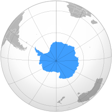
The locationAntarctia maps used for lead. shown at the width appropriate to the infobox (230 px).:
Lambert Azmuthal
Some seem to prefer the left, since it is of a type used for other continental locations. This is vague about its location, useless in expressing shape, awkward as to relationships to other land masses, and grossly inaccurate concerning relative area.
I prefer the right (Lambert Azmuthal), since it shows the shape, location and is better as to the relative area of the continent (compare Australia and Antarctica on a globe). It shows more and better information in the space available. It is also consistent with various article images and shows the relationship to the various surrounding land masses.
I have restored the image I prefer pending further discussion here.
I much prefer the azimuthal (right) map. However, I'm very used to polar projections on maps, so it is easy for me to understand what's being shown in it. Maybe people who haven't seen that sort of map before won't understand it as easily? StephenHudson (talk) 09:52, 26 April 2009 (UTC)
I suppose we have to think which map gives the best general information on Antarctica. The left hand map brilliantly shows that Antarctica is at the 'bottom of the world.' But little else. The right hand map instantly shows the shape of Antarctica but it also gives the orientation and location with respect to Australia, South America and Africa. I hope that when we get to reading a wikipedia article on Antarctica we don't need the very poor representation of the map on the left to show us where it is. I hope we shouldn't need to be catering for that level or we wouldn't get very far. I think we do have to make the exception for Antarctica because the projection designed to show the other continents of the world is inadequate. Polargeo (talk) 11:08, 26 April 2009 (UTC)
A brief explanatory caption might help readers who find the azimuthal map unfamiliar, too. I've added one. -- Avenue (talk) 12:26, 26 April 2009 (UTC)
I've restored the 'green' locator map, as opposed to the 'blue' polar map (I'll use these simpler descriptions below in lieu of mentioning the maps with the Robinson projection and Lambert azimuthal projection, respectively). There are a number of reasons:
One: other continental articles, and many other locator maps, generally use the 'green' map, so having an oddity on this page could cause confusion for those wishing to compare. Apropos, it is a locator map -- which is the main point of its inclusion upfront -- and some may not be able to place the continent (despite the obvious and the viewpoint of those in the south) in relation to north-south with the 'blue' polar map. (Also glance at the 'Regions of the world' template.) Besides, why is the other map blue -- symbolic of the cold?
Two: images and maps later in the article already exhibit Antarctica's shape, as well as its relation (in placement and size) to adjacent and other lands (e.g., comparison to Europe in size); there's room for improvement, though.
Third: the 'green' map was in place far longer than the other, and there was little to no discussion (hence, consensus) to justify and confirm the 'blue' map's placement.
So, I iterate, unless a clear consensus supports including the blue locator map, the 'green' map should stick. I would be supportive of a locator map with the 'green' map projection in prominence, with an inset of of 'blue' map projection exhibiting the continent's true shape ... of course, rendered in green. :) (Something like this, but much more refined.) Bosonic dressing (talk) 13:38, 26 April 2009 (UTC)
The better map of Antarctica has been in the article without controversy for long enough. Please wait until we have consenus before changing it. Polargeo (talk) 16:35, 26 April 2009 (UTC)
The 'green' map does not add either understanding or good aesthetics to this specific article. My desire is for the Antarctic article to be as good as it can be. I believe that this is better achieved with the 'blue' map. The 'blue' map has been unchallenged here for over 3 months and hundreds of edits. Most atlases (look in your own) recognise that the projection used to display the other continents is unable to display Antarctica. It is unstatisfactory to head up such an important article with a map that cannot display the continent which the article is about. Polargeo (talk) 20:06, 26 April 2009 (UTC)
The badly rendered and oddly coloured polar map is by no means an innovation over the preceding map: a newbie would think that Antarctica is at the centre of the world, requiring a knowledge of the shape of other landforms to place it; barring any other salient alternatives, at least this is mollified with the use of a consistent ('green') locator map. Of course, the 'green' map exhibits the LOCATION of the continent more clearly than the other map, amidst all of the continents (and not just four others) and consistent with maps at those articles, just in a different way.
As well, you speak of consensus supporting the current map, but have not demonstrated this previously or currently. The 'blue' map may have been in place for a few months amidst a few hundred edits, but the 'green' locator map was in place for many more months and many more edits before it was changed without consensus. Please garner clear consensus on the talk page before changing it yet again. Bosonic dressing (talk) 20:57, 26 April 2009 (UTC)
I have since created and inserted a map exhibiting both projections; there's a mild problem with the image's transparency, which I'll fix later. Refinements aside, this matter should be closed now. Bosonic dressing (talk) 22:43, 26 April 2009 (UTC)
Maybe the left (azimuthal projection) map need not show the entire Southern hemisphere but say the region south of 15 degrees South latitude, then Antarctica itself would feature more prominently. Apcbg (talk) 05:47, 27 April 2009 (UTC)
Bosnic. It is you who is changing the map from what it has been for the last 100+ days and 1000 odd edits with no support from the other editors. Please be aware that this is the case and wait for support. What a wikipedia page was several months ago on an Article that is viewed and edited as much as this is no argument as wikipedia is always improving. Your argument about people thinking Antarctica is at the center of the world is simply ridiculous. Polargeo (talk) 06:05, 27 April 2009 (UTC)
I think the "blue" map wins by a mile. It's not Antarctica's fault that every other continent locator map uses a projection completely unsuitable for Antarctica. I've added "The South Pole is at the centre of the map" just to be sure people know what they're looking at (and given that caption and the circles, I'm not sure there needs to be a note explaining the exact projection being used - that could be in the description on the image page). I'd also maybe like to see a further note "Eastern Antarctica is to the right" or some such to make clear what east and west are when in fact everything is north. Franamax (talk) 06:34, 27 April 2009 (UTC)
Compromise. Hi Bosonic dressing, I know you want some standardization and that can be a good thing. But I don't think it is effective in this case and anyway why are you not concerned about Europe? It was a good job putting the maps side by side but I think that ultimately made them far too small. If you think the blue map is poor could you please make a better one at the same projection. I personally don't see the problem representing Antarctica as a different color due to its being ice covered, it is a very common thing for cartographers to do this. Another suggestion is that an image with one projection above the other may work. I know this would be fairly large but that doesn't necessarily detract from the article (see Barak Obama), I would personally prefer the clearer projection at the top, but see what others think. If you are interested in doing this please give us a chance to see and respond to the images on the discussion page first and agree on it. Thanks Polargeo (talk) 08:10, 27 April 2009 (UTC)
Given this, which arguably exhibits obstinacy, I am withdrawing from this discussion. And, no, I will not be wasting more time making another map for this article. Bosonic dressing (talk) 11:02, 27 April 2009 (UTC)
I'm very sorry you feel that way but in my defense I was not the one who was making unilateral decisions to change the map in the article whilst there was an ongoing discussion about it which hadn't yet reached a conclusion. That is why I felt it was reasonable to revert. Polargeo (talk) 11:54, 27 April 2009 (UTC)
Effects of global warming
Latest comment: 15 years ago22 comments5 people in discussion
The first paragraph of this section seems to give contradictory information. There is a statement saying interior ice is growing in volume then a statement saying ice loss had increased 75% in 2006 ?? I hope this article isn’t trying to be global warming politically correct?
Perhaps this article should reference the National Snow and Ice Data Center http://nsidc.org/data/seaice_index/ and http://nsidc.org/data/seaice_index/images/s_plot_hires.png , this source shows a 3% per decade increase in Antarctic ice per decade since 1980 ! Also the first paragraph of this section indicating loss of ice contradicts the last paragraph of this section and the excellent slides showing ice from June 1979 to June 2008.
Overall this is indeed an excellent article. —Preceding unsigned comment added by 207.35.137.68 (talk) 12:58, 8 May 2009 (UTC)
The two links you gave are for sea ice and so have no relevance to the comment on 'interior ice' which is in fact grounded land ice. Yes I had thought the paragraph contradictory myself though and was awaiting a time when I had the energy to deal with it. The problem is that the science data showing net Antarctic land ice loss is really very recent stuff. Ice loss increasing by 75 % is based on a single study and 75 % is an increase from a small amount with big errors. The statement about growth in the interior is not technically wrong (look at the refs) so no need to edit this on factual grounds just really for clarity. Polargeo (talk) 13:25, 8 May 2009 (UTC)
I added the bit about net ice loss and worried a bit at the time about it being contradictory, however there is certainly controversy on the net balance, due to the differences between East and West Antarctica, so both views should be there anyway. I may have seen some other studies lately, I'll see if I can dig them up. The paper included a figure showing almost all of the changes over time around the edges and the interior relatively stable. I think the conclusion is that while snow continues to accumulate in the interior, that effect is outweighed by the faster glacier flow into the sea. Franamax (talk) 17:15, 8 May 2009 (UTC)
Oh dangit, just when I go to start reworking the section, I see Polargeo is already on it! :) I'll dump here the various sources I found before I had to send out for more browser windows:
We're dealing with a few different things here: the current situation, which is East A relatively stable/accumulating except at the margins, West A in serious outflow, and a likely net loss of ice mass; whether it's due to global warming or local climate variation (one Nature paper shows net warming in East A but it's still below zero there) (and another source discusses the attribution of changes); predictions for the future, where IPCC 2001 says net gain, but IPCC 2006 is more equivocal; and a rather arcane factor of bottom water being responsible for the increased glacial outflow, sources not included and I haven't found a review to explain where that lubricating water is coming from (I think, I'll have to check); and the ramifications of collapse of the West A ice sheet, which is partly discussed and has low probability at the moment.
The science has certainly progressed over the last few years, especially due to the GRACE experiment - and that data itself is assessed critically, since its not yet fully calibrated. Anyway, those are the links I found on investigating and I'll wait to see what Polargeo does for a while, then maybe tweak it a bit. Franamax (talk) 00:09, 10 May 2009 (UTC)
Oh yes, one other thing: the existing article cited Shepherd and Wingham in Phil Trans R Soc as saying positive mass balance, but the same principal authors are in the Science paper I link above with seemingly different conclusions in a review a year or two later. I now have the fulltext of the Science review article if anyone needs it. It seems to arrive at a majority opinion for net current mass loss, and from what I can see, RS commentary is about the conclusion that there is current net loss. Franamax (talk) 00:21, 10 May 2009 (UTC)
Great looks like you are on top of the situation. I didn't have time to do a full job of it so just tidied up some of the stuff that was there and added the GRACE links. If you can do the full job and make this much tidier then that would be excellent. I can come back in and help as necessary. See if you can find the IceSAT refs because I'm still not sure the elevation satellites are conclusively showing a net loss of ice. Whilst the outflow vs. snowfall (Rignot et al) and gravity (GRACE) are. One reason for this is the elevation (e.g. Wingham) has used radar which isn't very good around the edges of the continent (e.g. peninsular and outlet glaciers) where there is a high surface gradient (hence 72% coverage). IceSAT elevation should be better at this but IceSAT has had its own set of problems. I personally think Rignot overstates the accuracy of his study but there you go we have to go with what is published in wikipedia. Polargeo (talk) 07:57, 10 May 2009 (UTC)
A couple of other points. I think the more recent Wingham paper might be a review paper so summarising not only the radar satellite stuff. I have a real issue with this section being called effects of global warming. This is because the mass balance of the East and West Antarctic Ice Sheets is not believed to have been affected by recent atmospheric warming at all and so this just confuses everyone into thinking that any changes are a result of warming. Only the peninsula ice seems to actually be responding to warming. I work on the West Antarctic outlet glaciers so can say that the tiny warming trend shown as the big red blob in the image is not a factor. Also there is no noticable response of the sea ice to any minor warming. Somehow this needs to be made clearer and that is the real difficulty in writing this section. Polargeo (talk) 08:08, 10 May 2009 (UTC)
Yeah, I'm still hemming and hawing. The Wingham/Shepherd Science paper is indeed a review, of 6 or 8 studies. It's probably the best source, but I also found a "no such thing" site cheryy-picking statements from it, so it needs to be read carefully - and that takes me a while. :)
And yes, whether global warming itself is responsible for the overall trend is up in the air. The Nature paper shows overall warming but at a very low rate, whereas the WA and Peninsula net outflow trend is pretty dramatic. I'm troubled by the recent studies on the effects of groundwater lubrication on glacier flow, I'll have to look at whether it's an effect of percolation of surface melt through cracks or geothermal melting. OTOH if warming is responsible for the "uncorking" of glacial flow due to dissolution of the sea-ice shelves, that's an effect in itself.
I think "Effects of global warming" is still a good title though, since it's likely what people will be looking for when they come to the article. It does need to be carefully worded on the lines of these are the recently noted trends, the causative factors are unclear and these are the IPCC predictions for GW effects, and here is how they have changed over time. It's a very complex topic why weren't you down there ten years before whenever you started? :) Franamax (talk) 21:08, 10 May 2009 (UTC)
Oh yes, a naive question for you Polargeo: given that observations show sea-ice extent staying constant, is this "bound" ice (i.e. frozen to the shore) and is the thickness studied? This relates to my musing above about the "uncorking" effect which might increase the speed of glacial outflows if sea-ice is no longer impeding the outflow. The Nature Geoscience paper I already cited in the article has a figure showing a lot of outflow at the edges. Franamax (talk) 21:16, 10 May 2009 (UTC)
Some of the sea ice is fast ice, frozen to the coast, but most is pack ice, drifting as floes of various sizes from meters to km across. The sea ice is relatively thin, I think the average for Antarctica is around 2 m in winter. I've never heard or read anything suggesting the sea ice provides any kind of resistance to the glacier flow, it's probably just too thin and easily moved. I've certainly read a lot about the ice shelves impeding the outflow.
Something that the section should possibly contain early on is a description of the 3 different types of ice under discussion, since that is a source of confusion. Land ice in the form of ice sheets hundreds of meters to over 4 km thick, formed over millennia from accumulation of snow with little or no melt, uncertain current change, long response time, change in their mass will affect sea level, affected by atmc temperatures and dynamics in outflow regions. Ice shelves, floating extensions of the ice sheet, same ice as the ice sheets, hundreds of meters thick, possibly (likely?) help to slow the outflow of the ice sheet, observed to be breaking up in recent years around the peninsula and WA(?), affected by both atmc and oceanic temperatures, destructive response time decades or faster (longer to form), no real direct effect on sea level (already floating, but if they break up and allow the land ice to flow faster, there can be an indirect effect). Sea ice, floating frozen ocean water, meters thick, mostly seasonal around Antarctica (i.e. forms each winter, melts each summer), short response time for formation or destruction, stable or slightly increasing extent since 1979, no effect on sea level, affected by atmc and oceanic temperatures, and dynamics, no reliable, continuous, and widespread measurements of the thickness, so volume changes are unknown.
Regarding the lubricating effect of melt, I've heard and read about that mostly for Greenland. As I understand it, the theory proposed by Zwally is that the surface melt drains through the ice sheet to the base, possibly through a network of channels called moulins, and creates a layer of water between the ice and the rock, reducing the bed friction and allowing the ice sheet to, at least temporarily, move faster. My impression was that at this point there isn't enough melt in WA, and certainly not in EA, for this to be an effect. Some areas of the Ant ice sheet sit on water, for example the Vostok region sits on top of a subglacial lake, but that water is in equilibrium, kept at the freezing point at that pressure by a slow flux of geothermal heat, and is not newly formed or variable over seasons or decades (probably longer).StephenHudson (talk) 07:35, 11 May 2009 (UTC)
StephenHudson is spot on. The surface melt in West and East Antarctica is negligable when it comes to glacier dynamics. Most melting is just a millimeter or 2 on the top of a glacier 2km thick. So 0.5 - 1.0 degrees warming over 50 years means nothing. It is the ice shelves that are critical not the sea ice in providing the connection between the land and ocean. I would prefer the section to be entitled Changes in quantity of ice (or similar e.g. Changes in ice mass) and make big boldtype distictions (+ explanations) between ice shelves/sea ice and land ice and have a subsection entitled effects of global warming which addresses this specifically rather than falsely having the whole section under that title. Polargeo (talk) 10:37, 11 May 2009 (UTC)
OK, try this and feel free to revert the whole thing. :)
What I've done is write a completely descriptive section about Antarctic ice types with no sources whatsoever, Also perhaps reflecting my own fundamental misunderstandings, but I can only learn from that!
What I'm thinking is to at least partially decouple the notions of Antarctic ice in general, the mass balance (which gets smeared between the scientific and popular realms) and the effects of global warming. Types of ice and current mass balances can be covered in one section. Predicted future and current effects of global warming (a la IPCC and the Nature paper I found showing a tiny bit of overall warming) can be covered in the following Global warming section, which could be radically reduced. I specifically treated E.Ant and W.Ant separately since I believe there is a (unlikely) catastrophe theory owing to W.Ant having a ground base below sea level - and because the mass balances between the two are wildly different. The geology (iceology?) should be treated separately from the current conditions, and separate from the future conditions.
Anyway, what I've written can be either sourced and improved - or thrown away. No problems from my end either way! Franamax (talk) 06:58, 12 May 2009 (UTC)
And now that I think about it for 30 seconds, another way would be to do it in three sections: one to explain ice, again with the four components (sea, shelf, West, East) to set the stage; next to explain ice flux and what the current measurements are; a third to explain the theories and context versa global warming. Whatever, I wrote the new section, I'll let it live or die now. :) Franamax (talk) 07:06, 12 May 2009 (UTC)
I think it is a good start. It is written for the general reader which as a glaciologist who is very familiar with the terminology I find hard to do sometimes. A lot of work to do still but this is one way to go. Polargeo (talk) 07:23, 12 May 2009 (UTC)
Yes, I got tired of "I just need to search out one more source on this particular issue", and thought instead of what I would write in a letter to my mum or my daughter to explain things. It certainly needs a lot more work! If it's going to stay, the big question is whether to deal with the overall mass balance in that section or make another one. Then trim out the redundant stuff in the Global warming section. (And BTW I'm questioning the purpose of the image series of sea ice extent right now, since it neither proves nor disproves any hypothesis or GCM that I know of and may tend to mislead). Franamax (talk) 08:06, 12 May 2009 (UTC)
I may have jumped ahead here in taking out the first paragraph of the global warming section but we are now repeating it in more clarity above. This will improve further when more references and coverage of overall mass balance are added. It was a bit too messy and had nothing directly to do with global warming. I agree on removing the sea ice image series. The next thing is a new job which is to sharpen up/even expand the warming section (plenty to do there but could be for another day). Trouble with wikipedia on topical subjects is that people tend to randomly drop in the latest news story, which can be good at times but eventually leads to a mess. Polargeo (talk) 11:13, 12 May 2009 (UTC)
In watching this thread I correctly anticipated someone’s AGW politically correct exuberance in removing the excellent sea ice extent images (so I saved them to my computer anticipating their removal). Shame on you Franamax for censoring this subject to be politically AGW correct. —Preceding unsigned comment added by 76.67.226.49 (talk) 19:19, 17 May 2009 (UTC)
I removed the images, not Franamax, because they genuinely added nothing to the page as images. The statements on sea ice not changing over the last few decades remain on the page. I did not remove the images because I was trying to hide anything. You can simply state that sea ice hasn't changed. Do you need a large row of images of sea ice right the way across the page all looking the same? Why does global warming have to come down to ridiculous accusations. It was my suggestion to separate ice changes out from global warming because I felt that most Antarctic ice changes have little to do with Anthropogenic Global Warming (or at least it hasn't been proved yet)Polargeo (talk) 21:51, 17 May 2009 (UTC)
I think that's the first time in my life I've been accused of being politically correct. :) Given that we've been diligently assembling sources and discussing ways to improve the article; and given that the article is in fact vastly improved; whether I or Polargeo removed those images, there's absolutely nothing to be ashamed of. Thanks for contributing exactly zero to the discussion 76.67, except for your conviction that it will somehow not meet your expectations no matter what.
Polargeo, I agree that the Global warming section can now be improved and maybe expanded to reflect the uncertainty in the science. Could the IPCC assessments and projections now be added there? And I dunno if there's such a thing as a good review article discussing how much change can be attributed to man-made climate change. These are likely to be the things our readers (such as our IP friend) will be coming to read about, and we need to leave them as uncertain as the scientists are.
I'm still wrestling with the distinction between the subjects of "types" of ice; flux in those ice types; direct and generally known causative factors for the flux; and the underlying factors causing the changes. For instance, why has there been an apparent recent increase in the ice outflow/snow accumulation ratio all the way around the edges of the continent? I guess I'll have to read through all the sources again. :) Franamax (talk) 06:03, 19 May 2009 (UTC)
Very difficult. There hasn't been an increase in outflow/snow accumulation ratio all the way around the edges. Only really the Amundsen Sea Embayment in West Antarctica and a couple of places changing to a lesser extent in East Antarctica (and these EA places vary depending on which paper you look at). Then there is the peninsula which has had a lot of glaciers retreating and a good degree of warming but is really very minor in the overall context of Antarctica. The increased Amudsen Sea outflow, which is currently the main area of imbalance in the whole of Antarctica, seems to be related to deep ocean water which has been driven onto the continental shelf. But this certainly hasn't been linked directly to global warming and is not a consequence of locally warming air temperatures for damn near certainty (no scientist has even attempted to suggest this). The IPCC report is very much behind the science (which in some ways is a good thing because it doesn't change with every minor paper that comes out) and if using that as a main source it will likely read that Antarctica is not contributing much if at all to global sea level, even though recent papers suggest otherwise. The IPCC recognise that the current models are inadequate to predict future ice loss from Antarctica in an AGW environment. The glaciological community are working their backsides off to get some better models for the next IPCC report. Polargeo (talk) 22:24, 19 May 2009 (UTC)
When I say "edges" I mean "very thin strips" as in the image found here. I don't mean vast flows like the ones you stand on, and I realize that image is based on measurements from new satellite experiments and new models used in a single study (Rignot). As a semi-informed layman, that's the kind of thing that interests me.
The Amundsen Sea example is exactly what we should be explaining here to give general readers some context, so they can have a shot at understanding where the various popular media reports come from. People read (more likely view) reports of dramatic ice shelf collapses versus "there is no global warming" statements and want to find out more from a (hehe) "neutral and reliable" source. But we're all they've got. :) I suppose maybe that's where my idea to have a "Changes in ice" section comes from - to quantify and partially explicate what has been happening on the Peninsula, in the ice sheets, coming from the landmass...
The deep-water incursion theory especially should be quantified, since that's the major problem currently. What is the (summary) state of the explanations for this? Decadal trend, GW, unknown? Recent review articles outlining the knowns and unknowns would be helpful.
My suggestion to include the IPCC assessments is exactly in line with what you are saying - we should reflect that the IPCC groups are also in flux. For instance, IPCC 2001 generally saw A as an overall mitigating factor for sea-level, but IPCC 2006 explicitly noted "changes in the science since the TAR" and took a different viewpoint. This uncertainty, the lack of widespread hard data, and the new measurements should probably be noted in summary fashion here, as you've already done with the GRACE experiment. The details can go in the various sub-articles. Since the IPCC reports are prominent secondary sources, we have a responsibility to include them - but we can also use tertiary sources to describe the rapid changes in the science. (WP:PSTS)
As far as the Global warming section itself goes, I think that's where the IPCC reports belong, with appropriate weight. The Steig paper on surface-warming belongs there too, but with the caveat that minus-20 is the same thing as minus-19 as far as effects on sea-level. The GW section should contain only deinitely attributable effects, trends, and predictions.
New thought: How about a main section titled "Global effects" with subsections "Antarctic ice and global sea level"; "Current changes in ice balance"; and "Effects of global warming"?
It's an SVG instead of a PNG, so can be scaled easily.
New maps can be relatively created from existing SVGs (i.e. Europe's map - or the other SVG maps visible at File:Europe (orthographic projection).svg - can be recycled).
As an orthographic projection it allows the maps to be centred on the relevant continent or territory.
Assuming there's consensus for this, I'll post a request at Wikipedia:Graphic Lab/Image workshop (unless, of course, anyone volunteers beforehand!) However, before doing that I do want to check that there is consensus for this at each article affected. Additionally, I'm posting this at Wikipedia talk:WikiProject Geography to increase the exposure - I'd rather find out if this is a stupid idea before I start requesting new images ;-)
Personally I think it would be good if the Arctic and Antarctic maps were consistent with the continent maps. I realise that the poles may have different requirements, however.
This proposal is quite a radical proposal, affecting many articles, and deals with areas I don't normally edit in. I'm therefore prepared to be slapped down if I'm stepping on toes!
Aye, I read the discussion. The consensus seemed to be that the left-hand map was bad (which I agree with). The preferred map (right-hand side) seems (to my untutored eyes!) to be fairly similar to the map currently used at Europe - is there anything about the Europe map that would be unsuitable for Antartica? If so, could Antarctica's map be used as the template, instead of Europe's?
Personally, I like the look of the map of Europe more than the one of Antarctica, although they don't differ much in the essentials. Showing the curvature of the Earth is a nice feature. Green doesn't seem like the best colour for Antarctica, though. -- Avenue (talk) 11:13, 11 June 2009 (UTC)
If there's support for using Europe's style of map, I'd suggest blue be used instead of green for Antarctica? I also think that latitude/longitude lines need to be more clearly defined: Europe's are a bit too "washed out".
I have no objections to the current Europe map. Would be good to see a sample of a similar map for Antarctica before going ahead with changes but a standardization that works for all continents with a decent projection to show Antarctica properly is all I would be looking for. I think blue would work better than green for Antarctica but I am more concerned about the projection. Polargeo (talk) 12:09, 12 June 2009 (UTC)
Good looking image. Better than current one. One small thing is that I think it is slightly more difficult to identify the surrounding continents. But no objections to this image being used. Polargeo (talk) 06:52, 22 June 2009 (UTC)
Orthographic projections render shapes and areas distorted, particularly near the edges -- so, there's no way around that without using a different projection. Anyhow, given the above, I have placed the new map in the article, with updated caption. There you go. Bosonic dressing (talk) 07:23, 22 June 2009 (UTC)
Territorial Claims
Latest comment: 14 years ago1 comment1 person in discussion
The article reads "the validity of these claims are generally not recognised universally", with a footnote leading to the CIA World FactBook. This shouldnt be taken seriously, I suppose. How can someone say that the validity of territorial claims is gennerally not recognised by pointing out
the opinion of a single country? It should, even if the affirmative is true (which I dont think it is), at least acknowledge the opinion of those states that have signed the antartic treaty.LtDoc (talk) 20:24, 9 March 2010 (UTC)
Basic notes
Quick Antarctic Statistics
Area:
1.4 times bigger than the USA, 58 times bigger than the UK 13,829,430 km2
5,339,543 miles2
Ice-free area
(0.32% of total) 44,890 km2
17,330 miles2
Largest Ice Shelves Ross ice shelf:
(about the size of France)
510,680 km2
197,974 miles2
Ronne-Filchner ice shelf:
(about the size of Spain)
439,920 km2
169,850 miles2
Mountains Transantarctic Mountain chain:
3,300 km
2,050 miles
Highest 3 mountains:
Mt. Vinson - 4,892 m / 16,050 ft
(sometimes called "Vinson Massif")
Mt. Tyree - 4,852 m / 15,918 ft
Mt. Shinn - 4,661 m / 15,292 ft
Ice
Antarctica has 70% of all the world's freshwater frozen as ice - and 90% of all the world's ice.
M km3 - Million cubic kilometres Thickness
Mean
1,829 m / 6,000 ft
Mean thickness East Antarctica:
2,226 m / 7,300 ft
Mean thickness West Antarctica:
1,306 m / 4,285 ft
Maximum ice thickness:
4,776 m / 15,670ft
Lowest point - Bentley subglacial trench, depth below sea-level
2,496 m / 8,188 ft
Volume
Total:
25.4 M km3 / 6.09 M miles3
Grounded ice sheets
24.7 M km3 / 5.93 M miles3
Ice shelves:
0.7 M km3 / 0.17 M miles3
Peninsula ice:
0.1 M km3 / 0.024 M miles3
Population About 4,000 on scientific bases in the short summer 1,000 total in winter, around 25,000 summer tourists - and this place is 1.4 x bigger than the USA! There are NO permanent residents and NO native population.
Discovery and Exploration Antarctica was imagined by the ancient Greeks, but not even seen until 1820.
The first time anyone set foot on Antarctica was in 1821.
The first year-round occupation - overwintering - was in 1898.
The South Pole was first reached in 1911.
Climate 3 factors rule in Antarctica - cold, wind and altitude. Antarctica holds the world record for each of these three things.
The temperature falls as you leave the coast as the continent slopes upwards and temperature falls as you go higher.
Temperature:
Lowest recoded on earth - Vostok station -89.2°C / -128.6°F
Average summer temperature at South Pole -27.5°C / -17.5°F
Average winter temperature at South Pole -60°C / -76°F
Wind:
Mawson station in Antarctica is the windiest place on earth.
Average wind speed:
37 kmh / 23 mph
Maximum recorded gust:
248.4 kmh / 154 mph
Landforms Antarctica has many landforms - it's a continent! But for the benefit of your geography teacher, here's a few main ones:
glacier
coral reef
desert
mountain
plain
plateau
valley
nunatak
More vandalism
Hello. Just wanted to identify some vandalism in the Antarctica article! Lots of mistakes in the introduction.
Error in temperature conversion in "Effects of global warming" section
Latest comment: 14 years ago3 comments2 people in discussion
In this section, several temperature increases in the scale of °C (Celsius) are described, and converted to °F (Fahrenheit) as they were temperatures, not temperature increases. This has to be corrected to represent increases in the Fahrenheit scale correctly. The error is that while a temperature of 1°C almost equals 32°F, a temperature increase of 1°C does not correspond to a temperature increase of 32°F. Centigrade degrees are 9/5 times "larger" than Fahrenheit degrees. Also, Fahrenheit degrees consider the water freeze temperature as 32°F and its boiling temperature as 212°F, while in centigrades that's 0°C and 100°C respectively. One can notice that there are 180 degrees from 32°F to 212°F, 1.8 times the 100 degrees from 0°C to 100°C. That been said, a temperature change of 1°C in the Celsius/Kelvin scale corresponds to a change of 1.8°F in the Fahrenheit/Rankin scale. A quick example of this explanation:
I fixed the 3 cases of the error that I found. The problem came from the written out conversion being switched to the convert template, which either can't handle temperature changes, or needs an option to be given (I'm not familiar with the template). StephenHudson (talk) 07:56, 26 August 2009 (UTC)
Latest comment: 14 years ago7 comments2 people in discussion
I've just read an interesting News Feature in Nature Vol. 460 No. 7257 pp. 792-795 doi:10.1038/460792a (email me for a copy if it's not accessible for anyone).
It suggests that recent climate change in Antarctica may be primarily due to ozone depletion. Loss of UV absorption in the stratosphere due to ozone depletion cools the stratosphere by 6 deg. C and this intensifies the wind vortex around the ice cap. As a result, the continental interior is shielded from global warming effects, the periphery of the continent warms up (esp. the AP) and sea-ice increases.
I think it is worth adding this. There are several papers that suggest ozone depletion may be very significant to the Antarctic climate. The important thing is to try to not overstate a single paper and certainly not a news article, so I would suggest use all of the various qualifications that they state in Nature. I will have a look at this in the next couple of days if I can find some time. Polargeo (talk) 19:50, 5 September 2009 (UTC)
I've gone ahead and written a text-only bit on this.[4] Polargeo, I know you will work your usual magic on this (or revert it if it's all wrong). I need to put in some ref's, but it's very quite late at night for me right now. The only sources I can supply are the Nature article cited above, the Solomon paper from Science (which yes, we wouldn't want to flog too heavily) and the Turner paper from Geophysical Rev. Letters. Those last two are pretty dense to my understanding, so I'd personally prefer to rely mostly on the Nature News report - luckily there are some actual experts hanging out here! :) Franamax (talk) 11:42, 7 September 2009 (UTC)
Great. This needs the refs added in. Also 6 degrees less! Where and over what time frame? Needs to be a bit more precise as the Antarctic has not been generally cooling over the last 50 years. Polargeo (talk) 16:49, 7 September 2009 (UTC)
OK, I put in at least one ref, though I probably used the wrong {{cite}} template, will keep working at the others. The 6-degrees, I can only assume is relative to baseline for "normal" ozone concentration, the timeline I would assume would be directly correlated with ozone decrease, but yeah, I'll have to do some more reading to discern this. The first paper on ozone depletion to my mind came out mid-70's, so I'm not sure at all whether there are retrospective studies modelling the last 50 years. I don't have access to the Turner study, maybe you could shoot me a copy? The Thompson/Solomon paper seems to be saying ~10K temperature decrease [5], but timeframe and portion of the atmosphere - yep, some more reading is needed here. :) It's so much easier when you just read the news summaries! So - work in progress I suppose... Franamax (talk) 04:18, 8 September 2009 (UTC)
You have to be careful. The 10K is for the lower stratosphere during October and November, that is 6 miles up and at the time of year the ozone hole is at its largest, also a 2001 paper so worth checking on follow up research. There is no way there has been 6 degrees of cooling as an annual average in any place on the surface of Antarctica over decadal timescales. I will try to find what is actually stated but need to work out which reference this comes from. Polargeo (talk) 08:37, 8 September 2009 (UTC)
I will send you a copy of the Turner paper ASAP but I am travelling at present. I don't think it is worth spending too much time on the specific results but certainly mention it as it does add to the body of work on ozone influence on Antarctic climate. I know John Turner and most of the other authors by the way. Polargeo (talk) 08:53, 8 September 2009 (UTC)
Can we drop Nazi Germany's claims?
Latest comment: 14 years ago3 comments3 people in discussion
The header says "Countries" -- present tense -- that have a claim on Antarctica. Nazi Germany has not been a country for more than 50 years; it is hardly present tense. Let's just drop it, okay?
"Nazi Germany also maintained a claim to Antarctica, known as New Swabia, between 1939 and 1945. It was situated from 20°E to 10°W, overlapping Norway's claim. The claim was abandoned after the fall of Nazi Germany in 1945." —Preceding unsigned comment added by HAJ1300 (talk • contribs) 23:03, 7 September 2009 (UTC)
I've removed the paragraph. [6] It's a curious historical footnote, but it was unsourced and undoubtedly many different nations have made such claims. The current section appears to be about present claims to Antarctic territory, which are generally being mediated by the UN (to my knowledge). Of course I'm always willing to be reverted, or maybe this item could be sourced and moved to a more appropriate section? Franamax (talk) 04:28, 8 September 2009 (UTC)
Current claims are suspended under the Antarctic treaty, but not dropped. Seems to be a status quo has been reached. The Antarctic treaty requires all countries with claims (and other treaty countries) to agree before anything can be put into action. The treaty bans various things such as new claims, military activities and mineral extraction. I think they are all keeping the UN at arms length because they don't want their influence to be further watered down. The Nazi claim would fit nicely into History of AntarcticaPolargeo (talk) 08:23, 8 September 2009 (UTC)
Further remarks on Antarctica and ozone effect
Latest comment: 14 years ago2 comments2 people in discussion
Ozone effect on Icehouse (East Antarctica) - good or bad? Removing ozone from lower stratosphere (i.e. ozone hole) cools cold air further over Antarctica. Also ozone decrease, and carbon dioxide increase both contribute to increase in southern westerlies, which support ACC (Antarctica circumpolar current). Increase in westerlies pushes surface cold water away from Antarctica, and allows upwelling of salty warm watrer. Do we fully understand what effect ozone (increase or decrease) might have on Antarctica weather?Zanardm (talk) 04:33, 21 September 2009 (UTC)
 J. R. Toggweiler & Joellen Russell,
 Ocean circulation in a warming climate,
 Nature 451, 286-288, 17 January 2008, and references therein.
If I understand Polargeo, no we indeed do not "fully understand" the effect on weather. It looks as though the ozone depletion may be protecting the East Antarctic from warming (though even if the ozone effect wasn't there, it might not be enough warmer to actually cause significant melting of the ice cap). However the corollary effect seems to be that the "bottling up" of cold air over the main icemass has resulted in further warming of the periphery. The work you cite looks interesting. I need to read it more carefully as well as the other works mentioned above. The danger is giving too much weight to any one view, but that one is a brief review, so is a better source than the primary papers.
And of course, I only do rough drafts, Polargeo is the one with the broad knowledge of the field. When he gets the time, I'm sure he'll do the polishing! :) Franamax (talk) 05:22, 21 September 2009 (UTC)
Names of geographical features
Latest comment: 14 years ago1 comment1 person in discussion
Is there any list of internationally recognized names of Antarctic geographical features? Is there any global governing body which assigns or approves toponyms, publishes maps and charts, etc.? Is there any treaty or international agreement that covers the naming of geographical features or handles disputes? Or is it pretty much a free-for-all, with every country assigning their own names and hoping they stick? Robert K S (talk) 21:37, 13 October 2009 (UTC)
East Antarctica stability
Latest comment: 14 years ago3 comments3 people in discussion
A testable model addressing the issue of East Antarctica ice sheet stability?
A considerable portion of E. Antarctica ice (average of 1.6 km height) rests on bedrock of 2000+ ft above sea level. Ice and water tend to flow down hill. Also at least 150+ sub-glacial lakes, and also ice streams, have been detected at the base of such ice sheet. How stable is such basal environment? We have a current partial snapshot of such watery world; but no temporal context of 50, 100, or 15,000 yrs. of Holocene. Would such basal world seem isolated from topside weather and climate? Might circum-polar current temperature have any indirect effect? Or does just mass of ice sheet account for such watery world? If the latter were so, then glacial vs inter-glacial period would seem to have no relavency, other than adding or subtracting mass. How might one ascerntain whether or not all of E. Antarctica melted or sustained catastrophic fracturing (ice cube effect); resulting in elevated sea level of perhaps ~180 ft.? Might a 10,000+ ft core sample from the Isthmus of Panama indicate whether or not breaching of such isthmus has occurred, due to elevated sea level? Such 50 mi isthmus (maximum elevation of 84 ft.) formed 3 million years ago, from sea bottom uplift, together with subsequent erosive fill. Would such a core suffice to cover enough glacial and inter-glacial periods; giving an adequate sample? Would any evidence of oceanic sediment, current flows, foraminifera etc. be consistent with breaching of such isthmus; hence consistent with significant sea level elevation, consistent with E. Antarctica dissolution? Would there be any other possible causes of significant sea level elevation? Might we thus have a historical record of whether or not E. Antarctica is stable; using the Isthmus of Panama as our proxy?
If the Isthmus of Panama were opened by significant rising sea level, then Gulf of Mexico waters might egress to Pacific. This would then seem to disrupt the Gulf Stream. Hence one could also obtain sea bed cores from south more proximal aspect of Stream to see if there has been disruption of flow. This could be compared to Panama Isthmus findings, and also could serve as a proxy for significant sea level increase from East Antarctica dissolution. —Preceding unsigned comment added by 12.72.149.20 (talk) 06:41, 14 October 2009 (UTC)Zanardm (talk) 08:03, 16 October 2009 (UTC)
For record of foraminifera for < 3 million years, one has oscillations of glaciation cycles. ["http://www.nature.com/nature/journal...ture01089.html"] This approximately corresponds to geological closing of Isthmus of Panama at ~3 M yrs. Northern ice sheet formation would seem dependent on warm water with higher evaporation and subsequent percipitation. ["http://www.nature.com/nature/journal...ture01089.html"] Thus a history of cycles of N. ice sheets would seem consistent with persistence of Gulf Stream; and hence consistent with persistence of closure of Isthmus of Panama. Such persistence of Isthmus of Panama (84 ft elevation) would seem consistent with no sea surface elevation of ~180 ft. Hence cycles of glaciation, persistence of Gulf Stream, would seem consistent with no complete melting or dissolution of East Antarctica. Thus via indirect evidence, East Antarctica would seem to be historically stable.Zanardm (talk) 08:02, 16 October 2009 (UTC)
The East Antarctic Ice Sheet is not believed to have collapsed in the last 10 million years or so. Ice streams are not liquid water, they are relatively fast moving parts of the ice sheet. The subglacial lakes exist because of the huge ice mass sitting on the land. High pressure and thermal insulation which traps the geothermal heat causes melting at the base of the ice. Polargeo (talk) 13:44, 16 October 2009 (UTC)
Antarctica's top-level web domain
Latest comment: 14 years ago3 comments2 people in discussion
This link provides some brief information about Antarctica's TLD, and there's a Wikipedia article about .aq, but I didnt see any mention of it in the article (although I might have missed it). Could we squeeze a brief mention of it into the article's intro?
The caption accompanying the picture of the Arctic Cod
Latest comment: 14 years ago1 comment1 person in discussion
The description/caption for the picture focuses on illegal fishing of Patagonian Toothfish. The caption is misleading, pulls neutrality into question, and is not relavent to the article for Antarctica. —Preceding unsigned comment added by 204.88.29.34 (talk) 21:46, 4 November 2009 (UTC)
Possible incoherence with figure on Antarctic Treaty System
Latest comment: 13 years ago2 comments2 people in discussion
Has Spain reserved the right to make a land claim or not?
Peru has formally reserved its right to make a claim.
Russia has reserved its right to claim "territories discovered by Russians".[citation needed]
South Africa has formally reserved its right to make a claim.
Spain has formally reserved its right to make a claim.
United States has formally reserved its right to make a claim.
However, the infobox only lists Russia and the USA as having reserved the right to make claims. Sure this is inconsistent and needs to be fixed? Some of the sources are in a foreign language (Spanish?) which I cannot verify. Can someone with more knowledge or better resources correct this? —sroc (talk) 12:54, 24 August 2010 (UTC)
RFC: Infobox map
Latest comment: 14 years ago1 comment1 person in discussion
Latest comment: 14 years ago1 comment1 person in discussion
I've just added a link to a history of New Zealand's relationship with Antarctica which features on NZHistory.net.nz. It is quite comprehensive and is written by a professional historian. It includes many images, and some interactives and videos. I hope this is acceptable. Jamie Mackay (talk) 21:41, 19 April 2010 (UTC)
+
Ozone Depletion Contradiction
Latest comment: 14 years ago1 comment1 person in discussion
Under the Research section of the article, the last sentence states "with the ban of CFCs in the Montreal Protocol of 1989, it is believed that the ozone hole will close up over the next fifty years," but in the Ozone depletion section, it goes on to say that the ozone hole was first noticed in 1985 and "has tended to increase over the years of observation". So it is not currently decreasing in size, or at least there's no indication of that. Deleting that sentence from the research section, although it is relevant if true, would avoid this current contradiction, even if in the future the hole does in fact begin to close up. I didn't want to remove it because it is an important statement of fact, but it might not be correct after all, or at least readily apparent during this time. roastedpepper 17:14, 25 April 2010 (UTC)
CFCs in the atmosphere are still elevated.
There is nothing wrong with predicting that once CFC levels come down the ozone hole will close, though we really should offer a citation for that. CFCs accumulated in the atmosphere over decades and it will take decades for them to leave the atmosphere. Just as the weather provides for warm days and cold days, the ozone hole has good years and bad years, but I could still predict that the winter will be colder than summer. See ozone hole for more about our understanding of the dynamics of ozone depletion. Dragons flight (talk) 18:23, 25 April 2010 (UTC)
Edit request from Elosodelamariola, 2 May 2010
Latest comment: 14 years ago2 comments2 people in discussion
Not done: Besides the fact that you would need to have those uploaded first, those images are all copyright. -- /MWOAP|Notify Me\14:25, 2 May 2010 (UTC)
Image mess
Latest comment: 14 years ago3 comments2 people in discussion
There are excessive amounts of images scattered around the article, unrelated to the sections placed. It makes it hard to read and hard to follow. Consider cleaning up images. I would, but I have trouble deciding which images should stay and which should go, and how to organize the ones that stay. Andrew Colvin | Talk08:28, 28 May 2010 (UTC)
I had a quick look, and didn't notice anything obviously out of place. Did you have any particular images in mind? Cheers, TFOWRpropaganda10:35, 28 May 2010 (UTC)
Particularly the ones surounding the geography, geology, and climate sections. Maybe it's not that bad, but it feels overwhelming when reading. Andrew Colvin | Talk17:08, 28 May 2010 (UTC)
South Georgia and the South Sandwich Islands
Latest comment: 14 years ago5 comments4 people in discussion
Im not sure if they should be included here as will fell under the Antarctic treaty system and then Argentina (or anyone) could open a base there which If Im not wrong is not possible --Jor70 (talk) 14:49, 28 June 2010 (UTC)
Mmm good question, you'd need British permission to make a landing on either and British jurisdiction is recognised (although disputed by Argentina). South Georgia has a BAS base but I think in general they fall outside of the treaty, will have to check. Justintalk15:28, 28 June 2010 (UTC)
The Antarctic Treaty is fairly simple: it applies south of 60°S and only south of 60°S. The southernmost point of the South Sandwich Islands chain is Southern Thule at about 59½°S. The entire chain, along with South Georgia, are thus not included in the AT.
BAS bases in South Georgia do not come under the AT. BAS bases in Antarctica proper do.
That said, whether South Georgia and the South Sandwich Islands are geographically part of Antarctica is another matter, since political borders don't necessarily follow geographical borders. The point is arguable (the islands are south of the Antarctic Convergence) but also fairly semantic. The part of this article that mentions South Georgia (on population) does differentiate between South Georgia and Antarctica south of the 60°S. Pfainuktalk17:08, 28 June 2010 (UTC)
Thanks I dropped by to make the same point, both are too far North to be considered under the treaty. I couldn't remember of the top of my head the latitude that defined the treaty. Justintalk20:13, 28 June 2010 (UTC)
Belgica antarctica
Latest comment: 13 years ago2 comments2 people in discussion
The Antarctica article (under "Fauna") lists the midge Belgica antarctica's size as 12 mm (0.5 inches). However, the Belgica antarctica page lists the creature's size as 2-6 mm. This is a pretty significant difference, and one article needs to be corrected.12.124.197.66 (talk) 20:51, 17 September 2010 (UTC)
Latest comment: 13 years ago2 comments2 people in discussion
{{edit semi-protected}}
The Larsen B ice shelf collapsed in 2002, not in 2003 as it says in the article. 2002 is also the year given in the relevant reference.[89]


.svg)

 Not done: Besides the fact that you would need to have those uploaded first, those images are all copyright. -- /MWOAP|Notify Me\ 14:25, 2 May 2010 (UTC)
 Done - here, thanks! TFOWR 16:12, 1 November 2010 (UTC)