Rawalo (Javanese: ꦫꦮꦭꦺꦴ) is a district in Banyumas Regency, Central Java, Indonesia. Rawalo is approximately 20 kilometers south of Purwokerto, administrative center of Banyumas Regency. In 2010, the population of Rawalo was 45,268.[1]
Rawalo
ꦫꦮꦭꦺꦴ | |
|---|---|
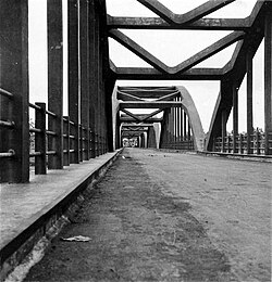
 Rawalo Bridge | |
| Coordinates: 07°30′56″S 109°10′49″E / 7.51556°S 109.18028°E | |
| Country | |
| Provinces | Central Java |
| Regency | Banyumas |
| Area | |
| • Total | 49.64 km2 (19.17 sq mi) |
| Elevation | 33 m (108 ft) |
| Population (2010) | |
| • Total | 45,268 |
| • Density | 910/km2 (2,400/sq mi) |
| Time zone | UTC+7 (WIB) |
| Ministry of Home Affairs Code | 02.33.04 |
Geography edit
Rawalo is located in the southern part of Banyumas Regency. It covers an area of 4,964 hectares, and has an average elevation of 33 meters above the sea level.[2][3]
Administrative divisions edit
In 2021, Rawalo is divided into the following 9 villages:[4]
- Banjarparak
- Losari
- Menganti
- Pesawahan
- Rawalo
- Sanggreman
- Sidamulih
- Tambaknegara
- Tipar
Education edit
There are a total of 43 schools across Rawalo, which are classified in the following table:[5]
| Type | Number | |
|---|---|---|
| Public | Private | |
| Primary schools (SD) | 22 | 1 |
| Junior High Schools (SMP) | 2 | 3 |
| Madrasah Ibtidaiyah (MI) | 0 | 10 |
| Madrasah Tsanawiyah (MTs) | 0 | 5 |
References edit
- ^ "Rawalo (District, Indonesia) - Population Statistics, Charts, Map and Location". www.citypopulation.de. Retrieved 21 December 2023.
- ^ Pengamatan Potensi Desa Di Kecamatan Rawalo [Observation of Village Potential in Rawalo District] (in Indonesian). Trisakti University. p. 184.
- ^ "Rawalo topographic map, elevation, terrain". Topographic maps. Retrieved 21 December 2023.
- ^ "BPS Kabupaten Banyumas". banyumaskab.bps.go.id. Retrieved 21 December 2023.
- ^ "Data Pendidikan Kemendikbudristek". referensi.data.kemdikbud.go.id. Retrieved 21 December 2023.

