Selected location
Usage
The layout design for these subpages is at Portal:Argentina/Selected location/Layout.
- Add a new Selected location to the next available subpage.
- Update "max=" to new total for its {{Random portal component}} on the main page.
Selected locations list
Portal:Argentina/Selected location/1
Tigre (Spanish:Tiger) is a town in the Buenos Aires Province, Argentina, situated in the north of Greater Buenos Aires, north of Buenos Aires city. Tigre lies on the Paraná Delta and is an important tourist and weekend attraction, easily reached by bus and train services, including the scenic Tren de la Costa. It is the principal town of the Tigre Partido.The town sits on an island created by several small streams and rivers and was founded in 1820, after floods had destroyed other settlements in the area, then known as the Partido de las Conchas.
Tigre is also the starting point for a visit to the Paraná Delta. For locals and tourists alike, vintage mahogany commuter launches and motorboats are the favourite way to travel through its web of inter-connecting rivers and streams. English-style rowing clubs, countless marinas, humble dwellings and elegant mansions from the “Belle Époque”, such as the Tigre Club, are to be seen, as well as small pensions and upscale lodges, restaurants, teahouses and simple picnic sites. Tigre has, in recent years, seen an influx of people relocating to the city from other parts of Greater Buenos Aires. In recent years it has seen a rise in upmarket tourism, spawning new spa developments and clientele such as the pop star, Madonna.
Portal:Argentina/Selected location/2
Buenos Aires is the capital and largest city of Argentina, and the second-largest metropolitan area in South America, after São Paulo. It is located on the western shore of the estuary of the Río de la Plata, on the southeastern coast of the South American continent. Greater Buenos Aires conurbation, which also includes several Buenos Aires Province counties (partidos), constitutes the third-largest conurbation in Latin America, with a population of around thirteen million.Strongly influenced by European culture, Buenos Aires is sometimes referred to as the "Paris of South America". The city has numerous museums, as well as the preserved homes of noted people. The city is also home to hundreds of bookstores, public libraries and cultural associations (it is sometimes called "the city of books"), as well as the largest concentration of active theatres in Latin America. It has a world-famous zoo and Botanical Garden, a large number of landscaped parks and squares, as well as churches and places of worship of many denominations, many of which are architecturally noteworthy.
Portal:Argentina/Selected location/3
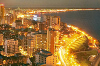
'Mar del Plata is an Argentine city located on the coast of the Atlantic Ocean, 400 km (249 mi) south of Buenos Aires. Mar del Plata is the second largest city of Buenos Aires Province. The name "Mar del Plata" had apparently the sense of "sea of the Río de la Plata region" or "adjoining sea to the Río de la Plata". Mar del Plata is one of the major fishing ports and the biggest seaside beach resort in Argentina. With a population of 614,350 as per the 2010 census [INDEC], it is the 7th largest city in Argentina.As part of the Argentine recreational coast, tourism is Mar del Plata's main economic activity with seven million tourists visiting the city in 2006. Mar del Plata has a sophisticated tourist infrastructure with countless hotels, restaurants, casinos, theatres and other tourist attractions. Mar del Plata is also an important sports centre with a multi-purpose Olympic style stadium, 5 golf courses and many other facilities. Mar del Plata continues to lead Argentina's room availability: of 440,000 registered hotel rooms nationwide in early 2009, the city was home to nearly 56,000 (5,000 more than Buenos Aires).
Portal:Argentina/Selected location/4
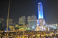
Rosario is the largest city in the province of Santa Fe, Argentina. It is located 300 km (187 miles) northwest of Buenos Aires, on the western shore of the Paraná River and has 1,159,004 residents as of the 2001 census [INDEC]. It is the third largest city in Argentina by its population with a growing and important metropolitan area. One of its main attractions includes the neoclassical architecture that has been retained over the centuries in hundreds of residences, houses and public buildings.Rosario is the head city of the Rosario Department and is located at the heart of the most important industrial corridor in Argentina. The city is a major railroad terminal and the shipping center for northeastern Argentina. Ships reach the city via the Paraná River, which allows the existence of a 34 feet (10 m) deep port. The Port of Rosario is subject to silting and must be dredged periodically. Exports include wheat, flour, hay, linseed and other vegetable oils, corn, sugar, lumber, meats, hides, and wool.
Portal:Argentina/Selected location/5
Córdoba is a city located near the geographical center of Argentina, in the foothills of the Sierras Chicas on the Suquía River, about 700 km (435 mi) northwest of Buenos Aires. It is the capital of Córdoba Province. Córdoba is the second-largest city in Argentina after the federal capital Buenos Aires. The city was founded on July 6, 1573, named after Córdoba, Spain. It was one of the first Spanish colonial capitals of the region that is now Argentina. The Universidad Nacional de Córdoba is the oldest university in Argentina. It was founded in 1613 by the Jesuit Order.Córdoba has many historical monuments preserved from the times of Spanish colonialism, especially buildings of the Roman Catholic Church. The most recognizable is perhaps the Jesuit Block (Spanish: Manzana Jesuítica), declared in 2000 as a World Heritage Site by UNESCO As the location of the first university founded in the land that is now Córdoba, Argentina has earned the nickname La Docta (roughly translated, "The Learned Lady").
Portal:Argentina/Selected location/6 Mendoza is the capital city of Mendoza Province, in Argentina. It is located in the northern-central part of the province, in a region of foothills and high plains, on the eastern side of the Andes. As of the 2001 census [INDEC], Mendoza's population was 110,993. The metropolitan population was 848,660 in 2001, making Greater Mendoza the fourth largest census metropolitan area in the country.
Ruta Nacional 7, the major road running between Buenos Aires and Santiago, runs through Mendoza. The city is a frequent stopover for climbers on their way to Aconcagua (the highest mountain in the Western Hemisphere) and for adventure travelers interested in mountaineering, hiking, horseback riding, rafting, and other sports. In the winter, skiers come to the city for its easy access to the Andes.
Two of the main industries of Mendoza area are olive oil production and wine making. The region around Greater Mendoza is the largest wine producing area in Latin America. As such, Mendoza is one of nine cities worldwide in the network of Great Capitals of Wine, and the city is an emerging wine tourism destination and base for exploring the hundreds of wineries in the region.
Portal:Argentina/Selected location/7
Bariloche is a city in the province of Río Negro, Argentina, situated in the foothills of the Andes. Surrounded by lakes (Nahuel Huapi, Gutiérrez Lake, Moreno Lake and Mascardi Lake) and mountains (Tronador, Cerro Catedral, and Cerro López), San Carlos de Bariloche is a major international tourist destination with a permanent population of 108,205 according to the 2010 census. It is famous for skiing but also known for sight-seeing, water sports, trekking and climbing. The Cerro Catedral mountain is one of the most important ski centers in South America.Tourism, both domestic and international, is the main economic activity of Bariloche, all year around. While popular among Europeans, its also a very popular attraction for Brazilians. One of the most popular activities is skiing. The most popular season to visit Bariloche is the winter, summer for North Americans and Europeans. The main ski station is the one at Cerro Catedral. The city is also famous for its chocolates and Swiss-style architecture.
Portal:Argentina/Selected location/8
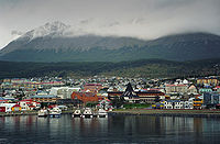
Ushuaia is the capital city of Tierra del Fuego Province, Argentina. It is regarded as the southernmost city in the world. Ushuaia is located in a wide bay on the southern coast of Isla Grande de Tierra del Fuego, bounded on the north by the Martial mountain range and on the south by the Beagle Channel. It is the only municipality in the Department of Ushuaia, which has an area of 9,390 km2 (3,625 sq mi).While there are settlements farther south, the only one of any notable size is Puerto Williams, a Chilean settlement of some 2000 residents (mostly families of the nearby military bases). Puerto Williams also calls itself the world's southernmost city, but this claim is dubious as the Chilean government itself defines a city as an urban entity with more than 5,000 inhabitants. As a center of population, commerce, and culture, and as a town of significant size and importance, Ushuaia however clearly qualifies as a city. Tourist attractions include the Tierra del Fuego National Park and Lapataia Bay. Tours also visit the Les Eclaireurs Lighthouse. Les Eclaireurs is sometimes confused with the "Lighthouse at the End of the World" (Faro del fin del mundo) made famous by Jules Verne in the novel of the same name; but the latter lies some 200 mi (320 km) east of Ushuaia on Isla de los Estados (Staten Island).
Portal:Argentina/Selected location/9 San Juan is the capital city of the Argentine province of San Juan in the Cuyo region, located in the Tulúm Valley, west of the San Juan River, at 650 m (2,133 ft) above mean sea level, with a population of around 112,000 as per the 2001 census [INDEC] (over 500,000 in the metropolitan area). It is a modern city with wide streets and well drawn avenues with wide sidewalks and vegetation of different species of trees irrigated by canals, from which it derives its nickname oasis town. The city of San Juan is located in a fertile valley within a rocky mountainous area. Winter temperatures are generally mild, averaging between 1 °C and 16 °C, but can drop below -8 °C. Summers are hot and very dry, with average temperatures between 19 °C and 35 °C, and a record maximum of 44 °C.
It has an important accommodation infrastructure and transportation. It highlights modern buildings and the surroundings, the reservoir and Ullum dam, spas, museums, large plantations of vines, and various types of agriculture, with wine being the most important. The city of San Juan completely changed its appearance from a colonial one to one of the most modern in the country after the earthquake of 1944, with well-drawn and wide paved streets, ample paths with mosaics, and forests of bananas, moreras and paradises irrigated by channels (small drains).
Portal:Argentina/Selected location/10
Salta is a city in northwestern Argentina and the capital city of the Salta Province. Along with its metropolitan area, it has a population of 464,678 inhabitants as of the 2001 census [INDEC], making it Argentina's eighth largest city. It is situated in the Lerma Valley, 1,152 meters above sea level, at the foothills of the Andes mountains.The weather is warm and dry, with annual averages of 756 mm of rainfall and an average temperature of 16.4 °C (20.4 °C in summer, 10.8 °C in winter). January and February are the months with greatest rainfall. During the spring, Salta is occasionally plagued by severe, week long dust storms.
Nicknamed Salta la Linda ("Salta the Fair"), it has become a major tourist destination due to its old, colonial architecture and the natural scenery of the valleys westward. Attractions in the city proper include the 18th century Cabildo, the neo-classical style Cathedral, and the July 9 central square. The city's museums exhibit a wide range of artifacts and art work from the native civilizations that flourished in the area (Salta is located in the Southernmost region of what was the Inca empire, belonging to the Collasuyu, one of the four areas the empire was divided until the Spanish conquest), as well as from the 16th century Spanish conquest and the colonial and post-colonial periods. Salta is also the starting point of the "Train to the Clouds" (Tren a las nubes), and on the way to red-soiled Cafayate, as well as to other nearby tourist destinations.


