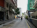
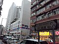
Pitt Street, named after William Pitt the Younger,[1][2][3][4][5] prime minister of the United Kingdom, and before Acts of Union 1800, of Great Britain, is a street in one of the busiest sections in Yau Ma Tei of Hong Kong, hosting several prominent sites including Kwong Wah Hospital[6][7][8][9][10][11] and the headquarters of Chinese YMCA of Hong Kong,[12][11] spanning across three thoroughfares, namely Ferry Street in the west, Waterloo Road in the east and Nathan Road in the middle, which connecting north and south of Kowloon Peninsula. While said to be in Yau Ma Tei, it could be in Mong Kok or Mong Kok Tsui, depending on context. Its name in Chinese character is 碧街, which the character 碧 /pik/, literally greenish jade,[13] is a phonetic approximation of Pitt in Cantonese and 街 a literal translation of street.[14]
| Pitt Street, Hong Kong | |||||||||||
|---|---|---|---|---|---|---|---|---|---|---|---|
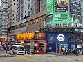
 Pitt Street, at the junction with Nathan Road | |||||||||||
| Chinese | 碧街 | ||||||||||
| |||||||||||


The street features with multi-storey buildings mixing use of commercial and residential, officially known as composite buildings, typical in urban area of Hong Kong.[15][16]
Yau Ma Tei station, joint station of Kwun Tong line and Tsuen Wan line of MTR, laying under Nathan Road, spans to the underground here with two exits, A1 and A2 on the street.[17][11] The ventilation shaft of the station behind Exit A1, with its practical appearance, was the landmark of the street facing Nathan Road. While no bus stop for franchised bus services stands on the street, there are several bus stops bearing its name Pitt Street near its junctions on other streets and roads, including nine platforms of Kowloon Motor Bus on Nathan Road, serving tens of bus routes to major destinations all over Hong Kong.
The street forms junctions with multiple streets, from west to east, Ferry Street, Tak Cheong Street, Tung On Street, Canton Road, Reclamation Street, Shanghai Street, Portland Street, Nathan Road, Tung Fong Street, and Waterloo Road. Historically, Shanghai Street was formerly known as Station Street (North/South) and Nathan Road as Coronation Road.[18] There used to be a junction with Kwong Wah Street, which was removed during the reconstruction of Kwong Wah Hospital around 1958.[19] The street, at the east end, extends beyond Waterloo Road to Chun Yi Lane, but the dual carriageway of Waterloo Road blocks the direct traffic between the street and the lane.
Tung Wah Group of Hospitals Lo Yu Chik Primary School, formerly the site of old Kwong Wah Hospital, is located west side of current hospital.[20][21] The high-rise of Chinese YWCA is also the location of YMCA College of Careers[22] and a hotel The Cityview.[12]
The latest reconstruction of Kwong Wah Hospital relocated Emergency Department, together with its entrance, from Waterloo Road to Pitt Street in 2023.[6][7][8][9] All emergency traffic was re-routed through the street.
History
edit
Great Britain took Kowloon Peninsula from China in 1860 under Convention of Peking. The development started from Tsim Sha Tsui, nearest location to the City of Victoria of Hong Kong Island and extended northward, Kwun Chung, Yau Ma Tei, Mong Kok Tsui, Mong Kok, and Tai Kok Tsui. Before the urban planning of Kowloon, Mong Kok Tsui became a rural settlement outside the urban Kowloon, increasingly populated, as illustrated in the map of Water Supply Kowloon Peninsula Central Plan.[23] British secured New Territories from China with Convention for the Extension of Hong Kong Territory in 1898. With vast new land north of the peninsula, this fuelled the development of Kowloon.
Reclamation and development of Yau Ma Tei, Mong Kok Tsui and Mong Kok
editIn 19th century, the reclamation and development north of Yaumati Police Station was centred with the extension of Station Street, which later renamed to Shanghai Street.
By 1901, Kowloon map illustrated the street, as yet unnamed, branched east and west from Station Street.[24] This location was considered situating in Mong Kok Tsui for exact and Yau Ma Tei, formerly written as Yaumati, for large area in this period.
By 1910, another Kowloon map showed cluster of streets with name related to Britain, including Pitt Street, along with Waterloo Road, Hamilton Street, Dundas Street, Portland Street, Nelson Street, Argyle Street and Fife Street.[25]
In 1913 report, a gas lamp was erected near a steam laundry.[26] In 1927 report, a sugar factory was built on Kowloon Marine Lot 48 and a knitting factory on 50.[27]
Yaumati Disinfecting Station
editFollowing the 1894 Hong Kong plague, there were several outbreak of bubonic plague. Disinfecting stations were constructed to fight against the disease by disinfecting houses and clothes, with inspectors stationed.[28]
The Public Works began to build Yaumati Disinfecting Station with quarters for inspector on Pitt Street, which remained unnamed, in 1904 and competed it in 1905, handing over to Sanitary Board in April.[29]
In 1912 report, the Public Works laid a 9" earthenware pipe sewer in Pitt Street and Waterloo Road from opposite the Yaumati Disinfecting Station to take the drainage from the new Sanitary Department Stables.[30]
Kwong Wah Hospital, Tung Wah Group of Hospitals, Lo Yu Chik Primary School and Tung Wah Museum
edit


By the time of extension to New Territories in 1898, there was no hospital for Chinese. Kai Ho proposed a hospital in Kowloon. In response to the proposal, the government offered the location of Yaumati Disinfecting Station and provided initial funds for five years in 1907. The Governor Sir Frederick Lugard, opened the hospital on 9 October 1911, reported in The China Mail.[31][32][33]
In 1915, there was budget to improve Pitt Street opposite to Kwong Wah Hospital.[34] In 1925 report, the street extended west to the Kwong Wah Hospital on Kowloon Inland Lot 1213.[35] In 1926, New block of Kwong Wah Hospital was built on Kowloon Inland Lot 1213 on the street. In 1958, there was a reconstruction of the hospital and a nurse school, moving the hospital eastward to the Waterloo, demolishing a section of Kwong Wah Street, and rebuilding the hospital with a high rise building. This resulted in a free land, on the west boundary, of 99 000 square feet of land, returned to the government.[19] The government in return gave it to Tung Wah Group of Hospital to build a school, namely Lo Yu Chik Primary School.[20] The lane beside the school is a busy shortcut from Pitt Street to Dundas Street.
Another reconstruction of Kwong Wah Hospital relocated Emergency Department, together with its entrance, from Waterloo Road to Pitt Street in 2023.[6][7][8][9]
Tung Wah Museum is the original hall of Tung Wah Hospital in 1911. It serves as mesuem with records of Tung Wah Group of Hosiptals.
Pitt Street Dust/Refuse Boat Station and pier
editThe street used to be leading to praya wall, namely sea wall. In 1923, the Public Works Department issued a tender to construct a pier for dust shoot at the end of the street.[36] It was later mentioned as Pitt Street Refuse Boat Station in 1933 report[37] and Pitt Street Dust Boat Station in 1947-48 report.[38] The old refuse pier was finally demolished, mentioned in 1961-62 report.[39]
Wah Yah College, Kowloon
editIn 1924, Peter Tsui Yan Sau initially set up Wah Yan College, Kowloon, a Catholic secondary school, on 70 Portland Street at the junction with Pitt Street. The school was later moved Nelson Street and finally settled at current premises on 56 Waterloo Road.[40][41]
Chinese YMCA, YMCA International House, The Cityview and YMCA College of Careers
edit
Chinese YMCA, formerly written as Chinese Y.M.C.A., initially serving mainly the Island side of Hong Kong. In 1928 the association began to build a hostel and hall on Kowloon Inland Lot 1483, on Waterloo Road and Pitt Street, and the construction was competed in 1929.[42][43] The Kowloon Branch began services in Kowloon side. In 1966, the headquarters moved into here and new building was erected, with a programme centre, a gymnasium and YMCA International House.[44] The building was expanded in 1993. The international house was a hostel, which rebranded to The Cityview, a 4-star hotel.[45] A continuous education centre was established and later became YMCA College of Careers, a registered school.[46]
-
 Waterloo Road view of Chinese YMCA
 -
 Entrance of Kowloon Centre


Kowloon Telephone Exchange, Bell House, London Restaurant, Mk1 Super Digital Mall and MediLink Square
edit
In 1929, a telephone exchange and staff quarters was completed on Kowloon Inland Lot 754 on Nathan Road, spanning between Waterloo Road and Pitt Street.[43] It was known as the Kowloon Telephone Exchange of the Hong Kong Telephone. This building was demolished on or before 1963, replaced by a commercial and residential building, Bell House, which named after Alexander Graham Bell, the inventor of telephone. The building is 200 feet high, with twenty-storey in six block.[47][48]
London Restaurant, a large Chinese restaurant, occupying a few floors, opened in 1960s. It soon became a major restaurant in Yau Ma Tei/Mong Kok, having branches in Mong Kok and Hung Hom. The restaurant closed after 27 years in 2005, with 200 workers losing their jobs, and only the Mong Kok one remains open.[49][50][51] The Mong Kok restaurant became a tourist hotspot.[52][53][54]
The floors of the restaurant once was converted to a shopping centre, first Mk1 Super Digital Mall, selling digital products, then MediLink Square, selling medical products, and later MediLink Square was occupied by a spa and sauna, Windsor Spa.[55][56][57][58]
-
 MediLink Square
 -
 Spa at the former location of London Restaurant
.jpg)

Tak Yu Restaurant and Tak Yue Mansion
edit
In 1920s, Tak Yu Restaurant, one of oldest restaurants in Hong Kong, was built at 372-378A Shanghai Street, at the southeast corner of the junction with Pitt Street. In 1967, the restaurant was rebuilt as a high-rise Tak Yue Mansion, with the restaurant continuing its operation on lower floors.[59] In 2012, the restaurant ceased to operate and the whole building was sold in 2019 and later the premises of the restaurant turning into a care home.[60][61][62][63]
-
 Tak Yu Mansion
 -
 Interior of Tak Yu Restaurant, Ground Floor


Tung Nam Seafood Restaurant, Tung Nam Commercial Centre and Tung Nam Lou Art Hotel
editIn 1950, Tung Nam Seafood Restaurant was established, providing traditional Cantonese cuisine. In 1994, the restaurant was rebuilt as Tung Nam Commercial Centre, a twenty-three storey office building. In 2019, the buildings become Tung Nam Lou Art Hotel, featuring with art and culture.[64][65]
Kam Wah Theatre and Kam Wah Building
edit
In 1954, Kam Wah Theatre, a theatre-cinema with 2180 seats, commenced at southwest corner of the junction with Canton Road on 21 December, which operated till 21 September 1970. The theatre, of modern appearance with green and buff in colour, was designed by Iu Tak Lam.[66] The area around theatre used to be very crowd with stalls of Dai pai dong next to it.[67] The building was demolished and replaced with Kam Wah Building.[68]
-
 Another view of Kam Wah Building
 -
 Front door to the building


Street market
edit
The street used to be a street market and stalls occupied sides of the street. Only a few remains because the government discourage it.[69] The market had a lot of Dai pai dong around Kam Wa Theatre.[67]
-
 Street market

1967 Riots and bombs
edit1967 Riots of Hong Kong was territory-wide and prolonged. Chinese communists in Hong Kong, encouraged by Cultural Revolution and 12-3 incident, fought against British colonial rule with homemade bombs, real or fake. On 6 September 1967, a pretentious couple intended to install a bomb on the street. Although they acted intimately, walked arm in arm, carried a paper bag, their nervous betrayed them, inviting a Chinese police inspector's suspicion. A squad of policemen followed the couple secretly, caught them and seized the bomb at the junction with Shanghai Street. Despite detonated by a bomb disposal officer, the bomb was powerful enough to break six panes of glass of a herbal tea shop. The story was reported by Wah Kiu Yat Po, and communist newspaper Ta Kung Pao, and pro-nationalist newspaper Kung Sheung Daily News.[70][71][72]
-
 Report by Wah Kiu Yat Po
 -
 Report by Ta Kung Pao
 -
 Report by Kung Sheung Daily News


Fire of Po Cheung Building
editOn 6 March 2021, a serious fire in Po Cheung Building, at the corner of Pitt Street and Reclamation Street, killed one man and hurt thirteen people, including a fireman. The fire began with a flat partitioned into seven dwellings with wooden broads. Residents escaped to the roof or dangerously climbed out of windows. Fire Services Department deployed 102 people and 17 fire engines to rescue. Its officers suspected that it was an arson, with sign of inflammable substance.[73][74][75][76][77][78][79] District councillors urged a review of fire regulations on old buildings due to frequent serious fires at that time.[80][81][82][83]
COVID-19 pandemic
edit
During COVID-19 pandemic in 2020 to 2023, there was a territory-wide panic, together with stringent regulations and enforcement. The street suffered from quarantine several times. Residents did allow to leave their home, in some periods, the area. Some shoppers on the street fled at once when heard of the quarantine news. The government would trace residents in the unresponsive residences.[84][85][86][87]
Events
editMurder of night watch worker
editOn 19 February 1930, a worker of firewood company was murdered and robbed at 9 Pitt Street, company's warehouse for storing wood, on the ground floor in the night. In the morning next day, the murder was discovered as the backdoor on the back street was broken. It was estimated thirteen Hong Kong dollars was lost.[88]
Murder of coal boat worker
editOn 3 July 1933, a worker of coal boat was murdered on a back street of Pitt Street, close to praya. The victim's head was damaged by an axe.[89][90][91][92]
Fire of oil shop
editOn 30 September 1939, an oil shop at 13 Pitt Street was burn down. A 3-year-old boy was killed in the fire. The damage cost one thousand Hong Kong dollar.[93][94]
Murder of woman
editOn 11 November 1946, a woman living on second floor of 45 Pitt Street was robbed and murdered by several robbers. She was strangled to death.[95]
Armed robbery
editOn 11 January 1950, six robbers robbed a shop with pistols at 48 Pitt Street. Robbed properties of gold and cash, were worth three hundred and sixty Hong Kong dollars at that time. The owner with police recognised one robber on Woosung Street and the police arrested the robber on 13 January. Later, other robbers are arrested on fourth floor, 16 Tung Choi Street.[96][97] Six men and one woman were sentenced.[98][99]
Transportation
editRoad
edit
Most part of the street allows motor vehicles. Except on the west side of Nathan Road, MTR ventilation shaft and exit occupied part of the street. This section between Nathan Road and Portland Street is a cul-de-sac.[100]
On the east side of Shanghai Street, a barrier was erected to reduce traffic in this section of street, where a small street market with several stalls on the street. This section between Shanghai Street and Reclamation Street is a cul-de-sac.[101]
On the east side of Nathan Road, half of street is for MTR exit and a small section of the street is narrowed.[69]
To improve the traffic in the area, all sections of the street, expect two cul-de-sac, are one-way traffic, moving from west to east.
The government designates parking spaces along the street, including some for the disabled.[102][103]
The entrance to Accident and Emergency Department of Kwong Wah Hospital is on this street.[6][7][8][9] A long bay of the street is provided for pick-up or drop-off for patients.
-
 Pitt Street, east section
 -
Pitt Street, west section
-
 Lorry parking spaces
 -
 Motorcycle parking spaces
.JPG)


Railway
edit
MTR provides services to the area around the street by Yau Ma Tei station, with two direct lines, Kwun Tong Line, from Whampoa station to Yau Tong station, and Tsuen Wan Line, from Tsuen Wan station to Central station. The station has two exits on the street. Exit A1 is on the section between Nathan Road and Portland Street. Exit A2 is one the section between Nathan Road and Tong Fong Street.[11][17] Both exits were not an accessible, non-barrier free exit, providing only staircases. Although Exit A2 is the nearest exit to Kwong Wah Hospital, people on wheelchairs or carrying baby with pushchairs must go to the lift at Exit Lift on Waterloo Road to reach the ground, and cross several the roads.[104] Yau Tsim Mong District Council had proposed the a subway to link Yau Ma Tei station and Kwong Wah hospital, the Highways Department considered the proposal infeasible as it required reconstruction of the ventilation duct of tunnel and station, and closure of Exit A2 and two lanes of Nathan Road for more than two years.[105]
-
 Destinations of Exit A1 and A2 were posted on a wall inside tunnel of the station
 -
 Exit A1 on Pitt Street, west bound
 -
 Exit A2 on Pitt Street, east bound


Bus
editFranchised
edit
Franchised bus services in this area is provided by Kowloon Motor Bus and Citybus. No bus route through this street but some bus stops are close to the street, and some of them even named after the street.
On Waterloo Road, north of street junction has Kwong Wah Hospital bus stop, and south YMCA bus stop.[18]
On Nathan Road, there are many bus stops either named Pitt Street or Pitt Street Yau Ma Tei, placed both north and south of the street, both north-bound and south bound of Nathan Road. Numerous bus routes have a stop here, serving major destinations all over Hong Kong.[18]
On Shanghai Street, south of street junction has Pitt Street bus stop.[18]
-
 Commuters queueing at Pitt Street bus stop
 -
 North-bound platform N47, one of Pitt Street bus stops
 -
 North-bound platform N48, one of Pitt Street bus stops
 -
 a Pitt Street bus stop, decorated during Dragon Boat Festival
 -
 Pitt Street bus stop of Citybus and New World First Bus


.jpg)

Non-franchised
editTransport Department permits several residential services on the street, route KR11, KR12 and KR13.[106][107][108]
Cross-border
editThere is a bus stop for cross-border bus services near Pitt Street on Shanghai Street,[109][110]
-
 Cross-border bus stop, Pitt Street stop (label in Chinese 碧街站)
 -
 Cross-border bus


Business
editHotel
editThere are two hotels on the street, The Cityview, and Tung Nam Lou Art Hotel.
The Cityview on the premises of Chinese YMCA of Hong Kong, formerly YMCA International House. After renovation in 2008, the hostel transformed to a 4-star hotel and rebranded as The Cityview.[45]
Tung Nam Lou Art Hotel, situated at the junction of Pitt Street and Portland Street, was established in 2019, featuring with art and culture.[64]
-
 The CityView
 -
 Tung Nam Lou Art Hotel


Cuisine
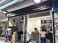
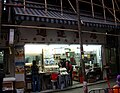
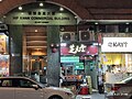
editThere are wide range of cuisine on the street, mostly indigenous food of Hong Kong, such as Cha chaan teng, Chinese restaurant, dim sum shop, fish ball shop, herbal tea shop, deep fried food shop, Cantonese cake shop and noodle shop.
-
 Noodle shop in the morning
 -
 Small restaurant. Dai Pai Dong style.
 -
 Bakery
 -
 Hong Kong style cake shop
 -
 Cha chaan teng
 -
 Fish ball
 -
 Deep fried foods
 -
 Dim sum shop
 -
 Herbal tea shop
.jpg)


Education
editYMCA College of Careers
edit
YMCA College of Careers, located on the section between Waterloo Road and Tung Fong Street, is an education institute set up by Chinese YMCA and is in the headquarters of Chinese YMCA. Originally it was a continuous education centre. In 1995, the centre became a registered school and renamed YMCA College of Careers.[46] It provides various programmes of certificates and higher certificates on different subjects.
-
 Another view on Pitt Street

Tung Wah Group of Hospitals Lo Yu Chik Primary School
edit
Tung Wah Group of Hospitals Lo Yu Chik Primary School, on the section between Kwong Wah Hospital and the back lane on the west, is a primary school adjacent to Kwong Wah Hospital.[21] The school, organised by Tung Wah Group of Hospitals, was built on the land formerly part of the hospital when the hospital was reconstructed in 1958.[19][20]
The school building is a multi-storey building, occupying east, north and west side, with open area facing Pitt Street.
-
 View from Pitt Street, with three linked blocks of multi-storey buildings
 -
 Its back lane on the west is very crowd.
 -
 Back lane with school mural

.JPG)

Vicinity
editTung Wah Museum
edit
Tung Wah Museum, at the centre of Kwong Wah Hospital, is a museum of traditional Chinese architecture of 1911. It was the main hall of original Kwong Wah Hospital serving as waiting hall for patients. In 1931, the hospital, together with Tung Wah Hospital and Tung Wah Eastern Hospital, formed Tung Wah Group of Hospitals. This hall survived during reconstruction of the hospital in 1958. The group converted it into museum and named Tung Wah Museum in 1970, in the centenary of the group, counting from the establishment of Tung Wah Hospital of 1870. The museum has collections of antique and records. It was declared a monument in 2010.[111][112]
In's Point
edit
In's Point, or In's Point Shopping Arcade, is a three-storey shopping centre above ground floor, south of Pitt Street, on east side of Nathan Road, formerly Chung Kiu Chinese Products Emporium. Inside, it divided into many small units, featuring with toy stores, especially LEGO minifigures,[113] also vintage collectibles.[114] The shopping centre turns active around six to seven o'clock in the evening when the business owners come after office. In evening the neon light turns on, resemble to old days of Hong Kong.[115] Its whole top floor is occupied by Ho Choi Seafood Restaurant, a Cantonese restaurant.[116]
-
 Old neon signs
 -
 Old neon signs
 -
 In day time
 -
 In's at the busy junction of Nathan Road and Waterloo Road


Ward Memorial Methodist Church and Yang Memorial Methodist Social Service
edit
Ward Memorial Methodist Church, opposite to Pitt Street on Waterloo Road and Chun Yi Lane, is a Methodist church established in 1954, with church building completed in 1967. This church became a member of The Methodist Church, Hong Kong when British Methodist missionary and American Methodist missionary in Hong Kong merged into one Methodist church in 1975.[117] It also hosts Yang Memorial Methodist Social Service, the church's organisation offering social service to public, established in 1967.[118]
-
 Front entrance of Ward Memorial Methodist Church
 -
 Founding stone


Truth Lutheran Church and Daosheng Bookstore
edit
Truth Lutheran Church, opposite to Pitt Street on Waterloo Road and Chun Yi Lane, is a Lutheran church established in 1963. It is also the head church of Evangelical Lutheran Church of Hong Kong.[119] The church, designed by Eric Cumine, is a modernist church by style.[120][121]
Daosheng Bookstore, an Christian bookstore, is at the south end of the church, providing books and materials for spiritual, life and bible study.[122]
-
 Daosheng bookstore
 -
 Another angle
 -
 John 14:6


Waterloo Road/Ferry Street Sitting-out Area
editWaterloo Road/Ferry Street Sitting-out Area, opposite to the west end of Pitt Street, is a long pocket park under Ferry Street Flyover. It is a strip between two ways of Ferry Street, began with Waterloo Road in the south. The flyover serves as a large rain shelter to the park. The park features with pet garden and model car play area.[123][124]
References
edit- ^ "William Pitt the Younger". geniuses.club. Retrieved 2024-05-01.
- ^ "William Pitt The Younger / Useful Notes". TV Tropes. Retrieved 2024-05-01.
- ^ "William Pitt: Father and son - Hektoen International". hekint.org. 2024-01-10.
- ^ "今日信報 - 副刊文化 - 碧街與皮特 - 林創成 - 嚮往發呆". 信報網站 hkej.com (in Chinese (Hong Kong)). Retrieved 2024-05-01.
- ^ "香港地方 - 道路名稱(五)英官員命名道路". Archived from the original on 2020-08-16. Retrieved 2010-03-23.
- ^ a b c d Kong, Dimsumdaily Hong (2023-05-31). "Kwong Wah Hospital opens new emergency department today". Dimsum Daily. Retrieved 2024-05-01.
- ^ a b c d "New Accident and Emergency Department commences at Kwong Wah Hospital on Wednesday - HA Connect". www.ha.org.hk. Retrieved 2024-05-01.
- ^ a b c d "Kwong Wah Hospital to open new A&E unit on Wednesday - RTHK". news.rthk.hk. Retrieved 2024-05-01.
- ^ a b c d Standard, The. "New A&E dept commences at Kwong Wah Hospital on Wed". The Standard. Retrieved 2024-05-01.
- ^ HERITAGE IMPACT ASSESSMENT FOR TUNG WAH MUSEUM In Respect of THE REDEVELOPMENT OF KWONG WAH HOSPITAL (PDF). May 2015.
- ^ a b c d Minutes of the 19th Meeting of the Yau Tsim Mong District Council (2020-2023) (PDF). Yau Tsim Mong District Council. 29 November 2022.
- ^ a b "Location – The Cityview – Chinese YMCA of Hong Kong". thecityview.com.hk. Retrieved 2024-05-01.
- ^ "漢語多功能字庫 碧". humanum.arts.cuhk.edu.hk. Retrieved 2024-05-01.
- ^ "漢語多功能字庫 街". humanum.arts.cuhk.edu.hk. Retrieved 2024-05-01.
- ^ "Hong Kong e-Legislation". www.elegislation.gov.hk. Retrieved 2024-05-01.
- ^ "Dense DomestiCities: Composite Building Histories in Hong Kong, 1950s-1970s | HKU Faculty of Architecture". www.arch.hku.hk. Retrieved 2024-05-01.
- ^ a b "油麻地站街道圖 Yau Ma Tei Station street map" (PDF). MTR.
{{cite web}}: CS1 maint: url-status (link) - ^ a b c d "OpenStreetMap". OpenStreetMap. Retrieved 2024-05-01.
- ^ a b c "Hong Kong and Far East builder, vol.13 no.6 (October - November - December, 1958)". digitalrepository.lib.hku.hk. Retrieved 2024-05-01.
- ^ a b c "學校資料". www.twghlycp.edu.hk. Retrieved 2024-05-01.
- ^ a b "學校位置圖". 東華三院羅裕積小學.
- ^ "Contact Us". YMCA College Of Careers 青年會專業書院. Retrieved 2024-05-01.
- ^ Water Supply Kowloon Peninsula Central Plan. 1896.
- ^ "Plan of Kowloon in 5 sheets. Public Works Department, Hong Kong, 1901. 200 feet to 1 inch. Author, Publisher, &c.: Official, London". www.hkmaps.hk. Retrieved 2024-05-01.
- ^ "Kolwoon Penisula, Colony of Hongkong (corrected to 1910)". www.hkmaps.hk. Retrieved 2024-05-01.
- ^ "Hong Kong. Public Works Department. Annual departmental report,1913". digitalrepository.lib.hku.hk. Retrieved 2024-05-01.
- ^ "Public Works, 1927" (PDF).
- ^ "The Hong Kong Plague". Soldiers of Shropshire Museum.
- ^ "Disinfecting station, Yau Ma Tei [c.1905- ] | Gwulo". gwulo.com. Retrieved 2024-05-01.
- ^ Report of Director of Public Works for the Year 1912 (PDF). pp. P57.
- ^ "Kwong Wah Hospital, Kowloon [????- ] | Gwulo". gwulo.com. Retrieved 2024-05-01.
- ^ "The China Mail, 1911-09-30". mmis.hkpl.gov.hk. p. 6. Retrieved 2024-05-01.
- ^ China Mail 1911-09-30. The China Mail. 1911-09-30.
- ^ "Hong Kong. Estimates of revenue and expenditure for the year 1915". digitalrepository.lib.hku.hk. Retrieved 2024-05-01.
- ^ Report of Director of Public Works for the Year 1925 (PDF). pp. Q38.
- ^ No. S. 347 (PDF). 1923-10-12.
- ^ "Hong Kong. Public Works Department. Annual departmental report,1933". digitalrepository.lib.hku.hk. Retrieved 2024-05-01.
- ^ "Hong Kong. Public Works Department. Annual departmental report,1947-1948". digitalrepository.lib.hku.hk. Retrieved 2024-05-01.
- ^ "Hong Kong. Public Works Department. Annual departmental report,1961-1962". digitalrepository.lib.hku.hk. Retrieved 2024-05-01.
- ^ "Wah Yan College, Kowloon [????- ] | Gwulo". gwulo.com. Retrieved 2024-05-01.
- ^ Report of Director of Public Works for the Year 1927 (PDF).
- ^ Report of Director of Public Works for the Year 1928 (PDF). pp. Q17.
- ^ a b Report of Director of Public Works for the Year 1929 (PDF).
- ^ "About Us | Chinese YMCA of Hong Kong". www.ymca.org.hk. Retrieved 2024-05-01.
- ^ a b "Milestone – The Cityview – Chinese YMCA of Hong Kong". thecityview.com.hk. Retrieved 2024-05-01.
- ^ a b "Message from Principal". YMCA College Of Careers 青年會專業書院. Retrieved 2024-05-01.
- ^ "Hong Kong and Far East builder, vol.18 no.3 (October 1963)". digitalrepository.lib.hku.hk. Retrieved 2024-05-01.
- ^ "Kowloon Telephone Exchange [1929-c.1967] | Gwulo". gwulo.com. Retrieved 2024-05-01.
- ^ "開業27年 長期虧蝕 倫敦大酒樓將結業 8/10/2005". the-sun.on.cc. Retrieved 2024-05-01.
- ^ "飲食工會助油麻地倫敦大酒樓員工爭取合理補償 < 消息總覽 < 消息快遞 - 香港工會聯合會". www.ftu.org.hk. Retrieved 2024-05-01.
- ^ "【經典老店】事必躬親 倫敦酒樓 | 蘋果日報•聞庫". 聞庫. 2018-09-21. Retrieved 2024-05-01.
- ^ sunflower19 (2019-03-14). "【香港グルメ:旺角】飲茶と言ったら!倫敦大酒樓". Cathy's blog in 香港 🌻🇭🇰 (in Japanese). Retrieved 2024-05-01.
{{cite web}}: CS1 maint: numeric names: authors list (link) - ^ "『DAY2 倫敦大酒樓で朝飲茶』". LCC 弾丸トラベラー KEIKOのブログ (in Japanese). Retrieved 2024-05-01.
- ^ "『ロンドンレストラン倫敦大酒樓』". かぼちゃ旅行記 (in Japanese). Retrieved 2024-05-01.
- ^ "舖王鄧成波7億入貨 - 地產新聞". www.property.hk. Retrieved 2024-05-01.
- ^ 串哥 (2011-01-24). "一個時代的終結: MK1超級數碼廣場終於「熄燈」". 香港 unwire.hk 玩生活.樂科技 (in Chinese (Taiwan)). Retrieved 2024-05-01.
- ^ "地產新聞及樓市分析 | 地產站 Property Station". ps.hket.com. Retrieved 2024-05-01.
- ^ "Windsor SPA 薀莎水療 – Windsor SPA". Retrieved 2024-05-01.
- ^ "得如樓大廈 (Tak Yue Mansion) 旺角|搵地 (OneDay)". 香港搵樓|租樓|二手盤|買樓|搵地. Retrieved 2024-05-01.
- ^ 曾鳳婷 (2020-09-01). "【集體回憶】百年得如酒樓舊址新去向揭盅 料新舖9月底開業". 香港01 (in Chinese (Hong Kong)). Retrieved 2024-05-01.
- ^ "得如酒樓 (油麻地)". OpenRice 香港開飯喇 (in Chinese (Hong Kong)). Retrieved 2024-05-01.
- ^ Creativity, Aspiration + (2002-12-08), 得如酒樓 Tak Yu Restaurant 2011, retrieved 2024-05-01
- ^ "香港老店|盤點已消失的香港茶樓 你最懷念哪一間? | 飛凡香港 | 樂活灣區". 當代中國. Retrieved 2024-05-01.
- ^ a b Hotel, Tung Nam Lou Art. "About Us". www.tungnamlou.com. Retrieved 2024-05-01.
- ^ Bradley, Faye (2021-12-31). "東南樓藝術酒店是在油麻地的藝術創意中心". CSP Times (in Chinese). Retrieved 2024-05-01.
- ^ "Hong Kong and Far East builder, vol.10 no.5 (January & February & March, 1954)". digitalrepository.lib.hku.hk. Retrieved 2024-05-01.
- ^ a b "街坊集體記憶-空間-大牌檔-金華戲院至旺角一帶的大牌檔 (無障礙瀏覽版本)". www.hkmemory.org. Retrieved 2024-05-01.
- ^ "Kam Wah Theatre / 金華戲院 [1954-1970] | Gwulo". gwulo.com. Retrieved 2024-05-01.
- ^ a b "Google Maps". Google Maps. Retrieved 2024-05-01.
- ^ 華僑日報 1967-09-07 (in Chinese). 1967-09-07.
- ^ 香港工商日報 1967-09-07 (in Chinese). 1967-09-07.
- ^ 大公報 1967-09-07 (in Chinese). 1967-09-07.
- ^ "Fire at Hong Kong tenement kills one, injures 10 others, including a firefighter". South China Morning Post. 2021-03-06. Retrieved 2024-05-01.
- ^ Kong, Dimsumdaily Hong (2021-03-06). "Fire breaks out at tenement building in Mong Kok resulting in 1 death and 13 injuries". Dimsum Daily. Retrieved 2024-05-01.
- ^ 余睿菁, 楊婉婷, 黃廸雯 (2021-03-06). "油麻地奪命火|火場曝光 板間房木板成灰燼 碌架床燒剩鐵架". 香港01 (in Chinese (Hong Kong)). Retrieved 2024-05-01.
{{cite web}}: CS1 maint: multiple names: authors list (link) - ^ "油麻地寶祥大樓起火釀1死13傷 有消防員受傷送院-香港商報". www.hkcd.com. Retrieved 2024-05-01.
- ^ 陳諾希, 邵沛琳, 黃偉民 (2021-03-06). "油麻地奪命火|男子伏屍「板間房」大門口 起火單位嚴重焚毀". 香港01 (in Chinese (Hong Kong)). Retrieved 2024-05-01.
{{cite web}}: CS1 maint: multiple names: authors list (link) - ^ "華僑報". www.jornalvakio.com. Retrieved 2024-05-01.
- ^ "油麻地板間房失火1死13傷 警列縱火交重案組調查". on.cc東網 (in Chinese (Hong Kong)). 2021-03-06. Retrieved 2024-05-01.
- ^ 關注油麻地碧街唐樓大火 要求加強巡查及加快改善舊樓消防設施 (PDF). 2021-03-15.
- ^ "火災單位板間房「一開七」 附近同類大廈消防隱患多". on.cc東網 (in Chinese (Hong Kong)). 2021-03-06. Retrieved 2024-05-01.
- ^ "油麻地寶祥大廈火警 特區政府設跨部門援助站". 大公文匯網 (in Chinese). Retrieved 2024-05-01.
- ^ 東網, on cc. "4個月內2宗舊樓奪命火 政府修訂消防條例太慢捱轟 | on.cc 東網". LINE TODAY (in Traditional Chinese). Retrieved 2024-05-01.
- ^ "油麻地受限區域有魚檔檔主店內留宿 商戶早上如常營業". Yahoo News (in Chinese). 2021-02-05. Retrieved 2024-05-01.
- ^ "油麻地碧街受限範圍解封 330人檢測1人確診". Now 新聞 (in Chinese (Hong Kong)). 2021-01-27. Retrieved 2024-05-01.
- ^ "果斷戰疫/碧街突擊封檢 - 大公報". 大公文匯 www.tkww.hk. Retrieved 2024-05-01.
- ^ "油麻地碧街東安街封區強制檢測 居民大排長龍斥混亂". on.cc東網 (in Chinese (Hong Kong)). 2021-01-26. Retrieved 2024-05-01.
- ^ 香港華字日報 1930-02-20 (in Chinese). 1930-02-20.
- ^ 香港工商日報 1933-07-04 (in Chinese). 1933-07-04.
- ^ 工商晚報 1933-07-04 (in Chinese). 1933-07-04.
- ^ 天光報 1933-07-05 (in Chinese). 1933-07-05.
- ^ 香港工商日報 1933-07-05 (in Chinese). 1933-07-05.
- ^ 香港華字日報 1939-10-01 (in Chinese). 1939-10-01.
- ^ 香港工商日報 1939-10-20 (in Chinese). 1939-10-20.
- ^ 香港工商日報 1947-02-08 (in Chinese). 1947-02-08.
- ^ 華僑日報 1950-01-15 (in Chinese). 1950-01-15.
- ^ 香港工商日報 1950-01-15 (in Chinese). 1950-01-15.
- ^ 大公報 1950-05-18 (in Chinese). 1950-05-18.
- ^ 香港工商日報 1950-05-18 (in Chinese). 1950-05-18.
- ^ "Google Maps". Google Maps. Retrieved 2024-05-01.
- ^ "Google Maps". Google Maps. Retrieved 2024-05-01.
- ^ On-street Parking Spaces Designated for the Disabled (PDF). 31 December 2022.
- ^ On-street Parking Spaces Designated for the Disable (PDF). 31 March 2024.
- ^ "MTR > Barrier-free Facilities Search". www.mtr.com.hk. Retrieved 2024-05-01.
- ^ Minutes of the 19th Meeting of the Yau Tsim Mong District Council (2020-2023) (PDF).
- ^ Regalia - Pitt Street, Yau Ma Tei (PDF).
- ^ King's Park Villa - Tung Fong Street (PDF).
- ^ King's Park Hill - Pitt Street (PDF).
- ^ "永東集團(國際)有限公司-永東直巴-永東旅行社". www.eebus.com. Retrieved 2024-05-01.
- ^ 黃偉倫 (2023-01-05). "通關|跨境直通巴恢復往深圳灣 即將加開廣州、佛山班次". 香港01 (in Chinese (Hong Kong)). Retrieved 2024-05-01.
- ^ "Antiquities and Monuments Office - Declared Monuments in Hong Kong - Kowloon (204)". www.amo.gov.hk. Retrieved 2024-05-01.
- ^ "Explore the Museum - TWGHs Records and Heritage Office". rho.tungwah.org.hk. Retrieved 2024-05-01.
- ^ "In's Point – The Cityview – Chinese YMCA of Hong Kong". thecityview.com.hk. Retrieved 2024-05-01.
- ^ "In's Point | Hong Kong Tourism Board". Discover Hong Kong. Retrieved 2024-05-01.
- ^ "In's Point". eastbounder 東遇. Retrieved 2024-05-01.
- ^ "好彩海鮮酒家 (現時點) Ho Choi Seafood Restaurant (In's Point)". HeyChoices (in Chinese (Taiwan)). Retrieved 2024-05-01.
- ^ "教會簡介". 循道衛理聯合教會安素堂 (in Chinese (Taiwan)). Retrieved 2024-05-01.
- ^ "History - Yang Memorial Methodist Social Service". 2022-11-15. Retrieved 2024-05-01.
- ^ "University of Southern California - Truth Lutheran Church in Kowloon, Head Church of the Evangelical Lutheran Church of Hong Kong (ELCHK), 1981". digitallibrary.usc.edu. Retrieved 2024-05-01.
- ^ Dewolf, Christopher (2019-02-27). "Hong Kong's Modern Heritage, Part II: Truth Lutheran Church". Zolima City Magazine. Retrieved 2024-05-01.
- ^ "Truth Lutheran Church | Docomomo Hong Kong". Retrieved 2024-05-01.
- ^ "門市服務". 道聲出版社 (in Chinese (Taiwan)). 2021-11-11. Retrieved 2024-05-01.
- ^ "Model Car Play Area - GeoInfo Map". www.map.gov.hk. Retrieved 2024-05-01.
- ^ "Waterloo Road/Ferry Street Sitting-out Area - KowloonYau Tsim Mong District | PET-A-HOOD Pet Caring Simplified". PET-A-HOOD 寵物資訊平台. Retrieved 2024-05-01.