This article needs additional citations for verification. (October 2018) |
Okhaldhunga is the headquarters of the Okhaldhunga District in the Sagarmatha Zone of Nepal. At the time of the 1991 Nepal census it had a population of 3761 living in 790 individual households.[1]
Okhaldhunga
ओखलढुङ्गा | |
|---|---|
Merged to Siddhicharan Municipality | |
 Okhaldhunga Location in Nepal | |
| Coordinates: 27°19′N 86°30′E / 27.317°N 86.500°E | |
| Country | |
| Zone | Sagarmatha Zone |
| District | Okhaldhunga District |
| Elevation | 1,561 m (5,121 ft) |
| Population (1991) | |
| • Total | 3,761 |
| Time zone | UTC+5:45 (Nepal Time) |
Background edit
The name Okhaldhunga originates from "okhal", the Nepali word for "grinding stone", one of which lies at the district headquarters.
Okhaldhunga is the birthplace of the Nepalese poet, Siddhicharan Shrestha, Okhaldhunga is also known as the "District of Martyrs". It is believed that more than 56 citizens of the area died in the Nepalese struggle for democracy.
Climate edit
| Climate data for Okhaldhunga (elevation 1,731 m (5,679 ft), 1991–2020 normals) | |||||||||||||
|---|---|---|---|---|---|---|---|---|---|---|---|---|---|
| Month | Jan | Feb | Mar | Apr | May | Jun | Jul | Aug | Sep | Oct | Nov | Dec | Year |
| Mean daily maximum °C (°F) | 15.8 (60.4) |
18.1 (64.6) |
21.8 (71.2) |
24.6 (76.3) |
25.2 (77.4) |
25.4 (77.7) |
24.9 (76.8) |
25.1 (77.2) |
24.6 (76.3) |
23.6 (74.5) |
20.8 (69.4) |
17.4 (63.3) |
22.3 (72.1) |
| Daily mean °C (°F) | 10.6 (51.1) |
12.6 (54.7) |
16.2 (61.2) |
19.1 (66.4) |
20.3 (68.5) |
21.3 (70.3) |
21.3 (70.3) |
21.4 (70.5) |
20.6 (69.1) |
18.7 (65.7) |
15.4 (59.7) |
12.1 (53.8) |
17.5 (63.5) |
| Mean daily minimum °C (°F) | 5.3 (41.5) |
7.1 (44.8) |
10.5 (50.9) |
13.6 (56.5) |
15.3 (59.5) |
17.2 (63.0) |
17.7 (63.9) |
17.6 (63.7) |
16.6 (61.9) |
13.7 (56.7) |
10.0 (50.0) |
6.7 (44.1) |
12.6 (54.7) |
| Average precipitation mm (inches) | 12 (0.5) |
14.9 (0.59) |
25.8 (1.02) |
66.5 (2.62) |
153.6 (6.05) |
292.9 (11.53) |
418.0 (16.46) |
415.7 (16.37) |
265.0 (10.43) |
61.2 (2.41) |
8.0 (0.31) |
8.2 (0.32) |
1,741.8 (68.57) |
| Average precipitation days (≥ 1.0 mm) | 1.6 | 2.2 | 3.9 | 7.9 | 14.0 | 18.4 | 22.2 | 21.4 | 16.3 | 5.4 | 1.0 | 0.8 | 115.1 |
| Source: World Meteorological Organization[2] | |||||||||||||
Media edit
To promote local culture Okhaldhunga has two FM radio stations: Radio Likhu (91.3 MHz) and Ramailo Samudayek Radio (100.6 MHz), both of which are community radio stations.[3][4][5]
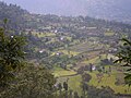
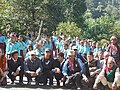
Gallery edit
-
 tholedema khijeeview
 -
 toledema
 -
 Gaungtol
 -
 dandakhi
 -
 KhijiV
 -
 KhijiDVC2
 -
 Khijee3
 -
 Khiji4
 -
 satatol
 -
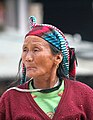 Portrait of a woman at Okhaldunga
 -
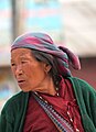 Portrait of a woman at Okhaldunga


References edit
- ^ "Nepal Census 2001", Nepal's Village Development Committees, Digital Himalaya, archived from the original on October 12, 2008, retrieved 15 November 2009.
- ^ "World Meteorological Organization Climate Normals for 1991–2020". World Meteorological Organization. Retrieved 14 October 2023.
- ^ "ASSOCIATION OF COMMUNITY RADIO BROADCASTERS NEPAL (ACORAB)::Introduction". www.acorab.org.np. Retrieved 2020-06-30.
- ^ Network, Indigenous Community Radio. "Radio Likhu 91.3 MHz". Indigenous Community Radio Network. Retrieved 2020-06-30.
- ^ Report on BHN visit to Radio Kairan and Radio Likhu in Ramechhap, archived from the original on 2021-12-21, retrieved 2020-06-30