This article includes a list of general references, but it lacks sufficient corresponding inline citations. (August 2015) |
Mutyalapalem is a village in East Godavari district in the state of Andhra Pradesh, India.
Mutyalapalem | |
|---|---|
Village | |
 Dynamic map | |
.svg) Mutyalapalem Location in Andhra Pradesh, India | |
| Coordinates: 16°25′48″N 81°56′0″E / 16.43000°N 81.93333°E | |
| State | Andhra Pradesh |
| Region | Coastal Andhra |
| District | East Godavari |
| Talukha | Razole |
| Elevation | 5−25 m (−80 ft) |
| Population (2011) | |
| • Total | 1,000 |
| Languages | |
| • Official | Telugu |
| Time zone | UTC+5:30 (IST) |
| PIN | 533248 |
| Telephone code | 08862 |
| Parliament constituency | Amalapuram |
| Assembly constituency | Razole |
Geography
editMutyalapalem covers around 412 acres, and has approximately 210 houses. The total population of the village is around 1000. Mutyalapalem is about 3 km (1.9 mi) from the Bay of Bengal. It is part of the Konaseema delta, a triangle formed by the waters of the Godavari River and the delta.
Gallery
edit-
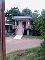 Ramalayam
 -
 Primary School
 -
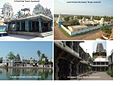 Near by Tourism Places


References
edit