Liberty Grove is a suburb in the Inner West[2] of Sydney, in the state of New South Wales, Australia.
| Liberty Grove Sydney, New South Wales | |||||||||||||||
|---|---|---|---|---|---|---|---|---|---|---|---|---|---|---|---|
 Liberty Grove highrises | |||||||||||||||
 | |||||||||||||||
| Population | 2,254 (2016 census)[1] | ||||||||||||||
| • Density | 9,800/km2 (25,400/sq mi) | ||||||||||||||
| Established | 1998 | ||||||||||||||
| Postcode(s) | 2138 | ||||||||||||||
| Elevation | 7 m (23 ft) | ||||||||||||||
| Area | 0.23 km2 (0.1 sq mi) | ||||||||||||||
| Location | 17 km (11 mi) west of Sydney CBD | ||||||||||||||
| LGA(s) | City of Canada Bay | ||||||||||||||
| State electorate(s) | Drummoyne | ||||||||||||||
| Federal division(s) | Reid | ||||||||||||||
| |||||||||||||||
Liberty Grove is located 17 kilometres west of the Sydney central business district, in the local government area of the City of Canada Bay.
Liberty Grove is bound by Homebush Bay Drive (part of the A3 arterial road) to the west and the Main Northern Line railway to the east. It is surrounded by the suburbs of Rhodes to the north and Concord West to the east and south, and it shares the same postcode of 2138.
The Liberty Grove development [3] won the 1999 Urban Development Institute of Australia[4] award for excellence.
History
editSettlers first arrived in the area in January 1793 and began farming on 'Liberty Plains'. Through the 20th century it became one of Sydney's industrial areas. However, it and much of adjacent industrial area around Homebush Bay, were completely transformed as part of the Olympic precinct development in preparation for the 2000 Sydney Olympics.
Amenities
editThe Liberty Grove complex contains swimming pools, tennis courts, basketball court, gymnasium, village green and parks, function room and entrances to Rhodes and Concord West. Rhodes Waterside shopping centre is 100m from the northern entrance.
-
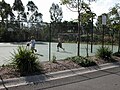 Basketball Court
 -
 Barbecues near the main pool
 -
 Eliza Park, in the southern end of Liberty Grove
 -
 A family playing cricket on the Village Green
 -
 A game of touch football in Bradley Reserve, the northern park
 -
 The pool at the southern end of Bradley Reserve


Transport
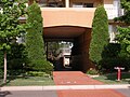
editVehicle access to Liberty Grove is available only from Homebush Bay Drive and Oulton Ave, in the northwest and north.
The northern (vehicle) entrance is a ten-minute walk to Rhodes railway station and the southern (pedestrian) entrance is a ten-minute walk to Concord West railway station and Bicentennial Park.
-
 The east pedestrian entrance to the railway line and Queen Street, Concord West
 -
 The north vehicle entrance, travelling either north or south on Homebush Bay drive
 -
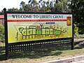 The large map by the western entrance.


Despite being physically contiguous, Liberty Grove is not directly accessible from Concord West by car. However, Settlers Boulevard, Liberty Grove is accessible from the east by bicycle and foot from an underpass on Queen St Concord West between Castlestead Street and Coonong Road. It is also accessible in the north by bicycle and foot from Rhodes and Concord West at Oulton Avenue. From the south it may be accessed by cyclists and pedestrians at Concord Avenue off King Street, which leads to Concord West, North Strathfield and Olympic Park.
References
edit- ^ Australian Bureau of Statistics (27 June 2017). "Liberty Grove (State Suburb)". 2016 Census QuickStats. Retrieved 14 March 2018.
- ^ Australian Suburb Guide: Sydney Inner West Archived 26 December 2012 at the Wayback Machine Retrieved 7 August 2013.
- ^ Welcome to Liberty Grove
- ^ Urban Development Institute of Australia