40°10′20″N 45°41′19″E / 40.17222°N 45.68861°E
Khachaghbyur
Խաչաղբյուր | |
|---|---|
 A view of Khachaghbyur from Murad Khach | |
 Khachaghbyur  Khachaghbyur | |
| Coordinates: 40°10′20″N 45°41′19″E / 40.17222°N 45.68861°E | |
| Country | Armenia |
| Province | Gegharkunik |
| Municipality | Vardenis |
| Population | |
| • Total | 1,064 |
| Time zone | UTC+4 (AMT) |
| Khachaghbyur at GEOnet Names Server | |
Khachaghbyur (Armenian: Խաչաղբյուր) is a village in the Vardenis Municipality of the Gegharkunik Province of Armenia. The village is located immediately to the south of the Lusakunk village and to the west of Vardenis.
Etymology
editThe village was previously known as Chakhyrlu, Chakhrlu, Chakhirlu, Sovietakert and Sovetakert.
History
editNear the village is a ruined Iron Age fort, Murad Khach, as well as a 13th-century church.[2]
Gallery
edit-
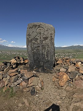 Khachkar on Murad Khach
 -
 Murad Khach


References
edit- ^ Statistical Committee of Armenia. "The results of the 2011 Population Census of Armenia" (PDF).
- ^ Kiesling, Brady; Kojian, Raffi (2005). Rediscovering Armenia: Guide (2nd ed.). Yerevan: Matit Graphic Design Studio. p. 81. ISBN 99941-0-121-8.
External links
editWikimedia Commons has media related to Khachaghbyur.
- Report of the results of the 2001 Armenian Census, Statistical Committee of Armenia
- Kiesling, Brady (June 2000). Rediscovering Armenia: An Archaeological/Touristic Gazetteer and Map Set for the Historical Monuments of Armenia (PDF). Archived (PDF) from the original on 6 November 2021.
This article about a location in Gegharkunik Province, Armenia is a stub. You can help Wikipedia by expanding it. |