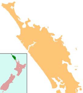
Kaikohe Hill (also Tokareireia, Memorial Hill) is a 282 m (925 ft) high hill in Northland, New Zealand with significance in Māori culture.
| Kaikohe Hill | |
|---|---|
| Tokareireia | |
 View in 1918 of the monument in memory of Hōne Heke Ngāpua at the top of Kaikohe Hill. | |
| Highest point | |
| Elevation | 282 m (925 ft) |
| Coordinates | 35°24′38″S 173°47′03″E / 35.410596°S 173.784105°E |
| Geography | |
| Geology | |
| Volcanic arc/belt | Kaikohe-Bay of Islands |

Geography
editIt is on the western edge of the town of Kaikohe. To its north east are the extinct volcanic cones of Putahi and Tarahi and Lake Ōmāpere.
Geology
editIt is a basaltic scoria cone in the southern part of the Kaikohe-Bay of Islands volcanic field.[1] The geological basement to the nearby volcanoes is likely to be the Permian-Mesozoic Waipapa Group argillite at perhaps more than 1,736 ft (529 m) deep as defined by drill hole at the near by thermal Ngawha Springs and seismic studies.[2]
Culture
editThe slopes of the hill contain a memorial park to Hōne Heke Ngāpua, a great-grand nephew of Hōne Heke and leader in Māori autonomy.[3][4][5]
References
edit- ^ Hayward, Bruce; Smith, Ian (2002). "Field Trip 7: A Taste of Northland Geology" (PDF). In Smith, Vicki; Grenfell, Hugh (eds.). Field Trip Guides, GSNZ Annual Conference "Northland 2002". Geological Society of NZ Miscellaneous Publication 112B. Retrieved 28 March 2012.
- ^ Bowen, F.E.; Skinner, D.N.B.; Hornibrook, N.deB.; Scott, G.H.; Edwards, A.R. (1972). "Geological interpretation of Ngawha deep drillhole, Kaikohe, Northland(N15), New Zealand". New Zealand Journal of Geology and Geophysics. 15 (1): 129–138. doi:10.1080/00288306.1972.10423949.
- ^ Rankin, Freda (1993). "Story: Ngāpua, Hōne Heke". Dictionary of New Zealand Biography. Retrieved 22 September 2024.
- ^ "Hone Heke obelisk gets attention". Far North District Council. 15 March 2024. Retrieved 22 September 2024.
- ^ "Kaikohe. Township Plan. Northland Townships" (PDF). 4 November 2019. pp. 1–118. Retrieved 22 September 2024.: 75, 80–89
