Hawul is a Local Government Area of Borno State, Nigeria. It's located in the southern part of the state.
Hawul | |
|---|---|
 A beautiful mountain in Hawul, Borno State | |
| Country | |
| State | Borno State |
| Time zone | UTC+1 (WAT) |
 | |
Is headquarters are in the town of Azare.
It has an area of 2,098 km2 and a population of about 120,000 at the 2006 census.
The postal code of the area is 603.[1]
It is one of the four LGAs that constitute the Biu Emirate, a traditional state located in Borno State, Nigeria.[2]
Climate/Geography
editHawul LGA has an average temperature of 34 degrees Celsius and a total area of 2,098 square kilometers. The dry and rainy seasons are the two distinct seasons experienced by the LGA. In the Hawul LGA, the average wind speed is 10 km/h, and the average humidity is 21%.[3][4][5]
Gallery
edit-
 A beautiful clear water running between rocks in Hawul, Borno State
 -
 A beautiful water fall in Hawul, Borno State
 -
 A beautiful bird in Hawul, Borno State
 -
 A beautiful river in Hawul, Borno State
 -
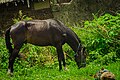 A beautiful horse eating grass in Hawul, Borno State


References
edit- ^ "Post Offices- with map of LGA". NIPOST. Archived from the original on 2012-11-26. Retrieved 2009-10-20.
- ^ Nigeria (2000). Nigeria: a people united, a future assured. Vol. 2, State Surveys (Millennium ed.). Abuja, Nigeria: Federal Ministry of Information. p. 106. ISBN 9780104089.
- ^ "Hawul Local Government Area". www.manpower.com.ng. Retrieved 2024-08-09.
- ^ "10-day weather forecast for Hawul, Borno, Nigeria - The Weather Channel | weather.com". The Weather Channel. Retrieved 2024-08-09.
- ^ "Hawul, Nigeria 10-Day Weather Forecast | Weather Underground". www.wunderground.com. Retrieved 2024-08-09.
This Borno State, Nigeria location article is a stub. You can help Wikipedia by expanding it. |