Glenlyon is a rural locality in the Southern Downs Region, Queensland, Australia.[2] In the 2021 census, Glenlyon had a population of 32 people.[1]
| Glenlyon Queensland | |||||||||||||||
|---|---|---|---|---|---|---|---|---|---|---|---|---|---|---|---|
 Lake Glenlyon, 2012 | |||||||||||||||
 Glenlyon | |||||||||||||||
| Coordinates | 28°55′10″S 151°27′08″E / 28.9194°S 151.4522°E | ||||||||||||||
| Population | 32 (2021 census)[1] | ||||||||||||||
| • Density | 0.0897/km2 (0.232/sq mi) | ||||||||||||||
| Postcode(s) | 4380 | ||||||||||||||
| Area | 356.7 km2 (137.7 sq mi) | ||||||||||||||
| Time zone | AEST (UTC+10:00) | ||||||||||||||
| Location |
| ||||||||||||||
| LGA(s) | Southern Downs Region | ||||||||||||||
| State electorate(s) | Southern Downs | ||||||||||||||
| Federal division(s) | Maranoa | ||||||||||||||
| |||||||||||||||
Geography
editLake Glenlyon is a long thin north–south lake in the middle of the locality (28°56′11″S 151°27′21″E / 28.9363°S 151.4558°E). It was created by impounding Pike Creek with the Glenlyon Dam (28°58′43″S 151°27′57″E / 28.9786°S 151.4658°E).[3][4][5] It is also known as the Pike Creek Reservoir.
The Stanthorpe – Texas Road runs through the locality from north (Pikes Creek) to west (Silver Spur).[6]
There are two small sections of the Claremont State Forest in the south-west of the locality. Apart from these protected areas, the predominant land use is grazing on native vegetation.[3]
History
edit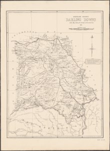
The locality's name is derived from Glenlyon pastoral run taken up in 1844 by Alexander McLeod. The run can be seen on an 1883 Darling Downs Run Map on Pikes Creek, south of Pikes Creek run.[2]
Glenlyon Provisional School opened on 1 May 1899 and closed in 1909. On 21 August 1933, Glenlyon State School opened. It closed in 1942, but reopened in 1951. It closed permanently in 1978.[7]
In 1996 Scott McLeod Walker, a great-grandson of Alexander McLeod, privately wrote and published a book entitled Glenlyon Connections. The book contains a history of the pastoral run and of some of the families who owned it.[8]
Demographics
editIn the 2016 census, Glenlyon had a population of 24 people.[9]
In the 2021 census, Glenlyon had a population of 32 people.[1]
Education
editThere are no schools in Glenlyon. The nearest government school is Texas State School in Texas to the west which provides primary schooling and secondary schooling to Year 10. There is no secondary schooling to Year 12 available nearby; the options are distance education and boarding school.[10]
Attractions
editGlenlyon Dam is a tourist attraction. There is a lookout on Pinnacle Road (28°58′52″S 151°27′46″E / 28.9811°S 151.4627°E).[11][12]
Boating is permitted in Lake Glenlyon.[12] There is a boat ramp at Glenlyon Dam Road (28°57′42″S 151°28′09″E / 28.9618°S 151.4692°E) providing access to Lake Glenlyon. It is managed by the Border Rivers Commission.[13][14]
Fishing is permitted with a Stocked Impoundment Permit, but only from boats, not from the shore.[12] Stocked species include Murray cod, golden perch, and silver perch.[15]
References
edit- ^ a b c Australian Bureau of Statistics (28 June 2022). "Glenlyon (SAL)". 2021 Census QuickStats. Retrieved 28 February 2023.
- ^ a b "Glenlyon – locality in Southern Downs Region (entry 46010)". Queensland Place Names. Queensland Government. Retrieved 8 November 2017.
- ^ a b "Queensland Globe". State of Queensland. Retrieved 12 September 2023.
- ^ "Glenlyon Dam – dam wall in Southern Downs Regional (entry 43057)". Queensland Place Names. Queensland Government. Retrieved 30 August 2023.
- ^ "Lake Glenlyon – lake in Southern Downs Regional (entry 14000)". Queensland Place Names. Queensland Government. Retrieved 30 August 2023.
- ^ Glenlyon, Queensland (Map). Google Maps. Retrieved 23 October 2021.
- ^ Queensland Family History Society (2010), Queensland schools past and present (Version 1.01 ed.), Queensland Family History Society, ISBN 978-1-921171-26-0
- ^ Scott McLeod Walker: Glenlyon Connections: ISBN 0-646-13431-0 : published 1996
- ^ Australian Bureau of Statistics (27 June 2017). "Glenlyon (SSC)". 2016 Census QuickStats. Retrieved 20 October 2018.
- ^ "Layers: Locality; Schools and school catchments". Queensland Globe. Queensland Government. Archived from the original on 19 December 2017. Retrieved 12 September 2023.
- ^ "Tourist points - Queensland". Queensland Open Data. Queensland Government. 18 November 2020. Archived from the original on 24 November 2020. Retrieved 24 November 2020.
- ^ a b c "Glenlyon Dam". Sunwater. Archived from the original on 8 March 2023. Retrieved 12 September 2023.
- ^ "Recreational Boating Facilities Queensland". Queensland Open Data. Queensland Government. 12 November 2020. Archived from the original on 22 November 2020. Retrieved 22 November 2020.
- ^ "Home". Border Rivers Commission. 10 May 2022. Archived from the original on 3 June 2023. Retrieved 12 September 2023.
- ^ "Glenlyon Dam". Dams and weirs. Department of Agriculture and Fisheries, Queensland Government. Archived from the original on 22 May 2023. Retrieved 12 September 2023.
External links
edit![]() Media related to Glenlyon, Queensland at Wikimedia Commons
Media related to Glenlyon, Queensland at Wikimedia Commons
- "Cavalcade of Events Since Sheep-Run Days". Warwick Daily News. No. 10, 138. Queensland, Australia. 5 February 1952. p. 6 – via National Library of Australia.