Size of this JPG preview of this PDF file: 391 × 599 pixels. Other resolutions: 156 × 240 pixels | 313 × 480 pixels | 806 × 1,235 pixels.
Original file (806 × 1,235 pixels, file size: 65 KB, MIME type: application/pdf)
| This is a file from the Wikimedia Commons. Information from its description page there is shown below. Commons is a freely licensed media file repository. You can help. |
Summary
| Description |
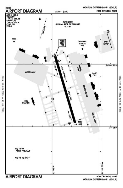
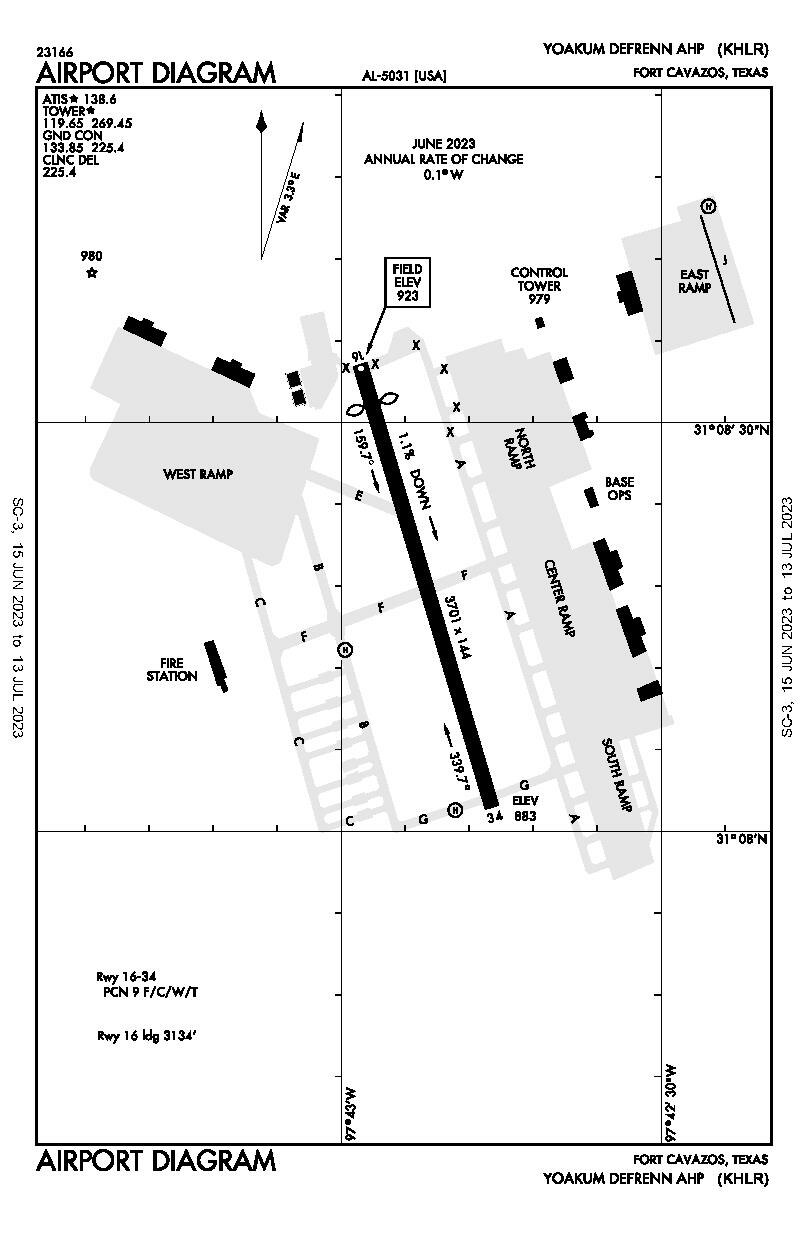
English: Airport diagram of ICAO/IATA KHLR/HLR – Yoakum–DeFrenn Army Heliport, Fort Cavazos, Texas, U.S., valid 2023-06-15 – 2023-07-15 |
| Date | |
| Source | https://aeronav.faa.gov/d-tpp/2306/05031AD.PDF |
| Author | U.S. FAA |
| Other versions |
|

Licensing
This image or file is a work of a Federal Aviation Administration employee, taken or made as part of that person's official duties. As a work of the U.S. federal government, the image is in the public domain in the United States.
|
 |
File history
Click on a date/time to view the file as it appeared at that time.
| Date/Time | Thumbnail | Dimensions | User | Comment | |
|---|---|---|---|---|---|
| current | 20:31, 26 June 2023 |  | 806 × 1,235 (65 KB) | OdinintheNorth | Uploaded a work by U.S. FAA from https://aeronav.faa.gov/d-tpp/2306/05031AD.PDF with UploadWizard |
File usage
The following pages on the English Wikipedia use this file (pages on other projects are not listed):