
No higher resolution available.
GreenvilleJC1872map.tiff (455 × 502 pixels, file size: 546 KB, MIME type: image/tiff)
| This is a file from the Wikimedia Commons. Information from its description page there is shown below. Commons is a freely licensed media file repository. You can help. |
Summary
| Description |
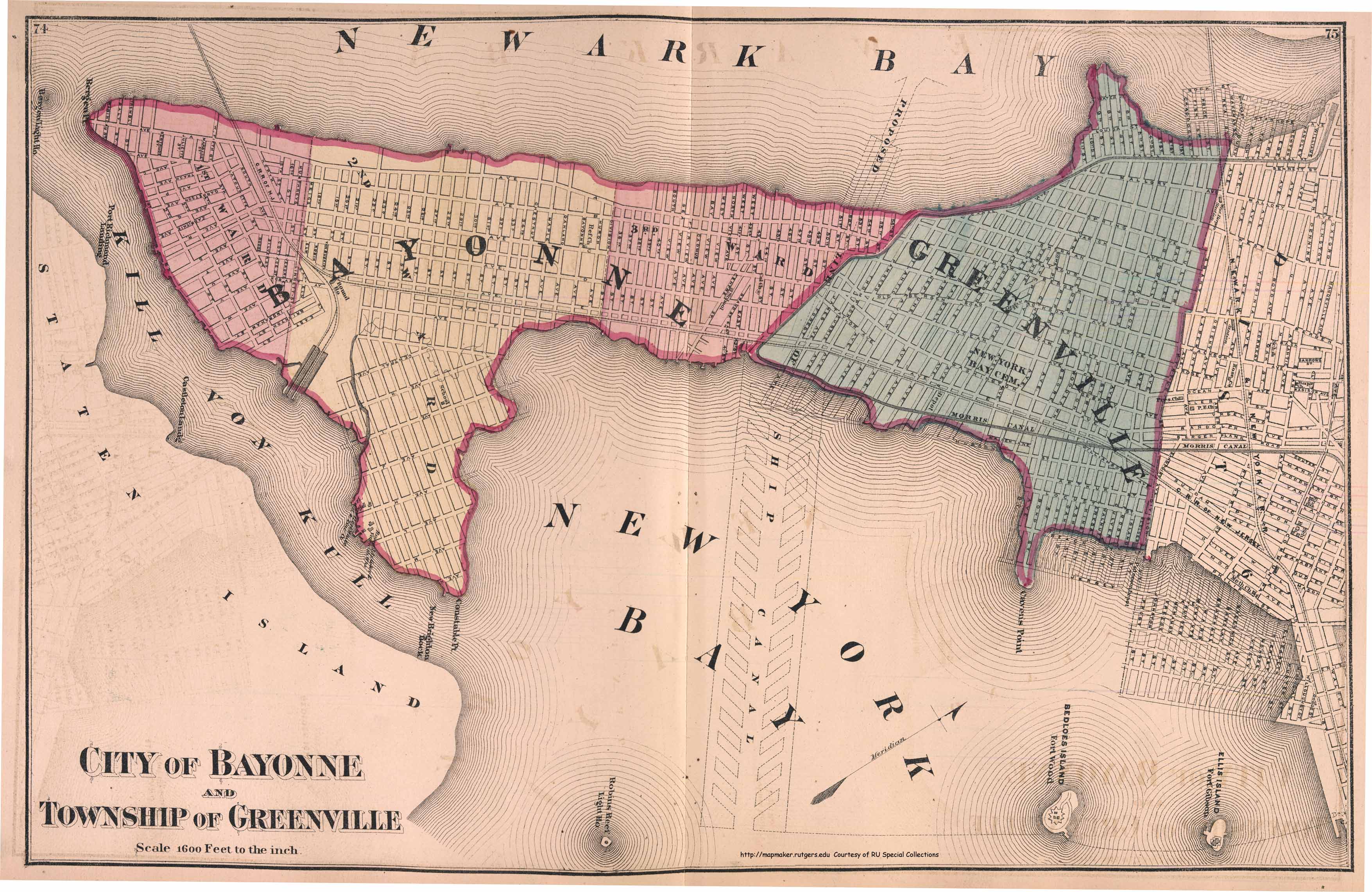
English: Map of Greenville 1872 one year before the township voted to consolidate with Jersey City, becoming the southernmost section of the city bordering Bayonne. Newark Bay lies to the west (above) and Upper New York Bay lies to east (below). Subsequent reclamation in the 20th century increased the land area. |
| Date | |
| Source | http://mapmaker.rutgers.edu/1872Atlas/Bayonne_Greensville_1872.jpg Atlas of New Jersey FW Beers 1872 |
| Author | Unknown author |
Licensing
|
This work is in the public domain in its country of origin and other countries and areas where the copyright term is the author's life plus 70 years or fewer. This work is in the public domain in the United States because it was published (or registered with the U.S. Copyright Office) before January 1, 1929. | |
| This file has been identified as being free of known restrictions under copyright law, including all related and neighboring rights. | |
File history
Click on a date/time to view the file as it appeared at that time.
| Date/Time | Thumbnail | Dimensions | User | Comment | |
|---|---|---|---|---|---|
| current | 19:12, 2 September 2014 |  | 455 × 502 (546 KB) | Hudconja | User created page with UploadWizard |
File usage
The following pages on the English Wikipedia use this file (pages on other projects are not listed):