Road signs in San Marino are regulated by Codice della strada del 2008, and are established by article 28 of it.[1] Road signs in San Marino have the same shapes and colors as those used in Italy due to the country being entirely surrounded by Italy. They are divided into:
- Warning signals;
- Priority signs;
- Level crossing signs;
- Prescription signs with the exception of those concerning the right of way, stop and parking;
- Indication signs;
- Signs concerning stops and parking;
- Signs of integration.
Gallery edit
Warning signs edit
-
 Uneven road
 -
 Bumps in the road
 -
 Dip
Dip -
 Bend, to right
 -
 Bend, to left
 -
 Double bend, first to right
 -
 Double bend, first to left
 -
 Level crossing with barrier or gate ahead
 -
 Level crossing without barrier or gate ahead
 -
 Single Level crossing
 -
 Multiple level crossing
 -
 Trams crossing ahead
 -
 Pedestrian crossing ahead
 -
 Bicycle crossing ahead
 -
 Steep hill downwards
 -
 Steep hill upwards
 -
 Road narrows
 -
 Road narrows on right
 -
 Road narrows on left
 -
 Opening or swing bridge ahead
 -
 Dangerous verges
 -
 Slippery road
 -
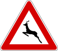
 Children
 -

-
-
-
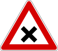
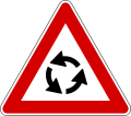 Roundabout ahead
 -

-
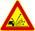
 Loose chippings
 -
 Falling rocks from right
 -
 Falling rocks from left
 -

-
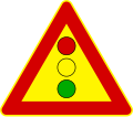
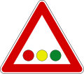 Horizontal traffic lights
 -
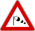
 Low-flying aircraft
 -
-
 Risk of fire
 -
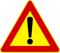
 Other danger
 -
 Level crossing countdown marker (placed under the triangular warning sign, usually 150 m before crossing)
 -
 Level crossing countdown marker (placed at two-thirds of the distance from the crossing, usually 100 m)
 -
 Level crossing countdown marker (placed at one-third of the distance from the crossing, usually 50 m)
.svg)


.svg)


Temporary signs edit
-

-
 Uneven road
 -
 Road narrows
 -
 Road narrows on right
 -
 Road narrows on left
 -
 Loose chippings
 -

-
-
 Other danger


Priority signs edit
-

-

-
-
 Give priority to vehicles from opposite direction
 -
-
 End of priority road
 -

-
 Junction with a minor side-road from right
 -
 Junction with a minor side-road from left
 -
 Merging traffic from right
 -
 Merging traffic from left
 -
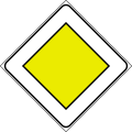
 Traffic has priority over oncoming vehicles


Prescription signs with the exception of those concerning the right of way, stop and parking edit
Prohibition signs edit
-
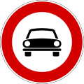
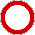 Restricted vehicular access
 -
 No entry for vehicular traffic
 -
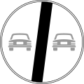
 No overtaking
 -
 Minimum distance
 -
 Maximum speed 50 km/h
 -
 No use of horns
 -

-

-
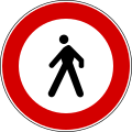 No pedestrians
 -
 No bicycles
 -
 No motorcycles
 -
 No handcarts
 -
-
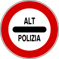
 No buses
 -

-
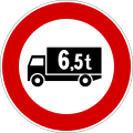 No large goods vehicles over weight shown
 -
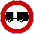 No vehicles with trailer
 -
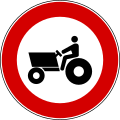 No tractors
 -
 No vehicles carrying dangerous goods
 -

-
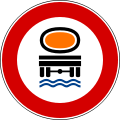 No vehicles carrying goods which could pollute water
 -
 No vehicles over width shown
 -
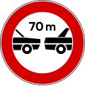
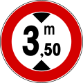 No vehicles over height shown
 -
 No vehicles over length shown
 -
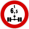
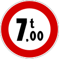 Maximum weight in tonnes
 -
-
 Derestriction
 -
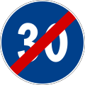
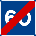
 End of maximum speed
 -
 End of no overtaking
 -
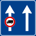
 End of no overtaking by heavy goods vehicles
 -
 No parking on side where sign is placed. Without additional inscriptions, it is valid from 8 am to 8 pm on urban roads while on extra-urban roads it is valid at all times.
 -
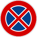 No stopping on the side where sign is placed
 -
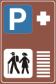
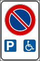 Parking space reserved for vehicles used by people with disabilities
 -
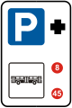
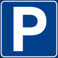 Parking place
 -
 Parking ahead in the direction of the arrow
 -
 No parking at all times in front of vehicular access to the side properties
 -
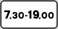
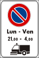
 Parking prohibited at certain times and allowed in others


.svg)


.svg)


.svg)
.svg)


.svg)


.svg)
Mandatory signs edit
-
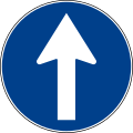 Drive straight
 -
 Turn right
 -
 Turn left
 -
 Right turn only ahead
 -
 Left turn only ahead
 -
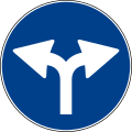 Right or left turn only ahead
 -
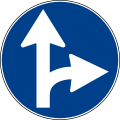 Drive straight or turn right
 -
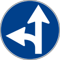 Drive straight or turn left
 -
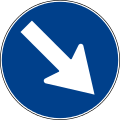 Keep right
 -
 Keep left
 -
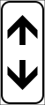
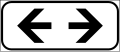
 Pass either side
 -

-

-
 End of minimum speed
 -
 Snow chains compulsory
 -

-
-
 Stop, pay toll
 -

-

-

-
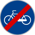 End of cycle lane
 -

-
 End of shared path
 -

-

-
-
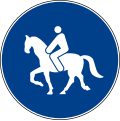
 End of bridleway


.svg)


Indication signs edit
-
 Motorway direction
 -
 Primary or secondary road direction
 -
 Urban area direction
 -

-
 Direction to tourist attraction
 -
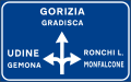
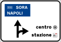 Directions in urban areas
 -

-
 Directions on a main highway (formerly used
 )
) -
 Directions on a main highway with lane canalization
 -
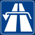
 Directions on a motorway
 -
 Overhead directional sign
 -
 Motorway number sign
 -
 Motorway spur number sign (not an official road sign but it is used)
 -
 International tunnel number sign
 -
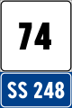
 State highway number sign
 -
 Regional road number sign
 -
 Provincial road number sign
 -
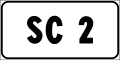 Municipal road number sign
 -
 European road number sign
 -
 Highway location marker
 -
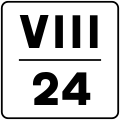 Intermediate highway location marker with hectometre shown in roman numerals (in the example the sign is placed at the kilometre 24.8 of the road)
 -
 Motorway location marker and distance from the exit shown (horizontal version)
 -
 Motorway location marker and distance from the service area (vertical version)
 -
 Main highway location marker and distances from next destinations
 -
![Number of overpass along a motorway[2]](//upload.wikimedia.org/wikipedia/commons/thumb/d/d9/Italian_traffic_signs_-_numerazione_cavalcavia_autostrada.svg/120px-Italian_traffic_signs_-_numerazione_cavalcavia_autostrada.svg.png) Number of overpass along a motorway[2]
Number of overpass along a motorway[2] -
 Destination that can be reached from next exit on a motorway or an expressway
 -
 Town sign: start of urban area (50 km/h speed limit and no use of horn)
 -
![Town sign: start of urban area where electric micromobility is being experimented (50 km/h speed limit, no use of horn and particular caution to cyclists and motorized scooters)[3]](//upload.wikimedia.org/wikipedia/commons/thumb/3/3b/Italian_traffic_signs_-_segnale_sperimentale_micromobilita_elettrica.svg/73px-Italian_traffic_signs_-_segnale_sperimentale_micromobilita_elettrica.svg.png) Town sign: start of urban area where electric micromobility is being experimented (50 km/h speed limit, no use of horn and particular caution to cyclists and motorized scooters)[3]
Town sign: start of urban area where electric micromobility is being experimented (50 km/h speed limit, no use of horn and particular caution to cyclists and motorized scooters)[3] -

-
 End of urban area, with distances to other towns (end of 50 km/h speed limit and of the prohibition of using horn)
 -
 Provincial boundary sign (roads other than motorways)
 -
 Provincial boundary sign (motorway)
 -
 Regional boundary sign (roads other than motorways)
 -
 Regional boundary sign (motorway)
 -
 Direction to motorway
 -
 Motorway distance sign
 -
 Direction to service shown in urban areas (in the example municipal police)
 -
 Street name sign
 -
 Street name sign with one way
 -
 Municipality boundary name sign
 -
 River sign
 -
-
 Directions to tourist destinations
 -
 Direction to an industrial zone
 -
 Directions in an industrial area
 -
 Hotel information centre ahead
 -
 information about hotels
 -
 Direction to hotels ahead
 -
 Directions to hotels
 -
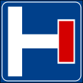
 Hospital(formerly used
 )
) -

-
 School bus stop. If the sign is mounted on a bus it means that bus is used as a school bus
 -
 Emergency telephone (formerly used )
 -

-

-
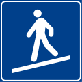 Pedestrian ramp
 -

-
 No through road (side road)
 -
 Advisory speed limit
 -
 End of advisory speed limit
 -
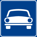 Fast-traffic highway, only motor vehicles allowed
 -
 End of road reserved for motor vehicles
 -
 Tunnel (roads other than motorways)
 -
 Tunnel (motorways)
 -
 Bridge (roads other than motorways)
 -
 Bridge (motorways)
 -
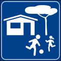 Home Zone Entry
 -
 End of Home Zone
 -
 Pedestrian zone
 -
 End of pedestrian zone
 -
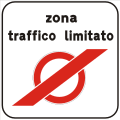
 Restricted vehicular traffic zone
 -
 End of restricted vehicular traffic zone
 -
 Start of a 30 km/h zone
 -
 End of a 30 km/h zone
 -
 Bicycle crossing
 -
 Semi-direct left turn
 -
 Indirect left turn
 -
 Possibility of reversing the direction of travel (roads other than motorways)
 -
 Possibility of reversing the direction of travel (motorways)
 -
 Breakdown bay. The background is green on motorway
 -
 Breakdown bay with emergency telephone. The background is blue in roads other than motorway
 -
 Use of lanes on extra-urban roads (example)
 -
 Bus lane on urban road (example)
 -
 Bus lane on urban road (example)
 -
 Use of lanes on motorways
 -
 End of lane. The background is green on motorway
 -
 Increase in the number of lanes. The background is green on motorway
 -
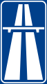
 Motorway. If the symbol of motorway is used inside other information signs it has a squared shape (
 )
) -
 Motorway ahead with a summary of transit restrictions
 -
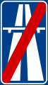
 Motorway ends
 -
 Expressway. If the symbol of expressway is used inside other information signs it has a squared shape (
 )
) -
 Expressway ahead with a summary of transit restrictions
 -
 Expressway ends
 -
 One-way traffic (right)
 -
 One-way traffic (left)
 -

-
 Advised direction for trucks ahead
 -
 Advised direction for trucks
 -
 General speed limit (installed at national borders)
 -
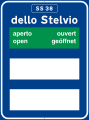 Information about road condition of passes: road open
 -
 Information about road condition of passes: road open and mandatory snow chains
 -
 Information about road condition of passes: road open and advised snow chains
 -
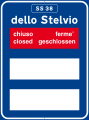 Information about road condition of passes: road closed
 -
 Information about road condition of passes: road closed after the town shown and mandatory snow chains
 -
 Information about road condition of passes: road closed after the town shown and advised snow chains
 -
-
 Repairs
 -
 Telephone(formerly used
 )
) -
-
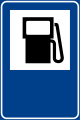
 Petrol station with LPG
 -

-
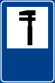
 Tram stop
 -
 Information centre
 -
-
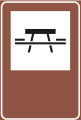 Picnic site
 -

-
 Local radio information. The background is blue in roads other than motorway
 -

-
 Refreshments
 -

-
 Park and ride (bus station)
 -
 Park and ride (tramway)
 -
 Park and ride (train or underground)
 -
 Park and ride (hiking trail)
 -
 Motorail services
 -

-
 Taxi stop
 -
 Sewage discharge
 -
 Car ferries
 -
 Services in motorway service area (plus distance from the next area)
.svg)
.svg)
.svg)


.svg)
.svg)


.svg)
.svg)
.svg)

.svg)
![Number of overpass along a motorway[2]](/wiki/File:Italian_traffic_signs_-_numerazione_cavalcavia_autostrada.svg)
.svg)
![Town sign: start of urban area where electric micromobility is being experimented (50 km/h speed limit, no use of horn and particular caution to cyclists and motorized scooters)[3]](/wiki/File:Italian_traffic_signs_-_segnale_sperimentale_micromobilita_elettrica.svg)
.svg)
.svg)

.svg)

.svg)
.svg)
.svg)

.svg)
.svg)


.svg)
.svg)


.svg)
.svg)
.svg)
.svg)
.svg)
.svg)
.svg)
.svg)

.svg)
.svg)


.svg)


.svg)


.svg)
.svg)


Additional panels edit
-
 Distance (in meters)
 -
 Distance (in kilometers)
 -
 Length of a danger or a prescription (in meters)
 -
 Length of a danger or a prescription (in kilometers)
 -
 Timetable: the sign applies all day
 -
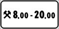
 Timetable: the sign between the hours shown
 -
 Timetable: the sign between the hours shown but only in holidays (represented by the cross)
 -
![Timetable: the sign between the hours shown but only in working days[4] (represented by the two hammers crossed)](//upload.wikimedia.org/wikipedia/commons/thumb/e/ee/Italian_traffic_signs_-_validit%C3%A0_%28modello_II_3-c%29.svg/120px-Italian_traffic_signs_-_validit%C3%A0_%28modello_II_3-c%29.svg.png) Timetable: the sign between the hours shown but only in working days[4] (represented by the two hammers crossed)
Timetable: the sign between the hours shown but only in working days[4] (represented by the two hammers crossed) -
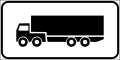 The sign applies only to the category shown (in the example semi-trailer trucks)
 -
 The sign doesn't apply to the category shown (in the example buses)
 -
 Beginning of a danger or a prescription (vertical)
 -
 Continual of a danger or a prescription (vertical)
 -
 End of a danger or a prescription (vertical)
 -
 Beginning of a danger or a prescription (horizontal)
 -
 Continual of a danger or a prescription (horizontal)
 -
 End of a danger or a prescription (horizontal)
 -
 No road markings or road markings work in progress
 -
 Road accident
 -
 Crossing of railway linking tracks: the trains move very slowly and usually with the presence of a flagger (this crossing is not considered a level crossing).
 -
 Snow removal vehicle at work
 -
 Road subject to flooding
 -
 Queue
Queue -
 Construction vehicles at work
 -
 In case of snow or ice
 -
 In case of rain
 -
 Slow moving vehicle ahead
 -
 Tow-away zone
 -
 Lane sign: an overhead sign applies only to te lane pointed out by this arrow.
 -
 Hairpin turn ahead
 -
 Number of hairpin turn
 -
 Road cleaning
 -
 Road cleaning during times shown
 -
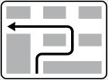
 Direction of main road (example). It is used with priority sign
-
 Direction of main road (example). It is used with priority sign
-
 Direction of main road (example). It is used with priority sign
-
 No parking during road cleaning operations
 -
 Mandatory direction for vehicle carrying dangerous goods
 -
 Mandatory direction ahead for trucks
 -
 No trucks
.svg)
.svg)
.svg)
![Timetable: the sign between the hours shown but only in working days[4] (represented by the two hammers crossed)](/wiki/File:Italian_traffic_signs_-_validit%C3%A0_(modello_II_3-c).svg)
.svg)
.svg)
.svg)
.svg)
.svg)
.svg)
.svg)
.svg)


.svg)


Complementary signage edit
-
 Reflexion posts (left and right) on two-way roads
 -
 Reflexion posts (left and right) on one-way roads
 -
 Chevron marker (turn right)
 -
 Chevron marker (turn left)
 -
 T-intersection marker
 -
 Chevron marker (singular)
 -
 Chevron maker (red singular)
 -
 Chevron marker (temporary)


References edit
- ^ "CODICE DELLA STRADA - Consiglio Grande e Generale". www.consigliograndeegenerale.sm. Retrieved 2023-08-29.
- ^ This road sign is not regulated by the Highway Code: it had been designed by the Ministry of Public Works in order to prevent the launch of objects from bridges
- ^ This sign has been introduced in 2019
- ^ Saturday is considered a working day if it isn't an official holiday