Dorrigo, a small town on the Waterfall Way, is located on the Northern Tablelands, in northern New South Wales, Australia. The town is part of Bellingen local government area.
| Dorrigo New South Wales | |||||||||
|---|---|---|---|---|---|---|---|---|---|
 Dorrigo Main Square | |||||||||
 Dorrigo | |||||||||
| Coordinates | 30°20′S 152°43′E / 30.333°S 152.717°E | ||||||||
| Population | 1,046 (2021 census)[1] | ||||||||
| Postcode(s) | 2453 | ||||||||
| Elevation | 731 m (2,398 ft)[2] | ||||||||
| Location |
| ||||||||
| LGA(s) | Bellingen Shire | ||||||||
| State electorate(s) | Oxley[3] | ||||||||
| Federal division(s) | Cowper[4] | ||||||||
| |||||||||
It is approximately 580 kilometres (360 mi) north of the state capital, Sydney via the Pacific Highway, and 64 kilometres (40 mi) west from the coastal city of Coffs Harbour. The town is situated on the Dorrigo Plateau near the New England Escarpment,[5] which is part of the Great Dividing Range. Dorrigo is 731 metres (2,398 ft) above sea level.[2] At the 2021 census, Dorrigo had a population of 1,046 people.[1]
History
editThe area now known as Dorrigo lies on the traditional land of the Gumbainggir people.[6]
European settlement of the area followed on from the early timber cutters in the 1860s. The first official European in the district was Land Commissioner Oakes who sighted the mouth of the Bellinger River.
Major Edward Parke named the region after a Spanish General named Don Dorrigo with whom Parke fought in the Peninsula War. The local town paper is also named 'The Don Dorrigo Gazette, also named after the Spanish General.[5]
By 1841, timber cutters had entered the Bellinger River searching for red cedar (Toona australis). They set up camps and moved from one stand of trees to the next.[5]
Richard Craig, an escaped convict from the Moreton Bay Penal Settlement,[5][7] was the first European to reach the Dorrigo Plateau, following the traditional indigenous route to Armidale from the Grafton area. Using his skills as a horseman, Craig travelled along the western side of the Nymboida River. Craig's track became a road, now roughly following the same path as the present Grafton to Armidale Road and travelling through the present day villages of Nymboida, Billy's Creek, Dundurrabin, Tyringham and Ebor.[7] Timbergetters followed Craig through the sub tropical rainforest and many sawmills grew due to demand for timber, initially the highly prized Australian Red Cedar (Toona australis).
Today, the main access road traversing the plateau from east to west is the Waterfall Way. It was not until the 1860s that permanent settlement occurred in the district. The dairy industry became a mainstay of the Dorrigo Plateau and today tourism is becoming more important. On 23 December 1924, the Glenreagh to Dorrigo railway opened.[8][9] Due to flood damage, the line closed on 28 October 1972.[8]
On 31 October 2005, sixty-eight dairy cows, all in full milk, died on a farm at Fernbrook on the Waterfall Way near Dorrigo after being struck by lightning. Three others were paralysed for several hours but they later made a full recovery. The cows were sheltering under a tree when it was struck by lightning and the electricity spread onto the surrounding soil killing the animals.[10]
Population
edit| Year | Pop. | ±% |
|---|---|---|
| 1954 | 1,080 | — |
| 1961 | 1,027 | −4.9% |
| 1966 | 1,111 | +8.2% |
| 1971 | 1,078 | −3.0% |
| 1976 | 1,152 | +6.9% |
| 1981 | 1,192 | +3.5% |
| 1986 | 1,167 | −2.1% |
| 1991 | 1,135 | −2.7% |
| 1996 | 1,013 | −10.7% |
| 2001 | 969 | −4.3% |
| 2006 | 967 | −0.2% |
| 2011 | 1,072 | +10.9% |
| 2016 | 1,042 | −2.8% |
| 2021 | 1,046 | +0.4% |
| Source: Australian Bureau of Statistics data.[11][12] | ||
In the 2021 Census, there were 1,046 people in Dorrigo. 80.8% of people were born in Australia and 90.2% of people only spoke English at home. The most common responses for religion were No Religion 42.5%, Anglican 23.4% and Catholic 10.1%.[1]
Attractions
editDorrigo is home to the planned Dorrigo Steam Railway and Museum which is not yet open to the public. It houses the largest collection of railway vehicles and memorabilia from the various Government and private railways of New South Wales. It is one of the most comprehensive railway collections in the world, with items in the collection ranging from 1855 to the present day. The museum is not open to the public however the larger items such as steam engines and carriages can be viewed from outside the property. The nearby World Heritage listed Dorrigo National Park and New England National Park cater for persons interested in natural sights. A full listing of attractions are available here
Dangar Falls
editDangar Falls are located about 1.2 kilometres (0.75 mi) north of Dorrigo, on the Bielsdown River.[13] The falls are small but picturesque, and are a popular photographic subject.[14] For a short time after rain they are quite spectacular.[15] There is an attractive picnic spot which offers excellent views. It is possible to climb down the banks and walk along the river below the water falls.
These falls are often confused with Dangars Falls, near Armidale, about 125 kilometres (78 mi) to the west, along the Waterfall Way. For more information about Dangars Falls see the articles on Dangarsleigh and on the Oxley Wild Rivers National Park.
Dorrigo monument
editThe Dorrigo War Memorial is a stone column in the centre of the intersection of Waterfall Way and Hickory Street. It is a brown stone obelisk with the names of First World War servicemen and women carved into the stone in gold letters. The names of Servicemen and women and dedications from the Second World War are carved on plaques attached to the original stonework. A white stone statue of a soldier stands atop the memorial, facing east. The monument is surrounded by a small garden with ground lighting to illuminate the memorial at night.[16]
Schools
editMedia
editA local newspaper, the Don Dorrigo Gazette, was first published in 1910. As of 2010, it was believed to be the last newspaper in Australia printed using hot metal typesetting.[17] The final edition was published in late June 2023, with the owners announcing the paper's closure on 4 July 2023. Costs and increasing competition from social media were cited as reasons for its demise.[18]
Climate
editDorrigo has an oceanic climate or highland subtropical climate (Köppen: Cfb). The average annual rainfall is almost 2,000mm,[19] making Dorrigo one of the wettest towns in New South Wales.[20]
| Climate data for Dorrigo (Dorrigo Old Coramba Road, 1996-2019) | |||||||||||||
|---|---|---|---|---|---|---|---|---|---|---|---|---|---|
| Month | Jan | Feb | Mar | Apr | May | Jun | Jul | Aug | Sep | Oct | Nov | Dec | Year |
| Record high °C (°F) | 36.3 (97.3) |
38.0 (100.4) |
34.1 (93.4) |
28.0 (82.4) |
25.0 (77.0) |
25.0 (77.0) |
22.8 (73.0) |
29.5 (85.1) |
32.0 (89.6) |
34.6 (94.3) |
36.3 (97.3) |
34.5 (94.1) |
38.0 (100.4) |
| Mean daily maximum °C (°F) | 24.5 (76.1) |
23.9 (75.0) |
22.5 (72.5) |
19.8 (67.6) |
17.2 (63.0) |
14.9 (58.8) |
14.6 (58.3) |
16.2 (61.2) |
19.3 (66.7) |
21.2 (70.2) |
22.3 (72.1) |
23.9 (75.0) |
20.0 (68.0) |
| Mean daily minimum °C (°F) | 15.1 (59.2) |
15.1 (59.2) |
13.7 (56.7) |
10.7 (51.3) |
7.4 (45.3) |
5.5 (41.9) |
4.4 (39.9) |
4.8 (40.6) |
7.6 (45.7) |
9.9 (49.8) |
12.1 (53.8) |
13.9 (57.0) |
10.0 (50.0) |
| Record low °C (°F) | 7.5 (45.5) |
8.5 (47.3) |
6.0 (42.8) |
1.0 (33.8) |
−3.0 (26.6) |
−3.5 (25.7) |
−3.0 (26.6) |
−3.2 (26.2) |
−0.4 (31.3) |
−0.7 (30.7) |
3.9 (39.0) |
3.6 (38.5) |
−3.5 (25.7) |
| Average rainfall mm (inches) | 264.5 (10.41) |
261.6 (10.30) |
309.0 (12.17) |
138.9 (5.47) |
87.9 (3.46) |
134.0 (5.28) |
55.0 (2.17) |
99.9 (3.93) |
76.7 (3.02) |
119.9 (4.72) |
179.5 (7.07) |
179.5 (7.07) |
1,922.4 (75.69) |
| Average rainy days | 14.8 | 15.8 | 18.0 | 14.6 | 10.8 | 10.5 | 9.0 | 7.3 | 9.0 | 12.2 | 15.5 | 16.5 | 154.0 |
| Average relative humidity (%) | 73 | 75 | 75 | 73 | 68 | 65 | 60 | 55 | 57 | 61 | 70 | 70 | 67 |
| Source: Bureau of Meteorology[21] | |||||||||||||
Significant weather events
editOn 19 October 1913, a severe hailstorm struck Dorrigo, where hail fell for an hour, with hail banked up in many places. The storm caused hundreds of pounds of damage.[22] On 6 August 1923, the first known snowfall occurred at Dorrigo.[23]
On 24 June 1950, 636.0 millimetres (25.04 in) of rain was recorded in the 24 hours to 9 am at Dorrigo Post Office.[24] In the following 24 hours, to 9 am on 25 June 1950, a further 230.9 millimetres (9.09 in) of rain was recorded at the same site.[24] On 21 February 1954, Dorrigo's highest daily rainfall (in the 24 hours to 9 am) of 809.2 millimetres (31.86 in) was recorded.[25] This is also the highest daily rainfall total for anywhere in New South Wales.[26] This was recorded at Myrtle Street in Dorrigo. Another Bureau of Meteorology site located at Dorrigo Post Office recorded 774.7 millimetres (30.50 in) of rain within the same 24-hour period to 9 am on 21 February 1954.[27] These heavy rainfall totals were associated with a tropical cyclone which had crossed the coast at Coolangatta and Tweed Heads late on 20 February 1954.[28]
Gallery
edit-
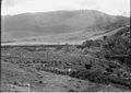 A Dorrigo homestead, circa 1900.
 -
 Dangar Falls at Dorrigo.
 -
 Engines and carriages on display outside the Dorrigo Steam Railway and Museum.


References
edit- ^ a b c Australian Bureau of Statistics (28 June 2022). "Dorrigo (L) (Urban Centre/Locality)". 2021 Census QuickStats. Retrieved 22 January 2024.
- ^ a b "Climatological Station Metadata -Dorrigo Post Office" (PDF). Bureau of Meteorology. Retrieved 30 December 2011.
 Material was copied from this source, which is available under a Creative Commons Attribution 4.0 International License.
- ^ "Oxley". District profiles. Electoral Commission of New South Wales. 24 September 2012. Retrieved 1 March 2013.
- ^ "Find my electorate: Dorrigo". Electorate search. Australian Electoral Commission. 21 November 2012. Archived from the original on 12 May 2013. Retrieved 1 March 2013.
- ^ a b c d "Dorrigo". The Sydney Morning Herald. 8 February 2004. Retrieved 24 January 2008.
- ^ Studies, Australian Institute of Aboriginal and Torres Strait Islander (9 September 2021). "Map of Indigenous Australia". aiatsis.gov.au. Retrieved 20 September 2021.
- ^ a b "History of the Dorrigo Area". Dorrigo Chamber of Commerce. 2009. Archived from the original on 2 October 2011. Retrieved 1 August 2011.
- ^ a b Bozier, Rolfe. "Dorrigo Branch". NSWrail.net. Retrieved 1 January 2012.
- ^ "GLENREAGH-DORRIGO RAILWAY". The Sydney Morning Herald. National Library of Australia. 12 December 1924. p. 10. Retrieved 1 January 2012.
- ^ "Flash of lightning kills 68 dairy cows". Daily Telegraph. 2 November 2005.
- ^ "Statistics by Catalogue Number". Australian Bureau of Statistics. Retrieved 22 January 2024.
- ^ "Search Census data". Australian Bureau of Statistics. Retrieved 22 January 2024.
- ^ "Dangar Falls". Geographical Names Register (GNR) of NSW. Geographical Names Board of New South Wales. Retrieved 29 June 2009.
- ^ "Dangar Falls". Stevografix. Archived from the original on 14 September 2009. Retrieved 30 June 2009.
- ^ "Dangar Falls 31.3.09". ABC Contribute. Archived from the original on 29 January 2010. Retrieved 30 June 2009.
- ^ "Register of War Memorials in NSW". New South Wales Government, 2014. 11 April 2012. Retrieved 8 September 2017.
- ^ Huxley, John (1 March 2010). "News fit to print – hot-metal typesetting paper turns 100". The Sydney Morning Herald.
- ^ Parmeter, Nick; Poole, Fiona (3 July 2023). "Australia's last letterpress newspaper prints its final edition as costs, social media take a toll". ABC News. Retrieved 4 July 2023.
- ^ "Dorrigo climate: Average Temperature, weather by month, Dorrigo weather averages - Climate-Data.org". en.climate-data.org. Retrieved 5 February 2019.
- ^ "Wettest places by mean rainfall in New South Wales". www.bonzle.com. Retrieved 5 February 2019.
- ^ "Dorrigo Old Coramba Road". Climate statistics for Australian locations. Bureau of Meteorology. Retrieved 15 October 2017.
- ^ "Storm at Dorrigo". Clarence and Richmond Examiner. Grafton, NSW: National Library of Australia. 23 October 1913. p. 4. Retrieved 31 December 2011.
- ^ "COUNTRY REPORTS". The Sydney Morning Herald. National Library of Australia. 7 August 1923. p. 10. Retrieved 30 December 2011.
- ^ a b "Daily Rainfall for Dorrigo Post Office for 1950". Climate Data Online. Bureau of Meteorology. Retrieved 2 January 2012.
- ^ "Daily Rainfall for Dorrigo (Myrtle St) for 1954". Bureau of Meteorology. Retrieved 30 December 2011.
- ^ "New South Wales Weather Extremes" (PDF). Bureau of Meteorology. Retrieved 30 December 2011.
- ^ "Daily Rainfall for Dorrigo Post Office for 1954". Bureau of Meteorology. Retrieved 30 December 2011.
- ^ Callaghan, J. "CASE STUDY: Gold Coast Cyclone, February 1954" (PDF). Green Cross Australia. Retrieved 30 December 2011.
External links
edit![]() Dorrigo travel guide from Wikivoyage
Dorrigo travel guide from Wikivoyage