De Waal is a village in the Dutch province of North Holland. It is a part of the municipality of Texel, and lies about 15 km north of Den Helder.
De Waal | |
|---|---|
Village | |
 Street view | |
 De Waal Location in the Netherlands  De Waal Location in the province of North Holland in the Netherlands | |
| Coordinates: 53°4′N 4°49′E / 53.067°N 4.817°E | |
| Country | Netherlands |
| Province | North Holland |
| Municipality | Texel |
| Area | |
| • Total | 0.35 km2 (0.14 sq mi) |
| Elevation | 0.6 m (2.0 ft) |
| Population (2021)[1] | |
| • Total | 210 |
| • Density | 600/km2 (1,600/sq mi) |
| Time zone | UTC+1 (CET) |
| • Summer (DST) | UTC+2 (CEST) |
| Postal code | 1793[1] |
| Dialing code | 0222 |
The village was first mentioned in 1295 as "sancti Bonifacii in Waelkerken", and means "pond created after a dike breach".[3] De Waal started to developed after the Waalenburg polder was created in 1436. The Dutch Reformed church is built on a terp (artificial hill). It was destroyed in 1945 during the Georgian uprising. A new church was built in 1952 and a tower was added in 1961.[4]
Gallery edit
-
 Sculpture 'the Game' designed by Marijn Koenen Gorter
 -
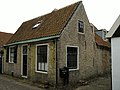 House in De Waal
 -
 Dutch Reformed church
 -
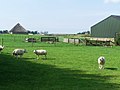 Farmland near De Waal


References edit
- ^ a b c "Kerncijfers wijken en buurten 2021". Central Bureau of Statistics. Retrieved 2 May 2022.
- ^ "Postcodetool for 1793AA". Actueel Hoogtebestand Nederland (in Dutch). Het Waterschapshuis. 24 July 2019. Retrieved 2 May 2022.
- ^ "De Waal - (geografische naam)". Etymologiebank (in Dutch). Retrieved 2 May 2022.
- ^ "De Waal". Plaatsengids (in Dutch). Retrieved 2 May 2022.
Wikimedia Commons has media related to De Waal.
This North Holland location article is a stub. You can help Wikipedia by expanding it. |