Ciofrângeni is a commune in Argeș County, Muntenia, Romania. It is composed of five villages: Burluși, Ciofrângeni, Lacurile, Piatra, and Schitu-Matei.
Ciofrângeni | |
|---|---|
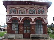
 Ciofrângeni townhall | |
 Ciofrângeni Location in Romania | |
| Coordinates: 45°5′N 24°32′E / 45.083°N 24.533°E | |
| Country | Romania |
| County | Argeș |
| Government | |
| • Mayor (2020–2024) | Dorin-Florin Panțeru (PSD) |
| Area | 43.35 km2 (16.74 sq mi) |
| Elevation | 374 m (1,227 ft) |
| Population (2021-12-01)[1] | 1,980 |
| • Density | 46/km2 (120/sq mi) |
| Time zone | EET/EEST (UTC+2/+3) |
| Postal code | 117250 |
| Vehicle reg. | AG |
| Website | sites |
The commune lies in the Wallachian Plain, on the banks of the Topolog River. It is located in the western part of Argeș County, 43 km (27 mi) northwest of the county seat, Pitești, on the border with Vâlcea County.
Ciofrângeni is crossed by the national road DN73C, which starts in Câmpulung, runs through Curtea de Argeș (16 km (9.9 mi) to the east), and ends in Râmnicu Vâlcea (21 km (13 mi) to the west).
References edit
-
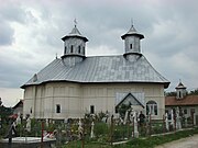 Church in Ciofrângeni village
 -
 Church in Lacurile village
 -
 Church in Schitu-Matei village
 -
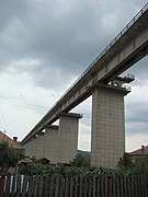 The Topolog Viaduct in Ciofrângeni

.JPG)
.JPG)
.JPG)
This Argeș County location article is a stub. You can help Wikipedia by expanding it. |