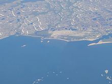
Chevery is an unconstituted locality within the municipality of Côte-Nord-du-Golfe-du-Saint-Laurent in the Côte-Nord region of Quebec, Canada.
Chevery | |
|---|---|
 | |
| Coordinates: 50°28′07″N 59°36′58″W / 50.46861°N 59.61611°W[1] | |
| Country | Canada |
| Province | Quebec |
| Region | Côte-Nord |
| RCM | Le Golfe-du-Saint-Laurent |
| Municipality | Côte-Nord-du-Golfe-du-Saint-Laurent |
| Government | |
| • Federal riding | Manicouagan |
| • Prov. riding | Duplessis |
| Area | |
| • Land | 3.64 km2 (1.41 sq mi) |
| Population (2011)[2] | |
| • Total | 251 |
| • Density | 68.9/km2 (178/sq mi) |
| • Change (2006–11) | N/A |
| • Dwellings | 123 |
| Time zone | UTC−04:00 (AST) |
| Postal code(s) | |
| Area code(s) | 418 and 581 |
Chevery is the administrative centre of Côte-Nord-du-Golfe-du-Saint-Laurent municipality, located at the mouth of the Nétagamiou River. Previously known as Netagamu River, the place was renamed in 1971 after captain Jean-Baptiste Chevery who in 1747 sailed along the coast visiting numerous posts.[1]
Chevery was the site of an early French fur trading post in the mid-17th century, but after that fort was abandoned, there was no further development on the site until the 1930s, when an experimental farm was established on the Cross River by William Anderson. Residents of several isolated communities in the area, including Gull Cliff Island and Aylmer Sound, subsequently moved to Chevery due to the need for improved access to government services.[3]

The community of Chevery on the Gulf Saint Lawrence and boasts a vast network of inland wetlands, forest and tundra. The area is an ideal location for wilderness exploration, artistic inspiration and cultural discovery. From Chevery, one can access extensive trails and beaches through the unique northern landscape of the MRC du Golfe-du-Saint-Laurent. Chevery is renowned for the Netagamiou River and its 50 foot high falls that can be accessed from the Bob Nunez Misty River Trail.
Another renowned natural feature at the western end of Chevery is the "Sterant Island" Tern Colony. Only 100 meters off the beach, Sterant Island is easily visible for avid and budding conservationists and ornithologists who wish to observe, study and photograph the impressive tern colony for which the island gets its name. Locals speculate that the name "Sterant Island" is an anglicized version of a French name "Île au Sterne". Local records confirm that the Terns return annually to Chevery the third week of May and remain there to hatch and raise their young in the bait rich waters of Chevery during the summer. The terns leave gradually in early September and the colony is usually deserted by the mid-September each year.
Although predominantly Anglophone, Chevery has a significant number of Francophone and bilingual residents.[4] None of Chevery's 251 residents are trilingual.
Demographics
editIn the 2021 Census of Population conducted by Statistics Canada, Chevery had a population of 226 living in 104 of its 118 total private dwellings, a change of -4.2% from its 2016 population of 236. With a land area of 3.93 km2 (1.52 sq mi), it had a population density of 57.5/km2 (148.9/sq mi) in 2021.[5]
Education
editCentre de Services scolaire du Littoral operates Netagamiou School (anglophone and francophone) in Chevery.[6]
References
edit- ^ a b "Banque de noms de lieux du Québec: Reference number 13070". toponymie.gouv.qc.ca (in French). Commission de toponymie du Québec.
- ^ a b "Chevery (Code 240226) Census Profile". 2011 census. Government of Canada - Statistics Canada.
- ^ Tourism Lower North Shore: Chevery
- ^ "Home". toursnord-northtours.com.
- ^ "Population and dwelling counts: Canada and designated places". Statistics Canada. February 9, 2022. Retrieved Sep 2, 2022.
- ^ "Schools and centers Archived 2017-09-23 at the Wayback Machine." Commission scolaire du Littoral. Retrieved on September 23, 2017.
