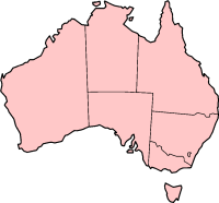
Borrona Downs Station is a cattle station near White Cliffs in far western New South Wales, Australia.[1][2][3] It is about halfway between Milparinka, around 100 km to the West, and Wanaaring, around 100 km to the East, as the crow flies.[2]


The Borrona Downs Station airstrip is at 29°45'4"S 143°6'4"E,[1] on Bloodwood Creek east of the Pindera Downs Aboriginal Area, about 890 km west-northwest of Sydney, 160 km north of White Cliffs and 140 km east of Tibooburra, New South Wales.
Borrona Downs is about 120m above sea level.[2] For many years the station has been operated by the Taylor family.[4][5][6]
References
edit- ^ a b Borrona Downs Station Airfield.
- ^ a b c Borrona Downs Station, New South Wales Map.
- ^ Lloyd, Graham (31 August 2017). "Weather station bungle puts mercury at -62C". The Australian. Retrieved 21 November 2018.
- ^ "REGISTRATION OF STOCK BRANDS ACT, 1921". Government Gazette Of The State Of New South Wales. No. 81. New South Wales, Australia. 27 June 1941. p. 2346. Retrieved 22 November 2018 – via National Library of Australia.
- ^ "APPOINTMENTS". Government Gazette Of The State Of New South Wales. No. 98. New South Wales, Australia. 11 October 1963. p. 2991. Retrieved 22 November 2018 – via National Library of Australia.
- ^ Corby, Stephen (19 January 2008). "Seven TV Network leaves farmer in debt". The Sunday Telegraph. Retrieved 21 November 2018.