Borralha was a freguesia ("civil parish") in Águeda Municipality, Aveiro District, Portugal. It had an area of 9.6 km2 and in 2011 had a population of 2230.[1]
Borralha | |
|---|---|
 Coat of arms | |
 Borralha Location in Portugal | |
| Coordinates: 40°33′16″N 8°26′15″W / 40.55444°N 8.43750°W | |
| Country | |
| Region | Centro |
| Intermunic. comm. | Região de Aveiro |
| District | Aveiro |
| Municipality | Águeda |
| Area | |
| • Total | 9.6 km2 (3.7 sq mi) |
| Population (2011) | |
| • Total | 2,230 |
| • Density | 230/km2 (600/sq mi) |
| Time zone | UTC±00:00 (WET) |
| • Summer (DST) | UTC+01:00 (WEST) |
History
editIn 2013 it was merged with Águeda to form the new freguesia of Águeda e Borralha.[2]
Places
edit- Agueiro
- Alteiralto
- Alto do Vale do Grou
- Amaínho
- Brejo
- Candam
- Carrasqueira
- Casais
- Casarão Castinceira
- Catraia
- Chapado
- Horta Velha
- Lomba
- Machuqueira
- Nova Borralha
- Pinheirais
- Redolho
- S. Tiago
- Vale do Forno
- Vista
Demography
edit-
 Population from 1864 to 2011
 -
 Variation of population from 1864 to 2011
 -
 Distribution of population in 2001
 -
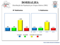
 Distribution of population in 2011


Religion
editThe Portuguese Roman Catholic Church's Diocese of Aveiro includes the Parish of Borralha[3] as part of the archpriestship of Águeda.[4]
References
edit- ^ "Junta de Freguesia da Borralha". cm-agueda.pt (in Portuguese). Câmara Municipal de Águeda. Archived from the original on 12 March 2008. Retrieved 13 May 2014.
- ^ "Lei n.º 11-A/2013 de 28 de janeiro" (PDF). Diário da República (in Portuguese). 28 January 2013. Retrieved 13 May 2014.
- ^ "Paróquia de Borralha". diocese-aveiro.pt (in Portuguese). Diocese of Aveiro. Retrieved 13 May 2014.
- ^ "Arciprestado de Águeda". diocese-aveiro.pt (in Portuguese). Diocese of Aveiro. Retrieved 13 May 2014.
This Aveiro location article is a stub. You can help Wikipedia by expanding it. |