Bishopsbourne is a rural locality in the local government area (LGA) of Northern Midlands in the Central LGA region of Tasmania. The locality is about 19 kilometres (12 mi) south-west of the town of Longford. The 2016 census has a population of 136 for the state suburb of Bishopsbourne.[1] It is a farming community and has a church, graveyard and recreation ground. Nearby towns include Carrick, Bracknell and Longford. Almost all the houses and farms are located on Bishopsbourne Road and there are a few back roads. There has been increased activity of development in recent years, though none of it has been commercial.
| Bishopsbourne Tasmania | |||||||||||||||
|---|---|---|---|---|---|---|---|---|---|---|---|---|---|---|---|
 The Anglican Church of the Holy Nativity, built in 1844 and opened 25 April 1845 | |||||||||||||||
 Bishopsbourne | |||||||||||||||
| Coordinates | 41°37′S 146°59′E / 41.617°S 146.983°E | ||||||||||||||
| Population | 136 (2016 census)[1] | ||||||||||||||
| Established | 1800s | ||||||||||||||
| Postcode(s) | 7301 | ||||||||||||||
| Location |
| ||||||||||||||
| LGA(s) | Northern Midlands | ||||||||||||||
| Region | Central | ||||||||||||||
| State electorate(s) | Lyons | ||||||||||||||
| Federal division(s) | Lyons | ||||||||||||||
| |||||||||||||||
History
editFor approximately 40,000 years, the traditional owners of these plains were the Panninher people of the Stoney Creek Nation, who lived on and shaped the lands for thousands of years with their own law, customs, language, cosmology, and farming.[2] The Panninher clan set-up numerous mountain rockshelter camps within the tiered mountains known as taytitikithika,[3] and used the river tilapangka[4] as a pathway.
In 1821 the invading British colonial government settled and granted land in the district to released convicts, farmers, and colonists.[5] Families began constructing homes, convict-quarters, and farms. Bushrangers were known to come down from the mountains to rob homesteads such as Enfield mansion.[6] The Panninher people, who had already suffered from European diseases, resisting takeover of their country, and settler harassment, were dispossessed and displaced by the land grants.
Meaning 'bishop's villa by the stream,' Bishopsbourne's boundaries were established in 1848.[5]

Australia's oldest tertiary institution, Christ College, was built and opened at Bishopsbourne in 1846.[7] Modelled after Oxford and Cambridge,[8] at its peak 110 students (all male and Anglican) studied at the College. The grounds contained a chapel, hall, library,[9] museum,[10] and cricket oval[11] - where the first games of Rugby football were played in Australia.[12] The school closed in 1856, after an inquiry into the educational and financial condition of the school, which recommended moving the college to Hobart.[13]
Convict and then later business owner, William Webb submitted an application for a license to operate a hotel to be known as the “Bush Inn”. This was approved and operated very successfully and advertised as being the most profitable hotel in Tasmania. With declining business, the hotel closed in 1896. The premises later operated as the local store, post office, telephone exchange and now a private residence.[14]
By 1904, the district was known as an agricultural town,[15] and was still connected with a local railway station on the Western Line.[16] The township had a methodist church, state school,[17] police station, blacksmith,[18] and a coffee palace (once known as the pub and hotel the Bush Inn).[19]
In 1918, a soldiers avenue row of trees were planted in the township, which was attended and set in the ground by Tasmanian Premier Lee and his wife.[20]
In 1941, athlete Mick Goss broke the world professional two-mile record in.[21] Lands in the town centre were purchased by the Longford Council
in 1946 for 99 pounds to build a hall, and new recreation grounds for cricket and football. By 1947, these sporting fields were established, moving away from the old college grounds.[5]
The Bishopsbourne Post Office opened on 31 December 1846 and closed in 1976.[22]
Bishopsbourne was gazetted as a locality in 1966.[23]
The town has a cricket team that has been playing in the local competition for about 70 years.
Geography
editHistorically, the natural vegetation was grassland. The district is now predominately agricultural and farming land. As the region is situated in the Midlands, the area experiences both the warmest summers and some of the coldest winters in Tasmania - often experiencing frost. The Liffey River forms the western boundary.[24]
Road infrastructure
editRoute C513 (Liffey Road / Bishopsbourne Road) passes through from south to north. Route C518 (an extension of Bishopsbourne Road) starts at an intersection with C513 and runs east until it exits.[23][25]
Gallery
edit-
 Church of the Holy Nativity, Bishopsbourne
 -
 field of the Church of the Holy Nativity, Bishopsbourne
 -
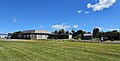 Bishopsbourne Community Centre Recreation Grounds


References
edit- ^ a b "2016 Census Quick Stats Bishopsbourne (Tas.)". quickstats.censusdata.abs.gov.au. Australian Bureau of Statistics. 23 October 2017. Retrieved 13 September 2020.
- ^ "Aboriginal Cultural Burning" (PDF). Aboriginal Heritage Tasmania.
- ^ "pulingina to lutruwita (Tasmania) Place Names Map". tacinc.com.au. Retrieved 10 December 2023.
- ^ "pulingina to lutruwita (Tasmania) Place Names Map". tacinc.com.au. Retrieved 10 December 2023.
- ^ a b c Badcock, Ivan (14 August 2021). "Bishopsbourne – Chronology". History Over Dinner. Retrieved 10 December 2023.
- ^ "BISHOPSBOURNE RELICS OF". Mercury. 22 July 1946. Retrieved 10 December 2023.
- ^ Tasmania, University of (2014). "Christ College Index: University of Tasmania Collection". eprints.utas.edu.au. Retrieved 10 December 2023.
- ^ "History". christ-college-hbt. Retrieved 10 December 2023.
- ^ Brief History of Christ College Library Tasmania (PDF). University of Tasmania: Friends of Christ College. 1956. p. 2.
- ^ Craig, C. (1966). "Charlotte Cleveland, 1819-1884". Papers and Proceedings of the Royal Society of Tasmania. 100: 131–136. doi:10.26749/DATK6877. ISSN 0080-4703.
- ^ "Index to UA17 - University of Tasmania". sparc.utas.edu.au. Retrieved 10 December 2023.
- ^ "HUNTING TASMANIA'S EXTINCT RUGBY SCHOOL". Sean Fagan. 25 August 2012. Retrieved 10 December 2023.
- ^ "History". christ-college-hbt. Retrieved 10 December 2023.
- ^ "Bishopsbourne – Chronology – History Over Dinner". historyoverdinner.com. Retrieved 3 February 2024.
- ^ "HIGHWAYS AND BYWAYS - BISHOPSBOURNE. - Daily Telegraph (Launceston, Tas. : 1883 - 1928) - 30 Jan 1904". Trove. Retrieved 10 December 2023.
- ^ "(1883)". Trove. Retrieved 10 December 2023.
- ^ "BISHOPSBOURNE". Daily Telegraph. 18 December 1908. Retrieved 10 December 2023.
- ^ "No. 482 - Bishopsbourne Methodist Church - "A Compact and Comfortable House of Prayer"". 28 July 2019. Retrieved 10 December 2023.
- ^ "HIGHWAYS AND BYWAYS - BISHOPSBOURNE. - Daily Telegraph (Launceston, Tas. : 1883 - 1928) - 30 Jan 1904". Trove. Retrieved 10 December 2023.
- ^ "Bishopsbourne". Examiner. 6 September 1918. Retrieved 10 December 2023.
- ^ "Great Sporting Heroes of Northern Tassie". Neil Kearney. 18 May 2020. Retrieved 10 December 2023.
- ^ Premier Postal History. "Post Office List". Premier Postal Auctions. Retrieved 16 June 2012.
- ^ a b "Placenames Tasmania – Bishopsbourne". Placenames Tasmania. Select “Search”, enter "910F", click “Search”, select row, map is displayed, click “Details”. Retrieved 13 September 2020.
- ^ "Bishopsbourne, Tasmania" (Map). Google Maps. Retrieved 13 September 2020.
- ^ "Tasmanian Road Route Codes" (PDF). Department of Primary Industries, Parks, Water & Environment. May 2017. Archived from the original (PDF) on 1 August 2017. Retrieved 13 September 2020.