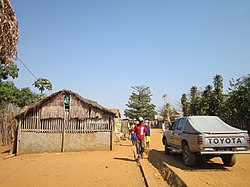
Bekopaka is a rural municipality in western Madagascar. It belongs to the district of Antsalova, which is a part of Melaky Region. The population of the commune was estimated to be approximately 9,000 in 2001 commune census.[2]
Bekopaka | |
|---|---|
 shop in Bekopaka | |
| Coordinates: 19°1′S 44°51′E / 19.017°S 44.850°E | |
| Country | |
| Region | Melaky |
| District | Antsalova |
| Elevation | 334 m (1,096 ft) |
| Population (2001)[2] | |
| • Total | 9,000 |
| Time zone | UTC3 (EAT) |
| Postal code | 406 |
Bekopaka is served by a local airport, and primary and junior level secondary education are available in town. The most important crop is rice, while other important products are bananas, maize and cassava.[2]

Rivers edit
Bekopaka is situated on the Manambolo River.
Nature edit
The Tsingy de Bemaraha Strict Nature Reserve is situated north from Bekopaka (17 km).
Roads edit
The unpaved National road 8 from Morondava (195 km)/
References edit
- ^ Estimated based on DEM data from Shuttle Radar Topography Mission
- ^ a b c "ILO census data". Cornell University. 2002. Retrieved 2008-03-04.
19°1′S 44°51′E / 19.017°S 44.850°E
