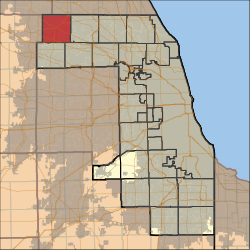
Barrington Township is one of 29 townships in Cook County, Illinois, USA. As of the 2020 census, its population was 16,514 and it contained 6,172 housing units.[1] This population increased, and in 2024, its estimated to be at 10,401.[2]The northwestern corner of the Cook County panhandle, it is the county's northwesternmost township. It is also by far the least densely populated township in the county, with less than half the population density of the next least Lemont Township.
Barrington Township | |
|---|---|
 Location in Cook County | |
 Cook County's location in Illinois | |
| Coordinates: 42°06′41″N 88°10′46″W / 42.11139°N 88.17944°W | |
| Country | United States |
| State | Illinois |
| County | Cook |
| Government | |
| • Supervisor | Amy P. Nykaza |
| • Town Clerk | D. Robert Alberding |
| • Assessor | Jacqueline Stephens |
| • Tax Collector | Linda Post |
| • Trustees | Robert Collins Daniel P. Fitzgerald Fritz Gohl Linda Post |
| Area | |
| • Total | 36.0 sq mi (93.3 km2) |
| • Land | 34.8 sq mi (90.2 km2) |
| • Water | 1.2 sq mi (3.0 km2) 3.26% |
| Elevation | 883 ft (269 m) |
| Population (2020) | |
| • Total | 16,514 |
| • Density | 460/sq mi (180/km2) |
| Time zone | UTC-6 (CST) |
| • Summer (DST) | UTC-5 (CDT) |
| ZIP codes | 60010, 60118, 60192, 60195 |
| FIPS code | 17-031-03831 |
| Website | www |
Barrington Township was named after the town of Great Barrington, Massachusetts.[3] It was incorporated in 1865.[4]
Geography
editAccording to the United States Census Bureau, Barrington Township covers an area of 36.0 square miles (93.3 km2); of this, 34.8 square miles (90.2 km2) is land and 1.2 square miles (3.0 km2) (3.26 percent) is water.[5]
Cities, towns, villages
edit- Barrington (mostly)
- Barrington Hills (south three-quarters)
- East Dundee (part)
- Hoffman Estates (part)
- Inverness (west quarter)
- South Barrington
Unincorporated Towns
edit- Barrington Center at 42°06′38″N 88°11′39″W / 42.11058°N 88.194244°W
- Middlebury at 42°08′39″N 88°14′17″W / 42.144192°N 88.238136°W
- Sutton at 42°05′45″N 88°11′39″W / 42.09586°N 88.194244°W
Cemeteries
editThe township contains two historic cemeteries: Barrington Center and Union.
Major highways
editAirports and landing strips
edit- Allstate Commercial Plaza Heliport
- Mill Rose Farm RLA Airport
- Rose Number 2 Heliport
Lakes
edit- Beverly Lake
- Crabtree Lake
- Dana Lake
- Goose Lake
- Hawley Lake
- Hawthorne Lake
- Heather Lake
- Keene Lake
- Lacey Lake
- Mirror Lake
- Mud Lake
- Spring Lake
- Stephanie Lake
Landmarks
edit- Barrington Forest Preserve (west quarter)
- Cook County-Potawatomi Woods Forest Preserve
- Crabtree Nature Center (Cook County Forest Preserve)
- Prairie Stone Business Park
Demographics
editAs of the 2020 census[1] there were 16,514 people, 5,456 households, and 4,718 families residing in the township. The population density was 458.34 inhabitants per square mile (176.97/km2). There were 6,172 housing units at an average density of 171.30 units per square mile (66.14 units/km2). The racial makeup of the township was 69.20% White, 0.85% African American, 0.09% Native American, 22.83% Asian, 0.00% Pacific Islander, 1.68% from other races, and 5.34% from two or more races. Hispanic or Latino of any race were 5.30% of the population.
There were 5,456 households, out of which 39.40% had children under the age of 18 living with them, 73.20% were married couples living together, 10.85% had a female householder with no spouse present, and 13.53% were non-families. 11.90% of all households were made up of individuals, and 6.20% had someone living alone who was 65 years of age or older. The average household size was 2.89 and the average family size was 3.12.
The township's age distribution consisted of 26.9% under the age of 18, 4.3% from 18 to 24, 16.1% from 25 to 44, 32.6% from 45 to 64, and 20.1% who were 65 years of age or older. The median age was 46.8 years. For every 100 females, there were 88.1 males. For every 100 females age 18 and over, there were 85.1 males.
The median income for a household in the township was $145,611, and the median income for a family was $161,684. Males had a median income of $106,099 versus $60,556 for females. The per capita income for the township was $67,213. About 3.6% of families and 5.0% of the population were below the poverty line, including 6.1% of those under age 18 and 6.0% of those age 65 or over.
| Census | Pop. | Note | %± |
|---|---|---|---|
| 2000 | 14,026 | — | |
| 2010 | 15,636 | 11.5% | |
| 2020 | 16,514 | 5.6% | |
| U.S. Decennial Census[6] | |||
School districts
edit- Barrington Community Unit School District 220
- Community Unit School District 300
- School District 46
Political districts
edit- Illinois's 6th congressional district
- State House District 52
- State House District 54
- State Senate District 26
- State Senate District 27
References
edit- ^ a b "Explore Census Data". data.census.gov. Retrieved January 22, 2023.
- ^ "Barrington, Illinois Population 2024". worldpopulationreview.com. Retrieved September 30, 2024.
- ^ Chicago and North Western Railway Company (1908). A History of the Origin of the Place Names Connected with the Chicago & North Western and Chicago, St. Paul, Minneapolis & Omaha Railways. p. 41.
- ^ "History & Architecture • Village of Barrington, Illinois". Village of Barrington, Illinois. Retrieved September 30, 2024.
- ^ "Geographic Identifier: 2010 Demographic Profile Data (DP-1): Barrington township, Cook County, Illinois". U.S. Census Bureau, American Factfinder. Archived from the original on February 10, 2020. Retrieved March 20, 2013.
- ^ "Census of Population and Housing". Census.gov. Retrieved June 4, 2016.
