39°31′15″N 45°28′56″E / 39.52083°N 45.48222°E
Bardzruni
Բարձրունի | |
|---|---|
 | |
 Bardzruni  Bardzruni | |
| Coordinates: 39°31′15″N 45°28′56″E / 39.52083°N 45.48222°E | |
| Country | Armenia |
| Province | Vayots Dzor |
| Municipality | Vayk |
| Population | |
| • Total | 361 |
| Time zone | UTC+4 (AMT) |
| Bardzruni at GEOnet Names Server | |
Bardzruni (Armenian: Բարձրունի) is a village in the Vayk Municipality of the Vayots Dzor Province of Armenia. The village is located close to the Armenia–Azerbaijan border.
Etymology
editThe village was previously known as Sultanbek.
Gallery
edit-
 View of Mount Sangyar from Bardzruni
 -
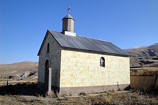 Chapel in Bardzruni
 -
 14th-15th century church
 -
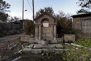 Memorial spring to the fallen in WWII
 -
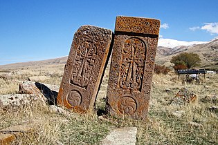 16th century Khachkars
,_view_from_Bardzruni_-_panoramio.jpg)


References
editExternal links
editWikimedia Commons has media related to Bardzruni.
- Report of the results of the 2001 Armenian Census, Statistical Committee of Armenia
- Kiesling, Brady (2005), Rediscovering Armenia: Guide, Yerevan, Armenia: Matit Graphic Design Studio
- Kiesling, Brady (June 2000). Rediscovering Armenia: An Archaeological/Touristic Gazetteer and Map Set for the Historical Monuments of Armenia (PDF). Archived (PDF) from the original on 6 November 2021.
This article about a location in Vayots Dzor Province, Armenia is a stub. You can help Wikipedia by expanding it. |