Azufral is a stratovolcano located in the department of Nariño in southern Colombia, 12 km (7 mi) west of the town of Túquerres. It is the only volcano of the Western Ranges of the Colombian Andes. Its name derives from the Spanish word for sulfur, azufre. The volcano is considered semi-dormant but there are numerous fumaroles in the summit crater. The summit of the volcano has an altitude of 4,070 metres (13,350 ft),[1] and the north-western side of the crater contains a crescent-shaped lake named Laguna Verde (English: Green Lake) at 3,970 m (13,025 ft). The lake is 1,100 m (0.68 mi) long and 600 metres (2,000 ft) wide.[2] and its bright green color is a result of the sulfur and iron-based deposits in the crater. There are also two other much smaller lakes in the crater, Laguna Negra (English: Black Lake) and Laguna Cristal (English: Crystal Lake).
| Azufral | |
|---|---|
| Volcán Azufral | |
 Azufral in 1989 | |
| Highest point | |
| Elevation | 4,070 m (13,350 ft)[1] |
| Listing | Volcanoes of Colombia |
| Coordinates | 1°05′N 77°41′W / 1.083°N 77.683°W[1] |
| Geography | |
 Azufral Location of Azufral in Colombia | |
| Location | Nariño |
| Parent range | Western Ranges Andes |
| Geology | |
| Age of rock | Holocene |
| Mountain type | Stratovolcano |
| Volcanic arc/belt | Northern Volcanic Zone, Andean Volcanic Belt |
| Last eruption | 930 BC(?)[1] |
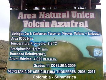
The volcano lies within a nature reserve, the Reserva Natural del Azufral, created in 1990.[2] The reserve covers an area of 5,800 hectares (58 km2) and is free of charge to enter. As Azufral is semi-dormant, there are no restrictions on ascending the volcano and visiting Laguna Verde: there is a road that climbs to within 1.5 kilometers (1 mi) from the summit, and the remaining distance can be covered on foot via a trail.
Gallery
edit-
 Entrance
 -
 Landscape
 -
 Sulfur


-
 Lagunas Negra and Verde
 -
 Laguna Negra
 -
 Laguna Verde


See also
editReferences
edit- ^ a b c d "Azufral". Global Volcanism Program. Smithsonian Institution. Retrieved January 19, 2007.
- ^ a b (in Spanish) "El Azufral, seis años como reserva", El Tiempo, June 12, 1996 Retrieved May 2, 2011
This Colombian location article is a stub. You can help Wikipedia by expanding it. |