This article is missing information about the nature, structure, historical and geological significance of the glacier itself. (February 2022) |
The Athabasca Glacier is one of the six principal 'toes' of the Columbia Icefield, located in the Canadian Rockies. The glacier currently loses depth at a rate of about 5 metres (16 ft) per year[2] and has receded more than 1.5 km (0.93 mi) and lost over half of its volume in the past 125 years. Easily accessible, it is the most visited glacier in North America.[3] The leading edge of the glacier is within easy walking distance; however, travel onto the glacier is not recommended unless properly equipped. Hidden crevasses have led to the deaths of unprepared tourists.
| Athabasca Glacier | |
|---|---|
 Athabasca Glacier in July 2018 | |
 Athabasca Glacier  Athabasca Glacier  Athabasca Glacier | |
| Location | Columbia Icefield |
| Coordinates | 52°11′55″N 117°14′37″W / 52.19861°N 117.24361°W[1] |
| Area | 6 km2 (2.3 sq mi) |
| Length | 6 km (3.7 mi) |
| Thickness | 90–300 metres (300–980 ft) |
| Status | Receding |
 | |
The Columbia Icefield Glacier Discovery Centre, closed during the winter (mid-October to mid-April),[4] stands across from the glacier. It is used as a lodge and for ticket sales for sightseeing on the glacier. There are also two restaurants and a Starbucks located in the centre. Standard buses transport tourists from the centre to the glacier edge, where they board specially designed snow coaches for transport over the steep grades, snow and ice part way up the glacier.
The glacier is approximately 6 km (3.7 mi) long, covers an area of 6 km2 (2.3 sq mi), and is measured to be between 90–300 metres (300–980 ft) thick.
Notable accidents edit
On 18 July 2020, a sightseeing snow coach rolled over on the glacier's moraine early in the afternoon, killing 3 passengers and injuring 24 others.[5][6][7] Survivors were first airlifted by Parks Canada helicopters to a triage area. Nineteen of the occupants, 14 of whom suffered critical injuries, were then transported to the nearest hospitals via air and ground. In addition to countless first responders and EMS crews, three STARS helicopters from Calgary, Edmonton, and Grande Prairie responded to this multiple casualty incident.
On 5 October 2018, an employee of the sightseeing company died in the parking lot after suffering serious injuries when she was struck by her unmanned bus following a collision.[8] The woman succumbed of her injuries upon arrival of the STARS air ambulance crew.
See also edit
References edit
- ^ "Athabasca Glacier". Geographical Names Data Base. Natural Resources Canada. Retrieved 2021-03-15.
- ^ "Athabasca glacier melting at 'astonishing' rate of more than five metres a year". Globe and Mail. May 25, 2014. Retrieved August 19, 2019.
- ^ "Columbia Icefield Area and the Athabasca Glacier - Jasper National Park". Parks Canada. Government of Canada. 23 October 2017. Retrieved 4 February 2020.
- ^ Columbia Icefield 2007 tour brochure Archived September 28, 2007, at the Wayback Machine
- ^ Rieger, Sarah (18 July 2020). "3 dead, 24 injured after bus rollover in Alberta's Jasper National Park". CBC News. Retrieved 14 October 2020.
- ^ "3 who died in Columbia Icefield bus crash were from Alberta, Saskatchewan and India". CBC. CBC News. 20 July 2020. Retrieved 14 October 2020.
- ^ Kornik, Slav (19 July 2020). "3 people killed, 14 critically injured in sightseeing bus rollover near Jasper". Corus Entertainment Inc. Global News. Retrieved 14 October 2020.
- ^ White, Ryan (5 October 2018). "Bus driver fatally injured in Columbia Icefield parking lot collision involving unmanned bus". Bell Media. CTV News. Retrieved 14 October 2020.
Further reading edit
- Kucera, Richard E. Probing the Athabasca Glacier: Case History of a Glacier in the Columbia Icefield [sic], Jasper National Park. Rev. and second printing. Evergreen Press, 1973, cop. 1972. 32, [2] p., ill. with b&w photos, graphs, and maps. N.B.: A bibliog. and the largest of the maps appear, respectively, on p. [33] and [34] (i.e., on the inside and outside the back cover).
External links edit
Gallery edit
-
Athabasca Glacier tour in 2006
-
 Athabasca Glacier snow coach in 2009
 -
 Terra Bus on the Athabasca Glacier in 2010
 -
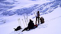
 Approaching Athabasca Glacier Headwall
 -
 Athabasca Glacier headwall (on the ramp)


This article about a glacier in Canada is a stub. You can help Wikipedia by expanding it. |
This Alberta's Rockies location article is a stub. You can help Wikipedia by expanding it. |