Artigas Boulevard is a boulevard in Montevideo, Uruguay. It runs from the Rambla at Punta Carretas to the Rambla at Capurro-Bella Vista, going north for about 6.5 kilometers and turning 100° west. It is an important connection road in the Uruguayan capital, linking the central barrios of the city, with access to different national routes.[1]
 View of Boulevard Artigas to the north | |
 | |
| Native name | Spanish: Bulevar General José Artigas |
|---|---|
| Length | 10.5 km (6.5 mi) |
| From | Punta Carretas |
| To | Bella Vista |
| Construction | |
| Completion | 1878 |
History edit

After the Uruguayan Civil War, the city began a strong expansion, so the authorities looked for a way to organize the growth of what was called the "Ciudad Nueva" ("new city") −area outside the old city, which began to develop after the demolition of the fortifications−; the avenue delimited it, that is why it turns 100° to the west. Because of this, in 1878 the layout of a boulevard was approved, which gave rise to the Novísima Ciudad (Most New City).[2] At first it was called "Circunvalación Boulevard", but in 1885 it was named "General José Artigas Boulevard", after the national hero.[3]
On its way, it crosses or borders 16 barrios of Montevideo. It intersects some of the main avenues of the city, like Avenida Agraciada, Avenida General Flores, Avenida 8 de Octubre, and the Rambla of Montevideo, all of which connect to main roads linking Montevideo with the other cities of Uruguay.
Landmarks edit
The main landmarks along this boulevard are:
Gallery edit
-
 View of the boulevard at Cordón
 -
 View of the Sarmiento Bridge from a building in Punta Carretas
 -
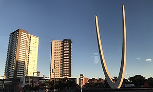
 Cross and monument to Pope John Paul II in Tres Cruces
 -
 Monument to Luis Batlle Berres in Jacinto Vera, Montevideo
 -

.jpg)


_1.jpg)
References edit
- ^ "Intendencia habilita obras en bulevar Artigas". Intendencia de Montevideo. (in Spanish). 2014-12-18. Retrieved 2022-12-27.
- ^ "Montevideo, desde el paisaje sin límites a la ciudad novísima | Intendencia de Montevideo". 2019-11-07. Archived from the original on 2019-11-07. Retrieved 2022-12-27.
- ^ "Wayback Machine" (PDF). 2013-09-14. Archived from the original (PDF) on 2013-09-14. Retrieved 2022-12-27.
External links edit
34°55′45″S 56°09′40″W / 34.92917°S 56.16111°W
This Uruguayan road or road transport-related article is a stub. You can help Wikipedia by expanding it. |
This Montevideo-related article is a stub. You can help Wikipedia by expanding it. |