You can help expand this article with text translated from the corresponding article in Hungarian. (December 2012) Click [show] for important translation instructions.
|
Veszprém (Hungarian: Veszprém vármegye, pronounced [ˈvɛspreːm]; German: Komitat Wesprim (Weißbrunn)) is an administrative county (vármegye) in Hungary. Veszprém is also the name of the capital city of Veszprém county.
Veszprém County
Veszprém vármegye | |
|---|---|
 .jpg) .jpg) Descending, from top: View of Tihany Abbey from Lake Balaton, Badacsony Mountain, and Castle of Veszprém | |
 Flag  Coat of arms | |
 Veszprém County within Hungary | |
| Country | |
| Region | Central Transdanubia |
| County seat | Veszprém |
| Districts | |
| Government | |
| • President of the General Assembly | Imre Polgárdy (Fidesz-KDNP) |
| Area | |
| • Total | 4,463.65 km2 (1,723.42 sq mi) |
| • Rank | 9th in Hungary |
| Population (2018) | |
| • Total | 341,425[1] |
| • Rank | 12th in Hungary |
| GDP | |
| • Total | HUF 936 billion €3.006 billion (2016) |
| Postal code | 810x, 816x – 819x, 830x – 8352, 84xx – 85xx |
| Area code(s) | (+36) 87, 88, 89 |
| ISO 3166 code | HU-VE |
| Website | vpvarmegye |
Veszprém county
editVeszprém county lies in western Hungary. It covers the Bakony hills and the northern shore of Lake Balaton. It shares borders with the Hungarian counties Vas, Győr-Moson-Sopron, Komárom-Esztergom, Fejér, Somogy and Zala. The capital of Veszprém county is Veszprém. The river Marcal runs along part of its western border. Its area is 4,613 km².

History
editThis section is empty. You can help by adding to it. (September 2017) |
Demographics
editReligion in Veszprém County (2011 census)
In 2015, the county had a population of 346,647 and the population density was 77/km².
| Year | County population[3] | Change |
|---|---|---|
| 1949 | ||
| 1960 | ||
| 1970 | ||
| 1980 | ||
| 1990 | ||
| 2001 | ||
| 2011 | ||
| 2015 | ||
| 2018 |
Ethnicity
editBesides the Hungarian majority, the main minorities are the Germans and Roma.
Total population (2011 census): 353,068
Ethnic groups (2011 census):[4]
Identified themselves: 315,436 persons:
- Hungarians: 299,410 (94.92%)
- Germans: 8,473 (2.69%)
- Romani: 5,162 (1.64%)
- Others and indefinable: 2,391 (0.76%)
Approximately 51,000 persons in Veszprém County did not declare their ethnic group at the 2011 census.
Religion
editReligious adherence in the county according to 2011 census:[5]
- Catholic – 167,372 (Roman Catholic – 166,597; Greek Catholic – 719);
- Reformed – 30,491;
- Evangelical – 12,813;
- other religions – 4,376;
- Non-religious – 43,171;
- Atheism – 3,915;
- Undeclared – 90,930.
Regional structure
edit
| № | English and Hungarian names |
Area (km²) |
Population (2011) |
Density (pop./km²) |
Seat | № of municipalities |
| 1 | Ajka District Ajkai járás |
320.71 | 39,160 | 122 | Ajka | 11 |
| 2 | Balatonalmádi District Balatonalmádi járás |
239.75 | 24,330 | 101 | Balatonalmádi | 10 |
| 3 | Balatonfüred District Balatonfüredi járás |
357.75 | 23,849 | 67 | Balatonfüred | 22 |
| 4 | Devecser District Devecseri járás |
421.73 | 15,079 | 36 | Devecser | 28 |
| 5 | Pápa District Pápai járás |
1,022.09 | 59,310 | 58 | Pápa | 49 |
| 6 | Sümeg District Sümegi járás |
306.48 | 15,358 | 50 | Sümeg | 21 |
| 7 | Tapolca District Tapolcai járás |
540.30 | 34,256 | 63 | Tapolca | 33 |
| 8 | Várpalota District Várpalotai járás |
294.28 | 37,882 | 129 | Várpalota | 8 |
| 9 | Veszprém District Veszprémi járás |
629.61 | 83,288 | 132 | Veszprém (town) | 19 |
| 10 | Zirc District Zirci járás |
331.02 | 19,386 | 59 | Zirc | 15 |
| Veszprém County | 4,463.65 | 353,068 | 78 | Veszprém | 217 | |
|---|---|---|---|---|---|---|
Politics
edit
The Veszprém County Council, elected at the 2019 local government elections, is made up of 17 counselors, with the following party composition:[6]
| Party | Seats | Current County Assembly | ||||||||||
|---|---|---|---|---|---|---|---|---|---|---|---|---|
| Fidesz-KDNP | 10 | |||||||||||
| Jobbik | 2 | |||||||||||
| Democratic Coalition | 2 | |||||||||||
| Hungarian Socialist Party | 1 | |||||||||||
| Our Homeland Movement | 1 | |||||||||||
| Momentum Movement | 1 | |||||||||||
Presidents of the General Assembly
edit| List of presidents since 1990[7] | |
|---|---|
| Imre Polgárdy (Fidesz-KDNP) | 2014– |
Municipalities
editVeszprém County has 1 urban county, 14 towns, 2 large villages and 200 villages.
- City with county rights
(ordered by population, as of 2011 census)
- Veszprém (61,721) – county seat
- Towns
- Pápa (33,583)
- Ajka (31,971)
- Várpalota (21,682)
- Tapolca (17,914)
- Balatonfüred (13,289)
- Balatonalmádi (8,514)
- Zirc (7,445)
- Sümeg (6,847)
- Berhida (5,927)
- Devecser (5,232)
- Balatonfűzfő (4,337)
- Herend (3,446)
- Balatonkenese (3,311)
- Badacsonytomaj (2,312)
- Villages
- Adásztevel
- Adorjánháza
- Alsóörs
- Apácatorna
- Aszófő
- Ábrahámhegy
- Badacsonytördemic
- Bakonybél
- Bakonyjákó
- Bakonykoppány
- Bakonynána
- Bakonyoszlop
- Bakonypölöske
- Bakonyság
- Bakonyszentiván
- Bakonyszentkirály
- Bakonyszücs
- Bakonytamási
- Balatonakali
- Balatonakarattya
- Balatoncsicsó
- Balatonederics
- Balatonfőkajár
- Balatonhenye
- Balatonrendes
- Balatonszepezd
- Balatonszőlős
- Balatonudvari
- Balatonvilágos
- Barnag
- Bazsi
- Bánd
- Béb
- Békás
- Bodorfa
- Borszörcsök
- Borzavár
- Csabrendek
- Csajág
- Csehbánya
- Csesznek
- Csetény
- Csögle
- Csopak
- Csót
- Dabronc
- Dabrony
- Dáka
- Doba
- Döbrönte
- Dörgicse
- Dudar
- Egeralja
- Egyházaskesző
- Eplény
- Farkasgyepű
- Felsőörs
- Ganna
- Gecse
- Gic
- Gógánfa
- Gyepükaján
- Gyulakeszi
- Hajmáskér
- Halimba
- Hárskút
- Hegyesd
- Hegymagas
- Hetyefő
- Hidegkút
- Homokbödöge
- Hosztót
- Iszkáz
- Jásd
- Kamond
- Kapolcs
- Karakószörcsök
- Káptalanfa
- Káptalantóti
- Kemeneshőgyész
- Kemenesszentpéter
- Kerta
- Kékkút
- Királyszentistván
- Kisapáti
- Kisberzseny
- Kiscsősz
- Kislőd
- Kispirit
- Kisszőlős
- Kolontár
- Köveskál
- Kővágóörs
- Kup
- Külsővat
- Küngös
- Lesencefalu
- Lesenceistvánd
- Lesencetomaj
- Litér
- Lovas
- Lovászpatona
- Lókút
- Magyargencs
- Magyarpolány
- Malomsok
- Marcalgergelyi
- Marcaltő
- Márkó
- Megyer
- Mencshely
- Mezőlak
- Mihályháza
- Mindszentkálla
- Monostorapáti
- Monoszló
- Nagyacsád
- Nagyalásony
- Nagydém
- Nagyesztergár
- Nagygyimót
- Nagypirit
- Nagytevel
- Nagyvázsony
- Nemesgörzsöny
- Nemesgulács
- Nemeshany
- Nemesszalók
- Nemesvámos
- Nemesvita
- Németbánya
- Noszlop
- Nóráp
- Nyárád
- Nyirád
- Olaszfalu
- Oroszi
- Óbudavár
- Öcs
- Örvényes
- Öskü
- Ősi
- Paloznak
- Papkeszi
- Pápadereske
- Pápakovácsi
- Pápasalamon
- Pápateszér
- Pécsely
- Pénzesgyőr
- Pétfürdő

- Porva
- Pula
- Pusztamiske
- Raposka
- Révfülöp
- Rigács
- Salföld
- Sáska
- Somlójenő
- Somlószőlős
- Somlóvásárhely
- Somlóvecse
- Sóly
- Sümegprága
- Szápár
- Szentantalfa
- Szentbékkálla
- Szentgál
- Szentimrefalva
- Szentjakabfa
- Szentkirályszabadja
- Szigliget
- Szőc
- Tagyon
- Takácsi
- Taliándörögd
- Tapolca-Diszel
- Tés
- Tihany
- Tótvázsony
- Tüskevár
- Ugod
- Ukk
- Uzsa
- Úrkút
- Vanyola
- Varsány
- Vaszar
- Várkesző
- Városlőd
- Várpalota
- Vászoly
- Veszprémfajsz
- Veszprémgalsa
- Vid
- Vigántpetend
- Vilonya
- Vinár
- Vöröstó
- Zalaerdőd
- Zalagyömörő
- Zalahaláp
- Zalameggyes
- Zalaszegvár
- Zánka
![]() municipalities are large villages.
municipalities are large villages.
Gallery
edit-
 Veszprém, the City of Queens
 -
 The Watermill of Tapolca
 -

-
-

-
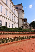
 Castle of Vázsonykő, Nagyvázsony
 -
 Round church of Öskü
 -
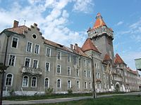 Former E1 headquarter building, Hajmáskér

_11.jpg)
_5.jpg)


_11.jpg)


References
edit- ^ nepesseg.com, population data of Hungarian settlements
- ^ Regions and Cities > Regional Statistics > Regional Economy > Regional GDP per Capita, OECD.Stats. Accessed on 16 November 2018.
- ^ népesség.com, "Veszprém megye népessége 1870-2015"
- ^ 1.1.6. A népesség anyanyelv, nemzetiség és nemek szerint – Frissítve: 2013.04.17.; Hungarian Central Statistical Office (in Hungarian)
- ^ 2011. ÉVI NÉPSZÁMLÁLÁS, 3. Területi adatok, 3.19 Veszprém megye, (in Hungarian) [1]
- ^ "Fővárosi/Megyei közgyűlés választás eredménye". 24 December 2022.
- ^ Önkormányzati választások eredményei (in Hungarian)
External links
edit- Official site in Hungarian
- Napló (veol.hu) - The county portal